About the Researchers: Dalhousie University’s School for Resource and Environmental Studies
Dalhousie University’s School for Resource and Environmental Studies (SRES) has been studying urban forests under the leadership of Dr. Peter Duinker for over a decade. One of their well-known projects includes co-authoring the Halifax Regional Municipality’s (HRM) Urban Forest Master Plan (UFMP).
Since the publication of the UFMP and its subsequent approval by HRM Regional Council, students and other researchers from SRES have been working closely with municipal urban forest and planning staff to support and monitor implementation of the UFMP.

This has included annual inventory of new contractor-planted trees, assessment of survivorship of trees and damages to public trees, participation in citizen- and NGO-led plantings and other educational events, and more.
Students and other researchers from SRES have been working closely with municipal urban forest and planning staff to support and monitor implementation of the Urban Forest Master Plan.
About the Challenge: Meeting Immediate and Long-Term Needs for Urban Forestry Management
Since adoption of the Urban Forest Master Plan (UFMP) in 2012, the HRM realized that — in order to meet the plan’s canopy targets — it would have to increase its planting volume by several hundreds of trees per year, resulting in a total annual planting of more than 1,000 non-replacement trees.
That number would be unprecedented in Halifax, where prior to 2013, annual tree plantings were performed primarily to replace losses in the urban canopy. That amount of trees was manageable for staff. Without the in-house capacity to plant so many new trees, HRM would need to hire contractors.
“The use of contractors allows us to pursue a more aggressive planting program,” former HRM Urban Forest Superintendent John Simmons said.
But the use of contractors also came with complications.

“HRM pays the contractor around $400 per tree, so it’s important that all tree mortality caused by natural causes is recognized, and replaced, while the tree is still under warranty.”
— John Simmons, Former HRM Urban Forest Superintendent
Primarily, the municipality requires a two-year warranty from contractors, intended both to protect the municipality against premature tree mortality from natural causes, as well as to ensure contractors stand by the quality of their planting.
“Contractors must be held accountable,” Simmons said. “But they don’t typically patrol the streets on their own looking for dead trees to replace.”
Yet tens of thousands of dollars are on the line when trees require replacement under warranty.
“HRM pays the contractor around $400 per tree,” Simmons said. “So it’s important that all tree mortality caused by natural causes is recognized, and replaced, while the tree is still under warranty.”
Halifax needed a way to inventory newly planted trees and monitor them individually during the warranty period.
But identifying the same tree year after year, let alone thousands, was no small undertaking.
About the Project: Inventorying Urban Forestry Under an Ambitious Plan
The UFMP called for HRM to collaborate with Dalhousie University in order to achieve two core goals:
- First, pursuit of neighbourhood-level canopy targets through increased planting
- And second, ongoing urban forest research enabling informed management decisions by HRM
Both Dalhousie University and HRM believed that an inventory of newly planted trees would be critical to satisfying these needs. Therefore, in the summer of 2013, students from SRES began the process for inventorying every single tree newly planted by contractors in HRM.
But finding the optimal field workflow took five years and the patience to overcome several limitations inherent to academia, forestry, and field technology.

“We had instances, especially in large medians where there were lots of trees, where we were unable to determine which tree was which, based on the inventory.”
— David Foster, Former SRES Intern and Current Dalhousie University Ph.D Student
Watch David Foster present his work at the 2018 Esri Canada User Conference in Fredericton:
How Interns Performed a Year of Field work in Just Four Months
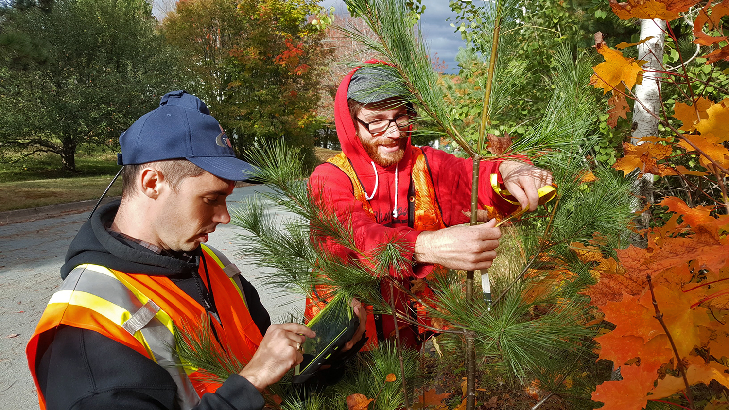
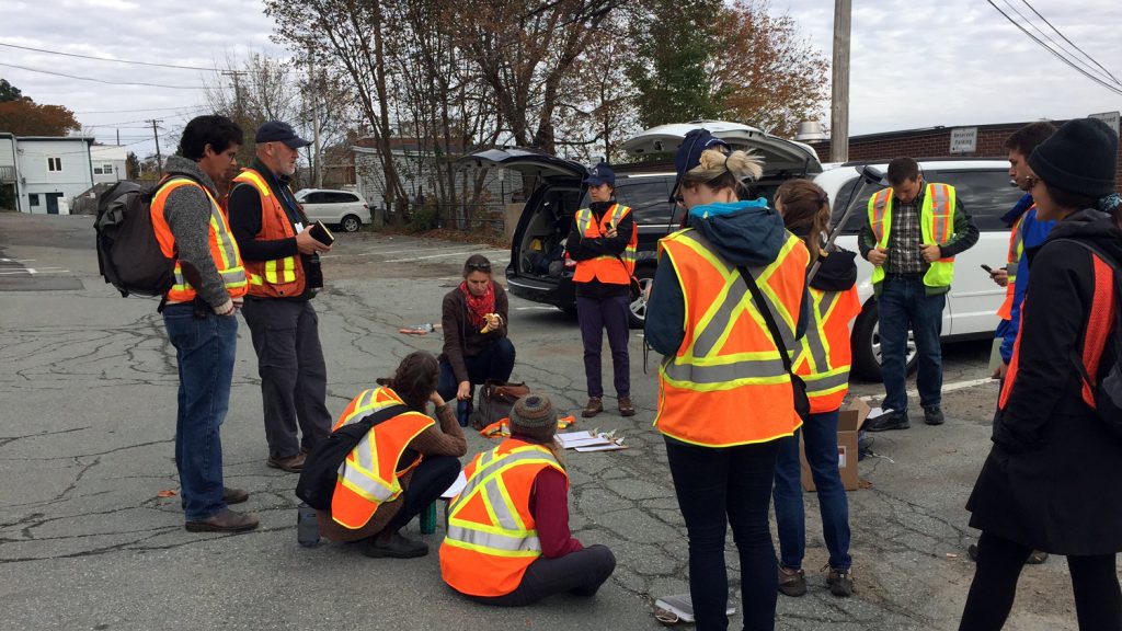
HRM grants an annual contract with SRES to hire two graduate-student interns per summer for work related to the UFMP implementation. These interns inventory new trees and revisit trees that fall within the warranty period to assess their survivorship.
The students’ work begins once a contractor plants a new tree. They visit the tree initially to record its location as well as important information about its origins, condition, and surroundings. A typical data capture would include:
- Planter’s Identity
- Submeter Location (i.e., GNSS coordinates and metadata)
- Relative Location (i.e., tied to a civic address)
- Species
- Diameter (at breast height)
- Condition
- Proximity to the curb
- Overhead Wire Presence (and type)
“It is a tall order for two students to complete all of this data collection for over a thousand trees within the span of four months,” said Dr. Duinker, who mentors the interns. “Efficiency is key in their day-to-day operations.”
Legacy Workflow
In the beginning, the students conducted their field work with now-legacy handheld devices manufactured by a major GNSS brand. These all-in-one units provided a more or less precise GNSS spatial location of each tree, which was required to allow next year’s students to return to the correct tree to monitor its health.
“These units provided good accuracy, but it was difficult to enter all the other data, like location relative to civic addresses or other landscape features,” former SRES intern David Foster said. Foster is currently a PhD student studying forest management and hydrology at Dalhousie. “So, we used a pen and paper to collect all the other information.”
This workflow became time consuming not just in the field, but also back in the office, where data had to be re-entered into the database.

“The workflow was quick in the field but time-consuming later on. The data had to be manually entered into the computer, and that created the possibility of data-entry errors.”
— Kelsey Hayden, Former SRES Urban Forest Intern
“The workflow was quick in the field but time-consuming later on,” former SRES urban forest intern Kelsey Hayden said. “The data had to be manually entered into the computer, and that created the possibility of data-entry errors.”
In addition, the legacy devices were aging, which made them increasingly prone to shutdowns. When this happened, some students said the units were “practically unusable” because they required additional time to re-establish connection to the GNSS differential correctional services.
“If the device had to be restarted for any reason, we had to wait in the field,” Hayden said.
In addition, the all-in-one units struggled to provide a reliable accuracy in challenging GNSS environments, such as underneath dense canopy.
“We had instances, especially in large medians with lots of trees, where we were unable to determine which tree was which, based on the inventory,” Foster said. “If the previous data-collector had been having a bad day, the spatial inventory was rarely of much help.”
These inefficiencies were considered “unacceptable” for both SRES and HRM staff’s standards.
They looked for a better field workflow that sped up the interns’ data collection while addressing some of the inaccuracies.
About the Solution: Spatial Inventory and the Arrow 100 with Collector on Android

First, to handle their high-accuracy location needs, the SRES team looked for an accurate external GNSS (GPS) receiver. By having an external GPS instead of an all-in-one device, the students could avoid complete shutdowns in the field. If their Android tablets failed, for instance, the GNSS receiver would continue acquiring high-accuracy locations until the tablet restarted. They could then resume their work without any further downtime. They chose the Bluetooth® Arrow 100 GNSS receiver from Eos Positioning Systems® because it provided the high accuracy, simplicity, and efficiency required, along with an increased level of productivity under canopy.
“One of the most valuable things we find about the Arrow 100 is that if our phone or tablet is having a bad day, we don’t have to worry about losing that precious location lock that can take a while to obtain,” Foster said. “Working on a limited budget, we also saw incredible value in the Arrow 100’s use of the free WAAS differential correction signal to provide submeter accuracy instead of having to subscribe to a paid, local RTK network.”


“One of the most valuable things we find about the Arrow 100 is that if our phone or tablet is having a bad day, we don’t have to worry about losing that precious location lock that can take a while to obtain.”
— David Foster, Former SRES Intern and Current Dalhousie Ph.D Student
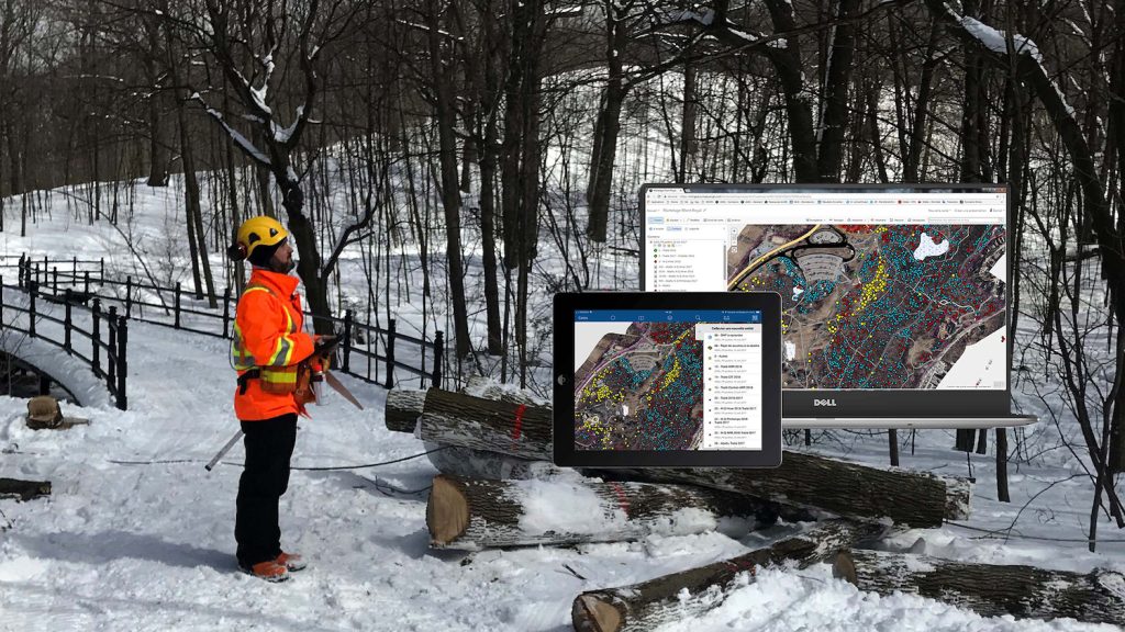
To simplify data collection, SRES started using Esri’s ArcGIS Collector® mobile app for map-based data collection. Collector allowed multiple users on different devices to edit a single feature layer at the same time. This meant two teams of students could update the inventory independently. Collector’s drop-down menus further accelerated the data collection. Moreover, the app worked both online, connected in real time to the ArcGIS server, and offline, disconnected, with a data sync performed once wifi was available. With the external GNSS receiver and Collector set up on Android tablets, the students were able to collect sub-meter accurate data in most of urban HRM.
“The receiver only struggled to obtain sub-meter accuracy in highly built-up areas, where tall buildings obstruct well over 60-70% of the sky,” Foster said. “All GNSS receivers will struggle when there is no clear view of the sky. In these instances, an imagery base-layer in Collector allowed the students to manually place points on the map with reasonable accuracy.”
Today, the students’ pace has become rapid. In just 25 field days this past summer, they visited over 2,100 trees for inventorying and follow-up monitoring. That’s an average of over 84 trees per day. On their most productive day, they measured 228 trees.
Trees can now be assessed every year for the two years of the warranty period. During a rapid drive-by inspection, a close collaboration between three stakeholders allows identification of the trees that need to be replaced under warranty. First, the students use the previously created spatial inventory on Collector to direct a municipal arborist, and the original contractor, to the right trees. The arborist then points out any trees requiring replacement, while the student makes notes on the corresponding trees in Collector. This method allows the them to assess the survivorship of hundreds of trees per day.
The Results: More than $270,000 in Warranty-Covered Tree Mortality Identified

Over 700 trees were covered under the warranty period and, therefore, marked for replacement by the contractor at no cost to the municipality.
Since inventorying began in 2013, the students have added over 8,800 trees to the database. Nearly nine out of every ten of these — or more than 7,800 — had been planted by contractors.
From their ongoing assessment of trees, the students have identified approximately 800 dead trees sometime after planting. Over 700 of these were noted within the warranty period and, therefore, marked for replacement by the contractor at no cost to the municipality.
“Dalhousie students have been able to identify about $270,000 worth of trees that require replanting by contractors, under warranty, for HRM,” Foster said.

Although there are many ways a tree can die, natural causes are by far the most common. Death related to natural causes usually happens within the first two years.
“This could be because the tree was planted incorrectly, not maintained properly, or was part of poor stock in the first place,” Foster said.
If the tree is noted to have died from natural causes within the first two years, the contractor must replace it.
“This has proven incredibly valuable as part of asset management in HRM,” Simmons said. “It ensures that contractors provide the service to which they are obligated.”
This constant monitoring of the trees results in significant savings to taxpayers, while providing a healthy urban forest for the municipality’s citizens and the environment.
The findings have also provided a number of insights that could be indirectly related to future cost savings, such as through risk mitigation and proactive planning.

“Dalhousie students have been able to identify about $270,000 worth of trees that require replanting by contractors, under warranty, for HRM.”
— David Foster, Former SRES Intern and Current Dalhousie Ph.D Student


Additional Results: Insights into Species Diversification
Historically, planting programs have tended to support the dominance of native and near-native (i.e., native to neighboring New Brunswick) trees. Yet, as North American cities have learned throughout the 20th century, with Dutch elm disease — and as they suffer today through the spread of the pernicious emerald ash borer — the dominance of any single species can be dangerous.
In HRM for instance, the Norway maple (Acer platanoides) is an invasive tree that currently comprises as much as 40% of the canopy in some neighborhoods and is no longer planted. Today, the municipality plants a wide diversity of trees, thereby reducing the risk that the total loss of any one tree species would be catastrophic to the tree canopy as a whole. Of the 8,800 inventoried trees planted since 2013, the following species are the most common:
- 869 American elm (Ulmus americana “Princeton”)
- 735 red maple (Acer rubrum)
- 706 basswood/American linden (Tilia americana)
- 572 red oak (Quercus rubra)
- 546 sugar maple (Acer saccharum)
“The diversity of these new tree plantings is helping us address what historically has been an imbalance that favored a Norway maple-dominated canopy in Halifax,” Foster said.
As the density of certain species changes each year, the researchers can recommend adjustments in the plantings.
“An analysis of the data gathered over the past six years shows us that future plantings may need to focus less on some of the species, such as the American elm, for example,” Foster said.
Additional Results: Protecting Powerlines

In addition, the inventory has shed light on the risk that street trees might pose to infrastructure. Trees are often the cause of damage to powerlines, for instance. But understanding the spatial relationship between trees and infrastructure can help make pro-active decisions.
“The majority of HRM’s powerlines are above ground, but trees are still planted in proximity,” Foster said. “Having a spatial view of the density and types of trees planted under powerlines, on any given street, helps the municipality move toward more proactive conflict mitigation, such as through cyclical pruning of street trees. This insight can help guide future operational planning and budgeting.”


Additional Results: Analyzing the Effect of Environment on Long-Term Survival

Spatial analysis also provides clues to future tree health. For instance, the distance between a tree and the nearest curb could indicate the volume of soil and other resources available. Depending on the resources available, a tree’s size and lifespan could be limited. Tracking this information allows urban foresters to understand the relationship between how trees are planted and how they might perform in the future.
“The goal is to provide trees with the greatest soil volume possible,” Foster said. “This ensures trees can have the greatest chance to an optimal growth.”


Looking Ahead: Students Expanding Knowledge of Tree Survival through Spatial Analysis and the Arrow 100

Not only did the SRES students find a way to inventory each of the 1,000+ trees planted annually, and not only did they also revisit each tree under warranty to track its survivorship — but as of this year, they were able to expand the project.
This year, SRES acquired another Arrow 100 for use with the inventory and other projects. Dr. Duinker was also able to add two more undergraduate students to assist the graduate interns. The students’ expanded team was able to revisit trees that had been planted back in 2013. This provided the data required to perform spatial analysis on long-term planting success.

“These data have yielded interesting insights into planting and condition trends over the years,” Dr. Duinker said.
— Dr. Peter Duinker, Dalhousie University Professor and SRES Supervisor
“Through analysis in ArcGIS, the inventory yielded interesting trends related to tree planting and development,” Foster said.
As the plantings continue, and as trees have more time to grow, the historical record is expected to help researchers at SRES and decision-makers at the municipality better understand the factors that contribute to long-term growth and survival.
“These data have yielded interesting insights into planting and condition trends over the years,” Dr. Duinker said.
The Dalhousie-HRM partnership has demonstrated immediate value to the municipality and its student researchers and provides HRM with a critical tool for urban forest management. Moreover, they hope their data help support a more successful tree-planting program that demonstrates the value of spatial inventories to urban forest management.
“We hope to continue tracking tree planting in HRM, and we look forward to continuing to improve how urban forest management is conducted,” Foster said. ““The ultimate goal is not just to ensure the municipality gets the value that taxpayers expect from contractors, but to use data and analytics to help make our cities greener, healthier places to live.”
Eos would like to thank David Foster for his contributions to this article.
Watch David Foster present his work at the 2018 Esri Canada User Conference in Fredericton:
Download a PDF of this article in ENGLISH.
Télécharger cet article en FRANÇAIS.
You May Also Like One of These Success Stories
Montreal Increases Pesticide Treatment by 6300% Annually
To save its iconic forests from the Emerald Ash Borer, Montreal used Arrow 100 for pesticide control with Collector and iPads, switching from manual tools.
Canada Students Determine the Health of 2,000 Street Trees
Students from Dalhousie University used the Arrow 100 for urban forestry. In just one weekend, students mapped over 2,000 trees on personal mobile devices.
