Eos Positioning Systems® offers a variety of hardware, software and solutions pertaining to high-accuracy GNSS positioning. This page provides a complete list of the current products Eos offers, including these:
- Arrow Series® GNSS Receivers
- Other GNSS Hardware and Solutions
- Eos Bridge™: Bluetooth® connector
- Eos Locate™ for ArcGIS®: Solutions for underground utility mapping
- Eos Laser Mapping™ for ArcGIS: Solution for capturing assets from afar with high accuracy
- Eos Software, Tools and Utilities
- Eos Tools Pro: Free GNSS monitoring app for Arrow GNSS receivers, which also houses Eos Locate™ and Eos Laser Mapping™ solutions
- Eos Utility: Configuration and monitoring utility for Arrow GNSS receivers which offers Windows users additional features than Eos Tools Pro
- Arrow USB Drivers: Utility for having your Windows device recognize Arrow GNSS Receivers
- Sources of Differential Corrections
- Atlas®: Providing 4-50 cm accuracy anywhere in the world, especially when SBAS, RTK, and local base stations are not available
Arrow Series® GNSS Receivers
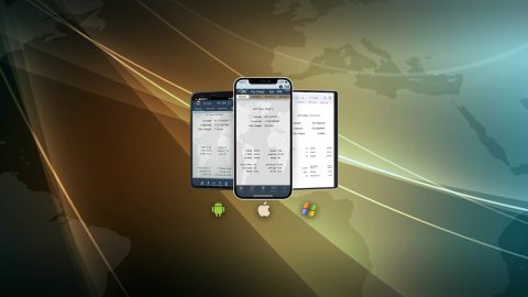
Arrow Series® receivers provide survey-grade or submeter positioning via Bluetooth® to any iOS®, Android or Windows device running a data-collection app. Choose from the Arrow Gold®, Arrow 200®, Arrow 100®, and Arrow Lite® GNSS and GPS receivers. Each receiver offers its own unique compatibility with various differential corrections systems, support for frequencies and channels, and enhanced features. The most popular Arrow Series® GNSS receivers are the Arrow Gold® and Arrow 100®. In addition, we invite you to explore our newer Arrow Gold+™ and Arrow 100+™ (plus models) GNSS receivers.
Arrow Gold® RTK GNSS Receiver
Arrow 200® RTK GNSS Receiver
Arrow 100® Submeter GNSS Receiver
Arrow Lite® GPS Receiver
Other GNSS Hardware and Solutions
Eos offers a variety of solutions which allow field crews to perform advanced data-collection workflows with Arrow Series® GNSS receivers. Each Eos solution is the result of strategic partnerships with leading software and hardware providers, such as Esri and Laser Tech (LTI). While Eos solutions are offered for free, you must have the required hardware and software, including partner products, to take advantage of each solution. The following hardware and solutions explain the current available Eos solutions and related hardware:

Eos Bridge™

Eos Laser Mapping™ for ArcGIS

Eos Locate™ for ArcGIS®
Eos Software, Tools and Utilities
Eos software, tools and utilities allow you to monitor GNSS data from your Arrow Series® GNSS receivers in real time. They also allow you to perform advanced capabilities, such as connecting your Arrow GNSS receiver to a Windows device and partaking in advanced functionality, such as audible and visual alarms, special configurations, and more. Browse these Eos software, tools and utilities below:
Eos Tools Pro

Eos Utility
Arrow USB Drivers
Sources of Differential Corrections
Eos Arrow Series® GNSS receivers work with a variety of differential correction sources worldwide (e.g., free SBAS, free and paid RTK networks, local base stations). But in places where these differential correction sources are not available, Eos offers a paid Atlas® subscription service. With Atlas® and Arrow GNSS receivers, you can acquire 4-50 cm positioning accuracy anywhere in the world, depending on your subscription. Learn more about Atlas® and contact us today.