


Workshops We Recommend:
Workshop 1 — “WK006: Intro to UAS for GIS Professionals”
Presenter: Michelle Carroll, SC Recon
Hardware Required: None Required: Bring a laptop or tablet to explore drone datasets
Description: Learn the fundamentals of unmanned systems and keys to integration with GIS, CAD and BIM. We’ll explore platforms, sensors, software, regulations, workflows, datasets, and geospatial deliverables. Attendees will leave with solid knowledge of the components . The concepts in this course are the building blocks for the intermediate UAS for GIS Professionals course offered in the afternoon. Bring a laptop or tablet to explore drone datasets
Workshop 2 — “WK015: Advanced UAS for GIS Professionals”
Presenter: Michelle Carroll, SC Recon
Hardware Required: Bring a laptop or tablet to explore drone datasets
Description: Unmanned systems have landed at the intersection of emerging technology and mainstream tool. This workshop touches on all the components of UAS that GIS professionals need to know: Platforms, software, mission planning, data processing, and data management. Attendees will explore real-world examples of UAS missions and leave equipped with considerations for both in-house programs and contracted flights.
Visit Eos Positioning Systems® (Eos) — a 2019 Esri Award-Winning Silver Partner and ArcGIS Online Specialty Partner — at the 2019 MN GIS/LIS Annual Conference. This year’s event will be held at the River’s Edge Convention Center in St. Cloud, Minnesota. An authorized Eos representative will be exhibiting from October 2-4.
Eos is a Canadian company and Esri Silver Business Partner that specializes in simple, affordable, high-accuracy field solutions (GPS / GNSS) for the GIS and mapping community. Eos Arrow Series Bluetooth® GPS (GNSS) receivers fit directly into existing mobile GIS workflows and data-collection apps (e.g., Collector, Survey123, and even your own proprietary application!). Our solutions simply replace lower accuracy native device locations with higher-accuracy (submeter/cm) GNSS locations and metadata. The Arrow Series® GNSS (external Bluetooth® GPS) receivers work with any mobile device and field data-collection app.
Scroll down to learn how to find an authorized Eos representative. Ask for a demonstration of submeter/cm data-collection with Arrow GNSS!
Location
River’s Edge Convention Center
10 4th Avenue South
St. Cloud, MN 56301
Expo Dates and Times
Oct. 2 from 2pm-5pm
Oct. 3 from 10am-7pm
Oct. 4 from 8am-11am
Social Media
Event Website
Find Us On The 2019 MN GIS/LIS Annual Conference Floor Plan!
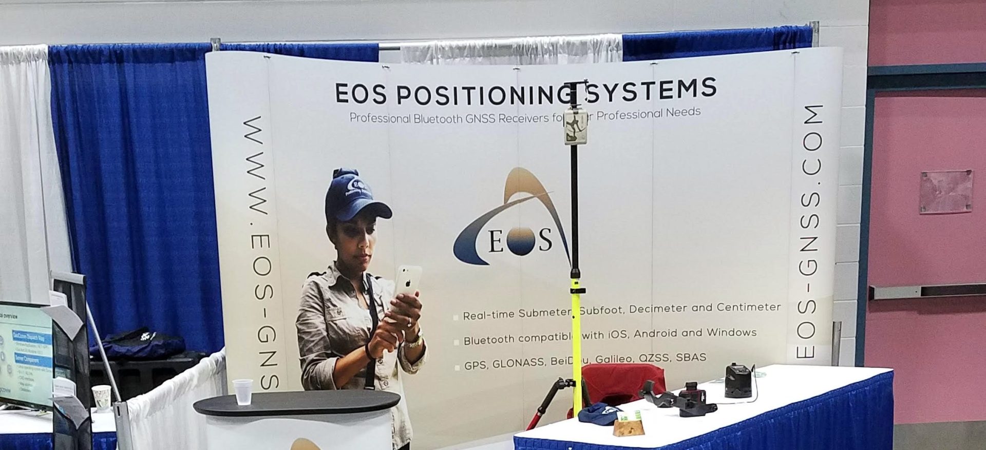
An authorized Eos Arrow representative will be exhibiting in the expo hall at the 2019 MN GIS/LIS Annual Conference. Here is how to find our authorized representative on the floor plan!
Look for the below setup at Booth #209:

Look our team at Booth 209!
