
Synopsis
Esri recognized Eos Positioning Systems with an Esri Partner Conference Award (EPC Award) in March 2019. In relation, Esri decided to explore why Eos and Esri technology work so well together. In this video interview with our CTO Jean-Yves Lauture, the storytellers explore why using high-accuracy Eos Arrow GNSS receivers with Esri mobile apps (e.g., Collector, QuickCapture, Survey123) makes for smart field data collection.
Note: Toggle on closed captioning by hovering over the video and clicking “CC” in the bottom right corner.

Transcript for “Video Case Study: Eos and Esri Make Urban Forestry Easy (An Esri Partner Spotlight Video)”
[Music]
I was born and raised in Port-au-Prince, Haiti. In 1991 there was a coup in Haiti and that’s how I moved suddenly to Montreal. The city has a beautiful landscape with a dense canopy; this is due to the wide variety of trees planted throughout Montreal.
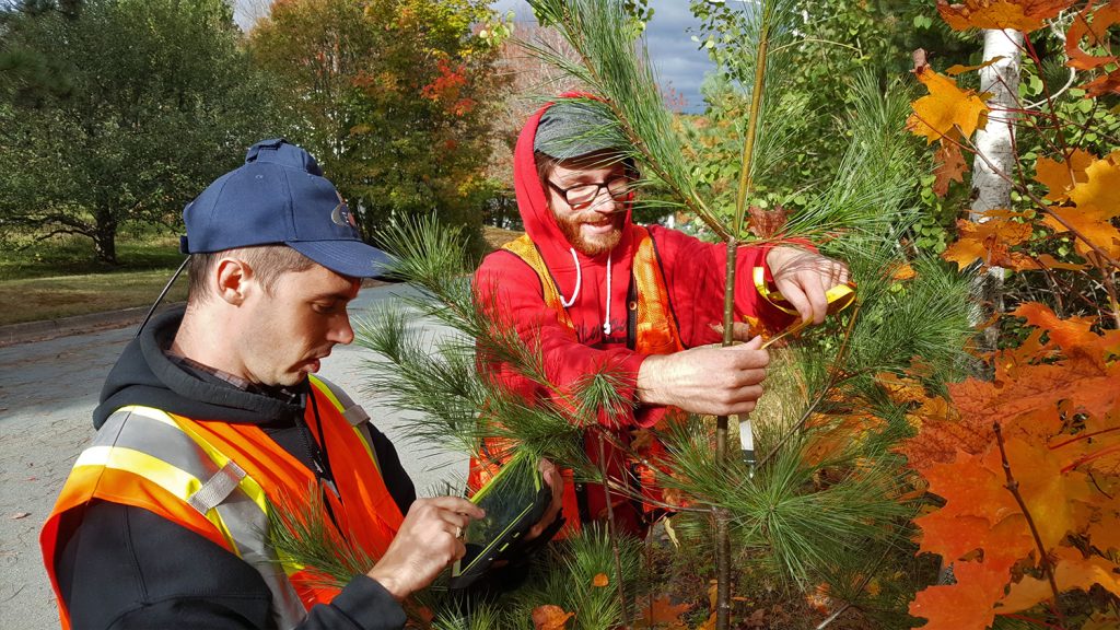
In 2011 there was an insect that came from Asia and started infecting the ash trees. The insect is called the emerald ash borer and after it infests a tree, it dies after a while. Before the residents realized, it had already spread throughout Montreal. So, first, the city had to assess how much damage had been done; what trees had been affected and which were healthy. So first they had to do an inventory of all the ash trees and they also had to find a means of cutting those trees and treating them.
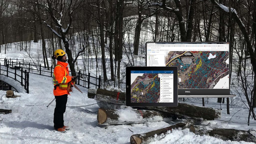
During the inventory of those trees, the city was initially using a consumer-grade receiver as they mapped them. They wrote everything on a piece of paper, then went back to the office and someone had to type the information into a sort of computer. This method was plagued with human errors and was also time-consuming; it was time for a change.
Over the years we have worked on a solution for this problem which is a receiver that is balanced between productivity and accuracy for forestry applications.
Since the early days of Eos Positioning Systems, we’ve always had a very tight collaboration with the Esri mobile teams. This collaboration led us to create a field mobile application called “ArcGIS Collector,” and it uses the internet. Thus, it can be used on your cellphone, your tablet, or with whatever device you choose. It’s live; all its data goes to the maps and people at the office can see the work being completed in real-time, which is fantastic.
With the new workflow that they achieved by using ‘ArcGIS Collector,’ they were able to increase productivity by 6300% and take inventory of 250,000 trees.
Currently, they have a map of every single species of every single tree and know the level of infestation that has occurred. This helps them make decisions like “which tree do I cut this year?” because they wanted to cut all of them at once. With our solution, the city of Montreal was able to go from 500 trees treated in 2011 to 32,000 trees in 2017.
[Music]
You May Also Like One of These Success Stories
Montreal Increases Pesticide Treatment by 6300% Annually
To save its iconic forests from the Emerald Ash Borer, Montreal used Arrow 100 for pesticide control with Collector and iPads, switching from manual tools.
Halifax Students Identify $270,000 of Covered Tree Replacements
Students hold contractors responsible for $270,000 in warranty-covered replacements by using Arrow 100 for tree inventory with Esri Collector.
