Synopsis:
Eos hosts “What’s New in High-Accuracy GPS for Esri Mobile Apps?” at the 2019 Esri User Conference in San Diego, California. In these speeches, we explore the value of multi-constellation GNSS paired with Esri Mobile apps, and give examples of its many applications.
[Music]
SARAH ALBAN: We’re going to have three presenters today, first up will be Jean-Yves Lauture. He’s our CTO at Eos Positioning Systems. Then we’re going to have Eric Gakstatter; he’s a technical consultant who’s going to speak to us on the benefits of having four constellations. And we’ve also got with us Jeff Shaner who is in charge of Esri mobile apps.
We hope you enjoy and definitely stick around to ask us some questions. If you haven’t come down to the booth in the expo hall yet, we encourage you to do so and get a hands-on demo. So, thank you so much and I will hand over to Jean-Yves.
Preview
JEAN-YVES LAUTURE: Happy to have you here and happy to host you.
Thank you for being present.
The flow of the presentation today is going to be first of all for those who don’t know about Eos; who we are Eos and what do we do. Also, we’re going to come in with some subjects or topic of high interest such as GNSS and GPS.
What is the status of GPS today?
We’ll talk about GNSS multi constellations; we will adequately cover that. Then I’m going to speak more on the few solutions that Eos has come up with since last year to empower Collector a little bit, to do things that it usually didn’t do; like laser offset and other things. And also we have with us Jeff Shaner, as Sarah mentioned. Jeff Shaner is going to talk to you about what has been done lately in the Esri mobile apps division, especially in ArcGIS Collector and its latest version. He will also tell you what is to come in their roadmap.
Who is Eos?
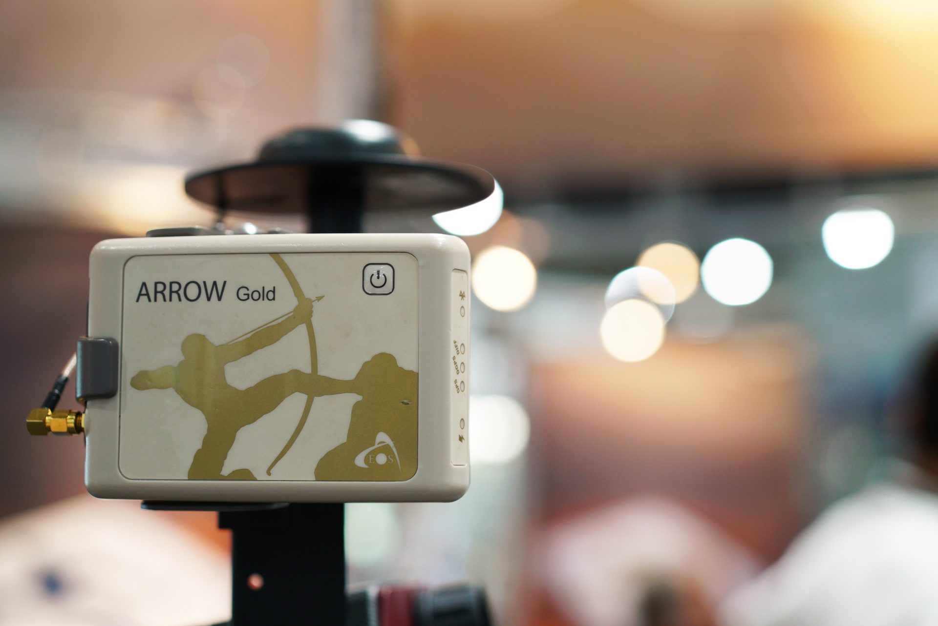
So for those of you who don’t know Eos; Eos builds and manufactures high-accuracy GNSS receivers for mapping applications. The idea behind it was to provide one-centimeter accuracy to people who know about GPS but are not surveyors and still want high accuracy in their mapping. It was a difficult task over the years because we pioneered our technical team for years by having the first Bluetooth receiver on the market back in 2001 and then having the first iOS®-compatible receivers on the market. I remember the old days with Jeff back in 2014 when the GNSS metadata was being added to Collector.
The Arrow 200 was the first iOS RTK compatible receiver on the market and fortunate enough the timing was perfect with us at Esri because we could develop and add metadata into the mobile applications.
GNSS Constellations
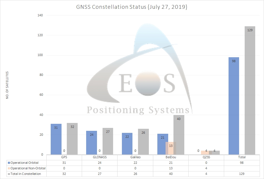
We have various models ranging from sub-meter down to one-centimeter accuracy using RTK. We’re going to start with the GNSS Constellations Status. We used to talk about GPS but now we talk about GPS, the American constellation. GLONASS, the Russian constellation. We also have Galileo, the new European Constellation that has come on very very strong with a lot of aggressive launches over the past two years, for us to currently have an almost complete constellation of Galileo satellites. We also have BeiDou which is a Chinese constellation, which is partly regional to China and also partly global. The global constellations today add up to a total of 128 satellites in orbit around the earth; with 98 usable. This 128 is a total of orbital and non-orbital like BeiDou. I’m going to be passing on to Eric and he’s going to show you the current performance and the reason why more constellations can help today in difficult conditions. This is because GPS has its limitations and adding more constellations will really help. Eric, I’m going to invite you to come up here.
Benefits of Having 4 GNSS Constellations (more satellites)

The current phase of the Chinese and European satellites are really helping us a lot and they have changed things dramatically even in the last year.
I give a similar talk on this about a year ago and since then China has launched 18 additional satellites. It really helps us out from a high accuracy standpoint, and this is one of the mantras I talk about in the presentations I give. From then it has even become more. I used to say this a couple of years ago “GNSS technology is going to change more in the next 3 years and it has in last 15” and I’m going to venture to say this currently “It’s going to change more in the next two years than it has in the last 20 years.”
“GNSS technology is going to change more in the next 3 years and it has in last 15” and I’m going to venture to say this currently “It’s going to change more in the next two years than it has in the last 20 years.”
The reason is that there’s more satellites. So here are a few acronyms and definitions to get out of the way so that we’re sort of on the same page. GPS is the U.S. constellation that was sort of the gold standard out there; there are 31 satellites in orbit and it’s pretty consistent. Whenever they launch a new one, they have to take one out of service because the ground infrastructure can only handle 31 currently. GLONASS is the Russian version of GPS with was designed or developed around the same time and then it took a nosedive at the end of the 1990s because of political instability. However, it was built back up and is stable now with about 24 satellites orbiting the Earth globally. The last two are the wild cards: Galileo is the only system of the four that is civilly funded the other three are funded primarily by the military. The Galileo system is civilly being funded by 28 member countries; 27 member countries from Europe. It’s really taken off and they’re launching about four a year, there’s 22 in orbit right now and they’ll finish off their constellation this year/next year but the satellites are usable now. As I mentioned BeiDou has gone from zero to hero in the last two years.
“BeiDou has gone from zero to hero in the last two years.”
There’s a glossary of terms here; so when I throw these acronyms out; I want to make sure we hit the definitions right. RTK is centimeter accuracy in real-time, that is centimeter accuracy GNSS in real-time/in the field. To define an RTK base station, let’s use a short explanation. With high accuracy GNSS, you have to have access to a base station of some kind, it doesn’t have to be next door, it could be 30 miles away or it could be a network in your state and half the states in the U.S. have RTK networks that have free access to them. But when I talk about RTK base stations or RTK networks, it’s infrastructure that is set up in an office building somewhere that’s collecting data and is connected to the internet and can send data to you in the field.
This is a cool slide from UNAVCO to give you an idea. We talked about stuff orbiting the Earth; these are the GNSS satellites orbiting the Earth. You know sometimes people ask why GPS satellites don’t crash into GLONASS satellites. Well, there are people a lot smarter than me that know how to manage those kinds of systems and this truly gives you a good idea of how they work. When you look at the orbit of the Hubble, you’ll notice its orbit in terms of the distance from the surface of the earth compared to GNSS. So just to give you an idea of scale; the GNSS satellites are about 12,000 miles. Of important note to me is how amazing this technology is. At 12,000 miles to outer space, they broadcast a signal strength of about 50 watts. Barely powerful enough to light a bulb but very efficient.
“Of important note to me is how amazing this technology is. At 12,000 miles to outer space, they broadcast a signal strength of about 50 watts. Barely powerful enough to light a bulb but very efficient.”
However, it’s a weak signal and that causes some problems. Such as problems we have when we go next to trees, next to buildings; this is because the satellite signal is weak and can be blocked by your body, it can be blocked by buildings it can be blocked by trees, and so on. So the more satellites you have for high accuracy, the better you are. So I’ve been talking about four constellations for a lot of years and how much benefit they’ll be to having four constellations but that’s all just talk, that’s all just theory until you actually test it.
“satellite signal is weak and can be blocked by your body, it can be blocked by buildings it can be blocked by trees, and so on. So the more satellites you have for high accuracy, the better you are.”
So, fall of last year I set up a test course near my office and we went through it. It took a lot of work to do it. It’s kind of hard to see but we’ve got about 22 control points underneath heavy tree canopy out in the open of this park, underneath medium tree canopy, light tree canopy and so on. I really wanted to know how much better if I ran through the test course with a different number of constellation receivers. So, we had it surveyed; I had some master student interns and layout the test course with a robotic total station, they went through it, adjusted all the points and ran it through opus. It really got them tied down reasonably tight. Also, you have to do this operation with survey points under tree canopy because you can’t do a GPS and be reliable with it. A neat thing we also did is to characterize the tree canopy around each of these points. We had a camera that had a bird’s-eye 360 lens, so we set it on the ground and took pictures straight up.
So this is a clearer open environment because it is one of the control points that was in a wide open region in the park. This is a light tree canopy and you can imagine it if you’re in a park. You’ve got some small trees around you that you’re working with and its a pretty benign environment and then it starts to get a little hairier; here’s some of the points we set up in moderate tree canopy where you have a complete side of view of the receiver blocked with pretty reasonable sized trees. Tree canopies is a subjective term – I mean what’s tree canopy in Arizona compared to tree canopy Pennsylvania compared to tree canopy in Texas and Oregon. We like to think that Oregon is the number one Christmas tree exporter in the US and has pretty good size trees. Here’s a heavy tree canopy where you don’t have a clear view of the sky at all, you’ve got big diameter trees around you and these are the nasty ones, right? Anybody ever been in these type of environments, it’s just, right? It’s frustrating because you’re just sitting there waiting for enough satellites to come in and your accuracy to get down to the point that you can accept. It’s a really tough environment but I wanted to make the environment as nasty as possible. I wanted to stress it to the point that GNSS didn’t work. So what we did is we took four days of the first week of January this year. There’s still lots of foliage because we’re in Oregon and foliage kind of never goes away for the most part. So, we took four days and about 20-22 survey control points, not sure how many. I had two crews running and we collected a thousand points of data. I had them going round and round; they worked really hard. I had four different receivers set up on the test course that the crew was running through. One receiver was GPS only. One receiver was GPS and GLONASS. One was GPS, Galileo, and BeiDou. And one was all four constellations. We took 30 seconds of data on the control points that were out in the open sky and sort of light canopy and then three minutes of data on the moderate and heavy tree canopy. The reason we took more time with the heavier canopy regions is because we didn’t know how fast it may fix to a centimeter solution and we didn’t want to run out of time before it had a chance to but then on your flipside, we didn’t want to wait there for 20 minutes. So we picked three minutes as a sweet spot to do that.
“One receiver was GPS only. One receiver was GPS and GLONASS. One was GPS, Galileo, and BeiDou. And one was all four constellations. The conclusions are that there’s a 50% productivity increase going from GPS-only to GPS plus GLONASS. And there’s another 50% increase going from GPS/GLONASS to using all four constellations.”
General conclusions:
We actually have a whole day presentation that I do on this whole test where we go through a ton of statistics and all kinds of different things here but I need to keep it short here. The conclusions are that there’s a 50% productivity increase and this is not out in the open sky right but under the heavy and moderate tree canopy. So 50% productivity going from GPS only to GPS plus GLONASS. Another 50% increase going from GPS and GLONASS which is pretty standard today to using all four constellations. The only asterisk as seen the bottom is that since the test course, there have been launches for the Galileo and the Chinese are much more active now. During the test course, we didn’t use the latest four Galileo satellites and eight BeiDou satellites. So we think our performance would be better if we ran it again today which we plan to.
What’s interesting is that folks ask “Well how much more accurate if I use Galileo or BeiDou?” It’s not about accuracy; it’s all about productivity. It’s, how long do I have to stand there when I’m next to a bunch of trees or under a tree canopy to get a centimeter or close to a centimeter position. That’s what we refer to as productivity. We’re not talking about accuracy with one constellation versus four given that you have a reasonable number of satellites which are about the same. So, there’s no accuracy improvement it’s all about productivity.
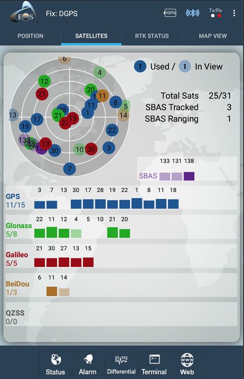
To give you an example, this is an actual receiver that we have running at our office and you can see GPS using nine, GLONASS – seven, Galileo – six and BeiDou seven. Actually, this is using the latest BeiDou as of last week maybe not Galileo but this is pretty solid. If you think about if you used a GPS only, you’d need three times more satellites. Again, it’s not about high accuracy, it’s all about getting more data and getting you a faster solution.
So just really quick I mentioned this before but about half of the US states now provide access to free RTK network. Down in California, it’s free, its GPS only and some GPS GLONASS. Arizona’s free, Oregon’s free, Colorado’s has free areas and the whole Midwest has free coverage except Illinois. That’s why people are moving out of Illinois these days. Now then down the southeast to and in the Northeast somewhat; about half the states have free RTK networks. Right now Utah is the only one offering four constellations and it’s partly because we have a project down there, I influenced them to set it up down there because we thought we could really benefit from it. New York offers three constellations. The rest are offering either GPS and GLONASS or GPS only. Most commercial RTK networks out there and I won’t speak for all of them because I’ll probably have someone yelling at me but most of them support two constellations maybe some of them support three or even four.
Having 4 Constellations Increases Field Productivity
So what is this leading this conversation up to? You have all these RTK networks out there; they’re only supporting one or two or three constellations, so a lot of clients that we have are setting up their own RTK bases which is pretty easy to do these days. Why would they do that? Well, one reason is that if you wanted more productivity in the field then you need an RTK base that’s broadcasting all four constellations, it’s best to set up your base because the others may be too expensive commercially. A lot of these are subscription services, especially up in the Northeast; they charge a thousand dollars a year per receiver, or down in Texas where they charge a thousand dollars plus per receiver per year. So, if you’ve got a field crew of 15, it’s reasonable to set up your own RTK base.
Here are just some of the entities that we’ve helped set up RTK bases for. We’ve got more than that but this is to give you a quick list of them. The interesting part about it is when you set up your base you can share data, and you can support a thousand users data requirements over Verizon or even your LAN, they aren’t too heavy for RTK; it’s really lightweight. Here’s what one looks like, it’s all baseline and there are different configurations. This one is developed with an Eos receiver, the box on the left is a Verizon cradle point modem. The modem is a $40 a month data plan or alternatively you can connect directly to your corporate LAN network and just piggyback off of it. On the lower right is a little Linux box that runs all the RTK software for base software that we developed. With the remote software we developed, you can have your users with their passwords and logins and remotely manage it. So we have bases even down in South America that we can log into from Oregon to help manage them. We set up monitoring so that if it goes down or if the Internet connection is interrupted, it sends a message out via text and email, you can set this up as well.
So that’s all I got. Any questions? I don’t want to take up too much time here because there are other people that have to talk. There’s my contact info, follow me on Twitter.
Great. Thanks.
Additional Benefits: Longer distances with retained accuracy
LAUTURE: As Eric mentioned, the results are mainly in productivity. But some other benefits of having multi-constellation is that it allows you to go to very long distances with your base station; it increases your baseline – the distance between the rover in the field doing the work and the base station. Typically, receivers are supposed to be within 20 miles of your base station. In the case of the Arrow Gold, for example, the normal baseline is about 50 miles and that’s what we tell people not to exceed. Because it’s about one centimeter error per 10km baseline distance. But using more satellites also allows you to have a better long-range baseline; it’s called the long-range RTK. So we’ve done testing up to about 80 miles and more and still getting below 10-centimeter accuracy, so the benefits are there and it’s going to get better in the future. Eos, as I mentioned before also provides unique solutions for Esri’s ArcGIS Collector. We know the powerful tool that Collector is today but Collector doesn’t go into specific type of applications, and this is where we come into play by offering our solutions.
Real-time Elevations
One that we offered late last year, which is highly in demand was the recording of orthometric heights following a GEOID model. In the U.S. it’s the GEOID12B which is part of the NAVD88 data on vertical datum.
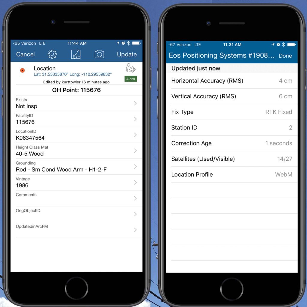
Collector did not yet have the function of supporting GEOID models, so we decided to do it and our receivers are now able to export a very accurate orthometric height and with the new version of Collector; 18.1.0 or whatever; the latest one in the App Store not Collector Classic, but Collector that used to be called Aurora in the beta phase. The new version of Collector now supports the Z value as part of its geometry – so you’re able to store orthometric height directly in the field.
Laser Mapping in the Field on iOS (with 3 workflow methods)
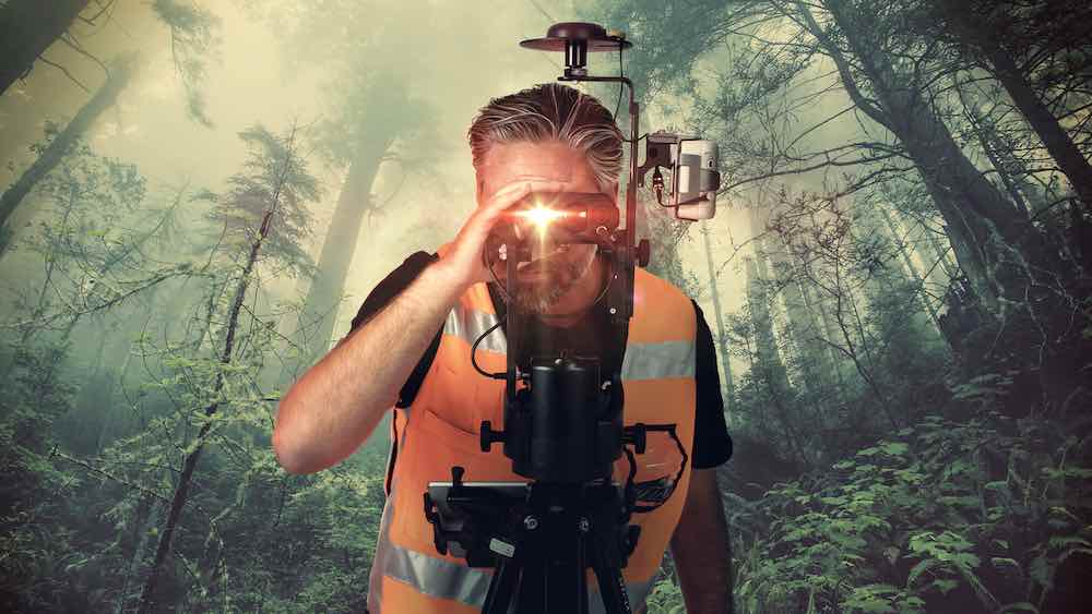
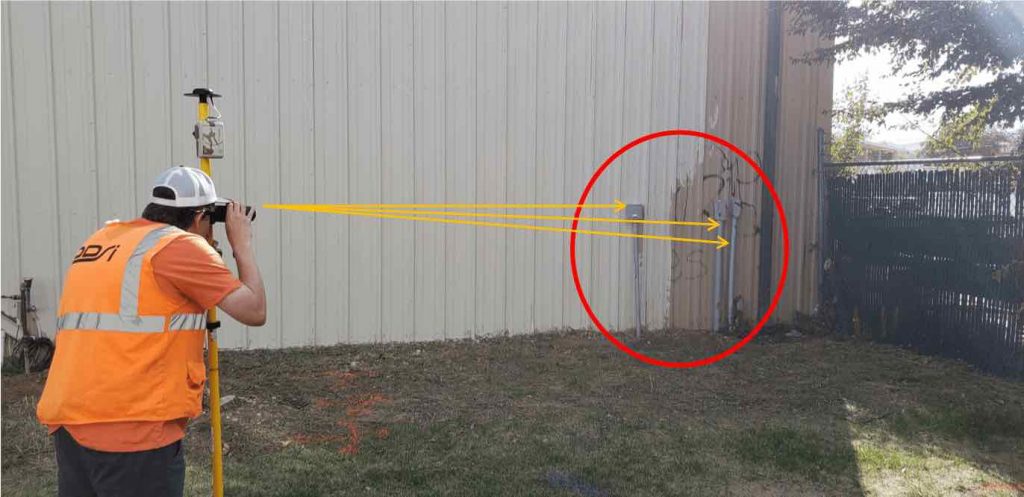
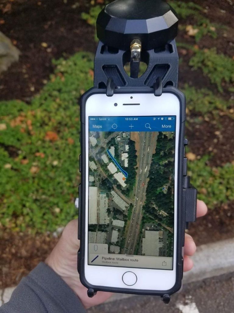
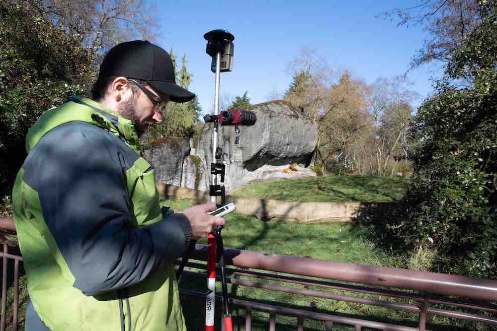
Last year we announced another solution for Collector, which is laser mapping on iOS. Yes, we have multi-constellation right now but sometimes you really need that accuracy on the canopy. There are situations where the assets that you want to map are not accessible. We had a nice case study that was published in August by our partners at the Woodland Park Zoo with regards to that. From the article, you really don’t have to go into a cage with a lion or bear in it to map assets. So they preferred to stay outside and using a range finder. It’s a very simple setup like this one where we have the receiver and you have a laser range finder from LTI which allows you to take a point from afar and still maintain your accuracy. There’s also another setup that is displayed on the right here; it’s a total station type of setup where you have an encoder. It is designed for people who require accurate angle measurements; you can make one point and then calibrate your encoder and map like a total station. What we did is to create a surveying technique that can be easily used by non-GIS people, that is people who don’t know anything about the system. So all this information is sent to Collector also.
So this is RTK data where RTK doesn’t work. It involves remote places and highway measurements. You can map panels on the highway without going there. When you need to map valves within a street intersection, you don’t have to block the road for that. There are a lot of situations where the laser can be very useful. It is very affordable, easy to use and does the job.
One of the three methods (workflows) of applying Laser is a Standard Laser Offset where you have a position; you enter a distance and azimuth and a slope then it computes the remote point.
The other one is a Range-Backsight; you define a backsight point, you record a control point, you’re going to be taking all your measurements, you calibrate your encoder with the backsight, so it gets where North is and then you’re able to map multiple assets afterward which requires a little tripod like this.
The other one is a Range-Range where you carry this set up shoot an asset, set a second GPS point, shoot that same asset. It gives you an intersection and gives you the opportunity to choose the proper point to maintain. It’s very easy to use and seamlessly transfers everything to Collector right in the field along with all the metadata. Something else that we’re working on right now that will probably be available in a month is another interface for Collector to bring underground subsurface mapping into Collector directly. The first model that we’re going to be supporting is a vivax Metrotech. Here’s a sample of a locate. So, the idea is to be able to locate and map at the same time. There won’t be any need for a separate initial mapping to know where the assets are. So the interface would be called up by Collector, and you will be able to record every single piece of information coming from your locator including the frequency, the depth below cover. It will measure the height at the ground level, the locate that was used, and everything along with all the metadata is transferred to Collector. There’s also a fully automated mode and there’s a semi-automated or fully manual mode. So watch out for this; those of you who are interested. With this solution we’re going to try and support the major models in the field and also rely on you — our users — to tell us what you’re using and if this is of interest to you.
Additional, Pending Updates from Eos
Other the things that we’re doing for existing users who are using Eos is to revamp the app in the next few months, so stay tuned for that on iOS, Android and Windows, which all have a new user interface. We are also coming up very soon with Windows version of Eos tools Pro that will eventually replace Eos GNSS tools and a tablet version of Eos tools Pro for Windows.
Other things that we will be coming up with are more solutions for Collector; one of them in this queue will be a point stakeout for people who want to stake out the point from a design and be able to compute, cut & fill volumes that will seamlessly be transferred into Collector.
At this point, I will leave the presentation to Jeff, who has more insight on Collector and other Esri mobile apps.
High-Accuracy for Esri Mobile Apps (Overview)
JEFF SHANER: First, I’d like to say thank you, everyone, for being the pioneers into field operations and using mapping technology outside of the office. You might not realize it but you are at the tip of the spear and you are the people in your organizations that are bringing a new evolution to Esri’s GIS technology as a whole and I want to thank you for all the work you’re doing. Within our group, our field operations team, we’re looking at the patterns of development of mobile solutions within your organization’s and the way that we think about it is through the context of the activities that you perform. We’re building a suite of mobile solutions to fit this need. It’s challenging for us to build a suite of apps that work across all the different sectors; anything from emergency management (I talked to someone today that’s using Collector to capture pythons in the Everglades — crazy stuff!) to any other need.
So we look at the ways that you work and we try to build new capabilities and new apps to support that workflow and we really do that by receiving feedback from all of you.
I’ll focus on the data capture aspects. We now have three products for field data collection as part of our suite. And the first one that Jean-Yves has been talking about a lot is our most mature product that’s out in the market right now and that’s Collector. How many of you here today are using Collector? Wow, that’s awesome, most of you are using it! And the rest of you should feel like why am I not using Collector yet, right? All these people are using Collector.
“How many of you here today are using Collector? Wow, that’s awesome, most of you are using it! And the rest of you should feel like why am I not using Collector yet, right? All these people are using Collector!”
So Collector has been primarily used for asset data collection and maintenance workflows where you are in charge of the maps and the data models and that has come to life because you’ve poured sweat equity into building our robust data models as part of what you do in your GIS system. We’ve been taking Collector and extending it with capabilities like integration with GNSS receivers from organizations like Eos. Collector as some of you might have noticed has been going through an evolution, we’ve basically replaced the engine that’s underneath, we’ve got a new body style to Collector, a whole bunch of new dials and features in it and we’re going to add to that continually, we released the iOS version of the new application late last year and the android version. We have all hands on deck trying to get another version done for this fall. Now one of the things I wanted to mention since most of you are Collector users today is some of the new stuff that’s come in. We recently released a new version of Collector shortly before the conference. You know within our development group we like to strain ourselves by not only presenting here at the conference but then trying to ship software right before it. So we’re not going to make it past the age of 55 most of us; my days are almost done. One of the most remarkable changes you’ll find in the latest iOS version is that there are over a hundred new transformation methods. If you haven’t used Collector with a receiver like the Eos Arrow receiver you might not be aware that when you Bluetooth pair it to your smartphone and you’re going to use RTK that you need to establish that transformation between coordinate systems or you might. It all depends on the map that you intend to make. We actually have a whole session and set of sessions on high accuracy data collection with Collector that I hope you’ve had the opportunity to be part of. However, most of the maps that you author and use in Collector are in WGS84 but your RTK networks at especially in North America are usually in NAD83. If you want to keep that accuracy you’ve got to do datum transformations. We have a whole suite of them now. We also have support for grid-based transformations in the location profile, and you can sideload those grid transformations to your mobile device, we also have them hosted in ArcGIS online so they can be downloaded, if you weren’t aware of that.
“Most of the maps that you author and use in Collector are in WGS84 but your RTK networks at especially in North America are usually in NAD83. If you want to keep that accuracy you’ve got to do datum transformations. It all depends on the map that you intend to make.”
Updates Coming to Esri ArcGIS Collector (map-based data collection)
Jean-Yves mentioned that we support elevation values in the geometry. Outside of an OS that elevation value is a height above ellipsoid value but thanks to Mr. Jean-Yves you can download an accurate GEOID model, and then it will get the orthometric height and then send it right into the elevation value. Where we’re headed next in that realm is that once the engine underneath supports vertical transformations, we’ll be able to provide that as part of the location profile as well. I think the other big thing to look forward to, especially if you’re a classic user of Collector on the Android platform moving to the new Collector is the user experience. We’ve done a lot in that realm to improve the way that you use GPS to collect data. When we first built Collector we were thinking very map-centric, it was about you tapping on the map to capture data but we’ve kind of moved to more of a GPS centric mode of data capture in the new application.
Some of the things I’ll mention will be in the next update of Collector. The last update to Collector added a whole host of new features. How many people here use the Apple platform? A good chunk of you. Anybody sideload basemaps? So you’ll be excited to know that you don’t have to use iTunes anymore you could just take your TPK or VTPKs if you want to build vector tile packages, share them to Google Drive and then use the files app on your iPhone® to automatically download them and bring them into Collector. Collector is instantly recognized in the ‘files’ app and off you go. There’s a whole new experience for offline that involves taking multiple map areas offline and you can move forward with that. As I stated earlier, we’re working hard to get the Android version ready. I briefly showed it in a road ahead presentation this morning and our goal is to get that out in Q3. We’re working now on a new design for a back-office capability with Collector that will really lower the bar of entry for getting up and running with those web Maps taking aspects like the location profile and all those settings while also giving you an administrative console for pushing them out to your users. Probably the biggest request out of all of this is to start to roll the smart form forum capabilities that you perhaps used with a Survey123 today into the rest of the platform.
“There’s a whole new experience for offline that involves taking multiple map areas offline and you can move forward with that.”
Updates Coming to Esri ArcGIS Survey123 (form-based data collection)
So we’ve just started working on the design experience for that. We designed it in a way that as you’re authoring a web map, you’ll get a pop up which will enable you to make a form and that form will have a conditional logic. We’re leveraging the Arcade expression language for this. If you haven’t learned Arcade yet, it’s a great weapon to have in your arsenal just like Python is. Arcade gives you the expression logic. We will have a new user experience on form controls and much more. So this is a prototype of some of that new functionality, look out for it.
The next application I’m going to briefly talk about is ArcGIS Survey123. Anyone here use Survey123? Wonderful. So Survey123 was born from us at Esri when we were getting our butts kicked in the nonprofit space. We were trying to compete with organizations like Open Data Kit and go after the census style of field data collection workflows where maybe you’re trying to assess or complete polio vaccinations in Nigeria, right? We needed to embrace a standard called XLS forms. We needed to provide a solution that provided a form in your mobile application and wrote that data to a feature service inside of our platform so that we got you stuck in our platform and into the feature service. That’s how Survey123 got started and then quickly evolved. A lot of you I’m sure don’t use it in Nigeria; I’m sure a lot of you use it to do inspections of assets, so we work closely with Jean-Yves and his team to make sure that as you’re out doing those inspection workflows with Survey123, it’s also directly supported by the Eos Arrow receivers.
Updates Coming to Esri ArcGIS QuickCapture (rapid, big-button data collection)
“With this application, you don’t get a form to enter attributes because it automatically creates the feature and it’s optimized for data capture while you’re moving.”
The last application I want to mention is a new one that we just released here at the conference called ArcGIS QuickCapture. Has anyone heard about it yet? There you’ve all heard about it. It’s a wonderful little application. Since you’re mostly Collector users here’s the way to think about it. When you make a feature layer, that feature layer has templates, right? The templates really drive the data dictionary inside of Collector. Well those templates can be buttons on a form and all the default values off of that feature template are just part of the feature that gets created but with this application, you don’t get a form to enter attributes because it automatically creates the feature and it’s optimized for data capture while you’re moving. So we’ve had a lot of organizations like pipeline companies for example that want to fly a pipeline in right away, or they’re working on a pipeline and they just want to mark out the violations or obstructions they see along the way. It may be brush that has overgrown and climbed an asset, and they just want to mark that and use their GPS at that location and move along. QuickCapture is the best solution for that but it can do much more than that. It can also capture lines and capture multiple lines simultaneously if you’d like as well.
I really encourage you to look at quick capture it works well with the Eos receiver it’s also been integrated like Survey123 and Collector. It’s an exciting new field data collection app that’s efficient from us as well.
That’s about all I have. We’ll continue to evolve all of these capabilities as we move forward. I think Jack’s goal for us is that we have at least two new applications a year that we have to build for you. So we’ll keep growing and evolving and you’re going to see a lot of exciting new development come from our team in the next couple of years. Thank you, Sir.
LAUTURE: Thank you very much, Jeff.
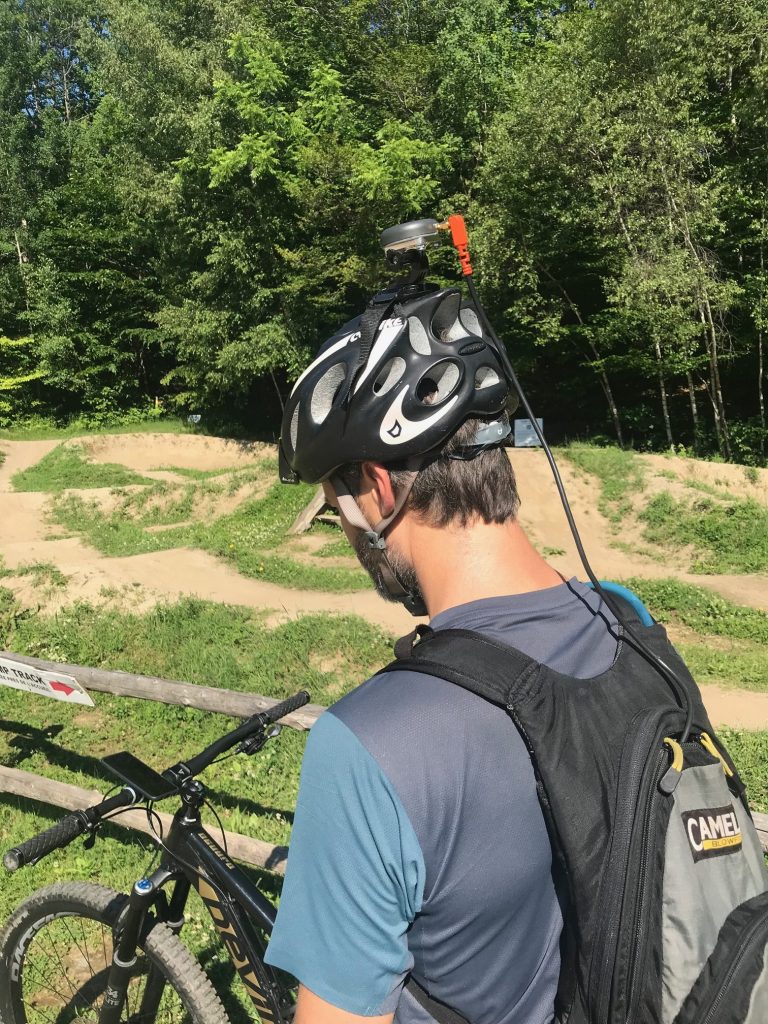
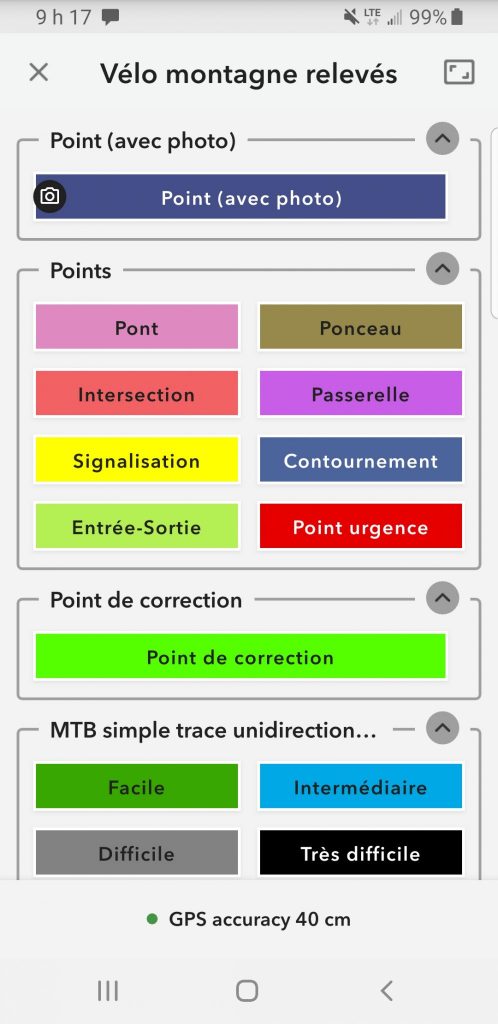
To add to what he said about QuickCapture. We have a project going on in Canada with the bicycle trail mapping of the province of Quebec. In those type of situations which some of you are familiar with during field mapping or ATV mapping, where you’re going high speed capturing at a very high definition. They were able to absorb five positions per second from our receivers with QuickCapture, which is very good. So there’s a lot of hope for this small application.
I think we’ve covered it all.
For those of you who have any questions for Eric, Jeff or myself on the receivers, on Esri’s products or multi-constellation. Feel free to ask them now.
Audience Q&A and Wrapup
Question:
SHANER: The question was; for those of you who didn’t hear it, “When you’re building your location profile there are a couple of projections listed for web locator — which is the correct one that you should use?”
Answer:
By my understanding, I’m going to try to recite the work order of a wkID, and I think it starts with twelve. Who knows that off the top of their head? Where’s Eric? I think Eric has the WkIDs tattooed on his arm. Yeah the 102 100, that’s it.
LAUTURE: Any other questions?
Well, thank you, everybody, for being here. For those who have not done so yet, please visit our website. For those of you using Collector for advanced high accuracy data collection we have a Learning Center with video tutorials showing you how to interface, how to create your profile. For example, with Collector, it gives you an instant tip depending on whether you’re using RTK or others. The tutorials show you how to set it up properly and how to take orthometric heights and record them in Collector. All these are on our website.
I also invite you to subscribe to our monthly newsletter. We receive news on the industry case studies and they are properly discussed in these newsletters.
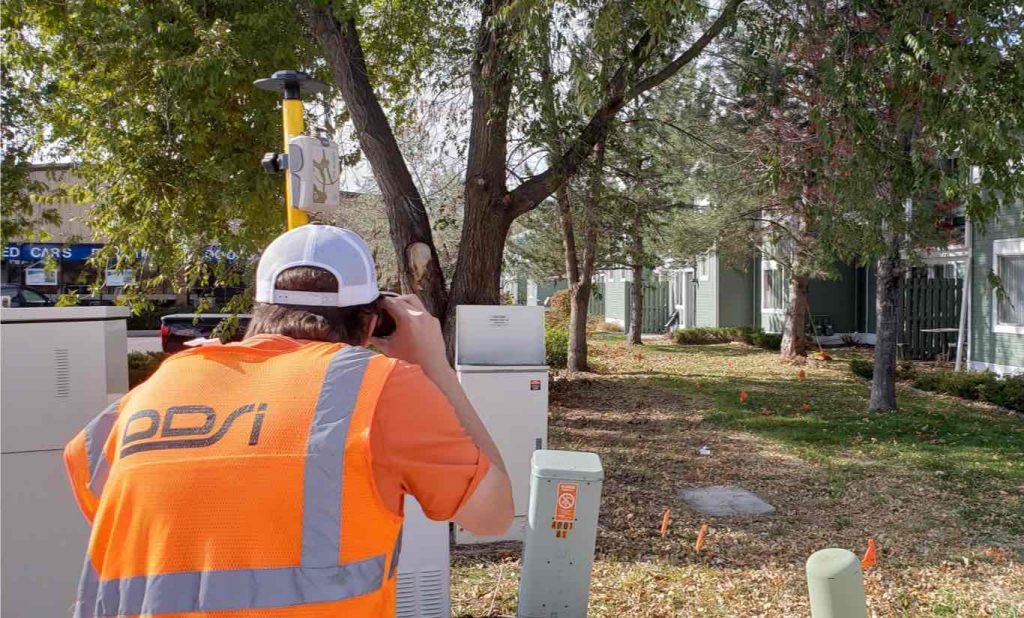
Also, drop by our booth number 719. There’s a whole bunch of case studies available depending on the situation you wish to apply this technology, whether it’s in the water or any other application of our solution. The latest case study that was released is with DDSI using laser mapping for telecommunication site surveys, explained by Mike George. That’s him seated right here – he used a complete laser mapping system for the case study.
Feel free to drop by and pay us a visit.
Thank you for being here and have a good day.
[Applause]
[Music]

