UAVs and GNSS: Using High-Accuracy GNSS to Set Ground Control Points (GCPs) for UAVs
Inexpensive unmanned aerial vehicles (UAVs) can collect a tremendous amount of valuable imagery that can be used to produce high-precision orthophotos resulting in 2 cm (or even less) pixel resolution. UAVs and GNSS receivers are amazing tools that complement each other. Notice that we wrote “high-precision orthophotos” and not “high-accuracy orthophotos”. There’s a big difference, and our Arrow receivers can turn high-precision into high-accuracy.
First, a quick discussion about precision vs. accuracy.
Precision vs. Accuracy
This is an important discussion when speaking of GIS because GIS professionals are constantly combining datasets from different sources. When you combine data sources in a GIS, it’s important that the spatial data is as accurate as possible. In other words, the spatial data is referenced to the same datum. If not, even “high-accuracy” data will be shifted, lose its accuracy, and be degraded to only high-precision. Please reference the following graphic for an illustration of precision vs. accuracy:
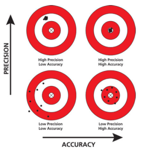
Figure 1 – Precision vs. Accuracy
High-precision with low accuracy isn’t always useless, but if you want to combine data collected from your UAV flight with other data in your GIS, you’ll need to reference your UAV imagery to the same datum/coordinate system as your GIS database. An efficient way to do this is by using ground control points (GCPs).
Ground Control Points (GCPs)
All inexpensive UAVs (eg. DJI Phantom Series, 3D Robotics, etc.) and some expensive UAVs, have a consumer-grade GNSS receiver built into them. The mediocre-quality GNSS receiver is generally accurate to 2-3 meters. This level of accuracy is ok for some projects, but if you want to really tie the UAV orthophotos down tightly, you’ll need to set ground control points (GCPs) for your UAV flights.
Setting GCPs involves two tasks:
-
Placing an actual target on the ground, or using a point (eg. curb corner) that is easily identifiable in the UAV photos.
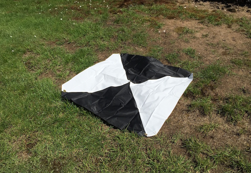
Figure 2 – Ground Control Point (GCP) target
-
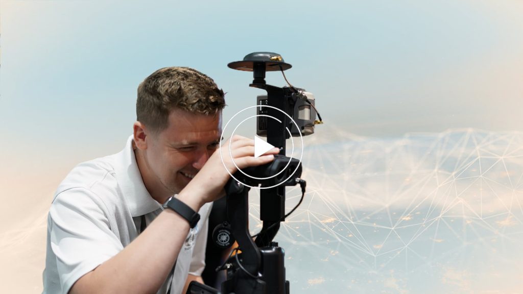
Collect high-accuracy GNSS coordinates on the aerial target or other ground control point. Of course, the more accurate the better, so most people use RTK GNSS, which is real-time centimeter-level accurate. Our Arrow Gold RTK receiver is a great candidate for such an application.
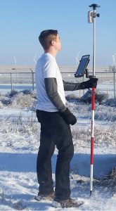 Figure 3 – Arrow RTK GNSS Receiver
What type of GNSS receiver should I use to set GCPs?
Ideally, you want to use the most accurate, efficient and flexible GNSS receiver. The Arrow Gold GNSS receiver fits that description perfectly. In addition to supporting all frequencies and constellations being deployed in the next decade, the Arrow Gold supports every GNSS correction option available today.
-
It’s RTK-enabled so you can use one of the hundreds of RTK Networks around the world to achieve centimeter-accuracy in real-time. With RTK GNSS, you can be setting centimeter-accurate GCPs in a matter of seconds.
-
If you’re not in range of an RTK network, the Arrow Gold can use the Atlas satellite correction service to achieve real-time accuracy of better than 8 cm anywhere in the world!
-
If you have a limited budget and want to give up the efficiency of RTK GNSS but maintain accuracy, data from the ultra-affordable Arrow Gold Basic can be post-processed anywhere in the world using free online post-processing services to achieve centimeter-level accuracy.
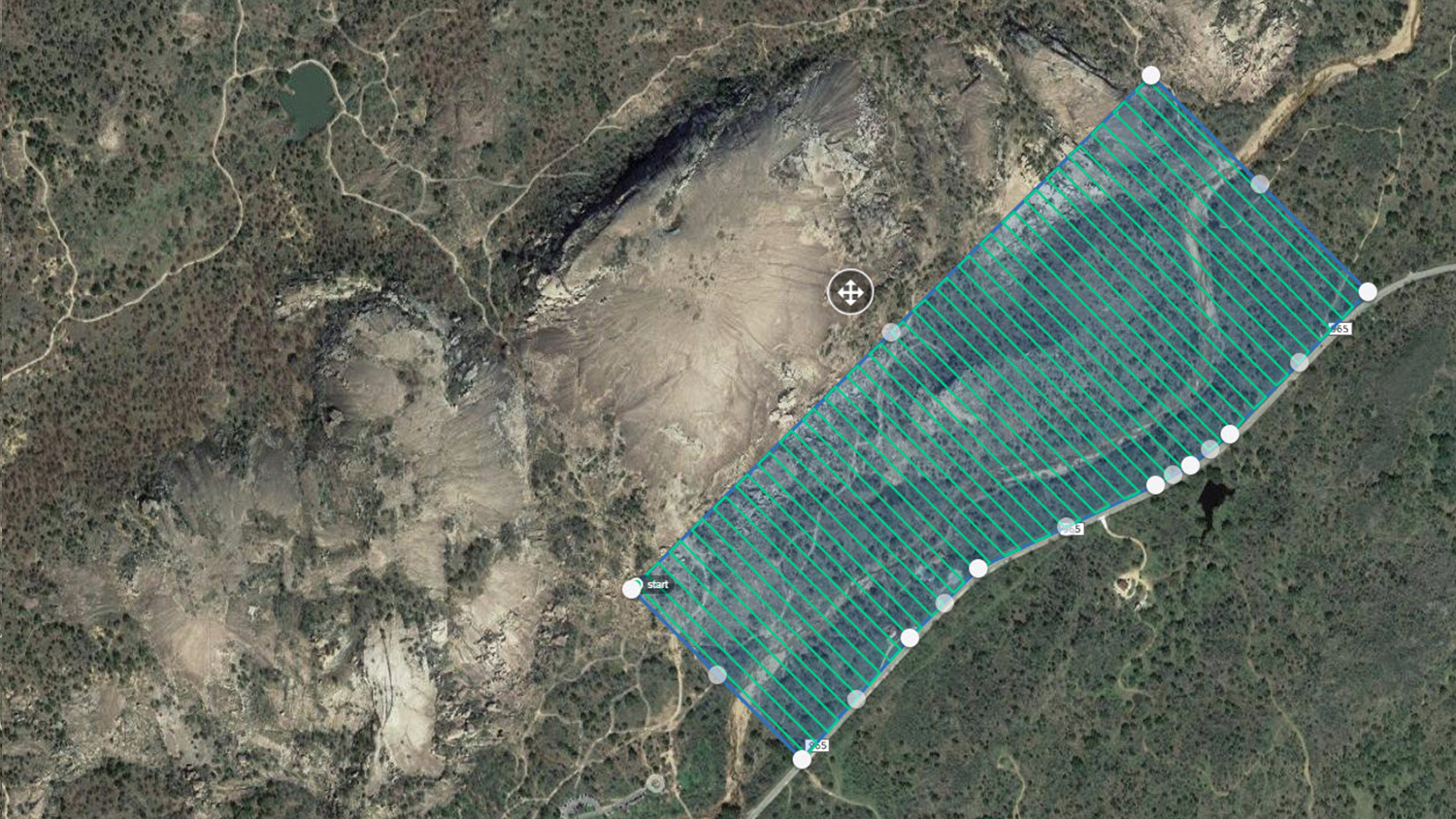
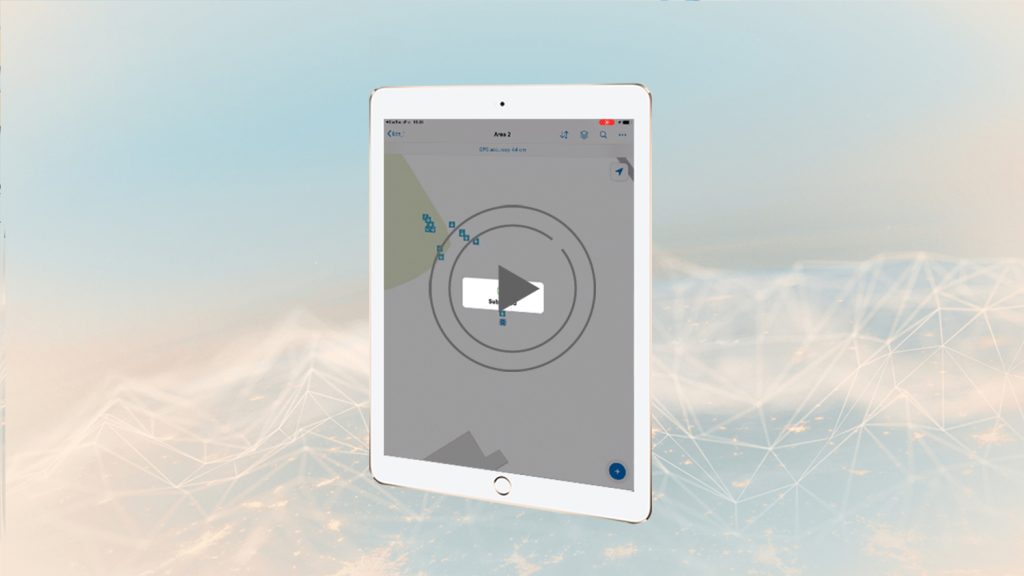
Following is an example of a small 18-acre site flown with an inexpensive UAV (Phantom 3 Pro) where five GCPs were set and surveyed with RTK GNSS.
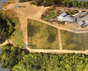
Figure 4 – Section of 18-acre site showing three GCPs
Following is a zoomed-in view of a GCP target:
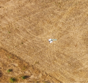
Figure 5 – GCP aerial target
In this example, the Arrow Gold GNSS receiver used to set the GCPs was using an RTK Network referenced to NAD83/2011 so the resulting UAV imagery is tied to NAD83/2011. Therefore, all data produced from the UAV will be tied to a standard datum, which in this case is the standard datum for the USA.
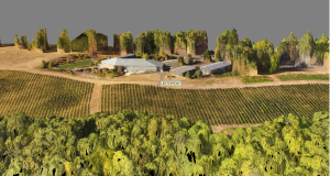
Figure 6 – 3D Point Cloud from UAV flight Referenced to GCPs
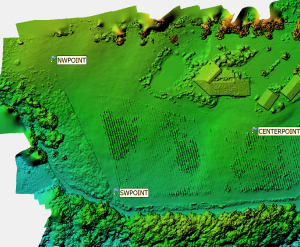 Figure 7 – Digital Elevation Model (DEM) generated from a UAV flight using GCPs
Of course, you can choose to purchase an expensive UAV with built-in RTK GNSS in an attempt to reduce the number of GCPs you need to set, but consider that since the RTK GNSS receiver is embedded in the UAV, you will be unable to use that expensive RTK -option for other purposes. On the contrary, when using an Arrow GNSS receiver to set UAV GCPs, you’ll also be able to use the Arrow RTK GNSS receiver on projects that don’t involve UAVs, and you’ll save a ton of money by not buying the expensive RTK-option for your UAV!
Explore Related Knowledge Base Items
Eos Locate™: How to Map Underground Utilities with ArcGIS
In the fifth and final Eos Locate tutorial, you’ll learn how to collect underground assets with Eos Locate outdoors with a recorded demonstration.
Field Demonstration: 3 Eos Laser Mapping Methods
In these videos, we demonstrate data capture using 3 Eos Laser Mapping methods: Range-Azimuth, Range-Backsight, and Range-Range.