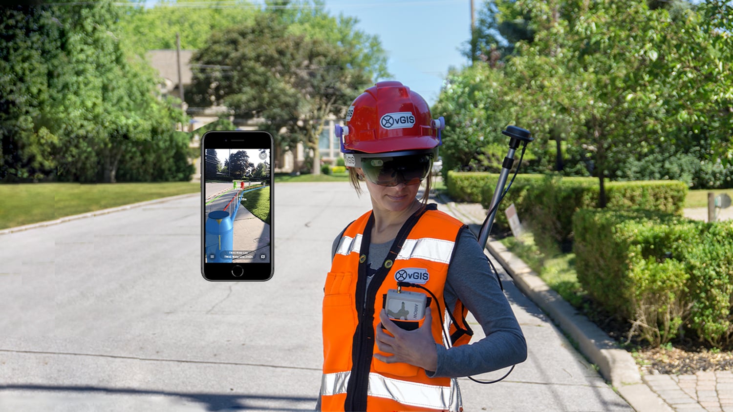

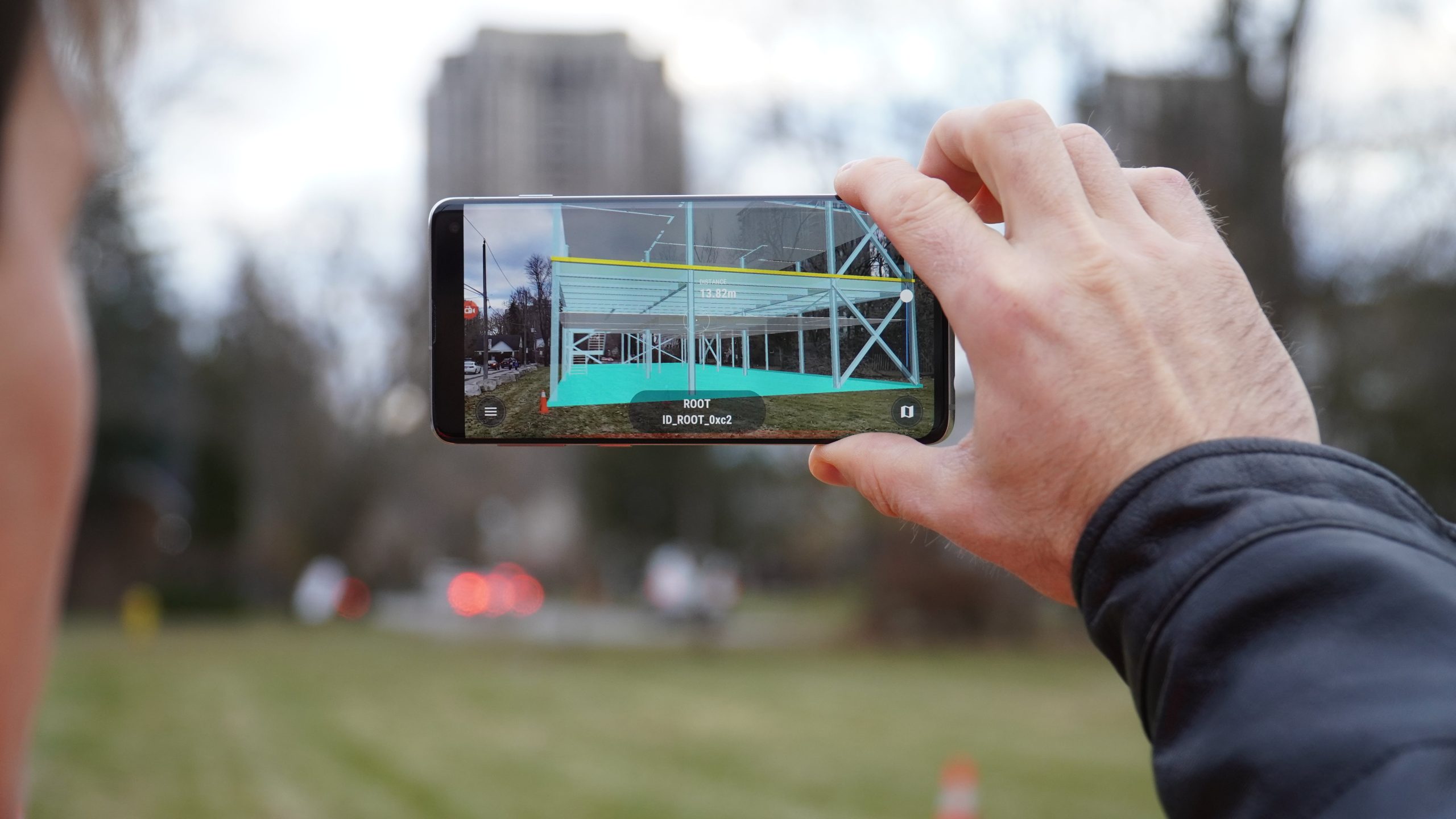
vGIS AR (formerly vGIS Utilities) is a leading high-accuracy augmented reality (AR) and extended reality (XR) visualization platform developed by vGIS Inc., an Eos partner. vGIS transforms spatial data—BIM, GIS, and Reality Capture (3D scans)—into descriptive AR visuals to power mobile productivity tools. vGIS automates data conversion for data from Autodesk BIM 360, Bentley iTwin, Esri ArcGIS, and other types of BIM and GIS files. The automations allow you to use many datasets at once while reducing the cost of preparing the data. The AR visuals of vGIS are generated in real time and positioned in space with unparalleled stability and centimeter-level accuracy using an Eos GNSS receiver such as the Arrow Gold®.
Accuracy
vGIS features patented GNSS and RTK integration designed for high-accuracy (up to 1cm) applications with Eos GNSS receivers.
Advanced Visualizations
vGIS is built on a proprietary visualization engine, which depicts infrastructure assets in an appealing and easy-to-understand way.

Fully Automated Workflows
Native integrations (Esri ArcGIS, Autodesk BIM360, Bentley iTwin) help eliminates manual data preparation. Your data automatically appears as 3D holograms in your field of view.
Effortless Setup and Maintenance
Despite offering highly advanced visuals, the vGIS system takes virtually no time to set up.
What We Like about this Partner App: vGIS
Device Agnostic
vGIS supports Eos GNSS receivers on all mobile platforms: iOS®, Android, and Windows.
Natural Addition
Augmented reality is an excellent solution within reach of companies that have already invested in high-accuracy locations.
Esri Aligned
vGIS is an award-winning Esri business partner, making their solutions ideal for ArcGIS-based organizations.
High-Accuracy Augmented Reality for BIM, GIS, and Reality Capture
The power of augmented reality (AR) lies in its presentation of information — in a format that helps one understand his or her surrounding infrastructure. This is where having high-accuracy AR in your BIM and GIS systems can deliver superior value. The vGIS system makes the depth, location and relative asset positioning plain and clear — so you don’t have to guess what each line (or point) represents or where it is located. Moreover, vGIS has high-accuracy positioning methods that manage your mobile worker’s position (X,Y,Z) and direction in real-time to compensate for drift. Whereas most AR systems usually fall into one of two categories (easy to set up but with limited capabilities and visuals, or visually advanced but requiring substantial manual setup or custom development), vGIS stands out as an exception that offers both advanced capabilities and quick setup. By combining vGS with Eos GNSS receivers, your team can streamline mobile work, reduce errors and delays, gain new insights, and improve worker safety.
Success Stories with Eos GNSS Receivers and vGIS
Oakland Co., MI, Maps Underground Utilities with Eos Locate
In this recorded Eos Locate case study, Michael Cousins explains how underground mapping (Arrow Gold®, Collector) improved legacy buried-asset records.
More InfoOther Apps You Might Like