From the Pioneers of High-Precision Bluetooth GNSS Receivers for iOS®, Android and Windows
The Esri 2017 International User Conference – A Perfect Technology Storm
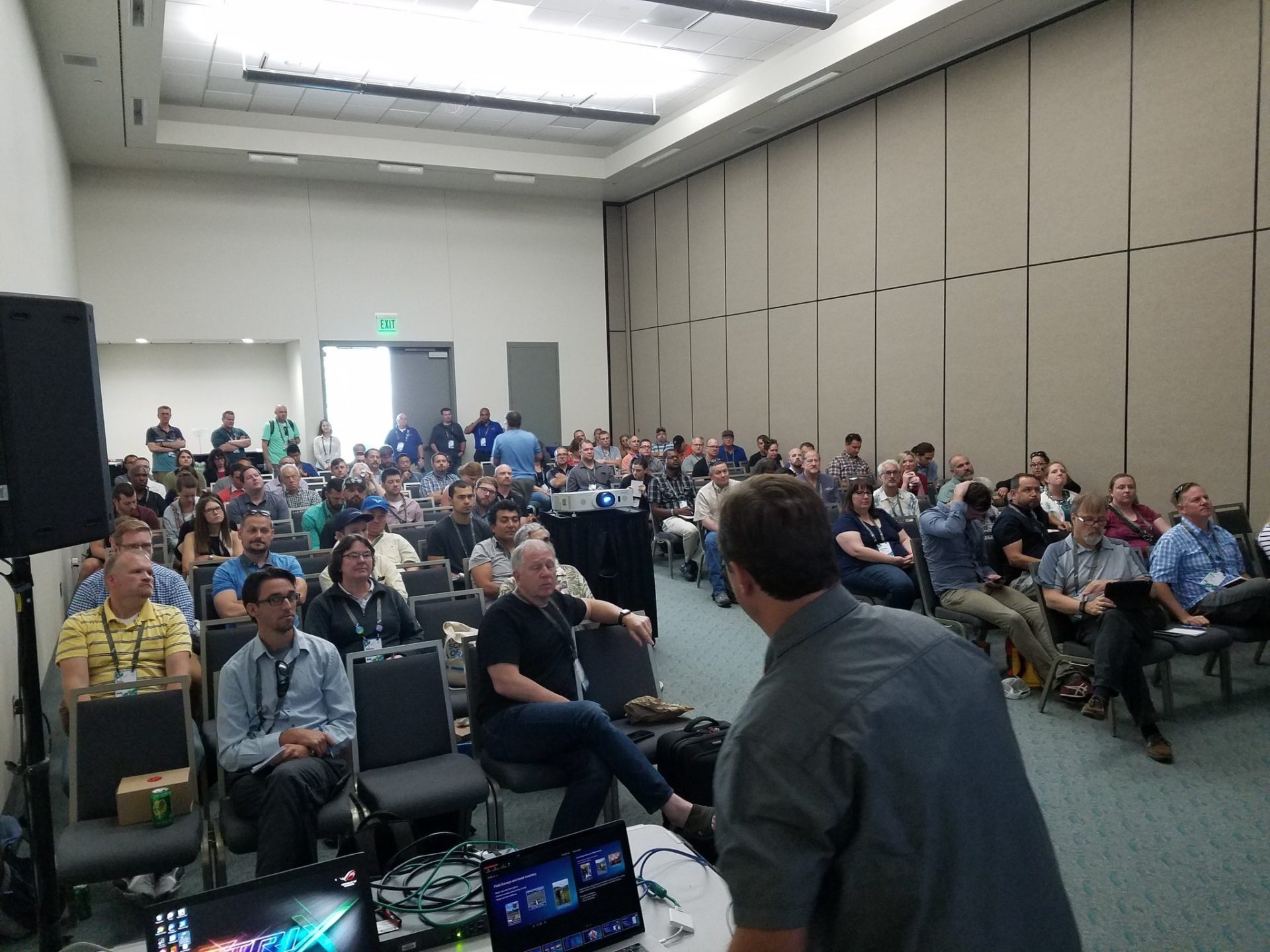
We’re back from our best Esri UC ever!
We’re locked in-step with Esri’s mobile GIS workflows and it shows. We estimate we had over 250 high-accuracy ArcGIS Collector users visit our booth who’ve deployed Arrow receivers since the high-accuracy feature was added to Collector about a year ago. We had some fun conversations with users about the Arrow RTK GNSS receivers with Collector showing an estimated accuracy of 0 inches! In other words, the Arrow RTK accuracy is so good that it displays as 0” in Collector for iOS or Android. So, if you see 0” displayed in Collector, rest assured the accuracy you’re achieving is very, very good.
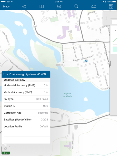
ArcGIS Collector screenshot showing 0” and Eos Tools Pro showing 5mm of HRMS
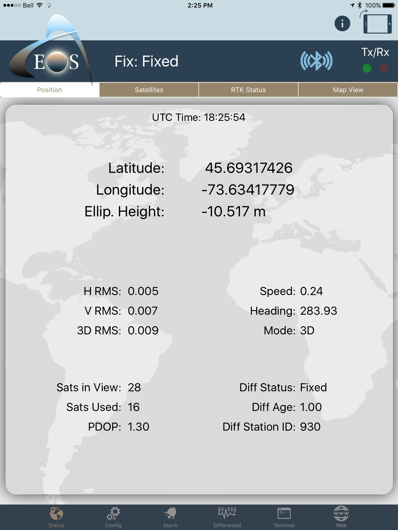
To Esri’s credit, the GNSS metadata fields were designed to accommodate high-accuracy RTK data so the values stored in the GIS database show full decimal precision (in centimeters). Remember, the conversion from centimeters to inches is 2.54cm to 1.0”. With our Arrow Gold RTK receiver, many times we’re seeing estimated accuracies of less than 1cm (<0.40”).
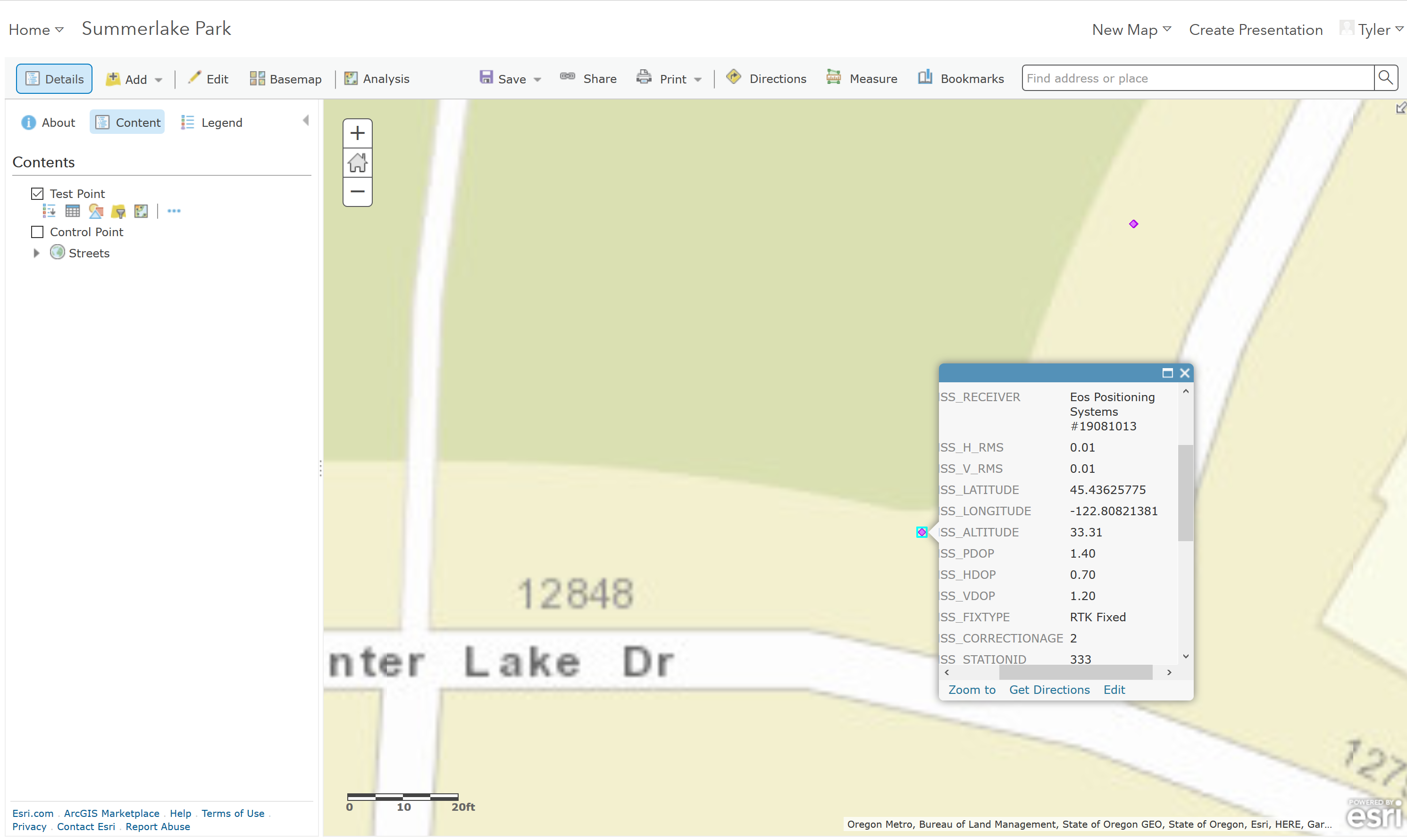
AGOL screen showing a map with RTK data and the pop-up GNSS metadata
The applications for Arrow GNSS receivers with Collector vary widely. There are lots of environmental companies, UAV service companies, forestry, mining, agriculture, fed/state/local government and utility companies using Arrow GNSS receivers with Collector for all kinds of high-accuracy GIS mapping. We’re seeing a massive shift from GNSS handhelds to BYOD (iOS and Android devices) with our GNSS receivers. This is a rare perfect storm where mobile GIS technology has converged.
The Mobile GIS Technology Perfect Storm
-
Our Arrow BYOD receivers serve all levels of accuracy, from centimeter to decimeter to submeter, supporting all GNSS constellations for the next 10 years.
-
The explosion of iOS and Android mobile devices that are far more cost-effective than ruggedized handhelds and tablets. We keep waiting to hear about our customers breaking iPad®s and Android tablets, but they don’t! Those devices are doing surprisingly well outdoors and even waterproof with some inexpensive ruggedized cases.
-
The last, and most important part of the mobile GIS technology perfect storm, is the software. Since Esri released the high-accuracy features in Collector last year, the adoption of Collector with our Arrow receivers has expanded at a rapid pace. We are working on a lot use-case stories to let you know how your colleagues are taking advantage of Collector and our Arrow receivers. In fact, you might want to attend this Esri webinar on August 17, 2017 showing how Indiana American Water is using ~30 Arrow 200 RTK GNSS receivers with Collector to map statewide water utility assets while connected to the free Indiana DOT RTK network. Their efficiency has gone through the roof since switching to a real-time workflow using Collector and ArcGIS Online.
The Science of Where™
There’s no better example of Esri’s UC theme this year, the Science of Where™, than with high-accuracy mobile GIS. It’s common knowledge that better data enables better analysis and better decisions. Watch Esri’s Electric and Gas User Group recorded webinar (May 24, 2017) with Kurt Towler of Sulphur Springs Valley Electric Cooperative to learn the benefits they earnt from high-accuracy GNSS data collection in their utility. Our Arrow receivers are providing our customers’ GIS databases some of the most accurate data they have ever seen. Some of our users are navigating back to assets within centimeters to find them. Is a valve paved over by new asphalt on a road? The Arrow and Collector/Navigator can guide you to it and tell you precisely where to dig it out without tearing up the road. Does your environmental team need accurate elevations to characterize a stream channel? An Arrow RTK GNSS receiver and Collector (yes, elevations can be stored as an attribute with Collector) can accomplish that very efficiently. Every day, we are seeing more applications where our technology is being deployed to enable Esri GIS technology to produce actionable results for our users.
We’re excited to be part of Esri’s The Science of Where™ vision as it pushes GIS into a greater level of technology adoption. The strategy seems to be working. We heard that nearly 18,000 people attended the Esri UC this year. That’s an attendance record, and it sure felt like it in our exhibit booth.
Arrow GNSS Receiver and Eos Tools Pro Developments
We’re working on some secret, and not so secret, projects to make our Arrow receivers perform better than ever.
–Long-range RTK. By supporting four constellations (GPS, Glonass, Galileo, BeiDou) and three frequencies (L1, L2, L5) and enhancing the RTK algorithms, we’re seeing some incredible results. We can’t wait to share them with you. It’s going to open the world of RTK centimeter-level mapping to a much wider group of users. Accuracy is addictive. Once you’ve experienced centimeter-level mapping in Collector, you won’t settle for anything less!
-Datum shift. Our Eos Tools Pro apps for iOS and Android now employ a datum shift inside the Arrow receiver. This makes the Arrow receiver very flexible for apps like Esri’s Survey123 that don’t have the datum transformation feature built-in.
-Enhanced RTK Status. Do you ever wonder how your Arrow RTK GNSS receiver is performing other than FIXed/Float and estimated accuracy data being displayed? We added a Enhanced RTK Status screen in Eos Tools Pro for iOS and Android so you RTK techies out there can look at cycle slips, detailed RTK correction status and analyze signal status in addition to all kinds of other techy RTK information.