Do you need an accurate and user-friendly GPS receiver for archaeological surveying? Eos Positioning Systems is pleased to offer cost-efficient GNSS receivers for all types of archaeological field work. Whether you need a submeter GPS system to capture corners of ancient buried landmarks, to georeference ground-penetrating radar (GPR) data, to guide excavation and archaeological site mapping, or similar work, we can help. Contact our team today to be connected to a local representative in your area. We will help you find the most accurate and streamlined GPS system that meets your needs.

High Accuracy, Even in Remote Areas
Eos GNSS receivers provide 30-60cm accuracy out of the box wherever free SBAS signals are available. If there is an RTK network or base station in the area, you can get centimeter-level accuracy. If no differential correction is available, we can help you set up a flexible AtlasⓇ satellite subscription. Our local representatives can discuss your accuracy needs.
Contact Our Team >
Rugged and Portable
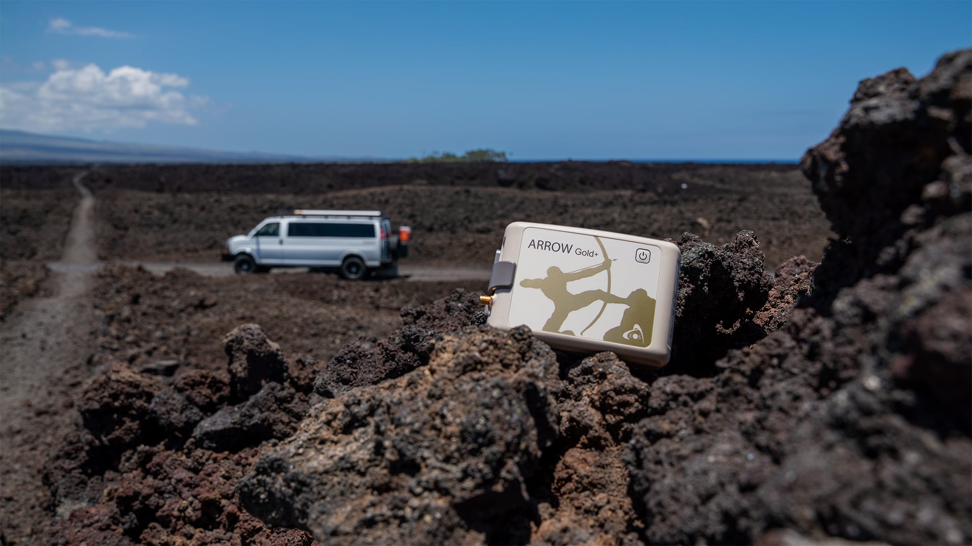
Your GNSS receiver should be able to withstand your toughest field environments. Eos hardware is water-proof, dustproof, and capable of working in extreme temperatures. We also offer various wearables to suit most requirements.
Explore GNSS Accessories >
Flexible and Future Proof
Our GNSS receivers support any mobile data-collection app and smartphones or tablets. So you can pair it with any of your existing or future hardware and software choices.
Explore Partner Apps and Hardware We Recommend >
Explore Archaeology Stories
Browse success stories about universities, cultural management groups, consulting firms, and others who are using Eos GNSS receivers to map important historical sites.
Browse Archaeology Case Studies >
A Flexible Survey-Grade GNSS Receiver for Archaeologists
Archaeology requires accuracy. Whether you need to record artifact locations, map buried objects or work sites, or otherwise help our global community record important history, Eos Positioning Systems can help. Our GNSS hardware has been chosen for archaeological surveying worldwide thanks to its flexibility in the accuracy, variety of landscapes in which our receivers work well, competitive affordability, and the myriad ways in which you can transport Eos GNSS receivers in the field. Contact our team today so that we can help you determine your specific product needs for your region, budget, and unique field requirements.

Professionals Using Eos GNSS Technology in Archaeology
Featured Success Story

Slipping Seaside: Preserving Florida’s Past By Mapping Erosion with GNSS
FPAN archaeologists and volunteers map historical sites and coastal erosion (in 3D!) to quantify erosion rates as Florida's sea levels rise.
More InfoEven More Archaeology GNSS Case Studies

Customer Spotlight: Emily Jane Murray Preserves Florida’s History Through High-Accuracy GNSS
Emily Jane Murray maps coastal archaeological sites before their valuable history is lost to rising sea levels.

Heritage at Risk: Documenting and Excavating Cultural Sites in Coastal South Carolina — Before They Are Lost Forever
Learn how the South Carolina Department of Natural Resources uses high-accuracy GNSS to excavate artifacts before they are lost to climate change.

Mapping Amache Internment Camp with High Accuracy
Arrow Gold for Ground Control Points: Over 110,000 Japanese Americans were interned in WWII. One man is using GIS, GPS, and AR to make sure we remember.

Customer Spotlight: Jim Casey combines GIS with philanthropy
In our Sept 2020 customer spotlight, Jim Casey shows us how he is putting his Arrow Gold® GNSS receiver to good use with his drone and AR.

Radiographers Locate Ancient Swedish Monasteries with GNSS
Swedish historians are using Arrow 100 for archeology. They’re locating ancient historically important buried monasteries with ground penetrating radar.

Customer Spotlight: Mike Markowski Uncovers Archaeology with High-Accuracy GIS
Mike Markowski turns to modern technology to learn about stories of the past. Learn how he uses high-accuracy Arrow 100 GNSS® to uncover archaeology!

Australian Organization Surveys Remote Archeology Sites
Hear how one Australian company uses Arrow 100® for heritage management alongside ArcGIS Collector. Originally presented at Ozri 2020.
What Archaeologists Say About Eos
Archaeologists In Action With Eos GNSS Receivers
Recommended GNSS Hardware and Software for Archaeologists


