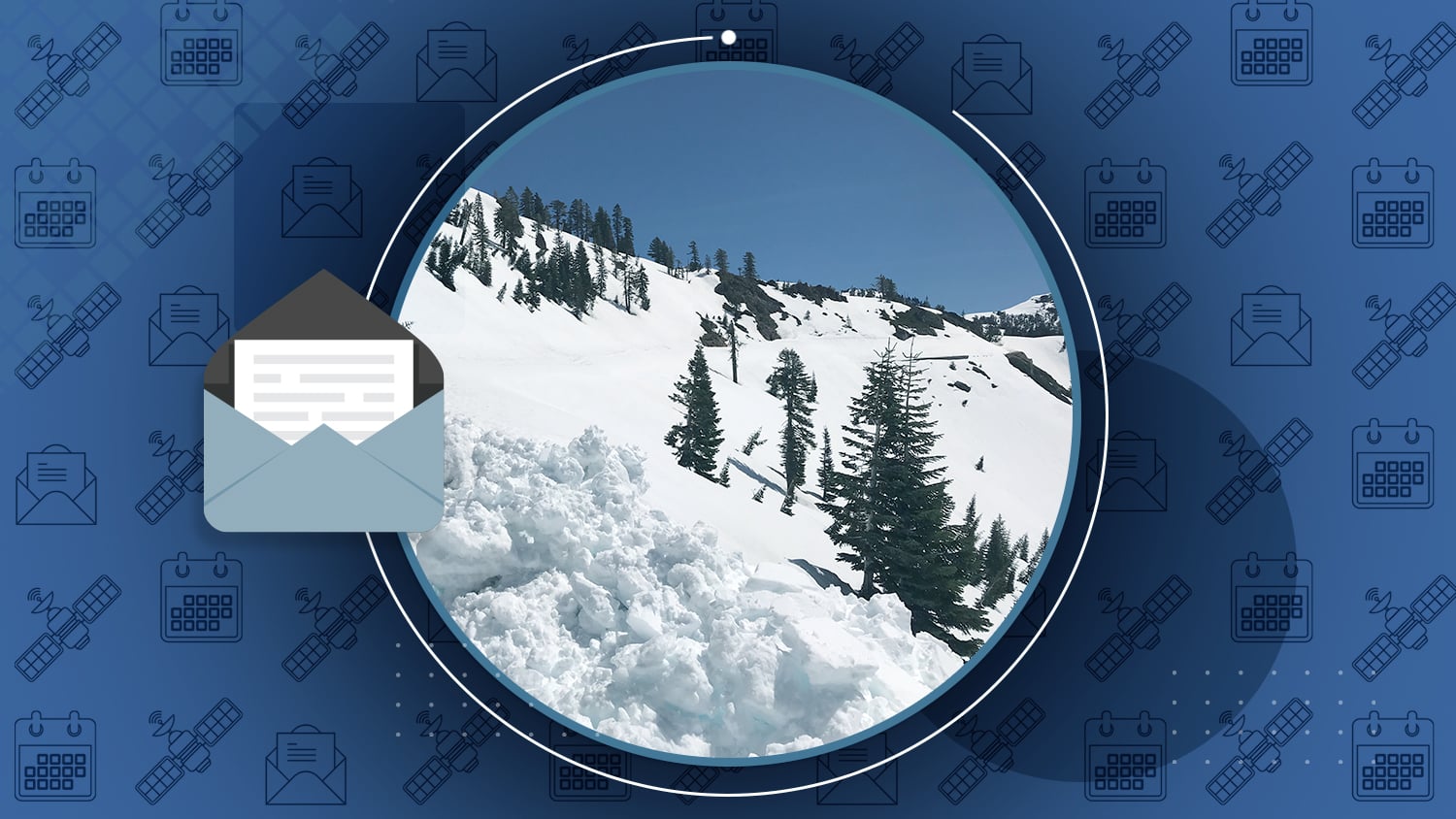

/// How GNSS Data Is Helping a National Park Clear Snow from Unmarked Alpine Roads

When spring comes to Northern California, a field crew has to find — and clear up to 40 feet of snow from — Route 89 in Lassen Volcanic National Park (LAVO). However, few clues indicate where Route 89 lies beneath the snow. “A lot of our work relies on having faith in our GPS and GIS,” said Mark Welch. Read how LAVO uses Arrow Gold, Samsung tablets, Esri Collector, and UHF radios with a base station to safely clear Route 89.
/// Download Your Eos GNSS Coloring Book
Staying at home due to the ongoing situation with COVID-19? A lot of the Eos team is in the same boat! That’s why we’ve created a free, downloadable Eos GNSS coloring book to help entertain your kids at home! The coloring book, “What is GNSS? Satellites that tell us where they are,” lets your kids explore GPS satellites from the comfort of their homes. Tag us in your pictures of your kiddos coloring on Twitter (@EosGNSS) and we’ll re-share them!
/// Santa Barbara Strengthens Field Data Collection with a New Mobile GIS Workflow

The City of Santa Barbara, California, located roughly 90 miles north of Los Angeles, supplies water to approximately 95,000 residents. Given California’s proneness to droughts, state water suppliers face operational challenges surrounding conservation, water-loss prevention, and system maintenance. In 2014, Santa Barbara’s Public Works Department team set forth an ambitious goal of replacing all 27,500 of the city’s water meters within five years. To collect the new asset locations and improve legacy field operations, the city deployed a new mobile GIS workflow solution: Collector and an Arrow Gold base station/rover. In doing so, they increased field-based workflow efficiencies by 50 percent, delivering faster response times and increased customer satisfaction.

/// Customer Spotlight: City of Sarasota innovates in the face of COVID-19

This month’s customer spotlight goes to the entire City of Sarasota! Their innovative leadership in a time of crisis has helped keep idle or partly idle staff productive during COVID-19. Managers put out the call for innovative projects to keep staff busy as the Florida city started to shutdown. The GIS team immediately saw an opportunity to train city staff from all kinds of non-IT departments on high-accuracy data collection using Arrow 100 and Collector on iPhone®s.
Read More.


Optimize Data Collection: Crop Scouting & Asset Inspection
Webinar from Esri Natural Resources
“Efficient asset inspection is critical for helping producers and agribusinesses make timely, informed, and economical management decisions.” See how field teams are optimizing data collection, including one vineyard saving over $500,000 with Arrow Gold and ArcGIS QuickCapture.
Register today for the Free May 14 webinar!
GNSS industry adapts during COVID-19 pandemic
Article by Tracy Cozzens, GPS World
“Social distancing and stay-at-home orders are affecting every sector of our economy. How are companies in our industry rising to this enormous challenge?” GPS World asked: What is Eos doing to keep their staffs, customers, and communities safe?
Here’s our response.

“Into the Woods” German Forestry Storymap
Storymap by Theresa Maier, GI GeoInformatik
Note: This storymap is in German
Browse through a variety of digital forest maps, data processing, GIS software and recording of forest infrastructure created with the GNSS receiver Arrow 100.
Go “Into the Woods” with European foresters!

Eos Locate for Collector: Now available in the ArcGIS Marketplace
ArcGIS Marketplace Listing
We are so excited that Eos Locate is among the newest ArcGIS Marketplace listings! See how utilities, municipalities, consultancies and others benefit from mapping buried assets in real time with centimeter accuracy.
The future of digital twins is here.
GPS constellation changes with addition of second GPS III satellite
Article by Tracy Cozzens, GPS World
“The U.S. Coast Guard has issued a Notice Advisory to Navstar Users (NANU) detailing the changes to the constellation now that the second GPS III satellite has joined.
Explore the next-gen GPS satellite’s impact.
Establishing an Operational SBAS Down Under
Article by Eldar Rubinov for GIM International
“The Australasian region took a major step towards gaining its first-ever satellite-based augmentation system (SBAS) in early 2017. That is when the governments of Australia and New Zealand agreed to fund a two-year test-bed.” Here’s what comes next.
Read about what to expect with SPAN.

/// GNSS Constellation Status: March 27, 2020


In this video, you’ll learn how to create your feature layer in ArcGIS Pro and publish your webmap. But first, a quick recap about why laser mapping is a great solution to explore using.
Get started with Laser Mapping by following this video!


Update on COVID-19 and Upcoming Events
As the situation surrounding COVID-19 develops, both Eos staff and event organizers recognize the impact of large events on public health. As a result, all May events have been postponed or cancelled. Please follow Eos on social media and check back on our events page for future updates on reschedulings.
Check upcoming event statuses on the Eos Events Page