Sitting in North East England, Northumbrian Water provides water and sewerage services to 2.7 million people covering an area of more than 8,500 square kilometres (5,300 square miles). Its network features 30,000 km (18,600 miles) of wastewater pipes, including 13,500 km (8,300 miles) transferred into its ownership as a result of a legislative change.
So when it came time to map unknown locations of wastewater assets, Northumbrian Water needed a toolkit that enabled high field-crew productivity and accuracy, yet came with low costs.
The Challenge: Low Cost, High Accuracy
Northumbrian Water faced mapping an estimated 13,500 km (8,300 miles) of assets. Although the utility had considered using an all-in-one handheld device that offered both data collection and high accuracy GPS, these proved an expensive option and would mean field workers carrying multiple devices.
GIS and Positioning Technical Consultant Andrew Hopkins wanted to see if he could bring the cost down but keep the accuracy up.
The survey crews at Northumbrian Water had a combination of Windows Toughpads and iPhone®s, so Hopkins looked for a solution that could work with this existing technology whenever high accuracy GNSS field capture was required.
“So we evaluated a number of field capture solutions, and we decided to go with the Arrow 100 along with Esri’s ArcGIS Collector,” Hopkins said.
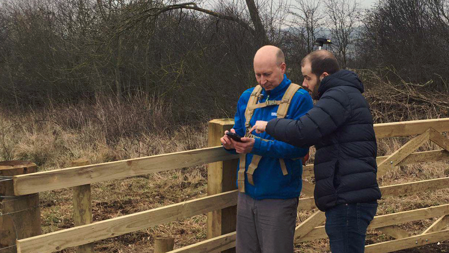
Why Arrow 100?

Northumbrian Water worked with MGISS, to identify the Arrow 100 GNSS receiver as a fit. The Arrow 100 is a GPS / GNSS receiver manufactured by Esri Silver Partner Eos Positioning Systems and distributed in the U.K. exclusively by MGISS.
Designed to be strapped to a utility vest, a backpack, a nylon pouch or a range pole, the Arrow 100 can be carried hands-free through the field to capture high accuracy location metadata at an affordable cost. It does so by tapping into high accuracy location metadata in even the most remote locations. It can then communicate this data, accurate to within a meter, over to Collector via Bluetooth. Besides being compatible with Collector on iOS®, Android or Windows, Arrow 100 also provides about 60cm accuracy simply by using the free EGNOS SBAS differential correction signal.
“In the field in the middle of nowhere, you need to record an absolute position,” Hopkins said.
Additionally, the Arrow 100 helped Northumbrian Water keep its total costs low. And because the field crews were already using Collector, the complete solution required little to no training.
Results: Confidence Up Internally, Costs Low
Two years after the project began, Hopkins has deemed the project a successful test case for both the Arrow 100 and Collector.
The utility has improved its location accuracy of wastewater assets. With the improved accuracy, it estimates future savings in maintenance activities, since maintenance crews will be able to pinpoint assets much more precisely.
It feels like we’re working smarter. The data-capture process is much more efficient, faster and accurate. The Esri software is totally in tune with the hardware, for extra accuracy. If we can accurately locate and record the position of our assets, then we are able to deal with any problems quickly and efficiently.
— Andrew Hopkins, GIS and Positioning Technical Consultant for Northumbrian Water
 Internally, confidence has grown in the technology’s ability to provide highly accurate location data. Hopkins is being asked how the technology can be used in other departments. The Northumbrian Water Conservation team, for instance, is testing out a similar solution to map its field boundaries with centimetre accuracy, which will enable Northumbrian Water to accurately register land use with authorities.
“It will go on, we are already spotting other applications for the technology” Hopkins said. “We’ve got such diverse departments within the water company, all doing different kinds of projects with varying requirements for high-accuracy capture in the field.”
Hopkins says he’s getting frequent requests to do more projects like this.
“At Northumbrian Water, we want a really great geospatial toolkit,” Hopkins said. “We want to use this technology in the cloud, keep our roadmap current and, when we see people doing innovative things at conferences, we want to make sure our guys can do it too. And what we’re finding is that people quite like Collector and the Arrow Series.”
You May Also Like One of These Success Stories

Arcadis: Transforming asset surveys on the railway
In a ground-breaking U.K. project, Arcadis captured accurate data efficiently in a live rail environment and shared in real-time to the client.

5 Water Utilities Using Bluetooth GNSS Receivers
Five water utilities are using high-accuracy Bluetooth® GNSS receivers to transform their mobile data collection. Here’s how.
