Visit Eos Positioning Systems® (Eos) with Esri at NvRWA 2022 Annual Training/Technical Conference & Expo. This year’s event will be held at the Nugget Casino Resort in Sparks. Eos will be in our booth from March 22–23.
Expo Dates & Times
Mar 22, 2022 / 8:00am – 4:00pm
Mar 23, 2022 / 8:00am – 4:00pm 2022-03-22 08:00:00 2022-03-23 16:00:00 America/Los_Angeles NvRWA 2022 Annual Training/Technical Conference & Expo Find an Eos Representative at the NvRWA 2022 Annual Training/Technical Conference & Expo Sparks, NV Eos Positioning Systems
Social Media
Find us on the floorplan:
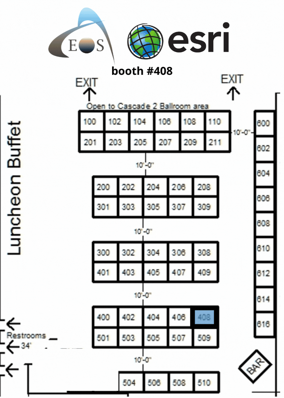
Our booth will look like this:
Learn about high-accuracy mapping at these Sessions:
Our Conference Sessions
The Eos team will be participating in the following sessions during the conference. Please join us for some informative discussion.
Session 1: High Accuracy Mapping of Rural Water Systems
Mar 22, 2022 / 10:45 am - 11:45 am |
Redwood 7
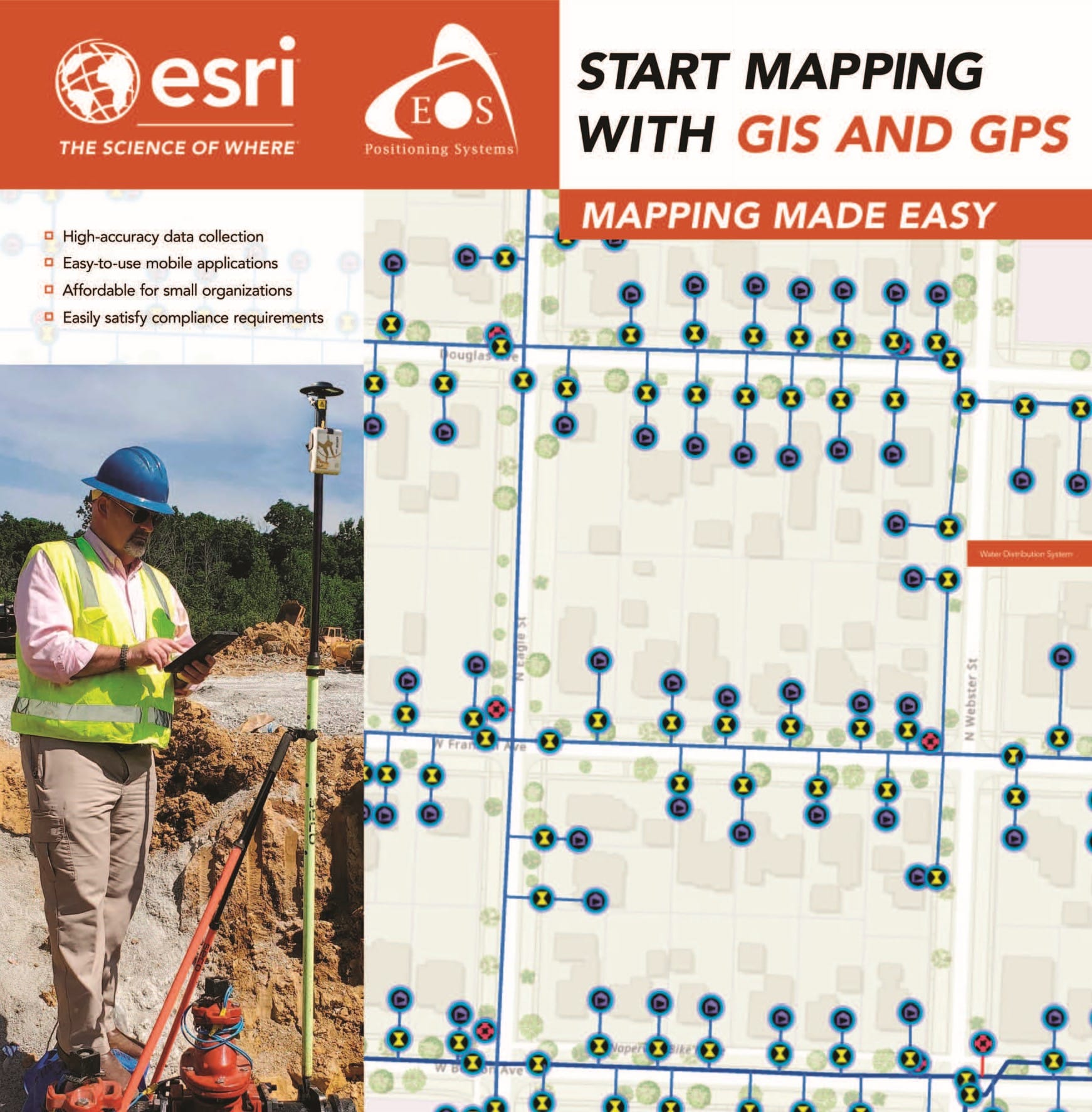
This presentation will outline the latest developments, processes, and tools for high-accuracy mapping of water systems using phones and tablets with Bluetooth GPS receivers. The latest in field apps will also be discussed, including the brand-new ArcGIS Field Maps mobile app. The presentation will also cover examples of 2 water agencies in Nevada that have successfully deployed high-accuracy mobile mapping to improve field efficiencies.
- Isaiah Mack, Eos Positioning Systems
Session 2: GIS for Small & Rural Water Systems (2 Hour Presentation)
Mar 23, 2022 / 1:15 pm - 3:30 pm |
Cascade 3
Maps have always been essential to understanding and improving the delivery of safe, clean drinking water and reliable sewer and stormwater services. In this workshop you will learn how modern GIS technology supports small and rural utility workflows with solutions that help you to set up digital maps and easy to use applications. The presentation and demonstrations will focus on how GIS enables field crews to quickly view and collect data with mobile devices and how this information can be easily shared with staff in the office as well as key stakeholders. In addition, discussion will include how this data can be used in simple analytics. Join us to learn how to: Store and manage asset data in GIS Turn your data into information that can be shared across your organization to improve coordinated operations Use analysis to support decision making Presenters will also discuss industry specific licensing and solutions that have been created to provide you with a jump start into GIS: Web GIS for Small Utilities Data management solutions Lead Service Line Inventory solution And more…
- Benjamin Segal, Esri
- Isaiah Mack, Eos Positioning Systems
Session 3: High Accuracy Mapping of Rural Water Systems
Mar 24, 2022 / 10:45 am - 11:45 am |
Redwood 6
This presentation will outline the latest developments, processes, and tools for high-accuracy mapping of water systems using phones and tablets with Bluetooth GPS receivers. The latest in field apps will also be discussed, including the brand-new ArcGIS Field Maps mobile app. The presentation will also cover examples of 2 water agencies in Nevada that have successfully deployed high-accuracy mobile mapping to improve field efficiencies.
- Isaiah Mack, Eos Positioning Systems