Feature Story
/// Where the Bats Go

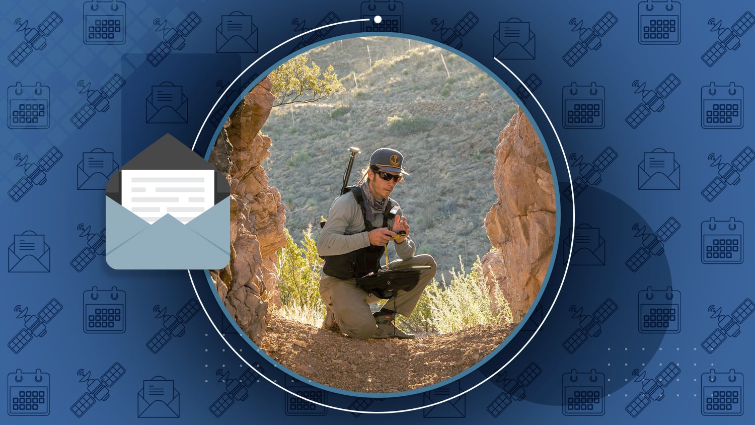
To locate potential bat habitats in abandoned mines, Bat Conservation International employs a new high-accuracy GIS-based workflow using Esri ArcGIS apps (ArcGIS Survey123, ArcGIS Field Maps & ArcGIS Collector) and Arrow 100 GNSS. After surveying hundreds of mining-related features, the team has identified a handful of potential habitats—which emphasizes how difficult and critical it is for bats to thrive in unprotected areas.
Read BCI’s full story, originally published in Esri ArcNews >
Industry News
")
Bridging the Gap with the Eos Bridge™: Bluetooth® GPS Connector
By Spatial Source
In case you missed it, Spatial Source recently featured the new Eos Bridge™. The Eos Bridge™ makes 3rd party sensors Bluetooth® compatible to iOS® and non-iOS devices (must be paired to an Arrow).

Eos Celebrates its 8th Anniversary
On February 12, Eos celebrated its 8th anniversary. In this never-before-seen throwback image, Chief Technical Officer Jean-Yves Lauture and Production Lead Bilal Elie work on the first assembly of Arrow GNSS receivers!
Russia expected to ditch GLONASS for Loran in Ukraine invasion
By Tracy Cozzens, GPS World
As the situation in Ukraine unfolds, some experts predict Russia might jam GNSS signals and use their Russia-owned Loran stations instead.
Al’s Corner: Technical Tips

Important Benefit of the Windows 11 Upgrade for Windows Device Users
The new Windows 11 operating system supports higher-resolution estimated accuracy values (which are reported by the device’s GeoLocation). Previously, in Windows 10, estimated accuracy was limited to integer-only values. This meant that applications storing estimated accuracies from Arrow GNSS receivers could not store submeter and centimeter-level values. (They would be rounded to 1m no matter if the resolution was much more accurate.) The new Windows 11 solves this. Now, applications such as ArcGIS Collector on Windows, which receive its coordinates from the Windows GeoLocation, finally support access to horizontal and vertical accuracy estimates down to the millimeter resolution.

Eos Welcomes Mapit Spatial in February
Eos is pleased to welcome Mapit Spatial as a supported partner app. Mapit Spatial is a powerful multilingual spatial surveying app for Android devices.
Current GNSS constellation status for February 18, 2022:

Customer Spotlight
Customer Spotlight: Zack Henry Helps Customers Succeed
As a Field Services Technician at Encepta, Zack Henry uses Arrow Gold with ArcGIS Field Maps to perform survey-grade data collection for utilities. When his clients succeed, Zack succeeds.
Upcoming Events

ITA Showcase Northwest
March 15-16 | Portland, OR
Eos will demonstrate a variety of survey-grade mapping solutions for utilities. You can also join our underground utility mapping session on March 16.

Nevada Rural Water Association
March 22-24 | Sparks, NV
Join Eos and Esri at the NvRWA event in Sparks, Nv. Each day you can catch an informative high-accuracy mapping session or workshop.

Penn. Rural Water Association
March 22-24 | College Station, PA
Join Eos and Esri at the PRWA event in College Station, PA. Ask GIS and GNSS experts from each company about all your high-accuracy mapping needs!

Midwestern Esri Utility User Group
March 23-25 | Rochester, MN
Join Eos at the MW EUUG in Rochester, MN. Our GNSS expert will be available for questions and will give a session about using 3D survey-grade RTK receivers at utilities in the region.

Virginia GeoCon
March 29-30, 2022 | Richmond, VA
Join an Eos representative at VAMLIS. Our local representative will demonstrate how to deploy high-accuracy mobile mapping with GNSS and GIS at your organization.