Integrating geographic information systems (GIS) with computer-aided design (CAD) is a long-standing question among professionals managing infrastructure. However, this transformation is not always as straightforward as it seems. The problem most organizations face is that their data is non-interoperable (e.g., pen and paper documents, Excel sheets, or thousands of records organized in tabular formats). In this lively 2022 Esri User Conference session from Benson Crowell of Texas Department of Health & Human Services (TDHHS), learn how high-accuracy GNSS / GIS can integrate with CAD to consolidate disparate data into a central system and optimized workplace.
Using high-accuracy Eos Arrow GNSS receivers, ArcGIS apps, drone imagery, and AutoCAD, Crowell worked to transform campus facility management.
Watch the full recorded session!
Or, keep reading below to read the session transcript …
In Memoriam
Eos Positioning Systems would like to dedicate this article to the memory of Benson Crowell. The Eos team feels fortunate to have met Benson during the 2022 Esri User Conference. At the event, we got to know Benson as a wonderful person who was so clearly passionate about his work and connecting with others. His enthusiasm for geospatial technology was evident through his vibrant presentation and conversations with attendees, exhibitors, and friends. We are honored to share his work and knowledge.
Introduction
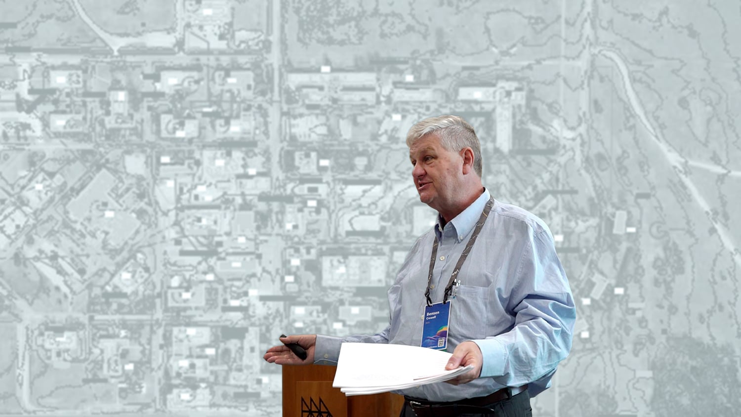
BENSON CROWELL: An introduction to me: I got into CAD back in the 70s. Actually, my mentor worked with Jack [Dangermond, Esri President] over at Harvard and well, while Jack went into GIS, my mentor went into CAD. I pursued that [CAD] since then. So, you guys can figure out that there’s been a lot of time between then. So that’s why I can cut out 30 minutes of my presentation right there.
[Audience laughter]
I was hired as someone who was ready to retire, that knew way too much about CAD, and could provide a subject expert for CAD, especially AutoCAD.
I tell people that I think AutoCAD and [other] Autodesk products were on my resume about 30-plus times, and so that’s how I was hired. They figured anyone that put it on there that much, must really know what they’re talking about.
But in the same breath, they expected me to do everything in AutoCAD. I was hired by three architects. It’s good that there’s no architects in this room because now I can tell architect jokes — this is great. Otherwise, I might get myself in trouble.
[Audience laughter]
But you know, all architects think they know how to use AutoCAD and they know how to put together construction documents. That’s not the case. So, they have me around to give them advice and, you know, tell them which way to go.
But I was told that, you know, I’m going to have a lot of time on my hands. I would be able to just look at the computer, watch videos, I could read books … as long as I answered the phone when people had a question and if they walked into my office.
So that was a great retirement job, okay? If you’re in your sixties and you get an opportunity to do that, take it. The problem is they sent me out in the field and they said, “You know, you’re going to have all this time available. Why don’t you find out what they need out there?”
The Goal: Updating Hundreds of Thousands of CAD Drawings
Now, I work for the Texas State Health and Human Services (TDHSS). And they thought the best thing to do, instead of hiring an engineering firm to update all their stuff and spend millions of dollars, was this: “We need to get every one of our campuses — I’ve got 23 campuses — and we’ll just give them a copy of AutoCAD. Give them a day of training, and they’re going to update all of their drawings.”
[Audience laughter]
Right? Sounds good. Well, that’s when they came in and hired me. They said, “You know, when you’re not doing anything else, you might want to update all these drawings.” Now, I’m one person. No staff, no money, no authority. They even told me, “You can’t tell them what to do. You can advise them if they want to do it, but you can’t tell them what to do.”
Now, by the time I got there about five years ago, there was about maybe three campuses that were still using their copies of AutoCAD. They were still licensed, we were still paying for it, but they weren’t using it. So they figured, I just need to go out and train, right?
What I did early in my career is I set up schools for AutoCAD training in New York and Boston, and I started going out into the world, kind of spouting all the stuff I knew. The stuff that puts my wife to sleep at night — I start talking about AutoCAD and she’s ready for bed. Okay? It takes about five minutes, guys. So anyway, they thought I could just go out and train them. I went out and found out that that’s not going to work.
Setting Up for Success: Organizing Previous CAD Drawings
So, the first thing that they said is, “We don’t have any building information.” So, what I did was, I actually scanned about 250,000 drawings over 100 years for all of our buildings in the campus. About 2,500 buildings. And all those projects are now in the cloud and [Microsoft] SharePoint, and they’re all organized by campus and building.
And so, all those projects are complete and ready to go. So, all that information is just sitting there. Next thing I did was I made sure that whatever masters I had were easy to get, and they could print. You couldn’t believe how easy that is to do, and yet it wasn’t done. So, we took care of that.
The Next Step: Accurately Updating Utilities at a Low Cost
Next, I had to figure out how to do utilities. This is what we’re going to talk about today. We’re going to talk about utilities and how to do it cheaply. Now, like I said, I’m one person — no budget, no authority. And, you know, they just figured, “How much damage can you do?” Right? “He’s going to go out there, he’s going to make a lot of promises, make a lot of enemies, and nothing would get done.”
Actually, what I’m going to do before I start off, is I got five copies of my notes here. How many people are over 60 that would like a piece of paper in their hand while I get this presentation?
[Audience laughter]
Oh, come on, raise your hand. You know what I’ll do, is I’ll just go up and look for anyone that’s got hair lighter than mine, and I’ll just hand it to you! And you’ll have to take it.
Okay, here’s what I’m going to do. I’ve got five copies — hold up your hand.
Audience member: “What about no hair?”
[Audience laughter]
No hair! Here you go.
Mapping Campus Facilities: The Requirements

All right, guys, I’ve officially warmed up the audience. Now we can actually talk about things.

All right, so the five things I needed were accuracy, completeness, current. It has to be current. It has to be low-cost and sustainable. The two on the bottom, we will get into that. They didn’t think there’s any way to do low cost.
The Requirements: Accurate and Low Cost

The accuracy and low cost were just impossible because none of the drawings were accurate. In the early days of CAD, we had paper drawings. They were drawn to the accuracy of a pencil line. And, you know, it’s like, okay, that’s fine. But who knows where they put the pencil line? And what happened was, they started digging and they hit the gas lines and the water lines. And just like these guys said, it shuts down half the campus when they do that.
So, what are you going to do if you’re not accurate and you don’t have a big budget? What are you going to do?
The Requirements: Complete and Current

It also needs to be complete and current because if you give anyone out in the field a map and they say, “Well, it says it’s on this side of the sidewalk, but I don’t see a sidewalk on my map.” You just lost confidence in even using that drawing and they’ll never ask for one again. That gave them an excuse to just go out there and start digging.
And then current. What I found out was that we’re spending an average, on a small campus, about $45,000 for the engineers to hire the survey group to put together as-builts — aerial and ground control, and the CAD people — just to do a small campus. They’ve got 23 of them. So, whenever they start a major utility renovation or repair, the first thing they want is an as-built.
Well, that thing is only current for that project. And you guys all know that after the project, no one spends the money to see if it was put in that way. Raise your hand if that ever happened to you.
Oh, one honest guy in the whole bunch!
[Audience laughter]
No, no, they never bothered to do that. And in my agency, what happens is there’s a lot of pressure to spend the money. The state legislature in Texas says, “You have this money to do it, and you get this much time to get it done. And if you don’t get it done in that much time, you got to tell them why.” And they said, well, you know, if you can’t spend the money, we’ll give it to someone else. So, there’s so much pressure to get this stuff done and get it out the door.
And then when do I get the as-builts? I get the as-builts two years later and they’re not even right. But I knew I go ahead and scan them, or I use the PDFs and I put them into the system, and I say, “There it is. And you know, it’s great to look at and maybe it’ll help you find something in the field.”
What if you had a map that was accurate, and it was accurate that day? In other words, you tell me that you want a map, and you want it that day — and I can give it to you.
So, I’ve been digging holes all over the campus here. I’ve been digging up a bunch of facilities. I want to know exactly where they are while these things are still open. I can give it to you with this system.
The photographic fixed-wing mapping is sort of the old school [version], and satellite imaging is something that’s new coming in, but it’s not really high resolution. Drone imagery is high resolution.
Staffing — oh, we already talked about this. I have no staff. Well, I have one. There’s one guy that does all this and he’s talking to you right now.
The Requirements: Sustainable

Vendor budget — we don’t have really a budget to deal with vendors. Except for I do have … I found out that all these campuses, they have an operating budget. And as long as I could do something under $2,000, they could put it on the credit card. Oh, that was great. You know, they put on their credit card.
The Solution: High-Accuracy GNSS, ArcGIS Apps, Drones, and Laser Mapping
So in all the surveys, this guy over here [points to an audience member], David, was working with me at the end and his group was able to do a survey of building points to GPS my campuses, and he was able to do it on the day. We’ll get to him in a second.
But it became a really cool workflow. I had building points, I knew exactly where those corners were, and I knew when things weren’t matching up when people were giving me stuff.

This is his crew, Ben and Thomas [shown in these photos]. And if you notice, they’ve got the Eos [Arrow Gold® GNSS receiver] rover. And what was cool about the Eos rover is that if you’re underneath the tree, nine times out of ten, it’s going to get the point within a few seconds.

Some of the other survey groups I used had a lot of different equipment. And sometimes we’d be sitting there, and sitting there, and it couldn’t find a satellite.
The Solution: Eos Laser Mapping™ for ArcGIS
This stuff was really cool. Also, you may notice halfway down is a rangefinder [the TruPulse® 200X]. What all my other survey crews were trying to do was take a tape measure, they had another guy come out, hold the tape measure at the building corner and measure it out. And then they would go ahead and in go ahead, take the shot from that point.
Now, if you get two of those points, you can triangulate where that corner is. And so that’s what we actually had to do. Then they actually had to create the CAD files to do that, and then they would give me the new points.
What these guys were able to do is use ArcGIS Field Maps [and the Eos Laser Mapping™ for ArcGIS solution] and they would actually track where the points were. And then they had a software app that actually found the resulting point and put it in. So, what they could do in a day would take an average survey crew two or three days to do.
So, they really saved my tail. And that’s the reason why they could do everything under $2,000. I probably shouldn’t have told that you could do it under $2,000 — well under $5,000. Okay. Give him a little room here.
David, in the audience: “If you’re as entertaining as Benson, the price goes down a little bit.”
Yeah, if you mention my name, you get $50 off.
[Audience laughter]
All right, and David’s going to hang out here. And when we get to the point where we have questions, you’re welcome to ask him, or we can ask me the question and I’ll just send it over to David.
The Solution: Drones for High-Resolution, Accurate Imagery
Actually, his crew, the guy with the real short hair (not the beard), he also flies drones for David. And he told me, he said, “You know what?” I was talking to him about the problem I have and he said, “Why don’t you capture one of these cameras with drones and see if you like it?”
And this is because we use a subscription service to actually, in the Abilene campus, to look at high-resolution imagery that was available in subscription. They would fly the whole city once a year and they pay $2,000 to get access to it. Well, $2,000 sounds like a lot of money to me, but Abilene city said, “We’re willing to do it.” And they started using the imagery directly. And so that was pretty cool.
But what happened with the drone is that we said, “Listen, I think we do the same thing with drones.” What we discovered with the drone is that it was a lot more accurate, and it was higher resolution. And there were things that we didn’t even know we needed.

So this is, you know, all the drawings that are in my system. I decided to cut out about 200,000 of them for these slides and only show you a few. But I mean, you guys have seen these kinds of things. The one on the upper right is where the points are actually located in the Abilene campus. But these are just standard drawings you guys are used to seeing.

Creating High-Accuracy 2D and 3D Maps
So, what happened with Abilene is that as we started looking at the imagery, we realized that there’s things in there like lines on the parking lot. Well, you know how I used to draw a line from the parking lot? I just make them, you know, I don’t even remember, eight feet apart and just start throwing them in. I had no idea where the lines actually were, but I wasn’t about to go out there and start measuring.

So then. I could actually draw on top of this. It’s high enough resolution for that. This is a campus in Big Spring, Texas, and those red dots, it’s kind of low resolution on this screen but those are the actual points. And you realize when you start zooming in that you get a lot more resolution.

And so you can see the points. And those are actually the 2D points. And then, 3D, we used an actual object. It’s like a cone, so see on the bottom of those cones? That is the actual point that we collected. You see they line up right on the buildings.

The Results: Meeting All Requirements with Ease
So the question is: did we actually get this thing done accurate, complete, current, low cost, sustainable? We proved it in two of our campuses that we could do it now with ArcGIS for AutoCAD. It’s easy as pie. I was in the other session and I said, you know, I can do that. I can draw in AutoCAD and then link it back up to ArcGIS stuff that I’ve got in there. And I can start building this stuff because I know AutoCAD. And eventually I’ll learn more and more about ArcGIS, but, as long as I can make the transition.

Now, one of the things I also know is that those three architects, the reason why you had to do it all in Civil 3D is because that’s what the professionals are going to want to do. You’re going to have to give it to them in Civil 3D. If not, you’re going to have to pay that $45,000 per campus to get it to them. You had to pay for that stuff upfront. So, it’s easy as pie going back and forth between these two right now. You can draw in AutoCAD, you can draw in ArcGIS, depending on what you’re comfortable with. But all the data that I want to use is in ArcGIS.
The Results: Easily Identifiable, Accurate Features
So, there’s something I’m not showing you on the slide. One of the things that happens with ArcGIS that doesn’t happen with AutoCAD is that it’s got a slider. And right now, it’s used mostly for showing before and after shots and going through. You don’t have that in AutoCAD. What I can also do is I can populate all the utilities on one side and maybe just gas lines on the other. And you can actually just look at the gas system and then see how that interacts with all the other systems.
So, we’re going out, I think you guys already mentioned it — there are certain things that are easy to find on the surface. Things like manholes, fire hydrants, and you don’t see those very easily in the system if you’re working with satellite and even fixed wings. The drones? I can read the writing on the manhole. That’s the difference. And so that imagery is all important.
The Results: Real-Time Accuracy with High-Quality Drone Imagery
So my workflow right now is, I’ve told my management, “I can give you updated drawings that day.” Now, if you’ve been sitting in some of the other sessions, and you’re a drone guy, you probably saw what a mission was. So, Site Scan for ArcGIS is what I’m using right now for my missions. And all you have to do is put a boundary around the area, tell what pattern you want, and it takes all the pictures.
And those thousands of pictures you can look at would be processed in something like ArcGIS Drone2Map. That’s also a necessary product, and it will create your imagery for you in 3D or in 2D.
So that can be done in a day. I can fly a mission, like this is Big Spring right now, a small campus. I can fly that mission in an hour and a half. And I get about 1500 pictures that get all processed and they get all linked together to one object.
So that becomes my background. So, any time they start digging on the site and they said, “Oh, we’re digging, you need to come out here, take a look.” I said, “No, fly the drone and send me the pictures and I’ll give you an updated map. I’ll tell you exactly what you’ve done and where you’re at.”
So for construction, it’s really cool. The only problem I have right now is that, like I told you earlier, my management thought I would never do anything. And they thought, “Well, there’s only one guy, and he has no budget and he has no staff. He doesn’t have to be watched too closely.” And then I flew my drone into a broadcast tower, and it really wasn’t my drone. It was some other campus’ drone. And I had to send copies of the email to my boss, which shut me completely down for the last four months.
But you know, I work for the state; I understand that. You know, there’s issues with getting your name in the paper. It wasn’t in the paper yet, so it wasn’t that bad — but I did damage the drone.
The good news is I was just flying a pretty inexpensive drone. It’s a DJI Phantom 4. Raise your hand if you know what that is. So, a Phantom 4 is really cheap. You just can’t buy them anymore because DJI decided they can’t make any money off of them.
So they want you to buy the $18,000 drone instead of the $1,700 dollar drone. And I understand why. But I got on eBay and I bought a bunch of them, so I’m in good shape.
All right. Hold on. I’m going to show you how much I know with technology. There it is! We’re at the end. All right. Questions, go ahead.
Audience Q&A
Audience member: “How many of the drones did you buy?”
I bought three. But I had no way to buy them except through the campuses. So what I did was, I told the campus, “You buy a drone, I fly your campus and I update your plans for you.” And I had three of the campuses buy the drones before I had my crash and I was told not to talk about drones anymore.
Audience member: “What funds did they use to buy them?”
Just operating budget. Like I said, if it’s under $2,000 with the state of Texas, they could use their credit card. If it’s under $5,000, they don’t have to go through purchasing and they don’t have to get competitive bids. They can say, “I want this and it’s under $5.000.” They get it. So, it’s like what you were talking about — know your purchasing. Because if you can’t if you can’t fund it, it’s not going to get done. That’s right. Yeah. Well, you know, you figure that out.
Audience member: “The cloud service system you mentioned that you were hosting all of your scanned documents, what is it exactly?”
SharePoint. The State of Texas has created SharePoint sites for anyone that wants to take all their paper stuff and move it over into electronic. And I told them that’s what I wanted to do, they created the site for me, and all my documents are set up by campus and then by building. So, if you want to know — go ahead.
Audience member: “Is there a size limitation or anything?”
No actually, they bought so much size. The limitation of it, I don’t even know. You know, I know what the terabyte is, but they mentioned something a couple hundred thousand higher than that. So that’s what we purchased. So, they actually encouraged me to use more capacity than I needed.
Actually, what got me into SharePoint was I was initially on the network and my boss’s boss kept on coming home and saying, “Why are you using up the network space, why are you using up the network space”? And they figured out it was me.
They told me I had to do it on SharePoint and I had to go over and talk to the administrative person. She had to show me what she knew about SharePoint and what she showed me was how to get into it. I said, “Well, so, so what does it do?” She said, “I don’t know.” And I said, “Well, how do I use it?” She said, “I don’t know.” But there’s, there’s a whole staff in the state that helped me through that. I had to fill out all kinds of forms.
So, you know, electronically moving everything over to SharePoint, and it had to be signed off by our information administrator. And I went to my director and I said, “Who’s that?” And he looked at me and paused and said, “That’s you.” So that’s the kind of help you get when you’re working in the state. It’s kind of a low budget.
Next, go ahead.
Audience member: “Was there ever an effort to update the interiors, or is it all just exterior accuracy that you were looking for?”
Actually, there is a lot of effort, but it’s like I told you one person, no budget.
So, what I’m doing first is I’m taking care of the outside stuff. I’ll give you a reason for that. The Abilene campus, I think I showed you a little bit of the Abilene campus. They had a major hit on their gas line. It turns out they actually looked at drawings that said all the valves, the major valves for their gas lines, were on one side of the parking lot. So they decided to put — as far away from that side of the parking lot, the other side of the parking lot — their diesel tank. And when they were digging the bollards for that diesel tank, they hit the actual gas lines, the mains. And if you guys ever had that happen to you when you hit a gas line, you had to evacuate the whole system and you had to prove that it doesn’t leak.
So that campus looked like a treasure map. You know, treasure, fine. Every gas line was uncovered. If you don’t know this, when you’re checking for gas leaks, it’s easy to do if there’s gas in the line because there’s locators that will actually detect that from long range — half a football field.
But in this case, you had to look for bubbles in the trench to see if the gas line was … you had to fill it up with air, compressed air, and you had to look for bubbles. It was like checking for leaks in a tire. And that was over the entire campus. Everything was uncovered and fencing on it and everything else. And they had to prove that it wasn’t leaking. Now, that sounds like a real big effort. Yeah, it was. What the real problem was is that it shut down half of the food service. Everything they had to cook had to be electric. And you say, well, that’s really bad. No, it gets worse. They were the laundry hub for three other campuses. So, everything that came from them and three other campuses had to go through a commercial laundry.
When you’re working for the state, if it makes the paper, then you aren’t doing your job. So, you guys didn’t hear about this from me. Okay? Alright. I don’t want any more leaks about what happens. What happens in Texas, stays in Texas.
Alright. Any other questions?
Now we got the room for the rest of the day, if you guys want to come up and just talk, we can talk. David’s here. He even brought some of his equipment. He’d be happy to show you what that looks like. And I really enjoyed having a chance to talk. Like I told you guys, whenever I want to put my wife to sleep, I talk to her about AutoCAD, I talk her about what I do at work. You guys actually, except for the two of you who left early, you stayed the whole time. I’m really proud of you. Very good job. Give yourself a hand.
You May Also Like One of These Posts

Customer Spotlight: Benson Crowell Integrates CAD with High-Accuracy GIS for Facility Management
Benson Crowell created highly accurate site plans to improve campus maintenance across Texas. This spotlight is dedicated to his legacy.

Maine Consultancy Captures Water Infrastructure Data
Faced with a retiring workforce, Northern Forest clients began mapping assets. See how one consultancy helps them deploy Arrow 100 GNSS and ArcGIS.
