Feature Story
/// A Forward-Thinking Michigan Municipality Implements High-Accuracy Maps for Program Management
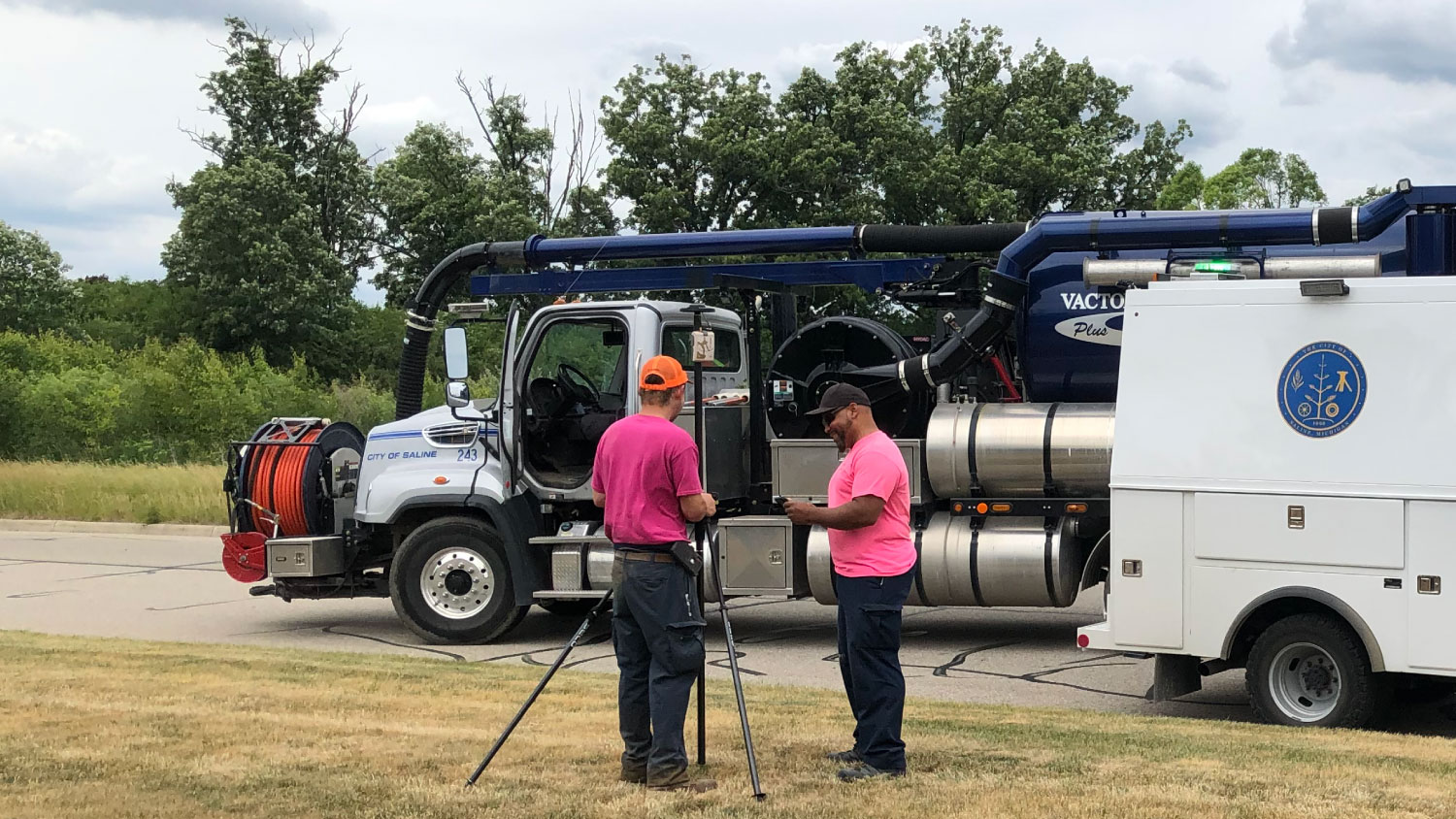
The City of Saline, Michigan, recently set out on a journey to totally transform how its Department of Public Works (DPW) takes advantage of maps. Leaving behind a previous world in which the DPW could not rely on an externally managed GIS, the city used a combination of Arrow GNSS hardware and ArcGIS software applications not only to bring their GIS in house, but also to maximize value from their investment. Learn how Saline staff created benefits including reduced third-party costs, more accurate proposal bits, and even longer-term gains such as a path forward toward building a more data-driven program management strategy.
Industry News
What Creates GNSS Positioning Error? (Part 2)
In part one of our new educational article series, you learned that all GNSS positioning is based on the time of satellite signals’ arrival. So if all positioning shares the same basic math, why are some positions more accurate than others? In part two, you’ll uncover the sources of GNSS positioning error, including such culprits as multipath, dilution of precision, and the pervasive ionosphere. Let’s dive in! …
Al’s Corner: Technical Tips
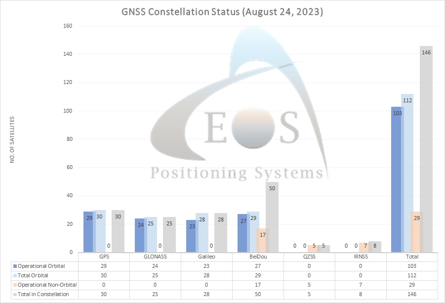
Current GNSS constellation status for August 24, 2023:
Upcoming Events
Arkansas Rural Water
September 11-12 | Arkansas
Join Eos as we return to Arkansas to discuss affordable, effective GPS mapping solutions for rural water utilities in the region.
Geodata Days
September 13-14 | France
Join Eos in Reims, France, at the annual Geodata Days event. We will be discussing Galileo HAS results from our European tests.
WaterPro
September 25-26 | Colorado
Join Eos and Esri as we return to WaterPro in Colorado. Sign up for our free Wednesday mobile mapping workshop.
Salon Affaires Municipales
September 28-30 | Canada
Rendez-vous with members of our local team in booth 304 and learn about using GPS across Quebec!

