/// Florida Utility Creates Digital Twin of Electric Assets with Highly Accurate Field Operations
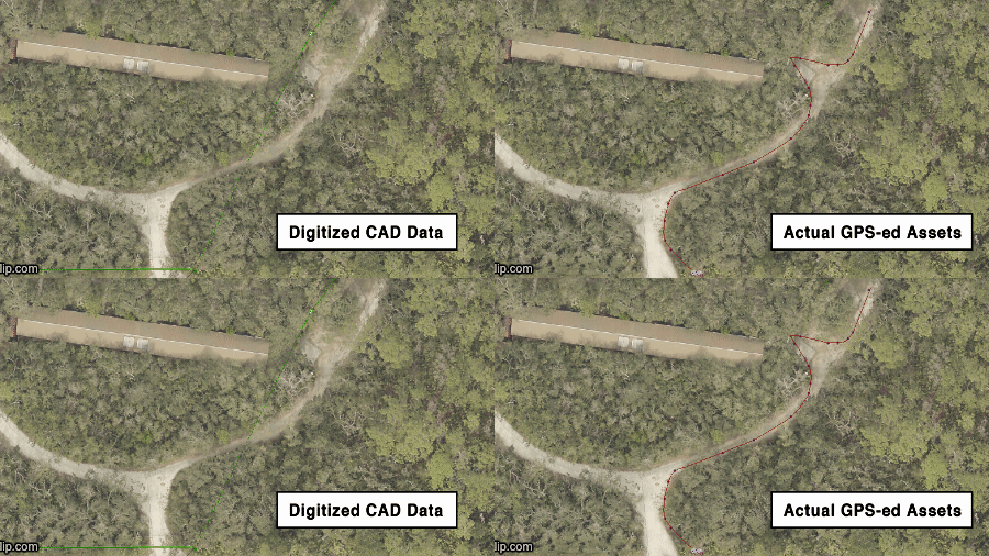
At the Utilities Commission of New Smyrna Beach (FL), original as-built records from CAD drawings, when transferred to GIS, did not accurately reflect the locations of assets in the real world. Using ArcGIS Collector, Arrow Gold, and iOS® devices, field crews create the first highly accurate digital twin of the utility’s transmission and distribution assets in 50 years.

/// New Video Case Studies
/// Improving Biodiversity with GNSS at the National Tropical Botanical Garden in Hawaii
Continuously monitoring native plants is the key to preserving ecological diversity — and ultimately preventing plant extinction. Learn how this Hawaii organization use Arrow 100 GNSS to monitor thousands of trees.
Watch the 2-minute video case study here >
/// Efficient, Centimeter-Level GPS Data Collection and Management on a Vineyard
How do you map half a million vines accurately and efficiently? One premium California vineyard saved $500,000 by using ArcGIS QuickCapture and Arrow Gold.
Learn about several GPS receivers currently compatible with Ecobot, including case studies from several wetland scientists, and a Q&A panel about pairing, and wearing, GPS.

/// Laser Mapping with Esri Collector for Utility Pole Space Management
Learn best practices on gathering data even in poor GNSS environments, safely and efficiently. Webinar covers Eos Laser Mapping™ use cases and workflows.
/// GNSS and Mobile GIS Updates
/// Eos Laser Mapping™ and Eos Locate™ now compatible with Esri ArcGIS Field Maps (beta)
Eos announcement
The August 2020 release of Eos Tools Pro (v.1.89) makes Eos Locate™ for ArcGIS® (underground mapping) and Eos Laser Mapping™ immediately available for use with the Field Maps beta.
/// What’s new in Survey123 (August 2020)
Article by Ismael Chivite, Esri
Updates to ArcGIS Survey123 include a new administrator “Organization” page, an organization “Settings” tab, better-looking basemaps, and more.
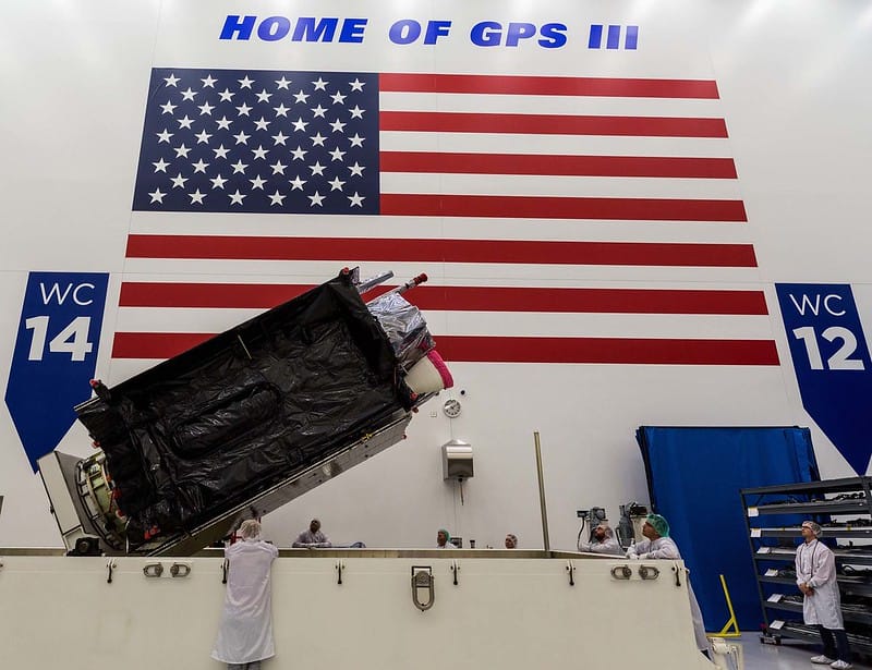
/// US Space Force grants GPS III SV03 operational acceptance
Article by Tracy Cozzens, GPS World
The GPS III Space Vehicle (SV) 03 received USSF’s Operational Acceptance approval on July 27. “This marks the third GPS III satellite to receive operational acceptance in less than a year.” (Photo: Lockheed Martin)

/// Eos makes top 3 Geospatial Award list
Eos announcement
Eos is shortlisted for the top 3 2020 “Most Disruptive Technology” nominees from geospatial technology supporter TECTERRA.
Read more about the release >
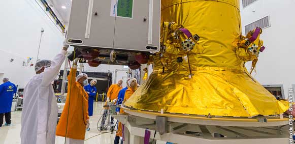
/// Galileo next-gen satellites to be more powerful, reconfigurable
Article by Tracy Cozzens, GPS World
With 26 satellites now in orbit, Europe’s Galileo navigation system will soon become even better. The next-gen satellites will include substantial improvements to service and capabilities.

/// Featured Video: How to Configure Initial Settings in ArcGIS Collector and Eos Tools Pro for Eos Locate™
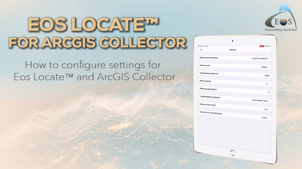
In this video, we will show you how to configure some initial settings in ArcGIS Collector and Eos Tools Pro for use with the Eos Locate™ underground mapping solution. (This is Video #2 in a five-part tutorial series.)
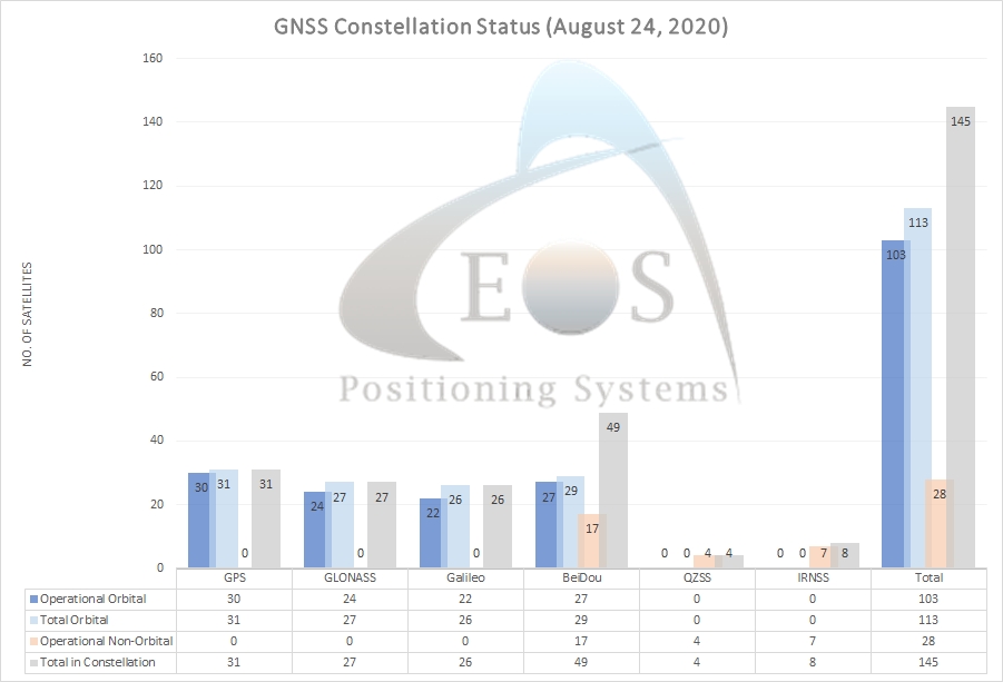
/// GNSS Constellation Status Update: August 24, 2020

/// Chris Kahn, with Eos from the beginning

Geospatial professional Chris Kahn MGIS, GISP was one of Eos’ earliest and most passionate customers. For years, Chris has found endless opportunity with GNSS, GIS, CAD, and UAV field work.

2020 North Carolina ArcGIS User Group Annual Meeting | Virtual
Wednesday, Sept. 02 – Friday, Sept. 04
- Registration: $25 (Register here)
- How to meet Eos: Visit our virtual listing page and click “Schedule a Meeting” with Davis.
GNSS Advancements for AEC | Virtual
Wednesday, Sept. 09 – Thursday, Sept. 10
- Registration: FREE
- How to meet Eos: On the day of the event, open the virtual event PDF emailed to you, flip to the “Meetings” page, and book a meeting with one of our 5 representatives any time until Sept. 22.
- Session we recommend: “Build Your Own Device (BYOD) GNSS Field Solutions”
2020 Delmarva GIS Conference | Virtual
Monday, Sept. 21 – Tuesday, Sept. 22
- Registration: FREE (Register here)
- How to meet Eos: Register for free. Following the event, Eos will email you with instructions to schedule a meeting with your local mobile GIS / GNSS expert.

