
/// AltaGas Utilities improves field-inspection time by 50% and prepares for upcoming regulations
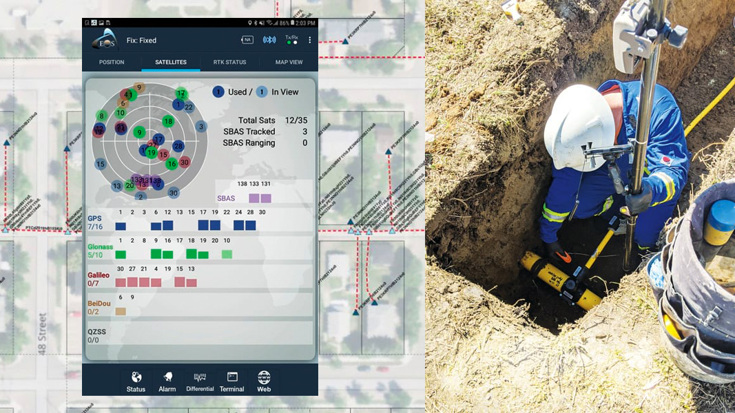
To meet new regulatory requirements for tracking and traceability, AltaGas Utilities upgraded its field workflow with ArcGIS Collector, Arrow Gold GNSS receivers, Bluetooth barcode scanners, and more. Read how their new workflow provided a strong business case, reduced field inspection time by 50%, and prepared their team to take full advantage of the Esri Utility Network.

Explore the Eos virtual Esri UC booth
Did you miss our 3D virtual booth at the 2020 Esri UC? No problem! You can still visit and explore! Watch the 1min video to preview what you’ll see.

Australia/New Zealand SBAS testbed to be retired on July 31
Update from the Australian government
The SBAS testbed trial, which successfully helped prove the business case for a new Australia/New Zealand SBAS (SPAN) will be discontinued on July 31. This is a planned end to the trial, and service is estimated to resume in 2021. Follow Eos for more updates about using Arrow GNSS during the interim.
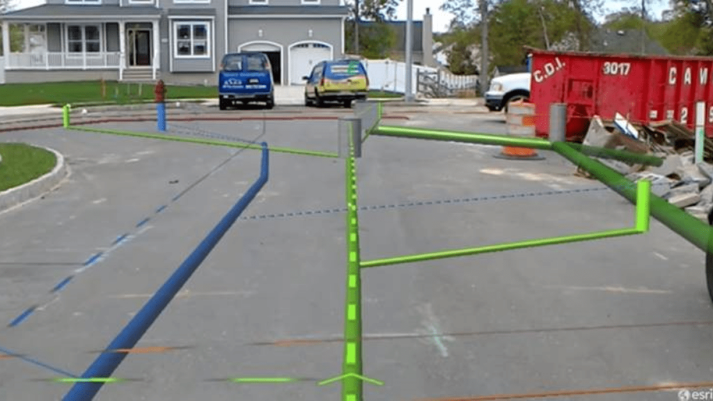
Is Utility GIS Ready for Augmented Reality?
Article by Bill Meehan, Esri
Augmented reality is a great technology, but it only works with accurate information. Explore the business case for why location accuracy matters, and uncover the 3 steps to prepare your data today. (Photo by vGIS)
Test the ArcGIS Field Maps beta today with Arrow GNSS
Esri beta program update
Joint customers of Esri and Eos can now download the Field Maps beta and use their Arrow GNSS receivers for high-accuracy data collection, read-only maps, locates, laser mapping and more. Read about the release.

Capturing current events via drone, Arrow Gold and Pix4D in Denver
Webmap by Jim Casey, Geospatial Denver
Jim Casey took his DJI Phantom 4 Pro drone and Arrow Gold (for ground control) to the streets to capture two Civic Center Street murals, by artists Pat Milbery and Adri Norris. See how the imagery turned out!
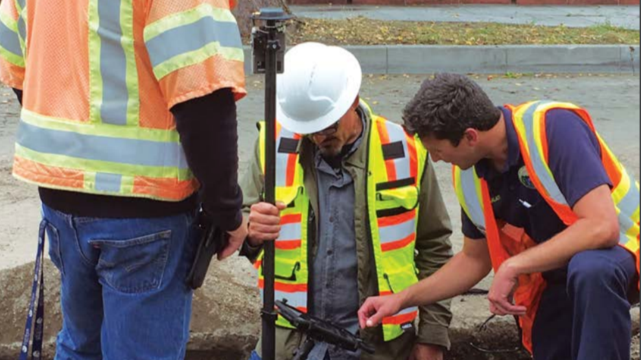
Strengthening Field Data Collection with Mobile GIS
Success story in WaterWorld
The City of Santa Barbara, Calif., has deployed a new mobile GIS solution with Collector and Arrow Gold, which has increased operational efficiencies and accuracy in its field-based workflows.
See how they are fighting drought conditions!
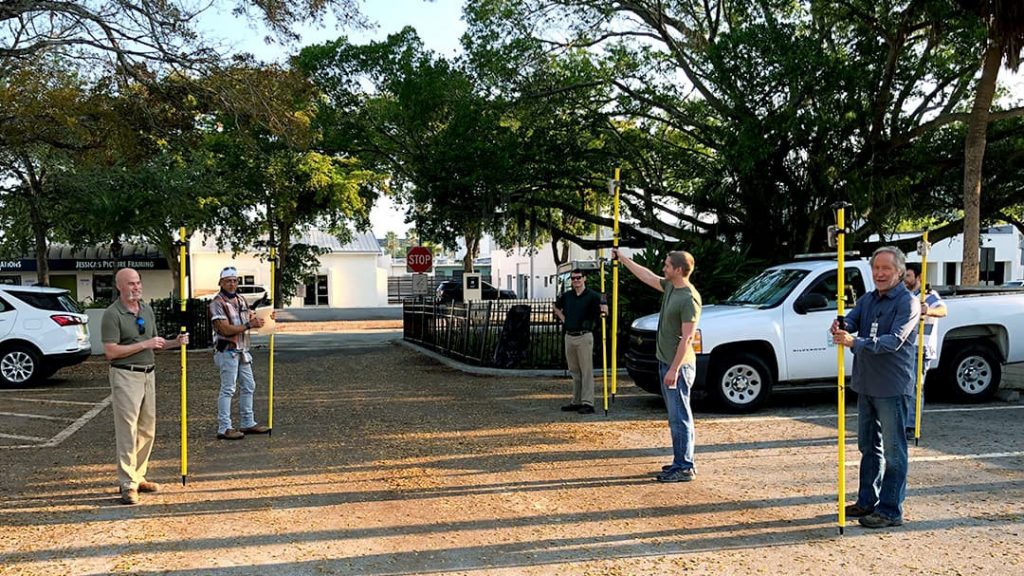
Pandemic Pivot: Collecting Data during COVID-19
Success story in ArcWatch
In the final installment of one of our favorite recent success stories, we revisit how the city of Sarasota, Florida, kept idled employees occupied with meaningful GIS work during the shutdown, and how the story ended.

Calling all innovative water utility individuals or teams!
Call for participation in global festival
Northumbrian Water, an early Arrow GNSS adopter in the U.K., is looking for similarly forward-thinking water professionals in other countries who would like to participate in the first-ever virtual iteration of their annual Innovation Festival. Collaborate on an international “challenge” project to drive the future of water-utility technology forward.

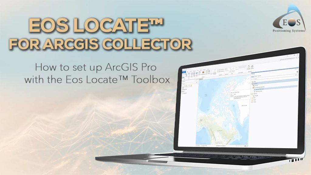
How to set up ArcGIS Pro with the Eos Locate™ Toolbox
Learn how to create locate layer in ArcGIS Pro, using the Eos Locate™ toolbox, and publishing your web map. This video is the first in five tutorials.
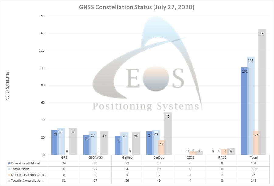
/// /// GNSS Constellation Status: July 27, 2020


Josiah Thomas betters his community
ADF Haiti CEO Josiah Thomas serves local farmers with nonprofit land surveying services and more. See why Josiah relies on Arrow Gold and ArcGIS.

Futura User Conference (Virtual)
July 29-30
Eos is also proud to be a Silver Sponsor of the first-ever virtual Futura UC. Visit our sponsor listing page to learn how Arrow GNSS works with Futura FieldPro. We appreciate your patience as this event’s digital collateral is being developed.
How to visit Eos at the Futura UC >>>
Texas Rural Water Association (Virtual Self-Paced CEU Learning)
July 27 – August 28
Register for the TRWA event to have exclusive access to “ArcGIS for Rural and Small Utilities,” an on-demand presentation from Eos partner Texian Geospatial. This presentation covers high-accuracy digital solutions that replace paper-based processes and inform operations. This session counts for CEU credit.
Browse TCEQ-approved sessions >>>
