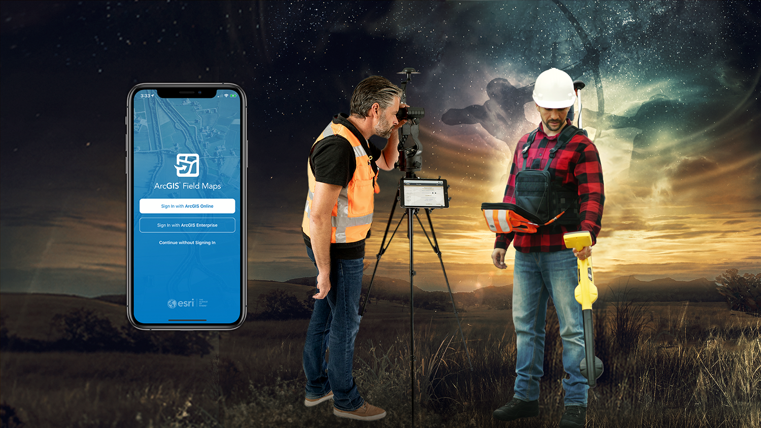
The August 2020 release of Eos Tools Pro version 1.89 makes Eos Locate™ for ArcGIS® (underground mapping) and Eos Laser Mapping immediately available for use with the Field Maps beta
AUGUST 2020, MONTREAL, CANADA — Eos Positioning Systems (Eos), the Canadian manufacturer of the popular high-accuracy Arrow Series® GNSS receivers, has announced today the compatibility of two popular Eos field data-collection solutions with the Esri ArcGIS Field Maps beta.
Eos Locate™ for ArcGIS® is the world’s first real-time, survey-grade solution for mapping underground utilities with ArcGIS field apps.
Eos Laser Mapping™ for ArcGIS is the world’s first laser-offset solution for mapping assets from afar with high accuracy, without having to physically occupy them.
“When Esri released the ArcGIS Field Maps beta, we saw the future of geospatial field data collection,” Eos Chief Technology Officer Jean-Yves Lauture said. “Customers currently using these two solutions with ArcGIS Collector may now choose to use them with Field Maps, without any extra work or cost.”
“It’s a seamless transition for folks who are using these workflows in Collector. That to me is compelling. You can just install another app, enable the workflow, and go — just as you did with Collector.”
— Doug Morgenthaler, Program Manager, Esri
Customers transitioning to Field Maps from Collector will be able to take advantage of additional capabilities (e.g., smart forms, markups) without having to deploy new training or workflows, according to Esri Program Manager Doug Morgenthaler.
“It’s a seamless transition for folks who are using these workflows in Collector,” Morgenthaler said. “That to me is compelling. You can just install another app, enable the workflow, and go — just as you did with Collector.”
To use the solutions, customers must download the latest version of Eos Tools Pro (1.89 or higher) and join Esri’s Field Maps beta program.
About Eos Positioning Systems, Inc.
Eos Positioning Systems®, Inc. (Eos) designs and manufactures the world’s premier, high-accuracy GPS / GNSS receivers for the Bring Your Own Device (BYOD) market. The Arrow Series® receivers feed submeter, subfoot and centimeter RTK GPS / GNSS location data to any iOS®, Android, Windows, and Windows Mobile device. Free Eos software utilities, such as Eos Tools Pro, were designed to provide users with the smoothest experience of integrating high-accuracy location data and metadata into their mobile workflows.