Visit Eos Positioning Systems® (Eos) at the 2022 Esri User Conference (Esri UC). This year’s event will be held at the San Diego Convention Center in San Diego. Eos will be welcoming you in our booth from July 12–14. Here is everything you need to know to maximize your time with our team at the 2022 Esri UC!
Tuesday, July 12: Eos Sponsored Lunch!
“What’s New in High-Accuracy GNSS/GPS for Esri Users?”
Join Eos with Special Guests including the product owner of ArcGIS Field Maps, Jeff Shaner (Esri); Veteran GNSS/Drone Expert Eric Gakstatter (DMG); and our Chief Technology Officer Jean-Yves Lauture (Eos)
(Lunch will be provided to the first 100 attendees to arrive at the session in room 15B)
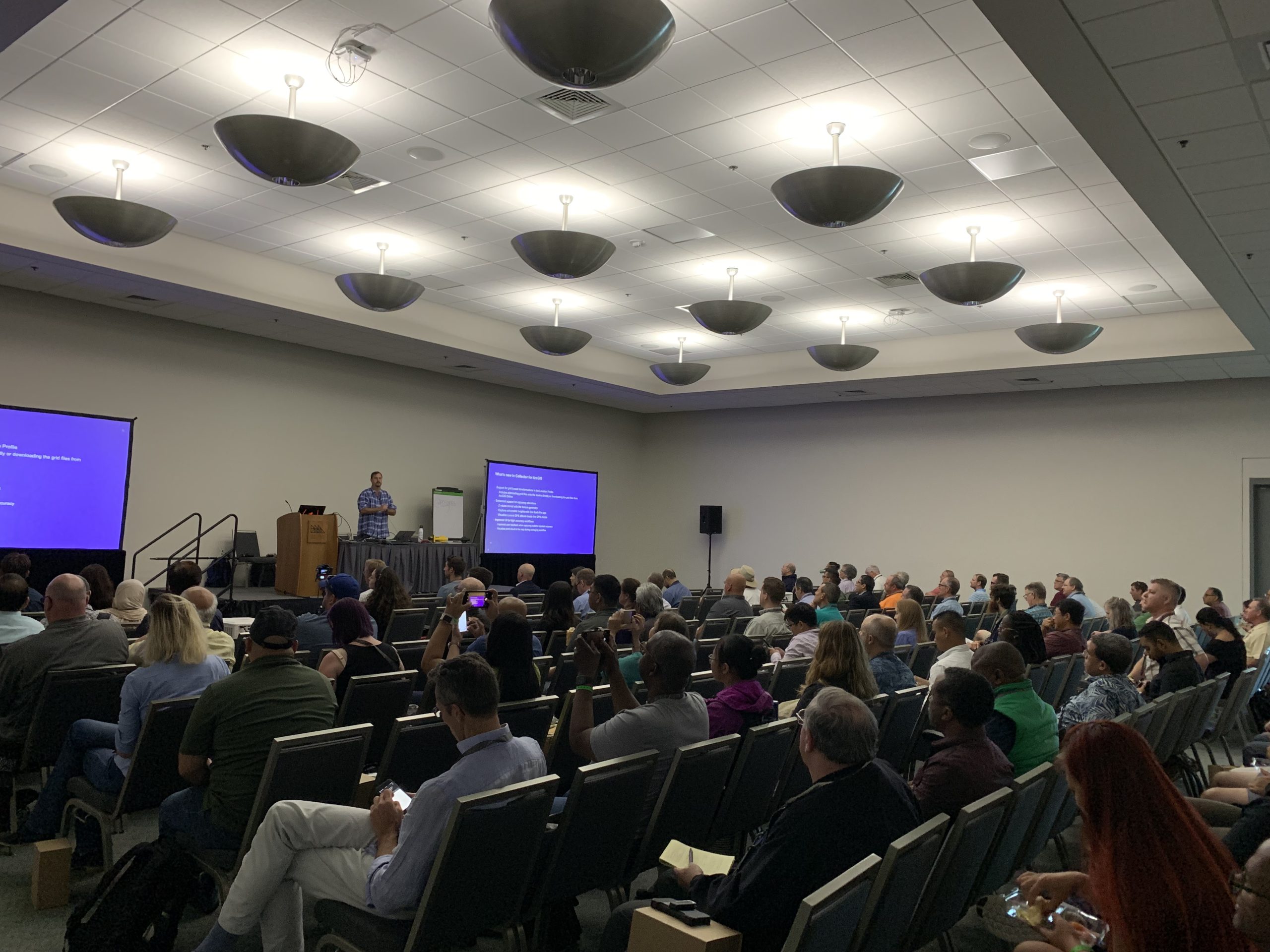
Join Eos Positioning Systems CTO Jean-Yves Lauture to learn what’s new in GNSS/GPS for Esri mobile app users. The last time this update was given live and in person by Lauture was three years ago, before the start of the COVID-19 pandemic. There have been a lot of changes in the state of GNSS and GPS that directly benefit Esri GIS users since then!
What’s New in High-Accuracy GNSS/GPS for Esri Users?
Jul 12, 2022 | 11:30 am – 12:30 pm | SDCC – Room 15 B
Lauture will be joined by ArcGIS Field Maps product owner Jeff Shaner (Esri) to talk about updates in this newest mobile app from Esri. Additionally, veteran GNSS and drone expert Eric Gakstatter (Discovery Management Group) will talk about advancements in GNSS specifically and how these are driving tangible productivity gains in field-data collection.
Add this session to your calendar today!
Pro tip: We recommend checking the Esri UC Detailed Agenda for the latest room information prior to the event start date. While we don’t anticipate the date, time, or room changing, this is always a possibility. As of June 9, 2022, the date, time and room are as posted above.
Tuesday, July 12 - Thursday, July 14: Eos at the Expo!
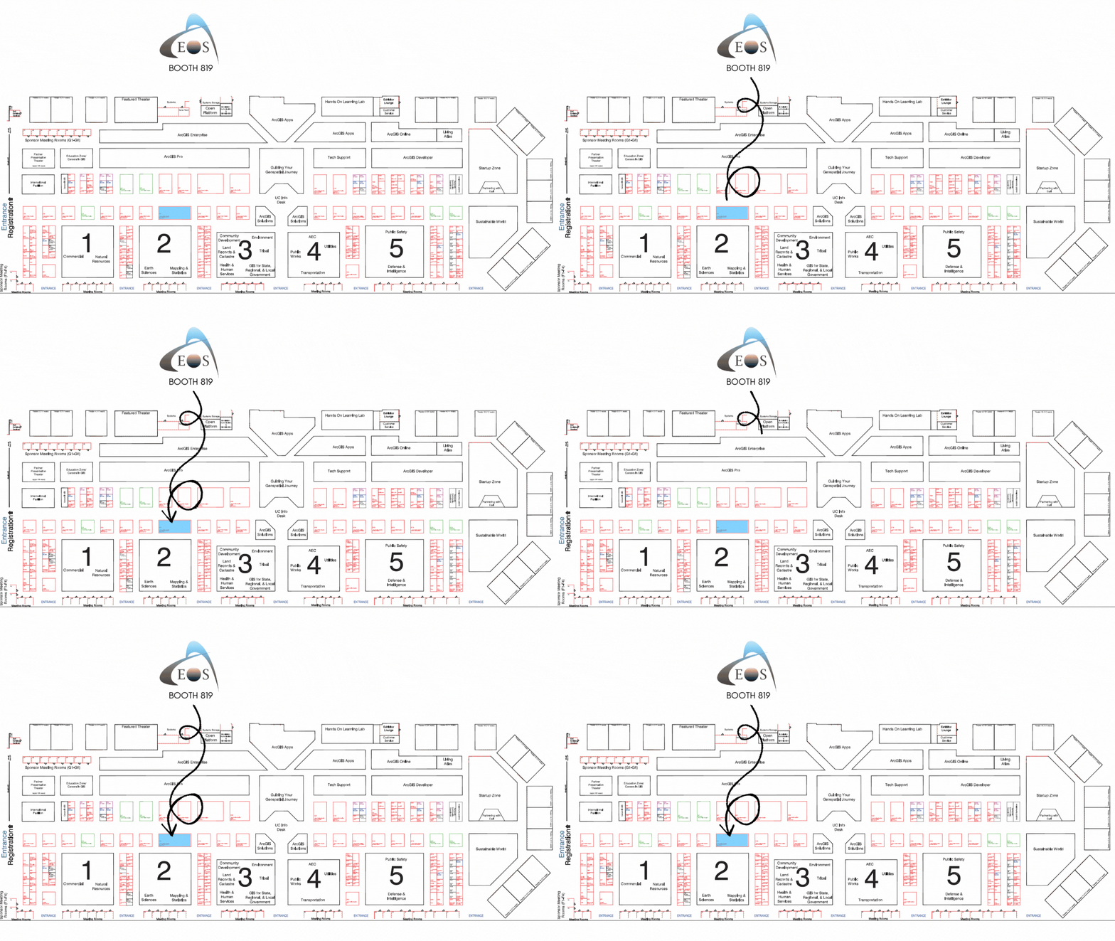
Find us on the floorplan in booth #819:
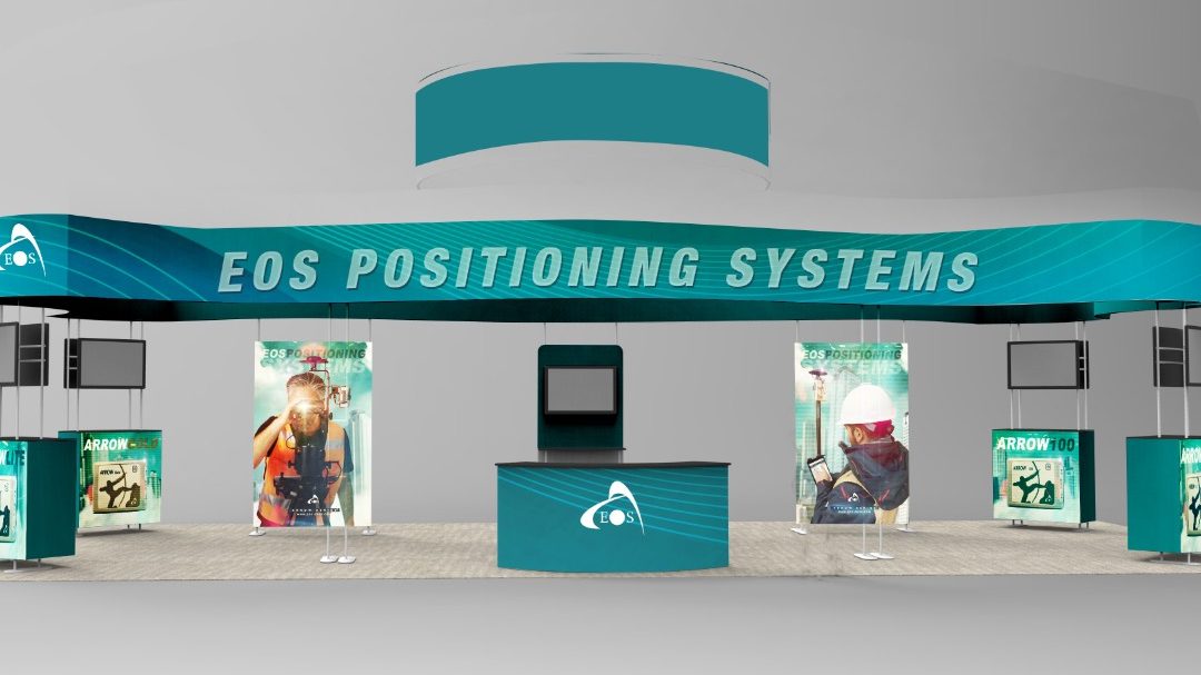
Our booth will look like this:
Expo Dates & Times
Jul 12, 2022 / 9:00am – 6:00pm
Jul 13, 2022 / 9:00am – 6:00pm
Jul 14, 2022 / 9:00am – 4:00pm 2022-07-12 09:00:00 2022-07-14 16:00:00 America/Los_Angeles Visit Eos Positioning Systems in Booth 819 at the 2022 Esri UC in San Diego, California! Visit Eos Positioning Systems in Booth 819 at the 2022 Esri UC in San Diego, California! San Diego, CA Eos Positioning Systems
Location
San Diego Convention Center
111 W. Harbor Drive
San Diego, CA 92101
United States
Social Media
Tuesday, July 12 - Thursday, July 14: User Presentations and SIGs!
Learn about high-accuracy mobile mapping in these sessions:
Our Conference Sessions
The Eos team will be participating in the following sessions during the conference. Please join us for some informative discussion.
Session 1: What’s New in High-Accuracy GNSS/GPS for Esri Users?
Jul 12, 2022 / 11:30 am - 12:30 pm |
SDCC - Room 15 B
SPONSORED LUNCH: Join Eos and Esri for a lunchtime session on everything new (sensors, signals, apps & more) in high-accuracy GNSS / GPS for mobile field crews.
- Jeff Shaner, Esri
- Eric Gakstatter, Discovery Management Group
- Jean-Yves Lauture, Eos Positioning Systems
Session 2: ArcGIS: Empowering Small and Rural Systems
Jul 12, 2022 / 2:30 pm - 3:30 pm |
SDCC Room 24 C
USER PRESENTATION: Paper 1 Abstract: When a water main leaks, accurate asset locations are key to an efficient repair. Digging in the wrong location can increase costs greatly, delay water services, and even cause further damages. As Jonah Water Special Utility District grew from a rural, small water system to a mid-sized system, the need for high-accuracy maps of their water system became clear. The water utility decided to use a mobile GIS workflow by deploying digital web maps on their tablets. By using ArcGIS Field Maps, an Eos Arrow Gold GNSS receiver, and setting up their own RTK base station, they are now able to pinpoint leak locations with maximum efficiency. In this presentation, you’ll learn what best practices they learned in deploying this kind of digital, highly accurate mapping system for leak mitigation. See how accurate GIS data allows for quicker repairs, informs decision-making, and promotes collaboration between departments.
- Dave Babicki, Jonah Water Special Utility District
Session 3: Gas Utility Solutions - Efficiently Capturing High Accuracy New Pipe Construction
Jul 12, 2022 / 2:30 pm - 3:30 pm |
SDCC Room 26 B
USER PRESENTATION: This session addresses how one gas utility implemented ArcGIS Utility Network to support gas operations through the full outage and restoration management lifecycle. Another explores how a customer leveraged Esri’s mobile applications, the Utility and Pipeline Data Model, and attribute rules to capture at high accuracy new pipe construction, and at the same time improve the productivity of the field technicians documenting the new construction. From Speaker Damon Nelton: "In 2019 our GIS team was challenged by our client to address the long-standing issues of inaccurate maps, safety and production efficiency when installing and documenting new gas pipe construction. Leveraging Esri’s mobile applications, the Utility Pipeline Data Model (UPDM), and attribute rules we were able to capture the new pipe construction to within 0.25 inches of its true location, and at the same time improve the productivity of the field technicians documenting the new construction. Come and learn how we developed this solution, overcame obstacles, and collaborated with the GIS community with new Esri workflows using Collector (now Field Maps), Survey123, high accuracy GNNS receivers, barcode scanning, tracking and traceability workflows with enterprise geodatabases and attribute rules, dynamic PDF customer reports, web-apps, dashboards, and portal-to-portal collaborations. The amazing results of real time data sharing and digital as-builts not only met our client’s needs but gave us data that has never been more accurate and current, allowing for future underground stakeholders to make and plan safe informed decisions."
- Damon Nelton, Data Manager, Ellingson Companies
Session 4: Construction Management SIG
Jul 13, 2022 / 7:00 am - 8:00 am |
SDCC - Room 25 C
AEC SIG: Eos Positioning Systems is pleased to *sponsor* this Esri SIG! "Join your infrastructure peers and colleagues at the AEC Design & Engineering Special Interest Group meeting. This is a unique opportunity to hear from industry leaders who will share their insights on Permit & Preliminary Design, As-built workflows, Collaborative Design Reviews, and Jobsite & Field workflows."
- Esri AEC staff, Esri
- Eos staff, Eos Positioning Systems
Session 5: Data Collection, UAS, and Augmented Reality
Jul 13, 2022 / 10:00 am - 11:00 am |
SDCC - Room 24 C
USER PRESENTATION: Join American Water staff for a full hour discussion focused on GIS. Topics include field data collection, use of high accuracy receivers, augmented reality, as-built workflows, unmanned aircraft systems, and return on investment.
- Chris Kahn, American Water
Session 6: Mobile Workforce SIG
Jul 13, 2022 / 11:30 am - 12:30 pm |
SDCC - Ballroom 06 F
MOBILE SIG: Eos Positioning Systems is pleased to *sponsor* this Esri SIG! "Please join us at the Mobile Workforce SIG to share best practices in applying a geographic approach to leveraging mobile workforces efficiently and effectively. Today, the demands of a modern mobile workforce apply across outdoors, indoors, and in-motion use cases, and deploying technology that meets all these requirements can be challenging. This SIG will cover a range of considerations with mobile workforce technology, including training staff, managing mobile devices, the use of high-accuracy GNSS receivers, dealing with environmental constraints, connected vs. offline workflows, and back-office integration."
- Jeff Shaner, Esri
- Eos staff, Eos Positioning Systems
Session 7: Transforming Gas Utilities
Jul 13, 2022 / 1:00 pm - 2:00 pm |
SDCC Room 26 B
USER PRESENTATION: This session addresses how one gas utility implemented ArcGIS as an enterprise system to transform support of all functional areas and roles. The implemented system integrates with SAP, the document management system, and SCADA. Another implemented ArcGIS capabilities to transform its ability for the office and mobile workforce to work better together in response to disaster emergencies. This solution includes the ability to identify impacted assets and needed valve closures. Teams in the office monitor system variables in real-time through dashboards.
- Mathew Desbiens, GIS Manager, Apex Utilities
Session 8: GIS: The Foundation for 3D Visualization in AEC
Jul 14, 2022 / 8:30 am - 9:30 am |
SDCC - Room 27 B
USER PRESENTATION: "Using High-Accuracy RTK GNSS and RTK Drone to Produce a 3D Golf Course As-Built" --> AEC work has always been about describing location, examining data, and telling a story. As ArcGIS users, we’re fortunate to be able to enhance our storytelling of GIS data in ways that weren’t possible before. While 2D will always enable us to create compelling stories about location, 3D and emerging interactive technologies are now enabling us to bring our data to a wider audience. This session will explore multiple projects using the wide range of Esri's solutions to deliver 3D visualization in AEC.
- Eric Gakstatter, Discovery Management Group
Session 9: Water Utilities SIG: Lead Service Lines
Jul 14, 2022 / 11:30 am - 12:30 pm |
SDCC - Room 28 E
WATER SIG: Eos Positioning Systems is pleased to *sponsor* this Esri SIG! "The Lead and Copper Rule Revisions include requirements that water utilities identify sources of lead, establish a trigger level for mitigation, test for lead in schools and childcare facilities, identify and make public the location of lead service lines, and plan lead service line replacement. Join this SIG to discuss the revisions to the Lead and Copper Rule and how they have impacted your organization."
- Vincent Fortino, Esri
- Christa Campbell, Esri
- Eos staff, Eos Positioning Systems
Session 10: Transforming Campus Facility Management with GIS
Jul 14, 2022 / 1:00 pm - 2:00 pm |
SDCC - Room 28 C
USER PRESENTATION: "Site Plans - ArcGIS Meets AutoCAD" --> The journey to successfully and sustainably transform your facility starts with data. However, the problem most organizations are facing is that their data is non-interoperable, e.g. pen and paper documents, Excel sheets, or thousands of records organized in tabular formats in an IWMS, CMMS, etc. This session will demonstrate how ArcGIS integrates with facility management systems to consolidate disparate data into a central system and optimized workplace.
- Benson Crowell, TDHHS


