The Skadi Smart Handle™ from Eos Positioning Systems® has two modes of operation: Extensible Virtual Range Pole™ and Invisible Range Pole™. Both modes are powered by a cutting-edge combination of sensors, including LiDAR. This article provides an understanding of the Extensible Virtual Range Pole mode. For more information about the Invisible Range Pole mode, click here.
About Extensible Virtual Range Pole Mode on the Skadi Smart Handle
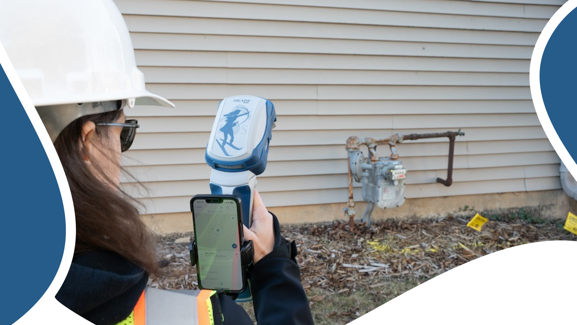
The purpose of the Extensible Virtual Range Pole mode is to streamline the precise measurement of targets that cannot be safely or quickly occupied by standing on them, such as a fixture in a trench. It may also be used to measure the positions of assets located in areas with partially obstructed line-of-sight to the sky, such as a meter on the side of a building.

Extensible Virtual Range Pole mode is the default mode of the Skadi Smart Handle. When you initialize your smart handle, this will be the mode that turns on automatically.
This mode is characterized by the use of a green laser pointer and the smart handle trigger.
Limitations
Distance
The Extensible Virtual Range Pole mode has a distance limitation of about seven meters, or ~20 feet. If your target falls outside this range, you will need to move closer.
Reflectivity
Your target must be able to reflect light. The functioning distance between the Skadi and the target is impacted by the reflectivity of the target. Darker and more porous targets, such as matte black surfaces and puddles of water, could prove challenging and require closer distance. Metallic, colored, and other targets that reflect lots of light are more suitable.
If your target falls outside the LiDAR’s range, moving closer should help.
Height
This mode is not designed to capture assets above the head, but rather those on the ground, such as assets in trenches.
Neither is this mode designed to replace a laser rangefinder. A laser rangefinder will still be needed to perform laser offsets of long-distance assets, those above the head, and other select situations. For more information about using laser rangefinders with Eos GNSS receivers, click here.
Important Safety Information Regarding the Visible Green Laser Pointer in this Mode
Read before operating the Skadi Smart Handle.

The visible green laser pointer used in the Skadi Smart Handle has a power output that ranges from 4-20 milliwatts (mW). This puts it at the very low end of Class 3B, which ranges from 5-499 mW.
At the low end of Class 3B, defined as ~5-50 mW, a laser poses a moderate risk of eye injury. According to www.LaserSafetyFacts.com:
It is unlikely that a handheld beam aimed from more than a few dozen feet away would cause injury — laser light could not stay on one spot on the retina long enough for heat to build up to injurious levels. However, the risk is increased if the beam is held steady or if the laser is relatively close to the eye.
To further mitigate risk of injury, the smart handle’s laser pointer blinks in a duty cycle, significantly reducing exposure time.
In regions where maximum mW is legally delimited below 5 mW, the Skadi Smart Handle’s power output can be restricted via the Eos Tools Pro app.
The Skadi Smart Handle is designed to prioritize safety under normal operational conditions and comply with applicable laser safety standards. However, improper use of the laser, including intentionally pointing it at a person’s eyes, may result in injury. By using the Skadi Smart Handle, the user agrees to operate it responsibly and assumes all risks associated with misuse or failure to follow the instructions outlined herein. The manufacturer disclaims all liability for injuries or damages arising from improper use, intentional misuse, or failure to comply with safety standards.
Get the Skadi Smart Handle™ User Manual here.
Using Extensible Virtual Range Pole Mode with a Third-Party App, such as for Data Collection and Mapping
In Extensible Virtual Range Pole mode, you will use the smart handle’s laser pointer and trigger to stream data to your third-party app. Each of these topics will be explained in detail next. Note that the Skadi Smart Handle does not collect data but rather transmits high-accuracy positions to your chosen, third-party data-collection app.
Overview of the Laser Pointer
Recall that the Extensible Virtual Range Pole mode is the only mode to make use of the Skadi Smart Handle’s laser pointer. In this mode, the green laser pointer is always visible. The laser’s location represents the position your receiver is measuring. In other words, wherever it points, you are measuring.
Wherever the visible green laser points, you are measuring.
The laser is designed to be visible in strong sunlight. Do not point the laser in anyone’s eye as it could cause damage.

Overview of the Trigger
The Extensible Virtual Range Pole mode uses a trigger to send data to your third-party app. This trigger is found on the underside of the smart handle.
 trigger undercarriage zoomed")
Important note: Triple-pressing this trigger will cause your mode to change to Invisible Range Pole mode. Be wary of this as you perform your field work.
Overview of Streaming Positions in Extensible Virtual Range Pole Mode
To stream positions to your third-party app, simply press and hold the trigger (for a minimum of two seconds) while aiming the laser pointer at your target. Your Skadi will continuously stream positions to your third-party app as long as this trigger is pressed and held.
Important Note:
Only while you press and hold the trigger will the values in the “Compensated” column of the “Position” page of Eos Tools Pro be green. If these values turn red while in this mode, it typically means you are not pressing the trigger. However, if you are pressing the trigger and the values are red, you have probably lost your initialization or RTK fixed status.
For more information about interpreting the “Compensated” column of the “Position” page of Eos Tools Pro, click here.
Recall: Only when you press and hold the trigger in this mode will your “Compensated” values be green. Once you release the trigger, the values will be red, and positions will no longer be sent to your third-party app.
Important Information for ArcGIS® Field Maps Users
Enable GPS Averaging to Stream Positions
If you are using the Esri® ArcGIS® Field Maps app as your data-collection app, you must enable a “2 Points” GPS averaging (i.e., a minimum of two points) in your ArcGIS map before using the Skadi Smart Handle to stream positions. We recommend pausing here to do so before continuing. In order to accomplish this, we recommend you follow the instructions here on Esri’s website to enable GPS averaging in your ArcGIS maps.
In most cases, we strongly recommend using this method (i.e., enabling GPS averaging and streaming positions) for data collection in ArcGIS Field Maps. However, if you do not wish to use GPS averaging, there is also an optional feature you may enable in Eos Tools Pro called “Single Point Mode,” which we will explain next.
Single Point Mode: Built for ArcGIS Field Maps Users Not Using GPS Averaging
The “Single Point” feature was designed for ArcGIS Field Maps users who are not using GPS averaging. To activate Single Point mode, open the “Skadi Smart Handle” settings in the Eos Tools Pro app. Make sure you are in the “Extensible” tab. Next, toggle on the “Single Point Mode” switch.

Note for iOS® Users: Eos Tools Pro Must Be Active Before Each Trigger-Press
If you are using an iOS® device in Single Point mode, Eos Tools Pro must be the active app (i.e., app in foreground) before you send a valid position to ArcGIS Field Maps.
- On iPad® (including iPad mini®), set Eos Tools Pro and ArcGIS Field Maps in Split View mode. This satisfies the need to keep Eos Tools Pro active in the foreground.
- On iPhone®, there is no Split View mode. Instead, you must simply call Eos Tools Pro to the foreground before each measurement.

For Android™ Users: Disable Picture-in-Picture
If you are using an Android™ device in Single Point mode, picture-in-picture (PiP) must be disabled for the Single Point mode to operate properly. Please disable PiP before using this method.
To Send Data in Single-Point Mode
To send data to ArcGIS Field Maps in “Single-Point mode” make sure Eos Tools Pro is your active app (for iOS users only) and make sure PiP has been disabled (for Android users only). Next, press and hold the smart handle trigger until you feel a double vibration. The double-vibration indicates Eos Tools Pro has transmitted a valid position to ArcGIS Field Maps. (This equates to you having tapped the “Add Point” button in ArcGIS Field Maps to capture a location.) At this point, you may continue entering attributes and submitting your data as you normally would in ArcGIS Field Maps. Repeat the process to send another position to ArcGIS Field Maps.
Verifying Valid Positions in Invisible Range Pole Mode
While holding the trigger, the Skadi Smart Handle will double-vibrate once per second to indicate that the GNSS positions being sent to your third-party app are valid. If the handle single-vibrates, your GNSS positions are invalid. Please consult the “Troubleshooting Invalid Positions” section of the Skadi Smart Handle User Manual to verify the cause of, and to resolve, invalid positioning.
Get the Skadi Smart Handle User Manual
For more information about requirements to use, enable, and initialize the Skadi Smart Handle to take advantage of the Extensible Virtual Range Pole, please consult the full Skadi Smart Handle user manual here.
Explore Related Knowledge Base Items

What is the Invisible Range Pole™? Overview and Explanation
This article will provide a foundational understanding of the Invisible Range Pole™ mode of the Skadi Smart Handle™.

Understanding “GNSS” vs. “Compensated” Coordinate Values When Using the Skadi Smart Handle™
This article will show you how—and why—to interpret “GNSS” versus “Compensated” coordinate values in Eos Tools Pro when using the Skadi Smart Handle™.