If you’re reading this article, you’ve probably heard of “GPS.” What you might not know is that GPS is an acronym that stands for “Global Positioning System.” Moreover, GPS is just one constellation, or group, of satellites that enable positioning — all part of a larger category known as Global Navigation Satellite Systems, or GNSS. The GPS constellation specifically, like all GNSS constellations generally, provides information that can enable the calculation of positions on the surface of the planet. This article will provide an understanding of how GPS and GNSS technologies achieve this.
On This Page: Table of Contents
- The Difference Between GPS and GNSS
- A Brief History of GPS
- The Proliferation of Other GNSS Constellations
- Putting the “G” in “GNSS”
- Key Takeaways
- Learn About the Satellites Themselves
- Each GPS Satellite is Outfitted With Atomic Clocks
- The Foundation is Time of Arrival
- Four Satellites to Solve for X, Y, Z and t
- Getting Four Satellites Used to Be Harder
- Does More Than Four Improve Accuracy?
- Key Takeaways
First, we need to address the difference between GPS and GNSS
As mentioned, GPS is one type of GNSS. Specifically it is the U.S. group of positioning satellites. So why do people refer to “GPS” when they really mean “GNSS”? The answer is the same reason people say, “I’m going to Google something” when they mean “I’m going to search for something online” or “I’ll Uber there” when they mean, “I will take a rideshare car.” Many people say, “I’m going to use GPS” when they mean, “I am going to use GNSS technology.” So how did this come about?
Similar to Google and Uber, GPS was the world’s first GNSS constellation, and it remains the best-known GNSS constellation with widespread brand recognition. It is also the most commonly used GNSS constellation — meaning all of today’s positioning receivers and antennas track GPS satellites. Therefore, many people all over the world use the term “GPS” when really they are referring to “GNSS” technology — whether they realize this or not.
It’s important to note that, moving forward, we will use “GPS” and “GNSS” intentionally in this article series. When we use “GPS,” we will be referring to the U.S. global positioning constellation, while the term “GNSS” will refer to all of the positioning satellites.
Speaking of which, let’s discuss the origin of the GPS constellation in the United States government …
A brief history of GPS
The GPS satellite constellation was established by the U.S. Department of Defense (DOD) beginning in 1978, when the first four GPS test satellites were launched into orbit. Some of the messages and signals broadcast from these GPS satellites to the Earth were originally accessible only to U.S. government and military personnel. But today, information broadcast by GPS satellites has been made available to both civilians and private industries worldwide, no matter their purpose or location. The only requirement is that someone has a receiver capable of receiving and decoding the GPS satellite messages. Today, the GPS constellation is still owned and operated by the U.S. government through its Space Force agency.
The proliferation of other GNSS constellations

Based on the institutional, consumer, and commercial values of the U.S. GPS constellation, other governments have since launched their own GNSS constellations. These satellite constellations each have their own names, and they share many technological similarities with GPS. For instance, all GNSS constellations are owned and operated by government bodies; all of them provide positioning information (among other information) to compatible receivers; and all of them can be used anywhere on the planet, by anyone who has a compatible receiver.
To date, there are four fully operational GNSS constellations with global coverage (with satellites orbiting the earth):
- GPS – owned and operated by the United States of America, first satellite launched in 1978
- GLONASS – owned and operated by Russia, first satellite launched in 1982
- BeiDou – owned and operated by China, first satellite launched in 2000
- Galileo – owned and operated by the European Union (E.U.), first satellite launched in 2011
There are also other regional GNSS constellations that service specific areas of the earth using geostationary satellites (see next section):
Putting the “G” in “GNSS”
Note that the “G” in “GNSS” stands for “Global.” This means that even if a GNSS constellation is owned and operated by one governing body, its satellites orbit the globe. Therefore, the messages these satellites send can be received and decoded by any compatible GNSS receivers within the signal’s reach. (This is different from geostationary satellites, which orbit the Earth at the same location all the time; geostationary satellites can be used only by individuals who are located within that specific region. The Chinese BeiDou constellation has both geostationary and globally orbiting satellites. When we talk about BeiDou in this article series we will be referring only to its globally orbiting satellites.)
Government bodies intentionally designed their GNSS technologies based on a principle of “interoperability,” which is what enables certain GNSS receivers today to receive and decode messages from all GNSS satellites, regardless of which country operates them.
It is important to note that every GNSS manufacturer will specify the constellations its receivers can track along with the various signals and messages they support. Some GNSS receivers support only the GPS constellation; others support two constellations, such as GPS and GLONASS; and still others like the Arrow Gold® support all four GNSS constellations. These days, Eos Positioning Systems recommends most people invest in a receiver that supports all four GNSS constellations, as this increases both accuracy and productivity. As we will explore later, the more satellites a receiver can track, the more reliable it will be in the field.
Key takeaways
- GPS is the U.S. GNSS constellation; however, people often say “GPS” when the term “GNSS” would be more appropriate
- There are four fully operational GNSS constellations with global coverage: GPS operated by the USA; GLONASS operated by Russia; BeiDou operated by China; and Galileo operated by the E.U.
- A four-constellation GNSS receiver can use information from satellites in all four constellations to calculate a position, no matter where the person is on the planet.
Now, let’s learn about the satellites themselves …
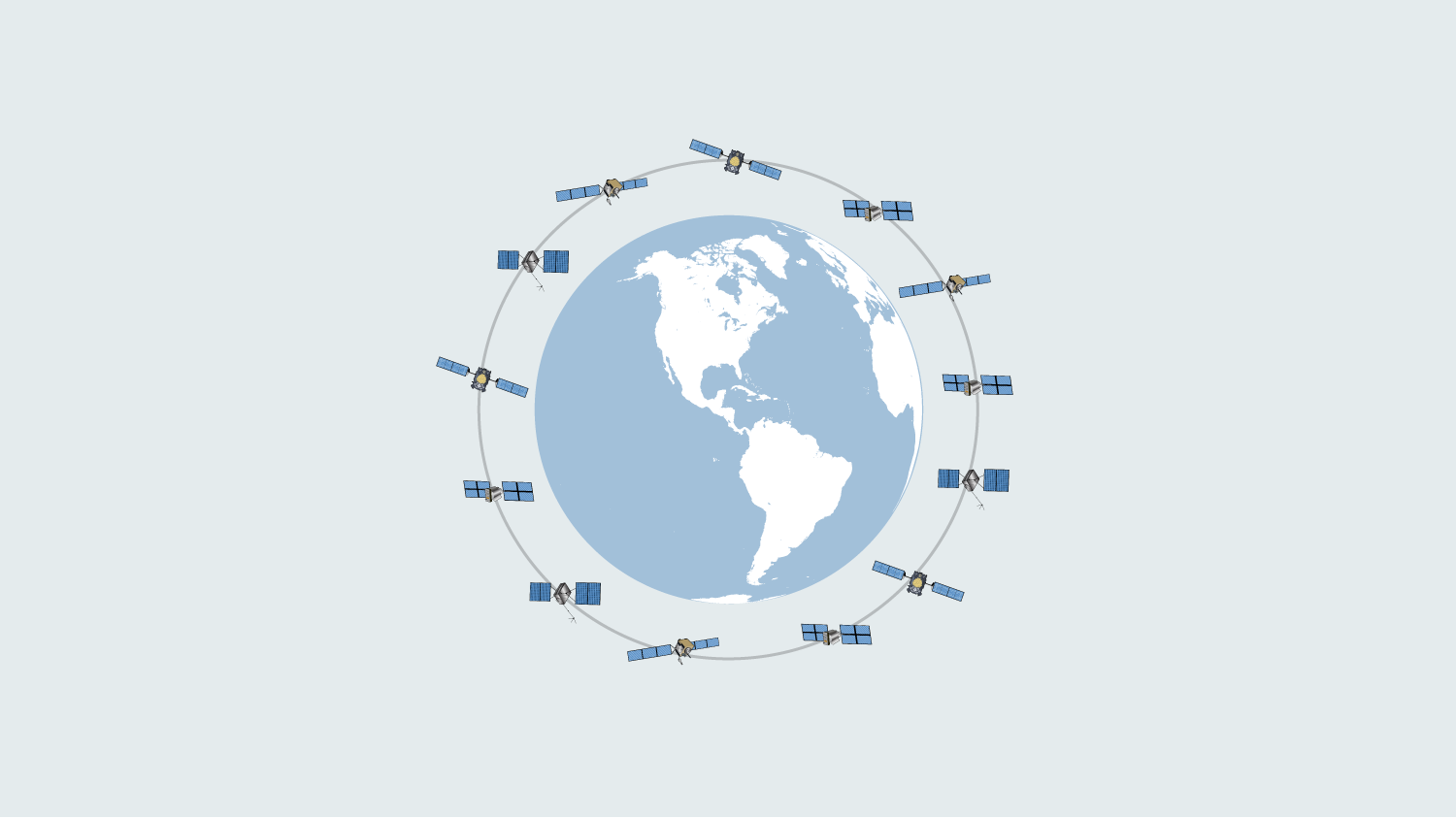
Now that we’ve established the difference between GPS and GNSS, we’re going to take a step back and learn about the satellites themselves. For the sake of being specific, we’re going to focus only on the GPS constellation. But the same principles apply to the other GNSS constellations.
Each GPS satellite is launched into a designated slot of a fixed orbital plane, which means it orbits the Earth along the same path. Each orbital plane exists at about 20,200 kilometers above the surface of the planet, at a 55-degree angle with respect to the equator. A single GPS satellite orbits the planet twice per 24-hour period — or once every 11 hours and 58 minutes. The GPS constellation specifically has a minimum of 24 total satellites, with currently 31 operational (usable) at the time of this writing. Here are the satellite counts for all GNSS constellations (in early 2023):

- GPS: 31 total satellites (31 operational)
- GLONASS: 25 total satellites (24 operational)
- Galileo: 28 total satellites (24 operational)
- BeiDou: 29 total satellites (27 operational; not including 20 geostationary satellites)
Each GPS satellite is outfitted with atomic clocks
The next most important thing to know is that each satellite is outfitted with multiple extremely accurate atomic clocks. When we say extremely accurate, we mean that these clocks will experience a drift of approximately one second every 30,000 years. In other words, these clocks keep nearly perfect time, to within 100 billionths of a second, insofar as this is technologically possible. The atomic clocks provide critical functions toward positioning and also timing applications.
When a positioning satellite broadcasts its signals to earth, its signal contains a few key pieces of information. For instance, the signal contains messages about the location of the satellite itself, various codes, and the timestamp of when the signal is sent. Once the signal reaches a GPS receiver on the ground, this generates a second timestamp: the time of arrival of the signal. The time of arrival is not only important — it is the basis of global positioning calculations for getting a set of location coordinates on Earth.
The foundation of positioning calculations is time of arrival
When we use GNSS technologies, what we really want to gain is our X, Y, and Z (latitude, longitude, and elevation) coordinates.
Although we don’t know our X, Y, and Z values (yet), we do know a few numbers that will help us. Some of these numbers are variable, and some of these are constant:
- Location: The location of the satellite sending the signal (variable)
- Time (of signal being sent): The time the satellite broadcast its signal (variable)
- Time of arrival: The time the signal reached a receiver (variable)
- Speed: The speed signal propagation, which is the speed of light (constant: 300,000 kilometers per second)
This means that for any given satellite, we know the value for “t,” or time of arrival, as well as some other critical figures.
Now let’s discuss how “t” will help us calculate values for X, Y, and Z …
We need four satellites to solve for X, Y, Z and t
If you studied differential equations, then you know the number of equations required to solve for unknown variables is equal to the number of unknown variables we have. This means if we have one unknown variable, we need one differential equation to solve it. If we have seven unknown variables, we need seven differential equations to solve it. Let’s look at some simple examples of this concept to strengthen our understanding:
Example 1: Assume I have one unknown variable: “X.” I will need one equation to solve for X. Here is an example:
X + 1 = 5
Therefore I can solve that X = 4
Example 2: Now assume I have two unknown variables: “X” and “Y.” I now need two equations to solve for both variables:
X + Y = 17
4X = Y + 3
Therefore X = 4 and Y = 13
You don’t need to actually do this math yourself; rather, it’s important to remember this guiding principle: The number of variables we have dictates the number of equations we need to solve for each variable. In GNSS, we have four total variables: “X,” “Y,” “Z,” and “t” (time). This means we need four equations to solve all four variables. Because each satellite signal provides us one solution to the “t” value, it follows that we need to track four GNSS satellites in order to solve all four variables.
Therefore, every person on the planet who wishes to use GNSS to calculate a position must track a minimum of four satellites concurrently.
Getting four satellites used to be much harder
Today, we are lucky enough that there are over 100 operational GNSS satellites orbiting the planet, which means that a receiver capable of tracking all four GNSS constellations will nearly always be able to track at least four satellites. In fact, a quality four-constellation GNSS receiver like the Arrow Gold® can track a total of 64 satellites concurrently with a current average of about 45 satellites visible above the horizon at any given location on earth. The number of visible satellites in the sky is only growing as governments launch and operationalize even more of them. But we shouldn’t take this for granted, because not so long ago this wasn’t the case …
In the earliest days of GNSS, there were so few operational satellites in orbit that tracking the minimum four satellites required both planning and preparation. For instance, back when GPS was the only operational constellation, there used to be only short windows of time during the day when four satellites would be “visible” (or above the horizon) to a receiver. It was common for mapping professionals to plan their field work during these specific windows — no matter if they were in the early morning, middle of the day, late at night, or middle of the night. This was known as “mission planning.”
Today, thanks to the proliferation of GNSS satellites, we no longer need to do this. This is one of the reasons, however, our team recommends avoiding GNSS receivers that support only some of the four GNSS constellations. A four-constellation GNSS receiver will have the greatest success with tracking satellites.
Does having more than four satellites improve accuracy?
In a word, yes. There are many reasons why you will benefit from tracking as many satellites as possible, beyond just the minimum requirement of four.
The more satellites you have, the more accurately the receiver can compute your X, Y, and Z values. In addition, not all received signals are of equal quality. Some signals are received more strongly, or cleanly, while others can be weakened or gather noise before reaching the antenna. For instance, a satellite signal that bounces off the water of a pond, a tree, or a building before reaching a receiver’s antenna can not only become weaker but can also accumulate delays and signal noise along the way. We’ll go into greater detail about this in the next article.

Key takeaways
- Time of arrival is the basis of all global positioning
- You need a minimum of four satellites to compute a three-dimensional GNSS position
- Tracking more than four satellites increases your position accuracy and productivity
Now that you understand the foundation of how GNSS receivers calculate a position, let’s discuss what makes some positions more accurate than others. Read part 2: “What Creates GNSS Positioning Error?“