Feature Story
/// A Small Water District Leverages GIS to Capture Distribution System Asset Information and Comply with California Regulatory Requirements

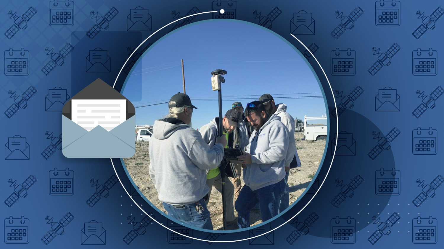
In 2022, the Littlerock Creek Irrigation District (LCID) embarked on developing a new GIS program to meet regulatory requirements and establish a comprehensive asset database, particularly focusing on buried valves in their distribution system located in the Mojave Desert. Led by LCID’s general manager James Chaisson, the district collaborated with MC Engineering, Inc., to implement a utility GIS program, integrating GNSS/GPS technology for precise asset location recording. MC Engineering conducted a high-resolution aerial survey and developed GIS-based applications accessible via iPad devices, allowing LCID staff to access record drawings and asset locations both in the field and through web applications. LCID invested in an Eos Positioning Systems Arrow Gold GNSS receiver for pinpoint accuracy in locating assets. Through workshops and training sessions, LCID staff familiarized themselves with the new system, enabling them to efficiently access and update asset information. As a result, LCID now boasts a centralized repository for asset data, enhancing their ability to manage and maintain their distribution system effectively.
Industry News
The experience locating assets after Hurricane Sandy prompted one utility to map over a million individual assets with sub-inch accuracy in a journey that took years. Follow their journey by watching this short video case study.
Al’s Corner: Technical Tips
Current GNSS Satellite Status for April 29, 2024:

Customer Spotlight

Kyle Emery Charts Coastal Change with GNSS
Dr. Kyle Emery is dedicated to deepening our understanding of coastal change. As an Assistant Researcher at the Marine Science Institute of the University of California, Santa Barbara, Kyle uses high-accuracy mapping and drone imagery to explore, research, and conserve coastal ecosystems.
Upcoming Events

GIS in Action
April 30-May 1 | Oregon, USA
Are you getting into the action at GIS in Action in Portland? Visit an authorized Eos representative in the expo hall. Ask us how to get high-accuracy GNSS locations in your GIS apps!

MISA Prairies Annual Conference
May 6-8 | Saskatchewan, Canada
Join Eos in the Esri Canada booth at the annual MISA Prairies Annual Conference in Saskatoon. Ask us how to get the most out of your GNSS throughout Canada.

Ohio Rural Water
May 6-7 | Ohio, USA
Eos and Esri are back at the Ohio Rural Water Association annual conference! Join us May 6 for our operators training workshop starting at 8 a.m. Then, find us in booth #62 for one-on-one questions about mobile mapping for rural water utilities!

Esri UK AC
May 14 | London, United Kingdom
Eos is pleased to be back sponsoring the Esri UK Annual Conference! Visit our team throughout the event in stand #12. We are there all day to answer questions about gaining higher GNSS accuracy in your ArcGIS apps.

New York Rural Water
May 21-22 | New York, USA
Eos and Esri are pleased to support the New York Rural Water Association’s conference in Verona. Find us throughout the event in booth #44 and let us answer any questions you have about mobile mapping with high accuracy!