Eos Positioning Systems

Tel.: +1 (450) 824-3325 (CAN)
  • Technical Support
  • EnglishEnglish
    • Français Français
    • Español Español
  • Home
    • About
    • Contact
    • Technical Support
    • Subscribe
    • Testimonials
    • Users
  • Products
    • Arrow Series™
      • Arrow Gold
      • Arrow 200
      • Arrow 100
      • Arrow Lite
      • Comparison Chart
    • Accessories
      • Antennas
      • Mounting Equipment
      • Extra Battery & Power
      • Field Gear
      • Atlas® Service
    • Tools and Apps
      • Eos Tools Pro
      • Eos GNSS Tools
      • Eos Utility
      • Eos Server
      • Arrow USB Drivers
    • Solutions
      • Geoid Height
      • Eos Locate™ for ArcGIS
      • Laser Mapping
  • News
    • Latest News
    • Success Stories
    • Events
    • Newsletter
    • Press Releases
    • Blog
  • Learning Center
    • Arrow
      • How-To Articles and PDFs
      • Video Tutorials
      • Arrow Datasheets (PDFs)
      • Manuals (PDFs)
    • GNSS
      • GNSS Articles
      • iOS and Bluetooth®
  • Partners
    • Field Apps
      • Esri
      • AmigoCloud
      • CartoPac®
      • Corvallis Microtechnology (CMT)
      • DigiTerra
      • Futura
      • GeoMobile Innovations
      • GI Geoinformatik GmbH
      • mapitGIS
      • SPOT
      • SST Software
      • TAXUS IT
      • TerraGo
    • Hardware
      • iOS
      • Android
      • Windows
      • Laser Technology
      • Tablet EX Gear
CONTACT
  • Home
  • News
  • Latest News
  • Release: Eos Releases Orthometric Height Support for Arrow GNSS Receivers (Survey-Grade Elevations)

Release: Eos Releases Orthometric Height Support for Arrow GNSS Receivers (Survey-Grade Elevations)

by Eos Positioning Systems / Monday, 29 October 2018 / Published in Latest News, News, Press Release
Eos Announces Orthometric Height Support for Arrow GNSS Receivers (Survey-Grade Elevations)

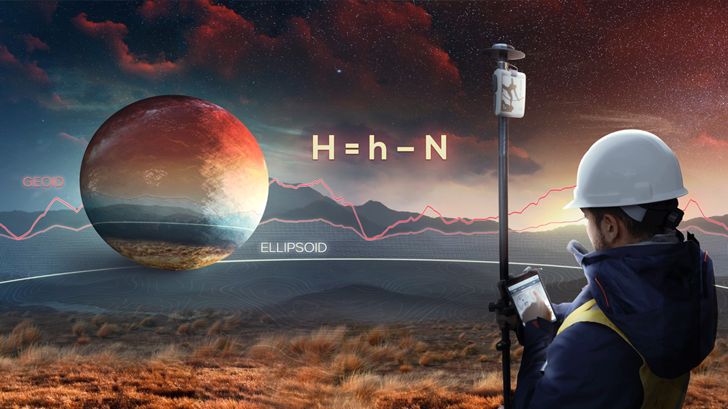
Supporting GEOID models enables Arrow GNSS receivers to collect high-accuracy, survey-grade vertical datum with any software

MONTREAL, CANADA — Eos Positioning Systems, Inc.® (Eos) announced today its support for GEOID height models within its Arrow Series™ GNSS receivers. Eos is the world’s leading manufacturer of affordable high-accuracy GNSS receivers for any app running on iOS/Android/Windows devices and using the Eos Arrow Series.

“You can use Arrow GNSS receivers with any data collection software in the world, and benefit from accurate orthometric heights. Our Arrow receivers will output accurate GNSS elevations no matter which data-collection software you use to capture it.”

— Jean-Yves Lauture, CTO, Eos Positioning Systems

“You can use Arrow Series receivers with any data collection software in the world, and benefit from accurate orthometric heights,” Eos CTO Jean-Yves Lauture said. “Our Arrow receivers will output accurate GNSS elevations no matter which data-collection software you use to capture it.”

With support for GEOID models, Arrow receivers automatically output survey-grade elevations to all iOS and Android data collection software. Support will also soon be available for Windows devices.

The Arrow receivers now support the entire United States to provide survey-grade elevation in NAVD88 orthometric heights through the GEOID12B (US) model. The Arrow receivers also support the Canadian CGG2013a and HTv2.0 GEOID models for the CGVD2013 and CGVD28 vertical datums, respectively. Additional GEOID models for other countries are planned in the future.

“Eos is intensely focused on supporting high-accuracy GIS, engineering, surveying and construction users by supporting the latest GEOID elevation models within our GNSS monitoring software,” Lauture said. “Our roadmap remains focused on high-accuracy BYOD users by supporting all iOS, Android and Windows users with this capability.“

The problem is that typical Bluetooth GNSS receivers usually provide inaccurate, built-in elevation models. This inaccuracy is reflected in the Mean Sea Level (MSL) elevation output by those receivers. By outputting orthometric height, the Arrow now solves this problem and turns any smartphone or tablet into a 3D, survey-grade accurate data collection device.

Eos has designed this new feature so that users will easily be able to update to new GEOID models as they become available in the future.

Field technicians in pipeline, construction, engineering, architecture, water, and any other industry are finally able to enjoy GNSS location with survey-grade vertical accuracy on their iOS and Android devices, with the data-collection app of their choice and their Eos Arrow receivers.

“We are pleased to offer this important feature to all mobile GIS software users,” Lauture said.

Download Eos Tools Pro here.

For more information, contact Eos.

###

Inside Look: Orthometric Height Support for Arrow GNSS Receivers (Survey-Grade Elevations)

  • How to Configure ArcGIS, Collector for ArcGIS, and Eos Tools Pro for Laser Offset Mapping and Orthometric Height
  • How to Configure ArcGIS, Collector for ArcGIS, and Eos Tools Pro for Laser Offset Mapping and Orthometric Height
  • How to Configure ArcGIS, Collector for ArcGIS, and Eos Tools Pro for Laser Offset Mapping and Orthometric Height
  • How to Configure ArcGIS, Collector for ArcGIS, and Eos Tools Pro for Laser Offset Mapping and Orthometric Height

What to Read Next?

Eos Esri workshop
27/11/2020
2020 Esri and Eos mobile GIS Workshop: Panel responses from the Q&A
READ MORE
Laser Offset Guide for Collector: How to Configure Collector for ArcGIS® and Eos Tools Pro for Laser Offsets
27/09/2019
Laser Offset Guide for Collector: How to Configure Collector for ArcGIS® and Eos Tools Pro for Laser Offsets
READ MORE
FEATURE IMAGE - PRESS RELEASE - NEW EOS TOOLS PRO RELEASE WITH BATTERY STATUS MONITOR AND MORE GEOID; 396668_EosTools_032519
27/03/2019
Release: Eos Releases New Eos Tools Pro with Updates for GEOID Support and Battery Monitoring
READ MORE
25/01/2019
How to Record Orthometric Heights in Collector v18.1.0 (Aurora) with Your Eos Arrow GNSS Receiver
READ MORE
How to Record Orthometric Height in Esri Collector Aurora with Your Eos Arrow GNSS Receiver
24/01/2019
How to Record Orthometric Height in Esri Collector with Your Eos Arrow GNSS Receiver
READ MORE
How to Collect Geoid Height with Arrow and Esri’s Collector for ArcGIS
19/11/2018
How to Use Real-Time Geoid Height with Arrow and Esri’s Collector for ArcGIS
READ MORE

About Eos Positioning Systems, Inc.

Eos Positioning Systems®, Inc. (Eos) designs and manufactures the world’s premier, high-accuracy GPS / GNSS receivers for the Bring Your Own Device (BYOD) market. The Arrow Series™ receivers feed submeter, subfoot and centimeter RTK GPS / GNSS location data to any iOS, Android, and Windows device. Free Eos software utilities, such as Eos Tools Pro, were designed to provide users with the smoothest experience of integrating high-accuracy location data and metadata into their mobile workflows. Learn more about Eos.

LOGO – Eos Positioning Systems Eos – with text – English - small for site

For more information about getting started with Arrow, contact Eos.

Contact Eos Today

CONTACT EOS

This post is also available in: Français Español

Tagged under: Elevation, Eos Tools Pro, Orthometric Height

About Eos Positioning Systems

Our technical team pioneered the BYOD (Bring Your Own Device) high-precision Bluetooth GPS / GNSS market more than a decade ago when they designed the SXBlue product line. In early 2014, this same team founded Eos Positioning Systems® to design the next generation high-performance Bluetooth receivers, the Arrow Series, which includes the world’s first Apple approved iOS RTK GNSS receiver capable of real-time centimeter accuracy, the Arrow 200.

NEED TECHNICAL SUPPORT?

Contact support now >

Search

Categories

  • Arrow Series™
  • Blog
  • Bluetooth
  • Firmware
  • GIS Articles
  • GNSS Articles
  • How-To Articles
  • News
    • Event Archive
    • Latest News
    • Success Stories
  • Newsletters
  • Press Release
  • Sessions
  • Technical Bulletin
  • Video Tutorials
  • Webinar

Archives

Twitter

Tweets by EosGNSS
Follow @EOSGnss

CONTACT

Eos Positioning Systems®, Inc. (Eos)

1160 Rue Lévis, Suite 100
Terrebonne QC, J6W 5S6
Canada

call-answer : +1 (450) 824-3325

M-F : 8:30 a.m. to 5:00 p.m. (ET)

Follow Eos:

SITE MENU

  • Home
    • About
    • Contact
    • Technical Support
    • Subscribe
    • Testimonials
    • Users
  • Products
    • Arrow Series™
    • Accessories
    • Tools and Apps
    • Solutions
  • News
    • Latest News
    • Success Stories
    • Events
    • Newsletter
    • Press Releases
    • Blog
  • Learning Center
    • Arrow
    • GNSS
  • Partners
    • Field Apps
    • Hardware

QUICK LINKS

  • Get Fast Technical Support
  • Contact Eos for Sales Inquiries
  • Subscribe to the Eos Newsletter
  • Compare Arrow GNSS Receivers
  • Find Partner Apps & Hardware

logo-standard-eos-blanc

Eos Positioning Systems © 2014 - 2020
Website designed and created by Backside Pixels

TOP