Synopsis:
On May 18th, the Mid-Michigan area experienced a heavy rain event and subsequently a double dam failure of the Edenville and Sanford Dams. Midland County and OHM Advisors discuss how they used their GPS Smart Bike with Arrow Gold® GNSS, Esri ArcGIS, and ArcGIS QuickCapture during this event, particularly how shared data became crucial during a global pandemic.
Midland County Project Overview
Chris Cantrell – Midland County
[Start transcript]
We are talking about the flood and subsequent dam failures that we had in Mid-Michigan on the 19th and how we used the ArcGIS program and others to manage the GIS. We will also be talking about some lessons learned in this massive emergency.
So as if COVID wasn’t enough going on in the world, we decided to up the ante here in Midland. On May 17th, our emergency management director started tracking a storm coming in from the plains. We started to get some emails and she said that the storm she was tracking had the potential of becoming a possible flood. That just ratcheted up the stress level; it had been four months of COVID in Michigan, and the way that things were going in mid-May, we were still right in the peak of it without fully understanding the pandemic and where it was headed. People were already struggling. So we started tracking that thing.
Midland background:
If you live in Midland, flooding is an annual event. The Tittabawassee River and the Chippewa river meet in downtown Midland where the famous bridge is located at – if you’ve ever seen that picture, you’d understand. The tidal velocity causes floods almost every spring, and the flood level for that tidal velocity is 26 feet. No one even breaks a sweat when we reach flood level. We don’t activate the emergency operation center (EOC ) when it’s at that level.
At that flood level, we just send out warnings because everyone that lives around the area understands what the water is going to do and where it can go most of the time. When it starts to get to 28, 29, 30 feet, that’s when we start reacting as far as EOC and we start looking at road closures, flood inundation models and where the water is going to go and start gathering information to make the EOC take effect at that point.
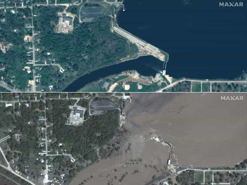
What you’re seeing in this video is the evening of May 19th. What you’re looking at is what used to be the Sanford Dam that dammed up Sanford Lake, which is the lower of the two lakes. Wixom is north of this and is held back by the Edenville damn, which flows into the Sanford Lake. The Sanford Dam bolted up here and then Midland is about 10 miles downstream from it. This was taken at probably 8pm and the Edenville Dam failed at about 6 – 6:30 pm. At that point, you can tell by the water in this picture that there was just was so much water that it was overrunning the Sanford Dam.
On May 19th, we started tracking heavy rainfall towards Mid-Michigan and total rainfall for the period was about 48 inches across the Tittabawassee River basin and with that amount of rain, the dam failed up in Edenville, which then subsequently overran the Sanford Dam. The rated flood stage level was around 30 to 39 feet. The record that we previously recorded to occur in May was 33 feet, which was set in 1986 and what we ended up with was a record of just over 35 feet. So knowing how high 35 feet was if it would have hit 38 feet, which was the estimate from the national weather service, it was obviously beyond our estimates by a wide margin. Nobody could imagine another three feet of water across Saginaw county; it would have been impressive what had already taken place, but that’s what happened.
About the Emergency Operation Center (EOC)
For those of you that have never gone through an emergency in your jurisdiction and activated the EOC. The process is to declare an emergency locally, which is stepped up to the state level where the governor needs to sign off and declare the area of an emergency, which begins to open up more resources for the areas impacted. At that point, if it is warranted, the governor will then request a presidential declaration of a disaster, and that goes up to the president of the United States.
What happened next
I think that process took about seven weeks before the president signed off and declared a federal disaster area for Gladwin, Midland, Saginaw, Arenac and Iosco counties. Edenville is about 2300 acres of surface area, Sanford Lake was about 1500 acres of surface lake. As you can imagine, it’s an incredible amount of water that was released through the dams as they were slowly ripped apart by the force of the water. The amazing thing is that there were no reported casualties with this event in Midland. I give credit to the fact that we know Midland floods and a lot of our annual EOC training is geared around flood suggestions and healing floods. So a lot of us got into the EOC, and we’ve been there before, and we knew how to handle it and we had developed evacuation procedures and road closures; we knew where the flooding was going to be, so we just methodically went about the processes and the training paid off. Credit to this training is the fact that there were no fatalities.
How we reacted as a team
As this event started to unfold on Tuesday, we came in on Wednesday – Nathan Fazer and I. We started with getting all the GIS stuff that we had prepped and gotten ready for a flood event in an EOC activation. A lot of that was done, and Nathan will go over the technical stuff, as a result of the 2017 flood. The EOC activation that we had gave us a heads up on things that we wanted in place the next time it happened.
It was really interesting because almost right out of the gate, we started getting phone calls from every agency you can imagine. I’ve gotten a lot more acronyms now than I ever knew before May 19th. We got calls from Michigan State Police, EOC, from Eagle DTMB, MDOT, FEMA region five out of Chicago, and the US Corps of Engineers. We also got calls from Consumers Energy. We also got calls from the Spicer Group, a local surveying engineering group. We also got a call from the Four Lakes Task Force – it is the nonprofit organization that has been given oversight of the four dams in the system. They’re going to be the future owners of the dams and are in the process of purchasing them from voice hydro.
The need for greater collaboration
So it got a little frustrating that day, because as Nathan and I are trying to get our work done, we kept getting phone calls and phone calls and phone calls. By the end of the day, we came to the realization that what we needed to coordinate our GIS efforts between every agency that was requesting data. That coordination will give them what they need to do their work at each level of government and on the private side.
So what I did was coordinate a daily 1 p.m. phone call and at its peak, during that week, we had 27 GIS folks. It was solely dealing with GIS and flood, which was impressive – the value of GIS was clear and every agency knew it.
We had 27 people on a call and it took about an hour each day going through what data was there and what data is available. How can we get the data mode between agencies and stuff like that. It was a big benefit to everybody vertically across the agencies. We also worked with the City of Midland GIS coordinator, Tyler, and we managed, edited and distributed all the data taken out to the different agencies – it coordinated between state and federal agencies.
Due to some of the things that quickly became a realization in 2017, the Michigan State Police, COC and FEMA had boots on the ground real quick up here in Midland to address damage assessment and damage across the area shortly after that disaster. However, that wasn’t going to happen this time as their folks weren’t allowed to travel due to the curfew. So the benefit of Midland having an enterprise GIS and an AGO account with licenses became invaluable because we were able to move data up and down without folks having to come up here and we didn’t have to snail mail or FTP anything. We could just move data through our AGO account to different folks.
One of the things you have to take as a lesson learned is that we can allow outside agency users to join our ArcGIS Online group only if the account managers of their respective organizations allow them to join. It became a problem if the managers refused because we couldn’t get them to join as guests in our ArcGIS Online account. The benefit of our enterprise licensing is that we had a lot of ArcGIS Online accounts for free, so we were able to just create users within our environment and have them join our ArcGIS Online enterprise org and be able to get the data they needed and use it in their respective agencies.
Nathan Fazer – Midland County
Just to expand on what Chris touched on with the ArcGIS Online. Any of you that are admins of your ArcGIS Online accounts would notice that by default, users have roles and you can customize those roles and buried in those role settings in ArcGIS Online is something to allow users to join outside organizational groups.
So as Chris mentioned, that was one of the issues we had as we had a lot of people asking, “Can you add this user to this group” and we’d go to add them, and it would say that this person doesn’t have permissions. It was basically a simple checkbox on a user role, but a lot of agencies have obvious privacy concerns and things like that.
So as far as getting into the technical stuff like road closures, we had started working with our 9-1-1 department on some solutions to allow dispatchers to mark up a map for road closures. So we were kind of in the middle of testing some options with them when this event happened.
So the way this worked is dispatch had a couple of ArcGIS Online logins, and it was just a very basic editing app that allowed them to go in and draw or trace on the map and say, “This segment of road is closed.” So obviously we would like to have a better solution using our road centerlines and things like that, but for a quick fix this worked.
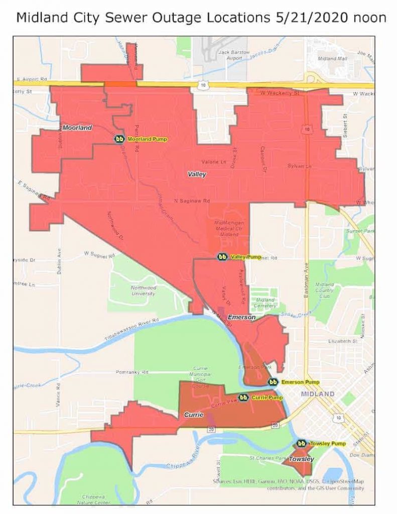
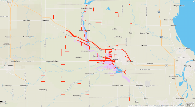
What we did is, as they were marking up the map as far as road closures (this was just a feature service in ArcGIS Online), we were making a backup or an export of that data. So, what you’re seeing on the screen now is what is the result of when the GIS technician, Ashley, at the road commission took all those exports we had — or the bulk of them — and merged them together into one layer. So we could have a time enabled dataset showing as things progressed over the course of a week, or what roads were closed or open.
One of the lessons learned is that we’d obviously have to find a better solution for the dispatchers to be able to mark up a road on what’s closed and what’s not. We worked on a better solution as opposed to doing an export two to three times a day and finding a way to better track time in that dataset as well. So we don’t have to merge 20 exports to get a time-enabled layer. So there are some things we got to work on there. But to be able to have the dispatchers draw the road closed, this was shared out to the public on the web so people could just look up a basic map and see what was closed.
Damage Assessment
So damage assessment is sort of the primary focus that we’ve been working on for a flood event. I worked with our damage assessment officer and emergency coordinator here at the county over the course of a year or two, to try to develop a process using GIS to track damage assessment both from homeowners, the public and also damage assessment teams on the ground.
Again this was another thing we were still developing and tweaking when this flood happened, so we basically had to roll out what we had. There were some things we learned quickly after the rollout that first day of some things we had missed, some things that were easy fixes and some things we will have to reassess on the backend and build a little better workflow with version 2.0.
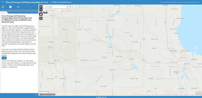
The way that we set this up was that it used our address point data and parcel data, and we then did some joins on the backend. The frontend was a web application in ArcGIS Online, and here is a screenshot of what that looked like. People would search for their address and if it was found in our GIS data. It zoomed into their house and had a little pop-up with a link and they would click that link and be taken to a ArcGIS Survey123 form. The reason we set this up was by going through this map is because we actually used the URL pass-throughs that you can build with ArcGIS Online and Survey123, and we pre-filled in the address and parcel ID number in that survey form.
Chris can talk at length about issues that were encountered after the 2017 flood here in Midland about people submitting damage reports and typing in addresses and information and people misspelling things and many of us trying to match up submitted data to GIS with spelling and formatting errors. That was a nightmare. So we thought that if we could somewhat reduce those issues by having people use our GIS information and having those things pre-filled in, we could easily join that back to our data by having that address and parcel ID in our GIS format already set.
More lessons learned with ArcGIS Survey123
Some of the things we ran into that we didn’t really account for while using Survey123 will be discussed below. There are a lot of different factors if people are on their smartphone and it sometimes records their location, so we had points sort of people all over the place or showing up in the middle of the ocean and there were a lot of goofy things happening with the data.
On the first few days that we experienced this, Chris, Tyler and I spent a lot of time cleaning up data and trying to organize things. After a while, we did get it all cleaned up and again, having those parts like these was very helpful as it allowed us to then join that to our parcel layer, and through some voodoo magic, we were able to also bring in attachments from that Survey123 form into the parcels, and we were able to create a dashboard internally.
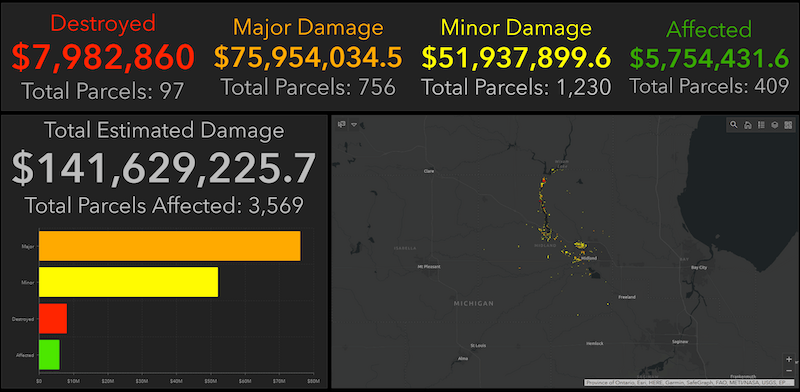
What this sort of final data set or dashboard allows you to do is zoom in so that you can see part of what we had set up with that the damage assessment information. We tied that into property values or values of buildings on the property and did some calculations, so you can see that as you move the map on the fly, those values change depending on what’s in the map view. And we can click on the parcel to see those attachments that were submitted. So, it’s now a neat data set that we now have after the fact.
I know local assessors are going to be using some of this information moving forward. Below are some of the lessons learned from damage assessment.
Outside boundaries
Initially, when we rolled out that app that I had a screenshot of, it was kind of assumed on our end that it was for Midland County but we were getting some submissions from outside Midland County. I’m not sure how that worked because if somebody was in Gladwin County and they searched for their address, it wasn’t going to find it, but they were somehow finding a way to submit a form and a point that was being recorded up north of the county boundary. So we had to go in and change some wording on things saying this is for Midland County property owners only if you’re in a different county, you have a different place to go submit damage reports.
Anyone can submit a public survey
So those are some of those minor things that occurred just after the first day of rolling things out. We had to go and tweak, but of course, with the way this ecosystem is set up, especially with things being shared publicly, you cannot prevent someone from submitting something. If you have a public survey out there, anybody can find it and submit something, so there were some of those issues we had to workaround.
Categorizing freeform damage descriptions
Another big thing is in our Survey123 in the backend we had a question as far as damage and we asked property owners to best describe what kind of damage they had and we had a whole list of options. And in the backend what that was doing was taking those descriptions and grouping them based on those FEMA standards whether the damage was major, minor, destroyed or affected.
By doing that, we kind of reduced eliminated people determining damage on their own right because a lot of people are going to say, ‘well, I had water in my basement – my house was destroyed.’ Everyone has different interpretations of damage levels, so by just providing a general description of what kind of damage they had, we did that on the backend.
Making a damage description required
What we ended up running into within the first few hours of having this app out there is we were getting a handful of reports that had a null value in the damage level and as we went back and looked at the question on what kind of damage they had wasn’t required which again was odd that people were submitting damage reports on their property but not answering “what kind of damage do you have?” It was one of those weird things. So we made that question required and then, of course, somebody would now have to submit that and then all of our codes would work on the backend. It was another one of those things that were an easy fix but it took a little while for us to realize what was going on.
Trouble finding addresses
Due to the way we set up our data collection in the app and map, some addresses weren’t being found and we had a few issues with that. Again we were able to give people a place for them to manually type in their addresses. So we were able to go back, find their property manually, put in that parcel ID and properly clean up the data.
So make sure you understand the data and how you have set things up; doing testing helps as well. Again we were kind of still in the middle of putting this together when the disaster happened. So due to the lessons learned from this, our damage assessment should be a little bit easier for everyone in our version 2.0.
Organizing drone data collection
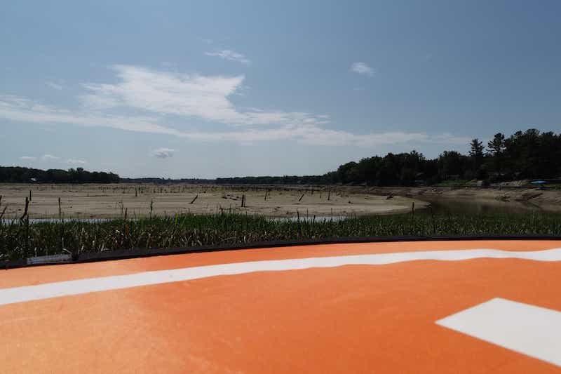
Drone collection was another thing that was really neat to have but it also caused some issues on our end. So obviously out of the EOC, we had a lot of organizations and teams and individuals as part of this come up with drones and they were out flying drones and collecting information but unfortunately, they weren’t really coordinated.
As Chris mentioned, it’s one of those things we didn’t really think of when we were planning for an event like this. What we eventually settled for was that at the end of every day for a week, we had people coming in saying, “Hey, we got drone stuff for you on the thumb drive we were just dumping it all into an external. We really didn’t know what we had but what we ended up with was a lot of just pictures and video of the dams or some floodwaters.” So obviously pictures are geotagged, we can bring those into GIS but a lot of the video don’t have geotags or location information. So when we were getting videos that were labeled ‘midland flood May 20th’ or 21st, and it was just a random spot in the county, we didn’t know where it was and what was their intention of taking it.
Pictures and videos are good but when you’ve got all these volunteers and teams and people out flying drones, it would have been nice to try to organize that a little bit.
So we had one guy from a township fire department that was flying a drone. He actually came to us and asked, “Is there something specific you guys would like me to go do?” which we appreciated. So he went to a few different areas and just flew grids to create orthos. Looking back now, I wish we had done this for a lot of other areas; maybe some people did and we just weren’t aware of it but this was something that was achieved.
We went and flew on downtown by the courthouse a few times. So with these orthos, I’m going to go through a couple flights that we did. So this was Wednesday at 11am, it is when the river was created at 28 feet and this was down by our courthouse. Then later that day at 29 feet. And then the next morning when I went out at 6:00am and flew the drone again, it had changed. It’s pretty interesting to see what happened overnight. It went up to 34 and then by noon that day it was at its highest peak of just over 35 feet. It’s pretty interesting to be able to go back and see that in the course of 24 hours, it went from 28 feet to 35 feet. This was at our courthouse but it would have been nice to get some other priority areas like the dams, highways, bridges or other critical infrastructure to see how over the course of those couple days those floodwaters spread out.
Documenting drone operators
So another one of the lessons learned as far as drone stuff out of the EOC is we had a GIS intern here this summer that helped go through a lot of this data. He put together some documentation and forms for us to use moving forward as far as if we have another event and the EOC is activated, and we have people come in with drones and we can document who they are, who they’re with, do they have FAA license and also note where they’re going and what they’re collecting. This will really help in tracking information.
Project summary
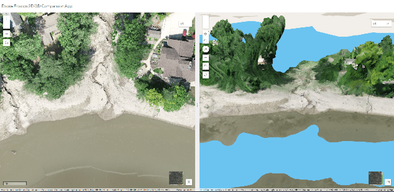
So just to wrap up. In the last couple of months, we’ve still been doing some work. It’s calmed down a little bit in the last few weeks but certainly well through to August, we were still doing a lot of work with Spicer and Four Lakes Task Force. We went out and did some more drone work for them tracking erosion issues, so this is an app we’ve got in a shared group in ArcGIS Online with them. So as we’re all collecting information, we’re putting this out in that group. So this is something that again, we went out and collected with our drone, which allows you to compare a 2D ortho and then the 3d mesh side by side. Now Spicer’s been using this to identify erosion issues, do some measurements and perform some other tasks which are pretty neat. We’ve got a survey form out there for property owners to submit, erosion issues and things like. So there are still some things going on even months after the disaster. We are using GIS4 and ArcGIS Online for sharing data, and it’s been working out pretty well.
Chris Cantrell – Midland County
Alright, thanks Nathan. A lot of what Nathan went through was a situational awareness of the dashboards and the instantaneous awareness of the EOC for all the staff at one point. We’ll probably have 50 plus people in there, so it’s just a quick heads up on the status of where things are going and what they’re doing.
So, in conclusion, a lot of the apps that we built, that Nathan built were built from experiences of past events like the 2017 flood and what we needed when we went through that event and every event that we find is that, even though it’s another flood event in Midland, and we know where the water goes, no two events are the same. Even if it is a flood event, this was completely different even if the dams hadn’t broken; we were seeing different areas flooded because where the water fell, this time was different than last time. In 2017 it was more west of Midland, and this time it was more north of Midland. So, the direction the water is coming into the city from makes a huge difference.
In this area of the county, we had planned on the direction it flowed in 2017 based on the damage assessment reporting with MSPs and FEMA. However, having those folks involved helped us to be able to shift gears real quick to be able to still get the information to them, and they used our data as the authoritative data — without having to put boots on the ground and verified the damage.
Some of the things that we didn’t anticipate — like dry wells, contaminated wells, debris management, erosion on the 60-plus tributaries that come into the two lakes, undercutting of sea walls and residential structures — is just an amazing amount of more stuff that we had to handle and develop GIS applications on the fly, as people requested.
One of the biggest things that put a smile on my face was communication and coordination between the different agencies. It became crucial because we weren’t sending the same data to 18 different people at 18 different times. By using ArcGIS Online and giving them access, we were able to one-stop and transfer the data to all the important agencies. They knew that we were all looking at the same data because it was coming from one source; the county’s ArcGIS Online account. We just kept the communication lines open, so each day we would talk about what each of the agencies was working on. This way, no two agencies were duplicating efforts. And that really streamlined things between FEMA, MSP, EOC, the city and then us at the county.
Looking ahead
So for any of you that are curious, I’m going to wrap this up so I can get this over to Mike. They are planning to rebuild the dams, they’re going to at least attempt to try to find the source money. They’re looking at three to five years before the dams may get rebuilt at the cost of about $350 million to $400 million. Whether they’ll be able to do it is something I’m not sure of, since we’re dealing with a whole new environment with no dams and no flood control for the next few years. The next flood event will certainly be different in Midland.
Finally, Nathan and I both want to thank all of you guys that reached out to us in May and offered your assistance; we appreciate it whether we took you up on your offer or not. It was certainly appreciated that the community pulled together, and you guys were willing to chip in and help us out, so with that, I’m going to hand it over to Mike. I believe he’s got some stuff he’s going to talk about regarding what the field agent did. So Mike, take it away.
Deploying the “Smart Bike”
Michael Cousins – OHM Advisors
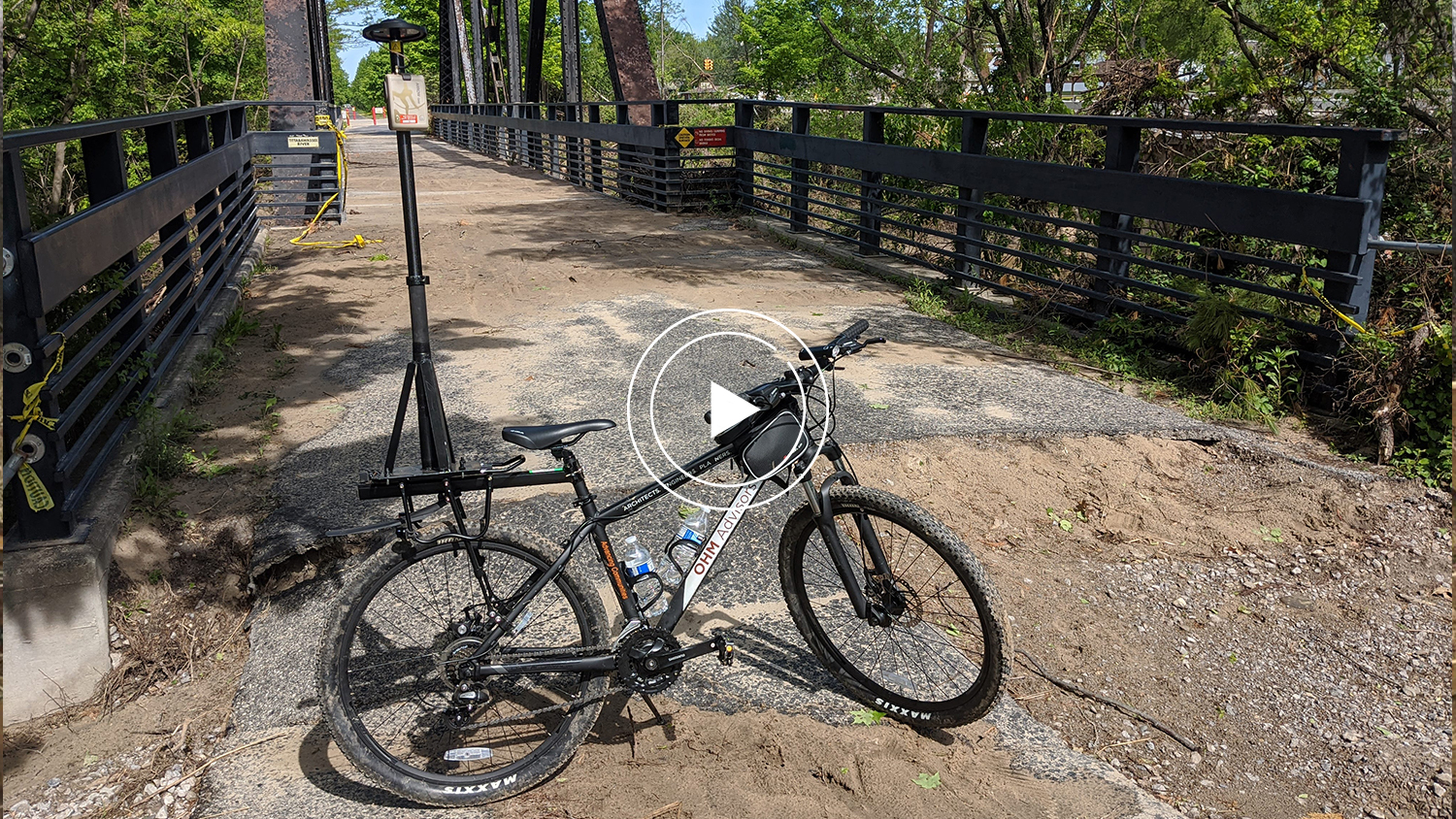
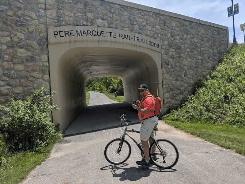
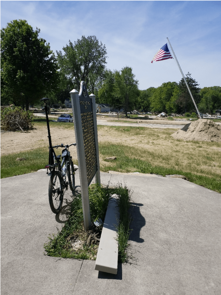
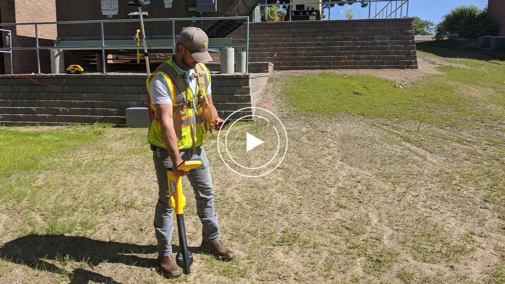
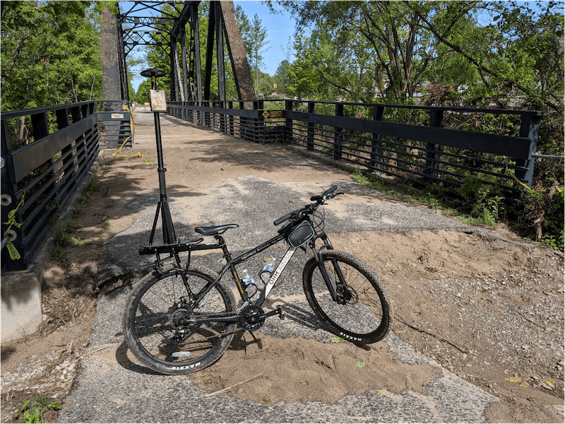
Time is of the essence to map out all the damage, so instead of walking several miles of the trail on either side, we dispatched our “OHM smart bike,” which is equipped with an Eos Arrow Gold® GNSS receiver, which was specially mounted on the bike. The Arrow Gold® was paired to our tablet, which was running ArcGIS Collector.
We had a second guy mapping along with myself utilizing an Arrow attached to a backpack mount seen here.
GPS Smart Bike benefits
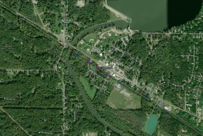
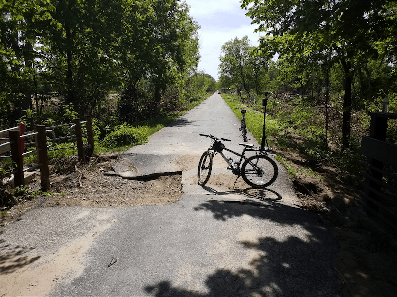
We mapped everything out from locations of washouts in the concrete or asphalt debris on or next to the trail that needed to be removed and structures along the trail that needed repair, among other things. We were able to traverse many miles of trail in a very short amount of time and capture high-quality data along the way. Our engineers at the backend were able to see the points and pictures live, which allowed them to start working on solutions to help fix the issues at hand as soon as possible.
By thinking outside the box, we were able to create an innovative solution that allowed us to effectively and efficiently map out the damage to help the local community.
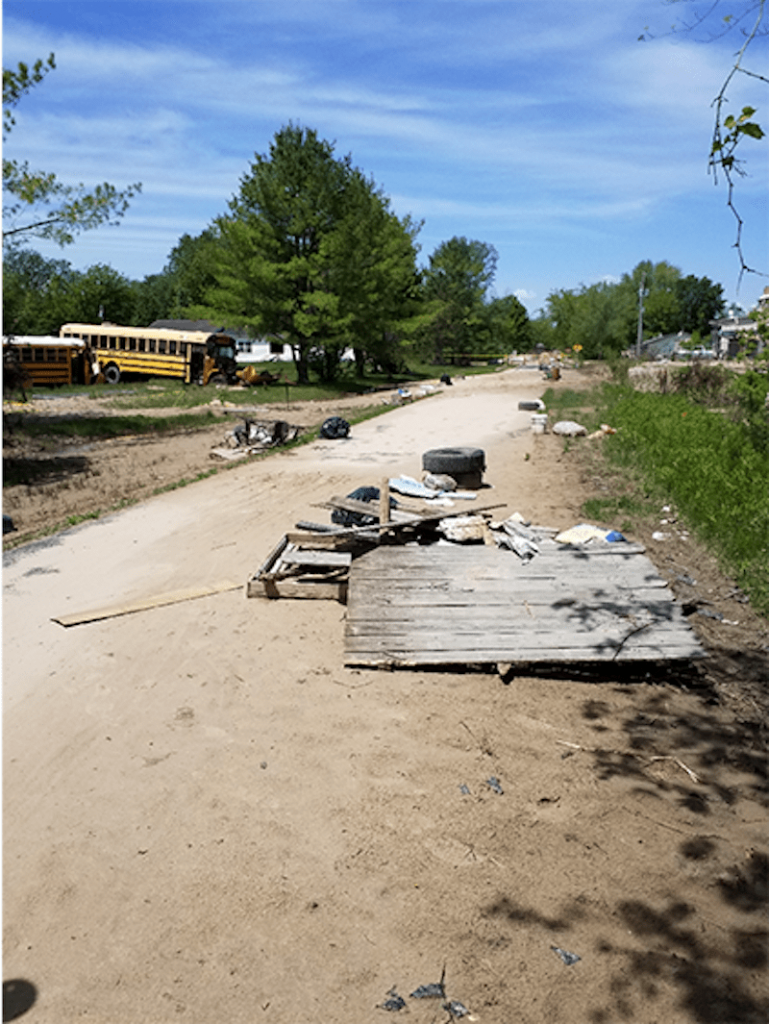
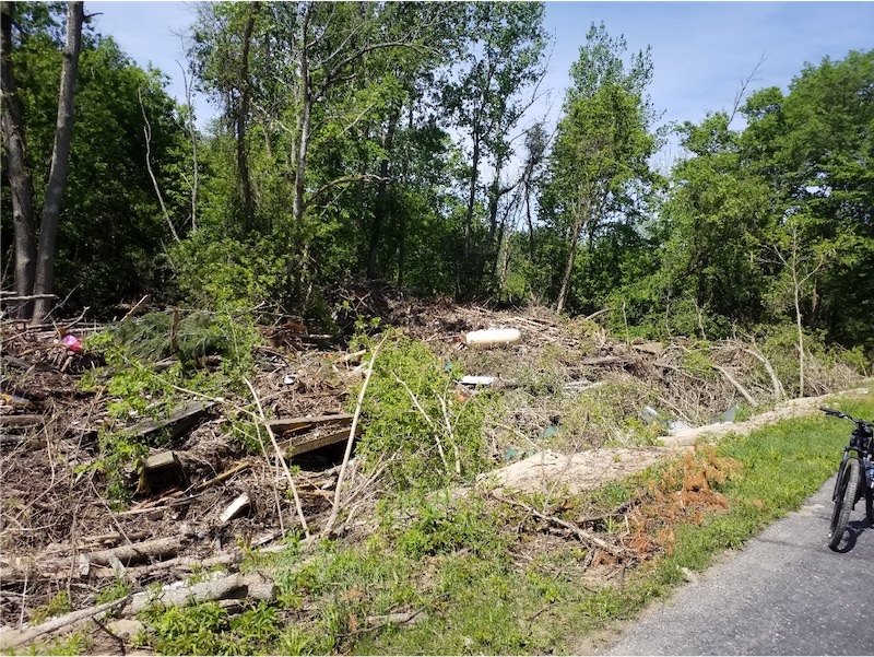
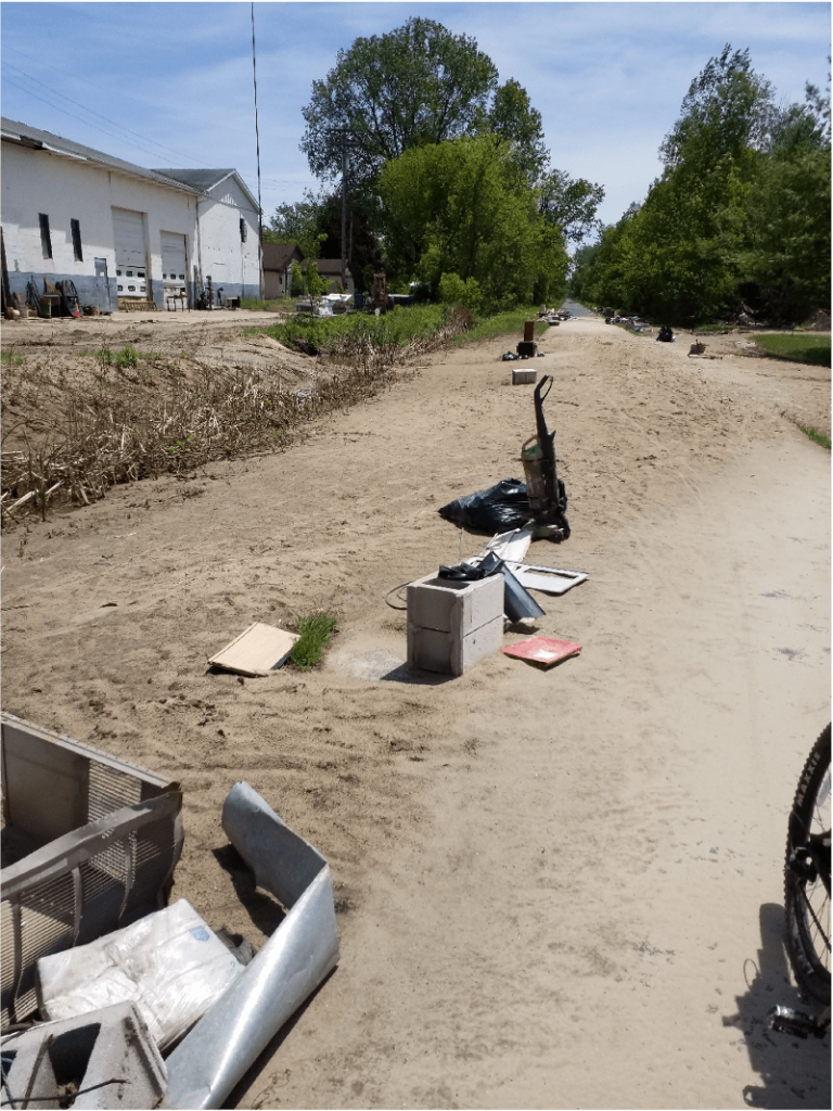
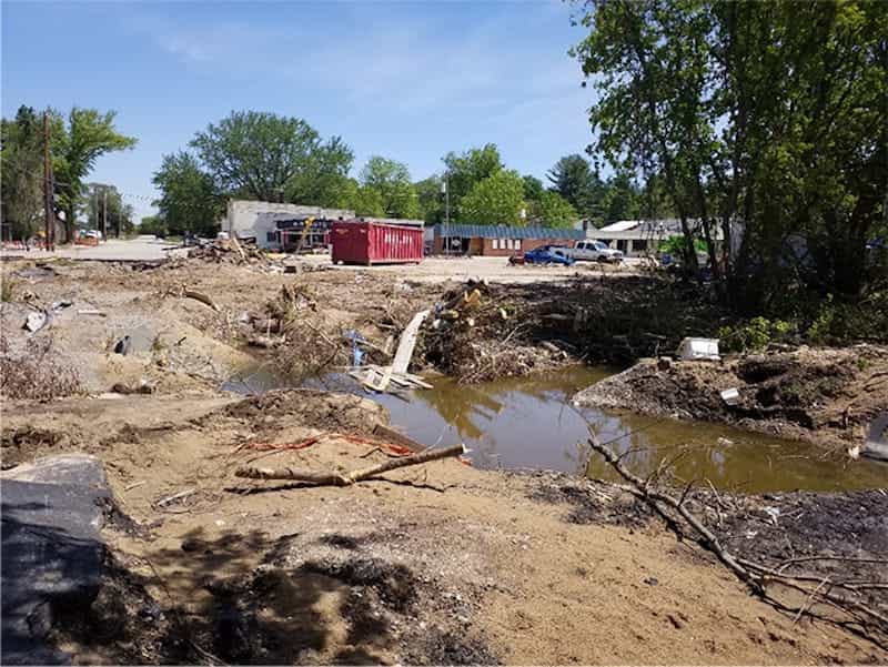
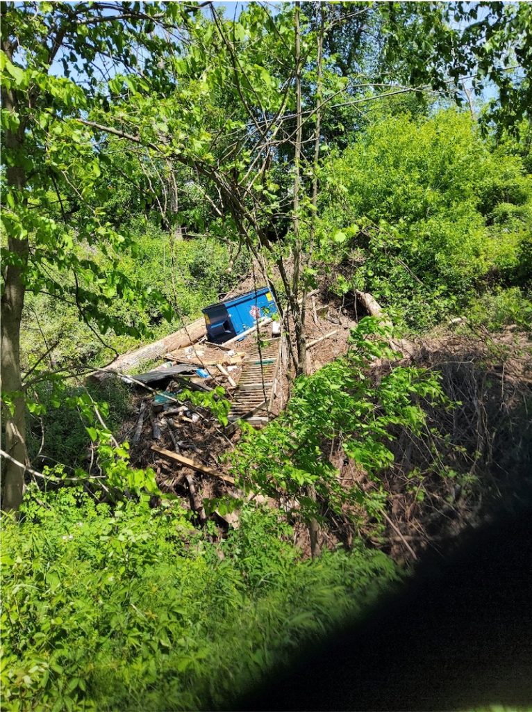
So here are some of the pictures of the damage that we kind of came across. Let me show you some examples, and then I’m going to switch gears in a second. As you can see, there’s just massive amounts of debris; this was kind of the biggest area directly downstream that was hit. Here’s some debris over the top of these two school buses; they were crashed into each other and are sitting on top of each other, it’s kind of gnarly.
This tank that you see in the middle there is one of the many propane tanks littered everywhere. Mapping out those potential hazards was crucial. I saw so many vacuums along the trail as well. I thought it was interesting. So I basically pulled up the bike on top of the area, pulled out the tablet GPS and precisely took some measurements and took several pictures of each site.
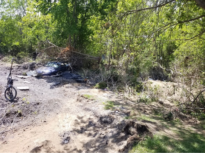
Here is one of the rest areas along the trail that is directly downstream of the blowout that happened. If you know the Fiero guy, he’s kind of here to the right in this picture, he made global news about his collection getting destroyed.
Here’s a car tucked up; it’s a Fiero I think tucked up between the trees.
This community right here was completely leveled and a little patch of houses were left behind. I really like this picture of the flag; they hung it back up – simply patriotic.
The other thing that we saw a lot of was trash cans miles away just tucked back in the woods; it was crazy seeing that.
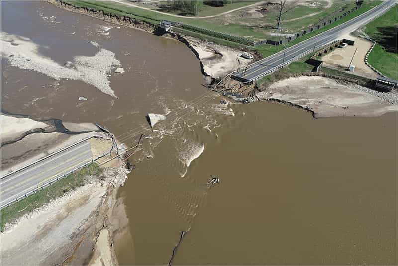
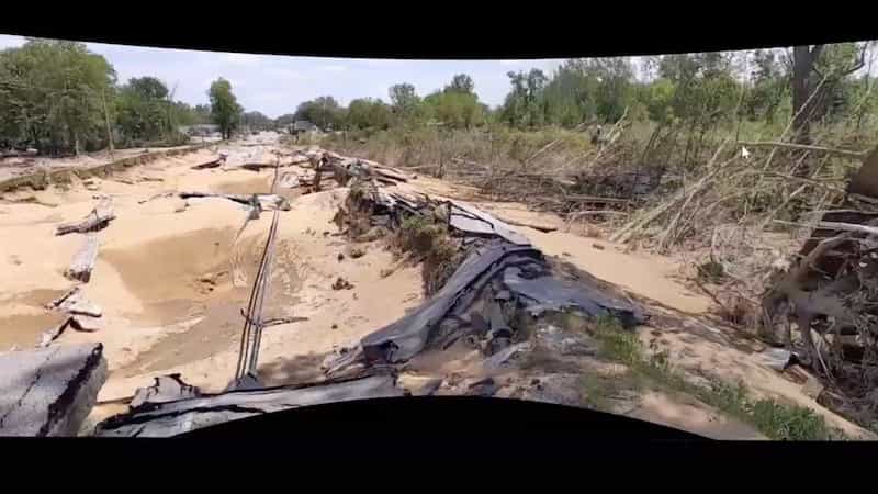
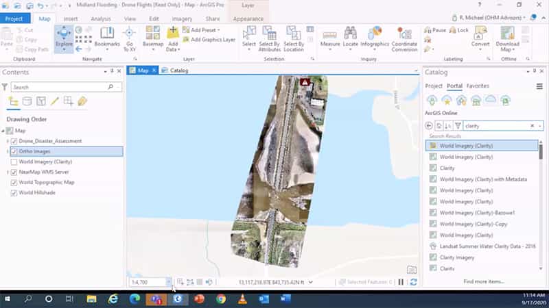
Here are some images of the M30 causeway that was blown out; we mapped this out with our drone full three-point cloud mesh head ground control points. It was just a complete failure of the bridge. It was kind of gnarly seeing the results.
This is looking outwards:
This is looking back at the bridge:
What I want to show here is a picture of the Sanford Bridge blown out up top here instead of following the river track; it just flowed right through this area. This is a bunch of ballparks ball fields that tore through the road; you can see that the force of the water laid down all the vegetation here, and the rail trail was on the back end so you can see the trees leaning one way and then leaning backward again. It was interesting to see.
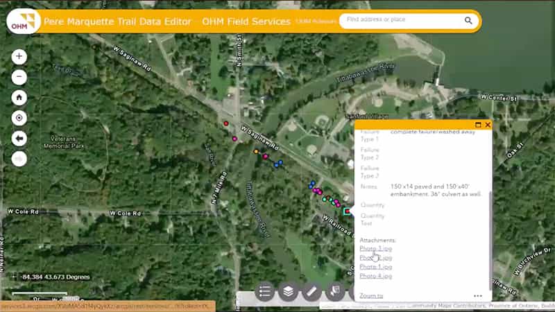
Here’s the ball field area that I showed you its destruction. So each one of these points has different pieces of data attached to it. So here’s the blowout that I just showed you with the pictures.
We were able to get that data back quickly, and then in ArcGIS Pro, we mapped out the drone flights that we did for each county. Each one of these lakes here is related to what I just showed you. Here’s a full ortho, and we have a full 3D surface that was being used to rehab the bridge, and then lastly, here’s a video that we took of the Sanford bridge after destruction. It was very eye-opening seeing a different angle of the complete destruction of the bridge and the area surrounding it.
And that’s it!
[End Transcript]
Thank you for watching this 2020 MiCAMP virtual conference session! For more great content, including recorded sessions, please browse the Eos website.

