As the largest water and wastewater provider in the United States, productivity and efficiency are essential to American Water’s operations. In this 2022 Esri UC Presentation, Chris Kahn, Director of Unmanned Aircraft Systems (UAS) and Geospatial Services, reviews how they upgraded their legacy global navigation satellite system (GNSS) technology to save money, reduce time spent, and increase accuracy for continued maintenance across the country.
Watch Chris’s full presentation with the video link below to learn how they did it! Or scroll down to read the detailed transcript …
Introduction
CHRIS KAHN: My name is Chris Kahn. I’m the Director of UAS and Geospatial Services at American Water. And we’ll talk a little bit about our data collection programs.
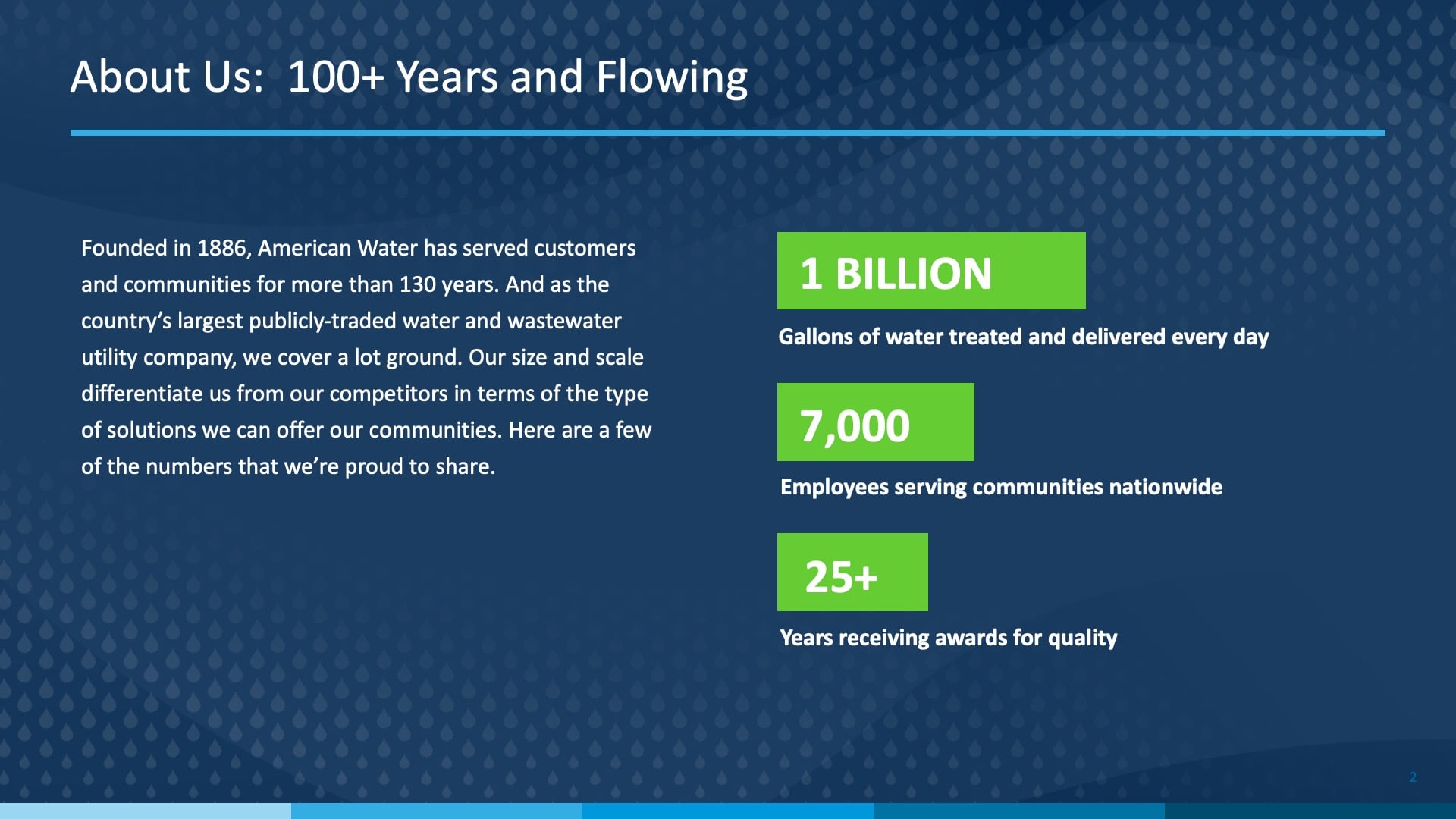
So first, we do have the obligatory “About the Company” slides. American Water is the largest water and wastewater utility provider in the country. And as such, we actually have quite a large footprint in a number of states.
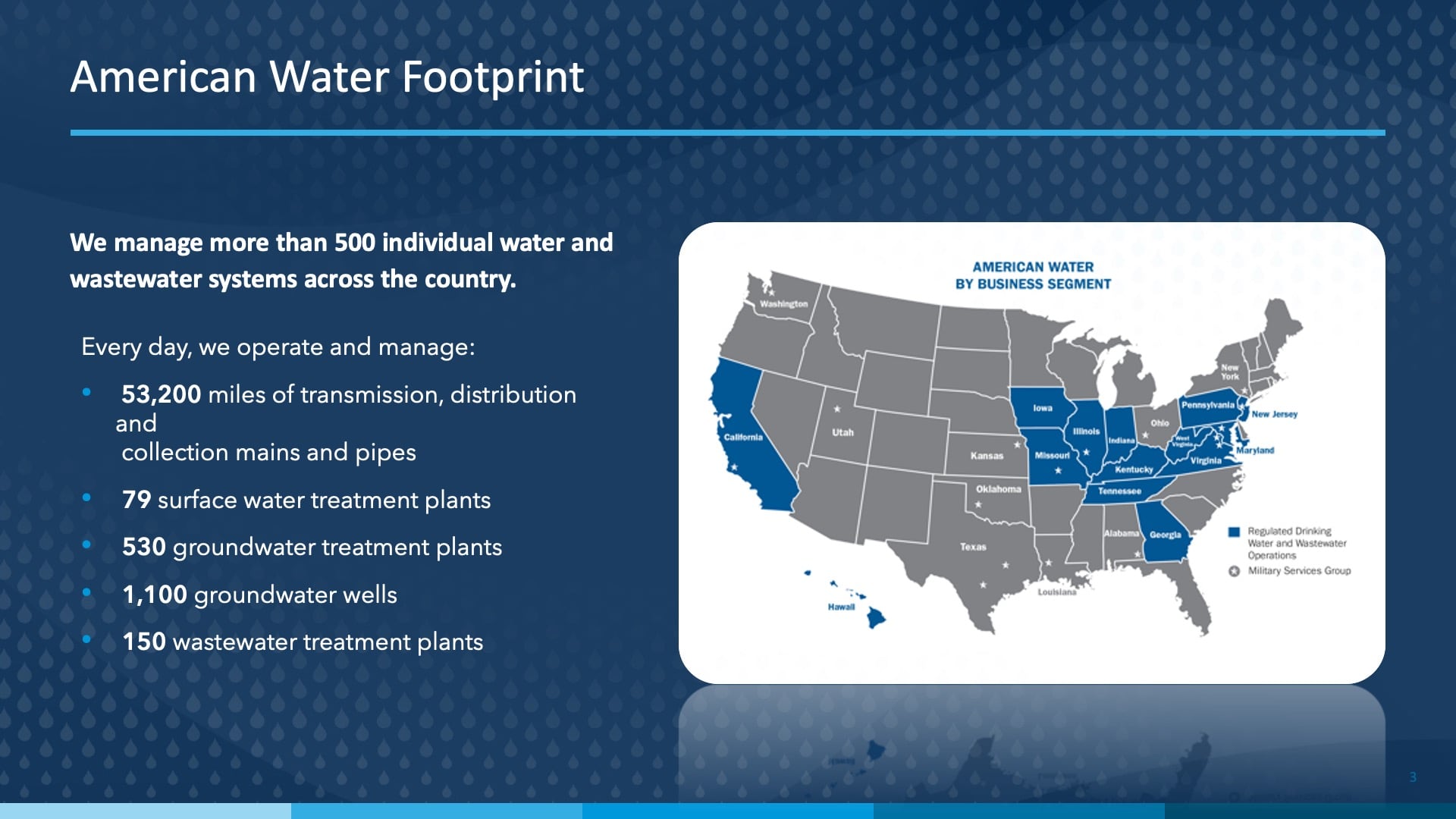
So, the 50,000 plus miles of pipeline we have equates to just over 5 million assets that rise to the surface. Assets like meter pits and curb stops, all of which have to be mapped and GPS’ed by our collective GIS teams.
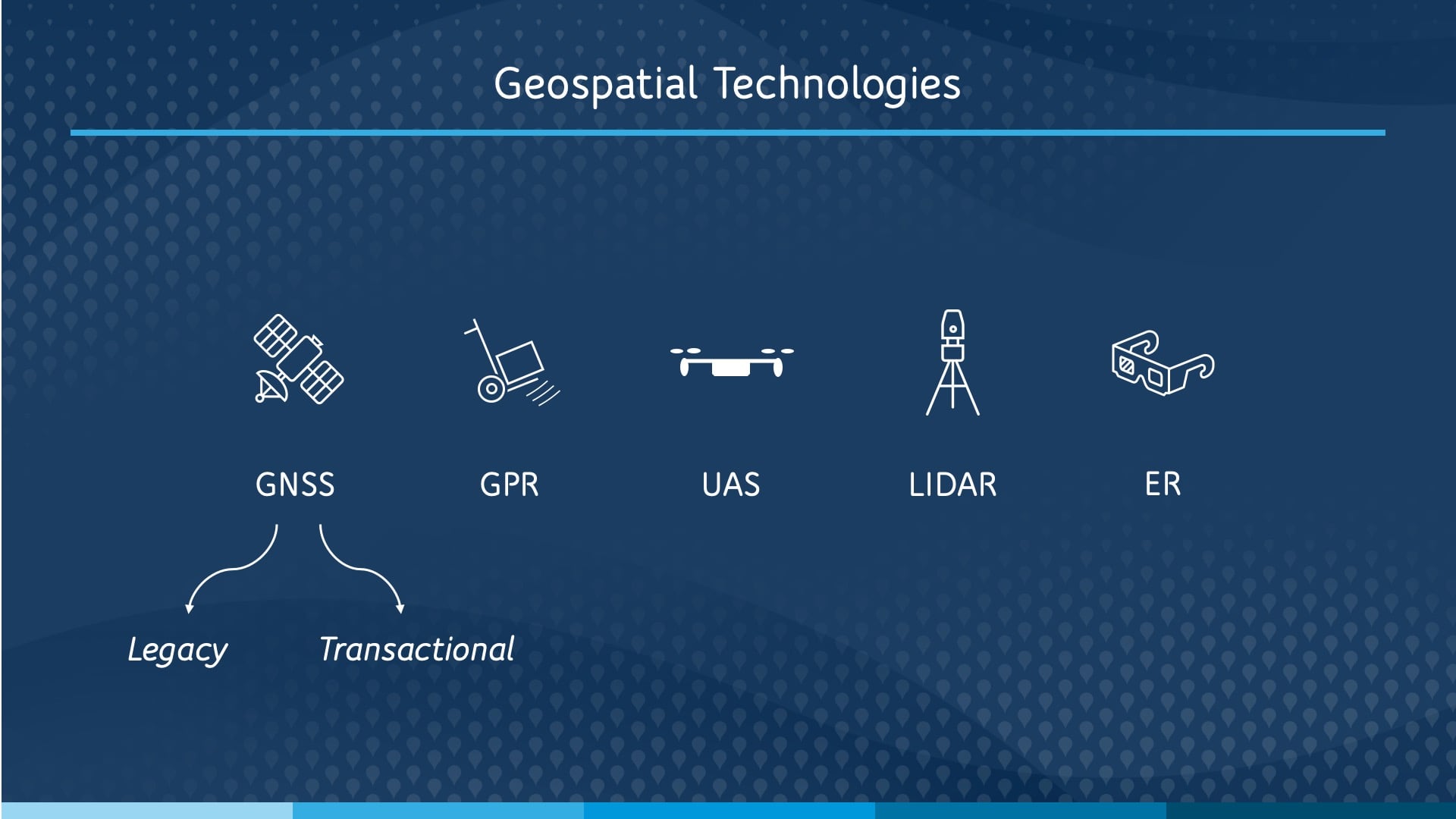
Overview of Geospatial Technologies Used to Capture Data
So, we’ll be talking today about a few specific geospatial data capture technologies. I’m going to cover the GNSS legacy project. So that’s a project in New Jersey where we span 10,000 miles of main and captured about a million assets with sub-inch accuracy.
Then, I’ll talk about our UAS program structure, and that’s how we extend our frontline staff’s ability to map with sub-centimeter / sub-inch accuracy on everything we do. Before I go into our legacy GNSS project, I really wanted to share this quote.
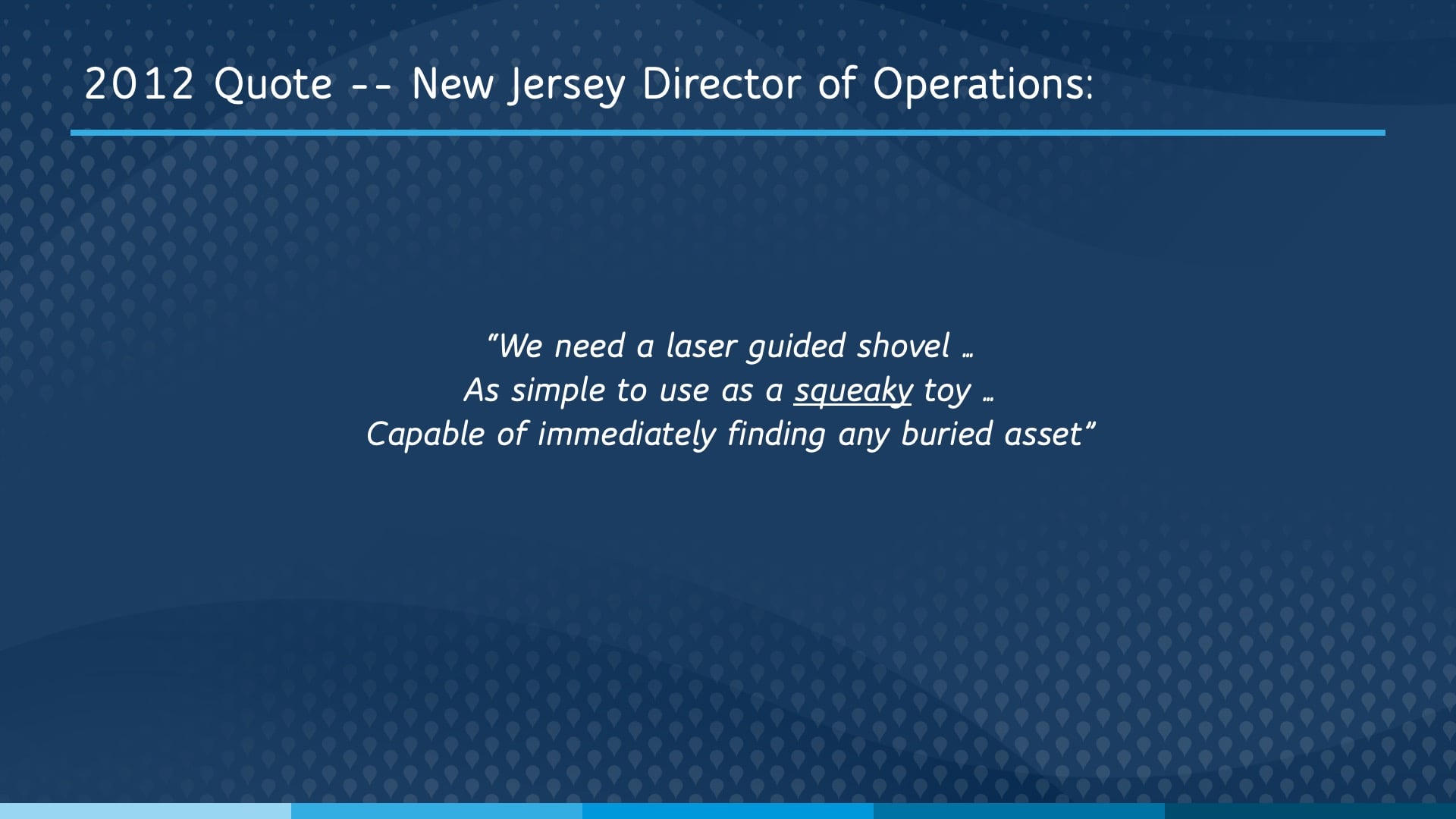
The Project that Started Everything
It was 2012 and we had just completed our deployment of offline mobile GIS to 500 of our frontline workers. And one of the greatest and most challenging things about GIS is as soon as you do something terrific, people ask for more.
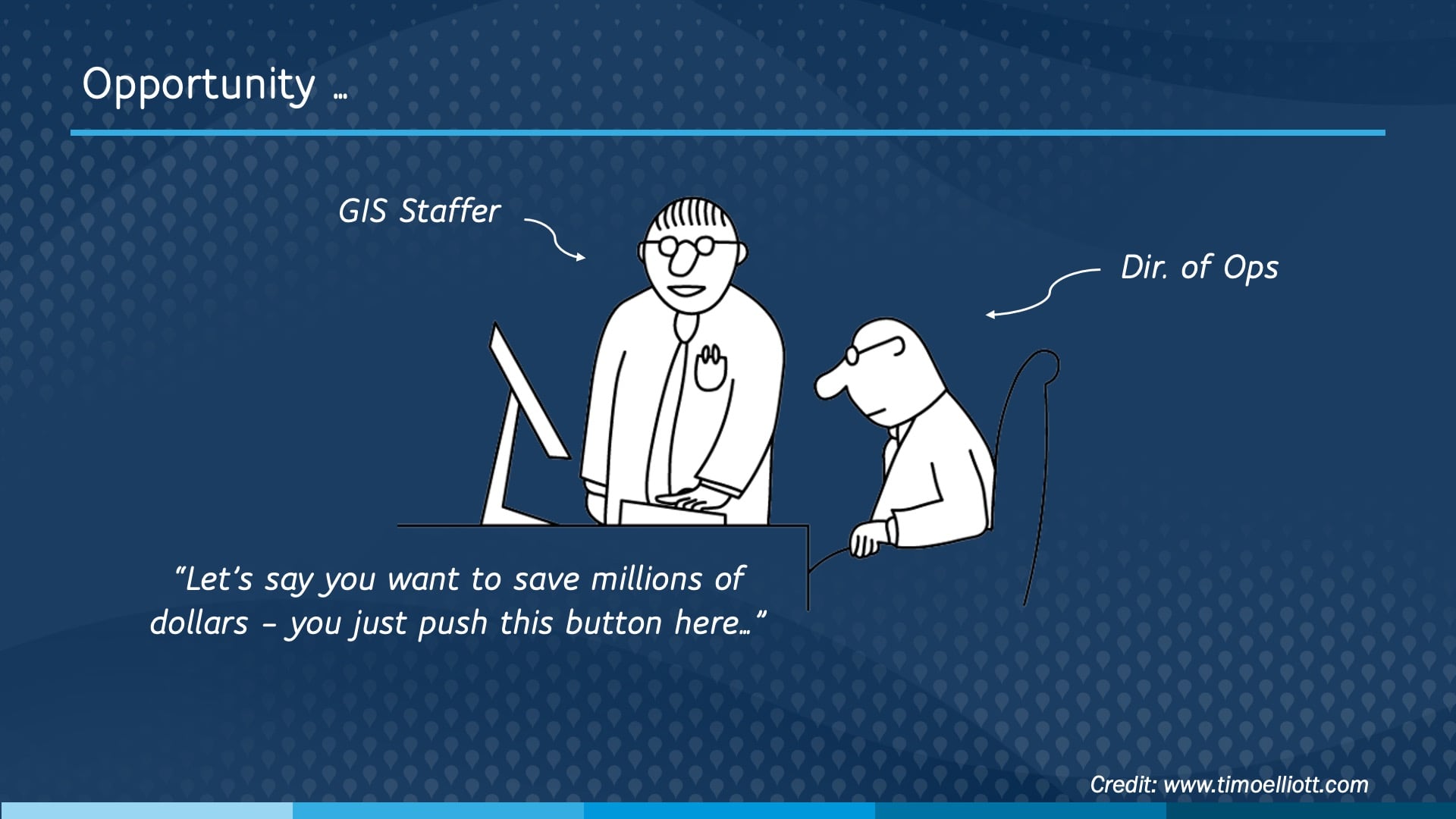
But this director did have a really good point, and this is sort of how we imagine ourselves delivering upon this request. We knew intuitively that there were millions of dollars in operational costs related to not having accurate locations on all of our buried assets.
Initial Assessment: What Improvements Were Needed?
We also knew there were just a few things that we needed to do before this glorious moment could materialize. We had a vague idea that, at a minimum, we would need to expand our department headcount pretty dramatically and purchase at least hundreds of thousands of dollars in equipment. And even with those things, we thought it was probably more than a ten-year project.
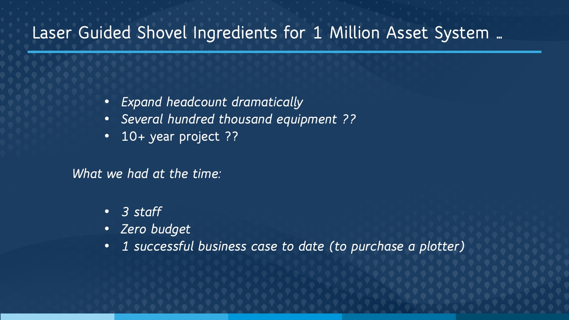
We had zero budget. In fact, up to that point, the only business case we had done was to purchase a $7,000 plotter. Successfully, I might add.
The Business Case: Cost Summaries, Benefits, and Projections

Undeterred, we developed a business case — of course, starting with the cost summaries. So, these are the costs of doing the project if we were to do it. And the key thing to notice here is our desired field data collection pace. It’s probably very hard to read, but [our field staff were collecting about] a third of a mile an hour. And that might not seem like much, especially with a million assets, but it’s actually pretty quick. This table allowed us to adjust the data collection and the GIS editing piece, the desired project length, accounting for time off, and all that stuff. And that was all based on our observations from testing and our desired outcomes.
And next, of course, we had to go into the benefits. And this is just a small snippet of the tables we developed. We got really nerdy with this.
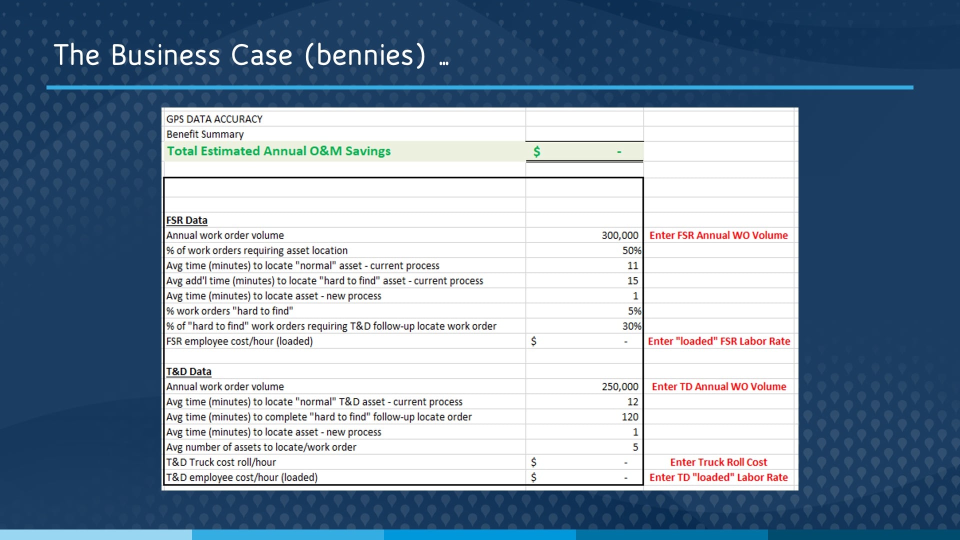
The benefits of the project are actually the costs too, right? The benefits are actually the cost of doing nothing. These tables were actually very conservative. We wanted to be careful, so they were an underestimation and they were all grounded in observable facts. So we did crew ride-alongs. We counted up how many work orders actually required a visit to a physical asset. The projected benefits of doing the project were over $2.5 million a year in reduction in operational expense — annually.
So, for those in the room who are in utilities, which I assume is most of you, you know that OpEx (operational expenses) is an unrecoverable cost. And anything to reduce OpEx, we love. So $2.5 million a year because our field staff, collectively, were spending over 55,000 hours a year just looking for stuff.

Finally, we had to figure out, “How quickly were we going to do the data collection that our GIS staff could manage?” [including] all of that incoming GPS data and updat[ing] our actual distribution map to reflect the changes. We created similar projections for the field work.
Launching the Project: The Evolution of GNSS Hardware
So, hardware. Again, we had over a million assets spread across 10,000 linear miles of pipe. And the hardware we had available to us at the time were these [legacy GNSS receivers]. So to scale, we knew we were going to need a paradigm shift.
After a few months of searching and a whole lot of tinkering, we managed to somewhat “hack” Esri’s Water Utility Mobile Map for Windows. Now this was before ArcGIS® Online [existed], and it would actually be years before ArcGIS Collector could even consume RTK data. So, we configured this Windows mobile map to update our default ArcSDE version with real time RTK data.
The first couple of units we used along with this setup were legacy GNSS receivers, but we almost immediately changed to Eos Arrow Gold® GNSS receivers. And this is primarily because Eos had the vision to develop for iOS back then, which even at that time we knew was where we wanted to take this.
And then once Esri enabled Collector to capture RTK data, we immediately switched over from the Windows to the iPad® devices. And then finally today, of course, we are using ArcGIS Field Maps along with those Eos [Arrow] Golds.

Obtaining RTK Accuracy with Arrow Gold Base Stations
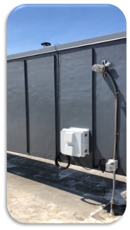
In fact, we now have over 300 Arrow Golds deployed across the state of New Jersey and nearly 1,000 deployed across American Water. We’ve also built 14 Eos Arrow Gold base stations. So these are [installed] in regions where we have service territory without free RTK services. One base station is right there; it’s on a roof of a college in our territory. That one took about an hour, maybe 45 minutes, to install. Quite easy to do. These base stations also provide corrections for all four [GNSS] constellations. For those of you that do RTK, you know that a lot of the RTK services that are free only do GLONASS and GPS. Ours includes Beidou and Galileo as well.
Avoiding Expensive Lane Closures by Using the Eos Laser Mapping™ for ArcGIS® Solution
We also use the Eos, ArcGIS Field Maps, and Laser Tech TruPulse laser integration.
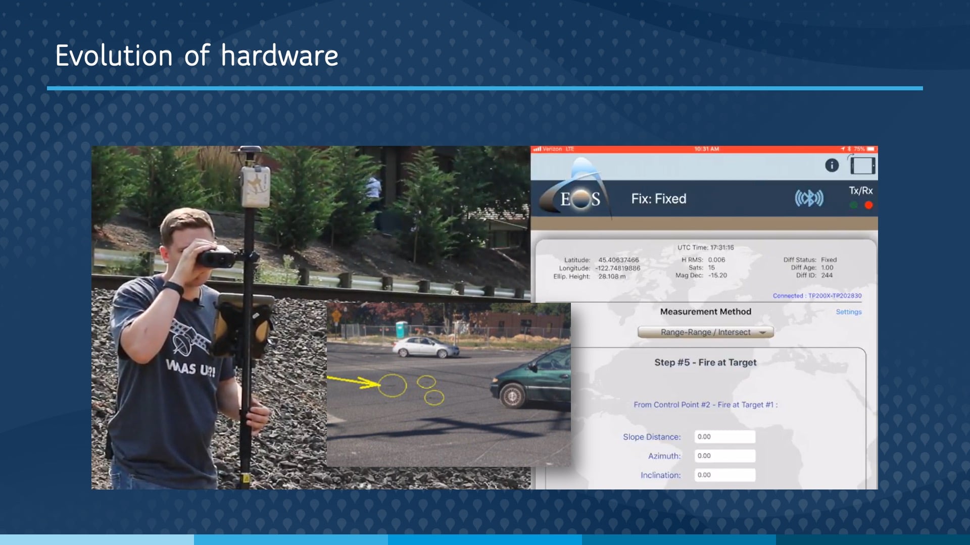
We use that for busy intersections. So, we have a little screenshot, and you can see the valves circled in the intersection. In order to [map our assets at] that intersection, we would need a lane closure and/or police assistance, which of course we have to pay for. Implementing this workflow alone saved about $1,000 an hour. And capturing those three valves, instead of a couple hours in traffic control, takes one person about one minute.
The Results: Increased Speed and Productivity
The speed [with which] we were actually collecting data is remarkable. It was not unusual for a single GPS technician to clock over a thousand points in a day. In fact, we were collecting GNSS data so fast it was 98% less expensive and 98-and-change % faster than our engineering contractors were providing as-built GPS data for us.
So we immediately fired them.
[Audience laughter]
Visualizing Data in ArcGIS Dashboards
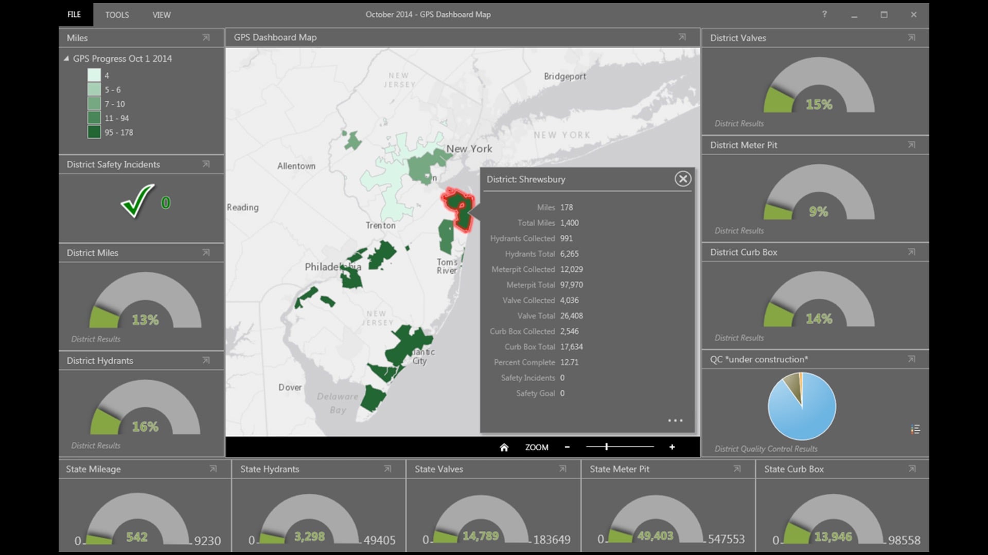
Early on, we relied very heavily on Excel, which you saw before from reporting. But in 2014 we were an early adopter of ArcGIS Dashboards, and this is our first dashboard that we started using to track this legacy project. And then over the years we continually updated [our] tracking and Dashboards (as it evolved as a product), and eventually it allowed us to capture all of the detail that we needed right in the dashboard.
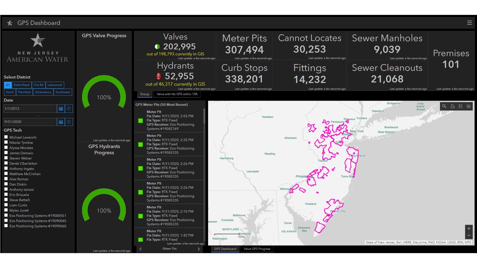
I do want to pause to point out that 30,000 number under the “Cannot Locates.” This is interesting. These are assets that our GPS “technicians” could not find on the first pass. It was really helpful to quantify, because these all became work orders to find them and dig them up, often by trenching.
And this was a somewhat silent OpEx expense for us. They [the “Cannot Locates”] were spread out across the state. They caused headaches, but only randomly. And then this project was able to find them, quantify how much they were costing us, and then fix them. And that quantification ended up being an extra $1.5 million in reduction OpEx for the project.
Precise Accuracy With the “Laser Guided Shovel”
So we actually had a clear [mandate]: a really good, laser-guided shovel that the director wanted really early on in the project, in 2014. And before I hand it off to [the next speaker], I really couldn’t resist showing an overly dramatic and very dated video that I put together in 2014, that I do remember being quite proud of.
[Audience laughter]
Cool. And our 2022 laser-guided shovel is pictured bottom right there. So it’s a little bit more sophisticated now. Frontline staff can now use their BYOD (bring your own device) paired with a lightweight GNSS clip, which is helpful in scenes like the top right, where the valve is completely flooded. Also, if the valve is buried [this is helpful]. And there are plenty of other situations, like snow.
So in this video, you’ll see training for frontline staff, and it’s actually on the proper use of offline maps. But it does have a nice little split-screen explanation of how to use the ArcGIS Field Maps compass tool. Our frontline staff will use the directions tool in our ArcGIS Field Maps to get turn-by-turn directions to an asset. And then, once out of the truck on foot, they will then use the compass tool as their laser-guided shovel.
[Chris plays the video]
VIDEO VOICEOVER: “Your location is indicated by the blue icon. In this example, you can see that we are walking towards a water valve.”
[VIDEO ENDS]
CHRIS KAHN: I really like how ArcGIS Field Maps has that dashed red line that even looks like a laser beam. And there’s [where you can see] our valve.
American Water UAS Program

I also head up the UAS program nationally at American Water. I’m private pilot with a single-engine land rating, and I do find that that experience helps me a lot in this role, which really places a heavy emphasis on instilling an aviation culture into our UAS operations. [To give an overview of our UAS program, I’ll be] starting out with some key program stats.
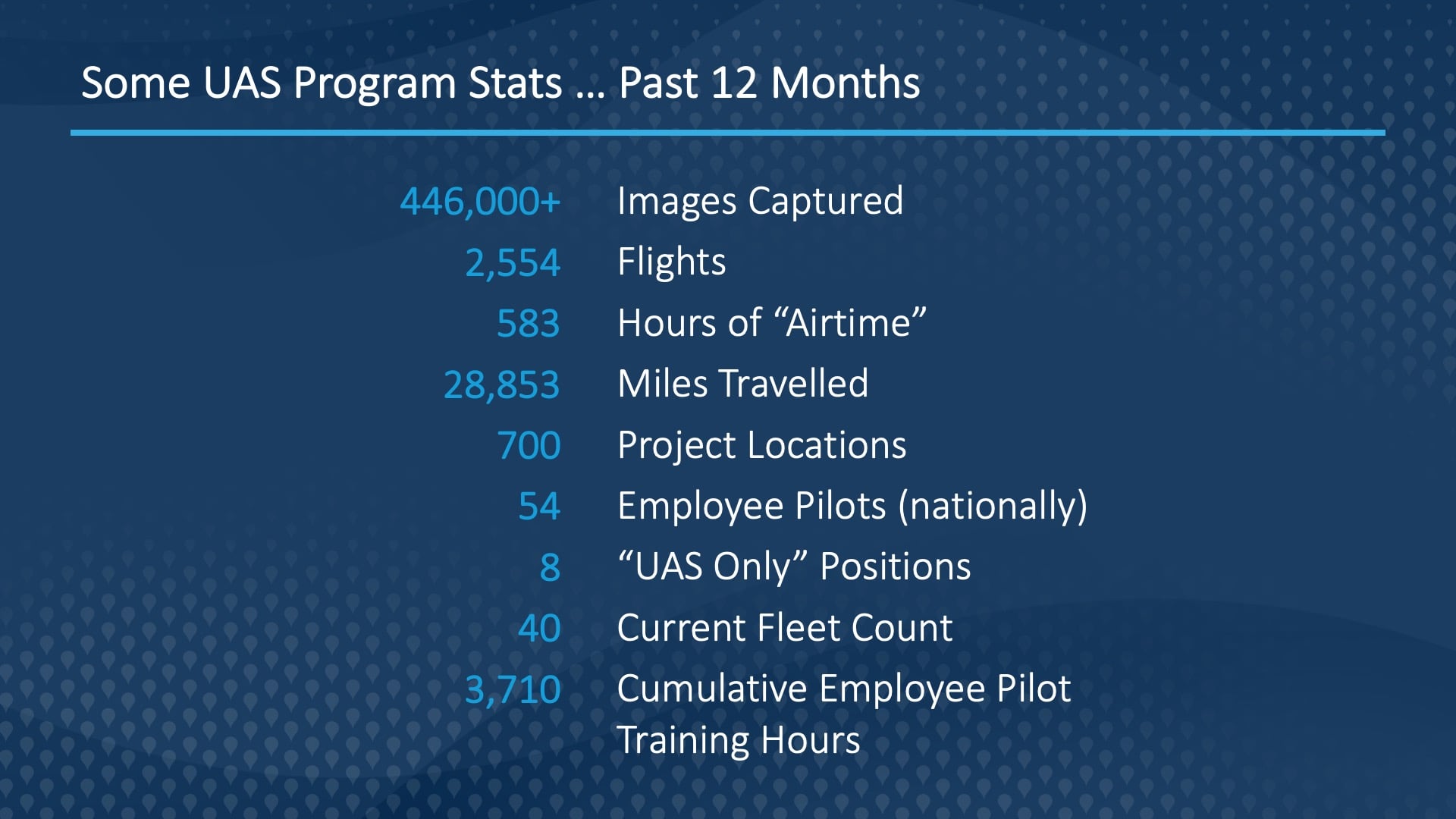
A key stat to look at right off the bat is that volume and imagery that we’re capturing. And we’re just getting started — that 450,000 [figure] was captured by about five pilots [out] of our 50 plus pilots. A huge part of the program is figuring out how to efficiently take all that data and deliver it to end users.
Training UAS Staff
Another key part of the program is the training. We run our program as if it’s part 135, not part 107. [What I mean by that is that] part 135 is the air-carrier and operation portion of the federal code. Whereas part 107 is just the UAS portion. And part 107 doesn’t contain any information about how to effectively run an aviation department.
Next, let’s take a little time … I’m going to play a three-minute video I put together. It’s a high-level overview of our UAS program.
CHRIS (IN VIDEO): The bottom line is always safety, and we have our safety of our employees and our customers in mind. We’re not doing this to be on the leading-edge of the technology, just for the technology’s sake. It really does pay kind of immediate dividends, and we’ve known that for quite some time.
So, it’s scaling now. We’ve been doing a lot of work over the past several years to ready the company to move more quickly. But to move more quickly, you have to have established policies and procedures. And now with the growing awareness, we’ll be able to scale without really needing to push or ask — people will ask us.
[VIDEO ENDS]
CHRIS KAHN (LIVE): All right. So, who could tell me what was happening with the back props at the end of that video?
[Audience doesn’t react]
Man, I thought we had one pilot in the audience! [It’s] stall prevention. So, it’s automatic stall prevention on the drone. That pilot banked up too high and was going to crash it. Safety first.
UAS Operations at American Water
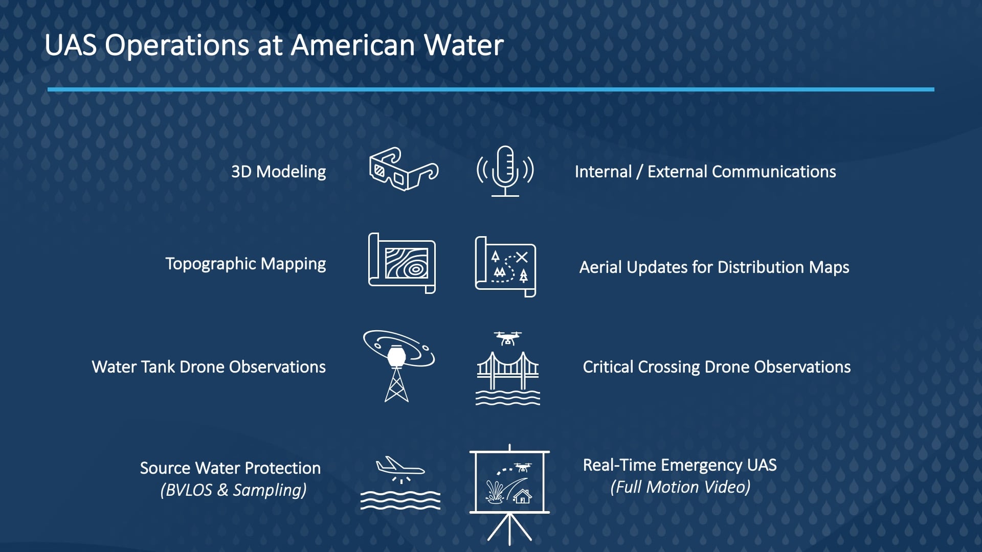
So, I hope the video was helpful in providing a high-level overview of the program. Most of our drone operations occur in these middle four icons here. So, these will all be the visual line-of-sight, the visual line-of-sight ops, with a high number of flights. And because so many of these are near obstacles, our flight standards and our flight training are actually pretty important.
Down at the bottom, [where you see] real-time emergency data streams, those are more complex [operations]. So, these have a much longer — and much larger — return on investment, and [they] take a little bit of a longer leash for my team to accomplish.
I’m very excited to announce that last Friday, July 9, [2022] the [Federal Aviation Administration] (FAA) approved American Water for the beyond-line-of-sight waiver for missions along that river, [which] you saw flooded a few minutes ago. The FAA has only approved 220 of these, and they’ve only approved 1% of applications. That does mean about 17,000 people have been denied applications. So, we’re really excited and proud to have gotten that approval. [As far as flying] beyond line of sight, this is pretty important for the company [because of] our goals of source-water protection, water quality [efforts], and asset hardening [related to being] in emergencies, so [in other words this waiver is important as it has an effect on] our resiliency. [In addition], to realize the program goals, we actually need to fly higher. We’re testing later this year — we’re going for approval to fly at 3,200 feet with a drone. And then we’re eventually trying to go 10, 20, [and even] 30 miles out.
So, baby steps: crawl, walk, run. I like to say. “Roll over, crawl, walk run.” And we’re on the “roll over” stage now. But a big, big step [was seen] with that approval.
Visualizing Data: Full Motion Video (FMV) in ArcGIS Pro
So, I’d like to take another look, a closer look at that video from the montage on the flooding with some of the remnants of Hurricane Ida. We have a flood wall around that plant. It happens fairly often. Flooding like this is a very common environmental threat to the company. But we’re going to begin to add some of the power of geospatial intelligence in by utilizing ArcGIS Pro’s FMV capabilities.
[SCREEN CAPTURE VIDEO]
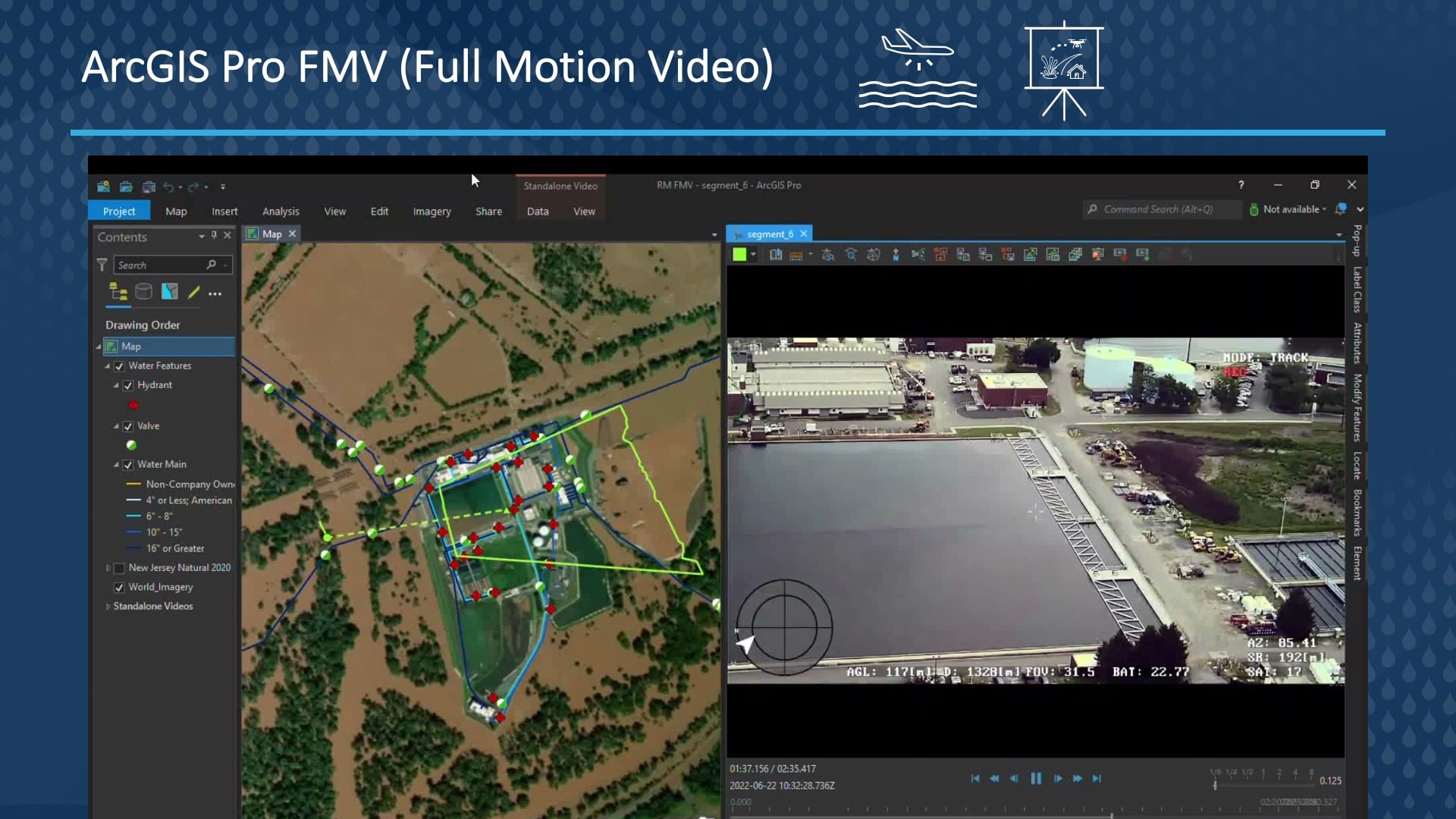
[What you’re seeing is] a full motion video, and the ArcGIS Image Analyst extension provides capabilities for playing as well as [analyzing] video data that is FMV compliant for drones. So, this geospatially enables our video data, providing [it to] end users who might not be very spatially aware (so C-suite leadership), [so that they can begin] begin to understand where the video feed is in relationship to a map and see that side by side. But it doesn’t stop there. We can now do simple map tasks, like taking measurements, directly in the video view.
And of course, we could display our ArcGIS Enterprise GIS data right in the video view. We can take a video still from the drone and instantly display that geospatially within our map. But the most powerful functionality is that FMV allows you to edit feature data, either in the video view or the map view, to provide an analysis capability. So, let’s say I wanted to identify features of my GIS from the video feed. I could telestrate [or, draw a freehand sketch over a moving or still video image] directly in the video feed as I just did. And it says this is now GIS data. I’m then going to use that to select my hydrants and valves that intersect with that shape that I just created.
[SCREEN CAPTURE VIDEO ENDS]
This is only a teeny peek into how we’re beginning to value engineer UAS data streams. For example, we also have a drone that can physically take water samples anywhere we need to in the water, [for example] in rivers. So UAS technology at American Water is on a similar trajectory as GNSS was about ten years ago, and we’re super aware of that. So today we have the benefits of many lessons learned through that GNSS project, and we’re able to anticipate, organize, and plan for explosive growth that we’re now experiencing with the technology of the company. In the next slide I’ll explain a little about how we organized to do that.
Managing a Nationwide UAS Program: Foundations, Strategies, and Implementation
We started with the foundation of how we would address UAS goals for the company, and these are our values, which really just boil down to safety. A big part of ensuring safety is having good governance. So, the structure, transparency, and accountability of proper aviation governance strengthens the program in, really, countless ways. And [in the] next [column,] we have added our goals. Goals are just things to measure, right? Notice all of the goals, they’re kind of hard to read, but they’re [all essentially saying,] “safety, safety, safety, safety, safety, safety, data.” One thing about data, and it just says, “Actionable Data.” That’s it.
And then [you see that] we add to that the strategic initiatives. So, these are all the projects that are going to accomplish those goals. And then finally, we had tactics last. These are the “how” and “what” that allow us to execute on our projects or our initiatives. I’ve actually highlighted a couple. Our ArcGIS Image Server and Site Scan for ArcGIS [line items] are tactics that achieve strategic initiatives of serving mapping imagery, processing photogrammetry, and standardizing on visual line-of-sight and flight controls. So those, in turn, accomplished strategic goals and outcomes of actionable UAS data and flight safety standards. Likewise, the ArcGIS Pro FMV I showed a moment ago, that’s another tactic that relates to physical & environmental security initiative.
Takeaways
So, if you’re thinking about starting a UAS program or if you already have, the advice I’ll give you is to try to not let the tail wag the dog. Right? So, start with your values, goals, and strategies and then use those to inform your decisions on tactics. All too often it happens the other way around. We start with tactical software and try to make our goals from that. Try to flip the script there.
We believe that our perfect map can be everywhere. And I think you saw that, right? It’s over us, it’s under us — indoors or outdoors. It doesn’t really matter. Our approach with all of these technologies is really holistic and brand agnostic.
You know, we pair the best tools with workflows that can scale within our business. Admittedly, the accuracy, precision, and sheer size of these datasets can be really daunting. But we hope that our presentation has sparked a few imaginations in here to believe that your perfect map is not just possible — but also doable.
Thank you. You can find me in about 30 minutes in the Mobile Workforce Special Interest Group meeting in Ballroom 06F. The entire team here, as Seth [Johnstone] mentioned earlier, will be in the utilities, telecom, and water booth in the expo hall at 1 p.m. to answer any questions that we can’t answer in the next 10 minutes. With that, I’ll turn it back over to Seth. Thanks again.
A Note from Eos Positioning Systems:
For updates on future events where Eos and our customers might be giving thought-provoking presentations, like this one from Chris Kahn, subscribe to the monthly Eos newsletter.

![American Water: Upgrading Data Collection and Drones [A 2022 Esri UC Session] 1 New Jersey American Water Utility Maps a Million Assets with Sub-Inch Accuracy](https://eos-gnss.com/wp-content/uploads/2022/08/New-Jersey-American-Water-Feature-Image-1024x576.jpg)
![American Water: Upgrading Data Collection and Drones [A 2022 Esri UC Session] 2 Customer Spotlight Feature Image Chris Kahn](https://eos-gnss.com/wp-content/uploads/2020/08/Chris-Kahn-Hero-Image-1024x576.jpg)
