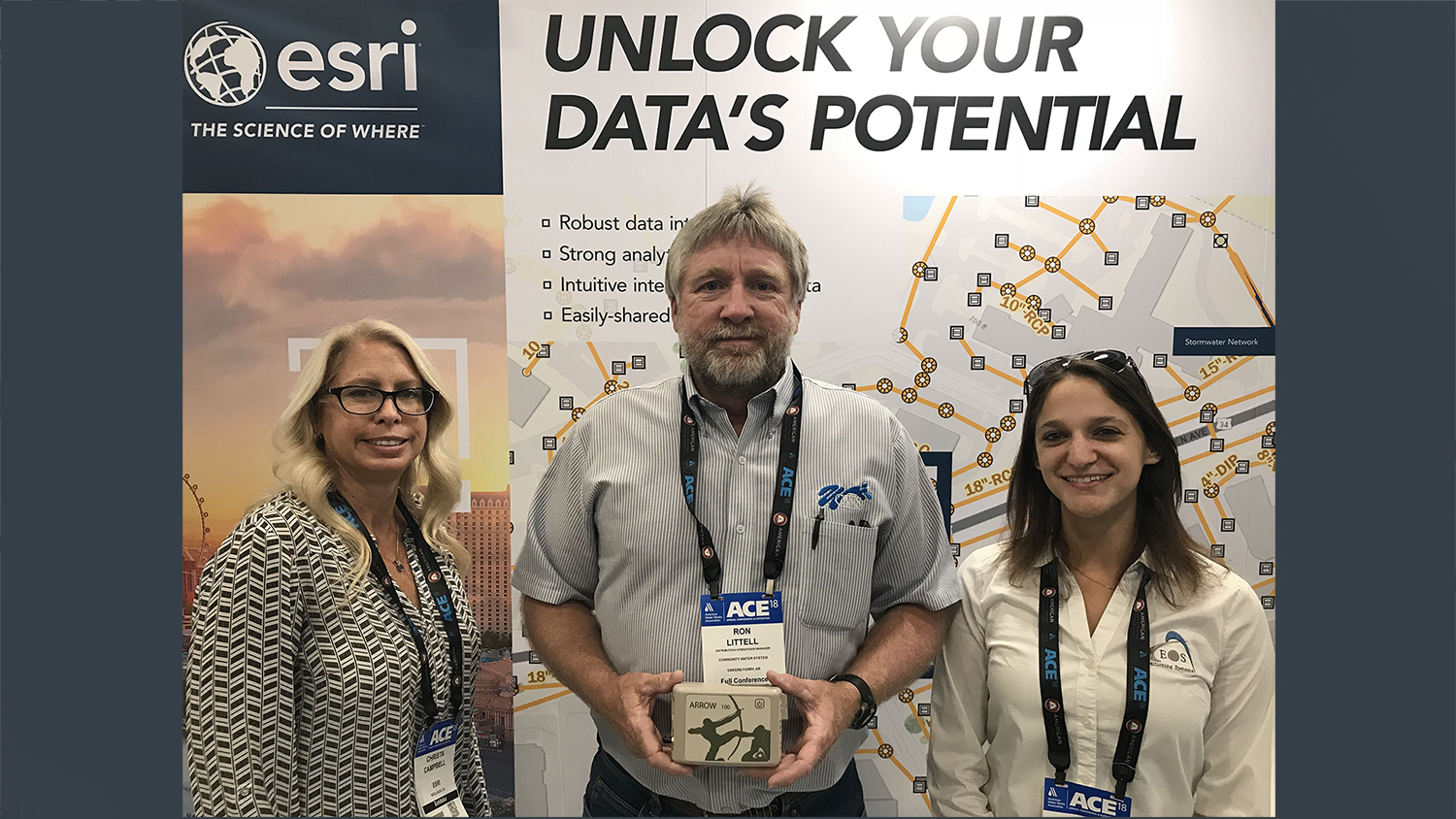
Community Water System of Greers Ferry, Arkansas, went home with a complete high-accuracy GPS kit and GIS platform
LAS VEGAS — Eos Positioning Systems, Inc.® (Eos), the world’s leading manufacturer of Bluetooth® high-accuracy GNSS receivers for any smartphone or tablet, and Esri® announced today the winner of the 2018 AWWA ACE Giveaway.
The winner is Ron Littell of Community Water System.
Community Water System (CWS) is a rural water utility in Greers Ferry, Arkansas. CWS is looking to improve their asset accuracy in the field, during workflows such as inspections and maintenance. They were looking at the Esri platform and Eos high-accuracy GPS unit combination solution when Littell entered the raffle at this year’s AWWA ACE event in Las Vegas.
Per their website, CWS “prides itself on supplying high quality water with the least interruptions possible.”
The utility focuses on utilizing the best technology available for water treatment, transmission and control.
“CWS prides itself on supplying high quality water with the least interruptions possible. This is accomplished by utilizing the best technology in water treatment, transmission and control. The technology is complemented by a highly skilled workforce commitment to continuous improvement.”
— “About Us,” Community Water System Website
“The technology is complemented by a highly skilled workforce commitment to continuous improvement,” their website states. “CWS will continue to be a leader in the water industry while providing our customers the best water available anywhere.”
The full technology kit, valued between $4,000 and $5,000, includes:
Eos and Esri have paired up to offer an unprecedented giveaway at this year’s 2018 AWWA ACE! Visit Eos at the Esri and become eligible to win a high-accuracy data collection package, which includes:
- An Arrow 100® GNSS receiver with all accessories
- A security vest with backpack range pole
- A one-year ArcGIS Desktop License
- A one-year ArcGIS Online subscription
- Free access to Eos Tools Pro (for iOS® and Android)
From all of us at Eos, we congratulate you in your adoption of the Arrow 100®, Esri mobile GIS workflow. We are confident your skilled team will be able to find even more ways to stay on the cutting edge of water service with this industry-leading technology.
About Community Water System
Community Water System (CWS) is proud to serve the water needs of north central Arkansas.
Utilizing Greers Ferry Lake as its source water, the system began supplying water to approximately 1500 customers in Greers Ferry, Higden, Edgemont and Fairfield Bay in 1970. From those humble beginnings, CWS continued to grow and currently supplies water to approximately 6470 retail water users and 10 wholesale users located in portions of Van Buren, Cleburne, Faulkner and Stone Counties Arkansas. This represents a service area of greater than 200 square miles, serving of approximately 70,000 people. Learn more about Community Water System.
About Esri
Esri, the global market leader in geographic information system (GIS) software, offers the most powerful mapping and spatial analytics technology available. Since 1969, Esri has helped customers unlock the full potential of data to improve operational and business results. Today, Esri software is deployed in more than 350,000 organizations including the world’s largest cities, most national governments, 75 percent of Fortune 500 companies, and more than 7,000 colleges and universities. Esri engineers the most advanced solutions for digital transformation, the Internet of Things (IoT), and location analytics to inform the most authoritative maps in the world. Visit us at esri.com.
Esri, ArcGIS, and esri.com are trademarks, service marks, or registered marks of Esri in the United States, the European Community, or certain other jurisdictions. Other companies and products or services mentioned herein may be trademarks, service marks, or registered marks of their respective mark owners.
About Eos Positioning Systems, Inc.
Eos Positioning Systems®, Inc. (Eos) designs and manufactures the world’s premier, high-accuracy GPS / GNSS receivers for the Bring Your Own Device (BYOD) market. The Arrow Series® receivers feed submeter, subfoot and centimeter RTK GPS / GNSS location data to any iOS, Android, and Windows device. Free Eos software utilities, such as Eos Tools Pro, were designed to provide users with the smoothest experience of integrating high-accuracy location data and metadata into their mobile workflows. Learn more about Eos.