If you’d like to expand your knowledge of high-accuracy GNSS (GPS) data collection at the 2020 Esri UC, you’re in the right place! Whether you are brand new to GPS data collection, or a veteran user of GNSS, there is something exciting for everyone this year.
Keep reading for an overview of everything to do with high-accuracy GNSS (GPS) data collection at this year’s event, including:
- On demand GNSS presentations
- Live-streamed data-collection sessions
- 3 ways to talk to GNSS experts from Eos
- Preview the Eos virtual 3D booth!
1. On-demand (GNSS) sessions
Esri user presentations are recorded this year! This means you can watch at your convenience. Some facts we find helpful:
- You can watch any time!
- Each session is 20 minutes long, making the sessions easy to watch and packed with valuable information!
- Links to on-demand sessions are not available until the day of the conference (July 13, 2020) after the Esri UC plenary has ended (approximately afternoon PDT)
- Search for and browse all on-demand sessions here!
Here are the on-demand sessions we recommend! …
On Demand: “What’s New in High-Accuracy GPS Field Solutions for Esri Mobile Apps?”
- Industry: GPS, GNSS for Esri users
- Speaker(s): Eos Positioning Systems and Friends
Synopsis: Get to know Eos Positioning Systems, an award-winning Esri business partner! This high-energy video will cover the evolution of the company and educate you on GPS/GNSS tech all in one session! The Eos Arrow GNSS (GPS) receivers were the first receivers on the market to be compatible with all three Esri mobile data collection apps (ArcGIS Collector, ArcGIS Survey123, and ArcGIS QuickCapture) across all three consumer mobile platforms (iOS®, Android, Windows). Eos is pleased to announce for the 2020 Esri User Conference complete integration with the newest Esri mobile app, ArcGIS Field Maps. See what makes Eos a pioneer in high-accuracy data-collection solutions for Esri users.

On Demand: “Implementing high-accuracy data collection and system mapping”
- Industry: Utilities
- Speaker(s): David Pritchard, Benjamin Griffith, Benjamin Rucks
Synopsis: If you’re a small water utility curious about upgrading to high-accuracy mobile data collection, this is the session for you! (Okay, large utilities are also invited!) We turn it over to Rockett Special Utility District, who explains how an RTK base station and ArcGIS Collector allow field crews to quickly and digitally collect water utility assets with high accuracy. This session also includes an overview of one of Eos’ most exciting solutions — RTK Laser Mapping!

On Demand: “Vancouver Parks and GIS”
- Industry: Parks and Recreation, Government
- Speaker(s): Mehran Malek
Synopsis: How do you maintain billions of dollars of park assets with proper maintenance and upgrades? The City of Vancouver is using the Esri Platform with Arrow GNSS to deploy a sustainable, accurate asset-management system. This session is a must-see for parks and recreation professionals looking to upgrade the quality of their data while staying in budget!
On Demand: “Efficient Centimeter-Level GPS Data Collection and Management on a Vineyard”
- Industry: Agriculture, Vineyards
- Speaker(s): Multiple
Synopsis: How do you map 500,000 vines on a vineyard in rural Napa, California? That was the challenge faced by one premium vineyard. After tossing out the idea of using barcodes, which would cost $1 apiece just for printing the barcodes alone (let alone the technology to scan and manage them), a vineyard and a consultancy decided to use ArcGIS QuickCapture and an Arrow Gold base station/rover configuration for high-speed, high-accuracy GNSS data collection.

On Demand: “ArcGIS Collector: Advanced Data Collection Workflows”
- Industry: Esri Product Session
- Speaker(s): Multiple
Synopsis: In this Esri staff presentation, you’ll learn how to get started with external GPS (GNSS) receivers. Learn how to pair ArcGIS Collector with an Eos Arrow receiver to take advantage of free solutions such as laser offsets (i.e., mapping assets from afar) and Eos Locate™ (i.e., underground utility asset mapping).

On Demand: “ArcGIS Collector: Working with High Accuracy Data”
- Industry: Esri Product Session
- Speaker(s): Multiple
Synopsis: If you’re just getting started with high-accuracy data collection, this Collector-friendly presentation is a great stop to make on your Esri UC journey! Learn the importance of setting your location provider, the basics of GPS data streaming and centimeter-level correctional sources, and more! We highly recommend this on-demand session as a GNSS starter course.

On Demand: “ArcGIS Survey123: Working with External GNSS Receivers”
- Industry: Esri Product Session
- Speaker(s): Multiple
Synopsis: Learn the in-and-outs of capturing high-accuracy GNSS data within ArcGIS Survey123. Esri staff will walk you through the benefits higher accuracy brings to downstream workflows, and they’ll also guide you through your first steps toward configuring an external receiver.

2. Live-stream sessions
Esri product teams will provide live-stream sessions on Monday, Tuesday and Wednesday. Benefit from app-specific overviews, best practices, and updates on the product roadmaps.
Here are the live sessions we recommend! …
ArcGIS QuickCapture: An Introduction and What’s New
- Monday, July 13
- 1:40 pm – 2:40 pm PDT
- Add to your Esri UC Calendar
Need to capture high-accuracy field data at a high speed? Learn about ArcGIS QuickCapture’s “big button” user experience, and how to capture at-speed asset inventories and more!
ArcGIS Survey123: What’s New
- Tuesday, July 14
- 2:50 pm – 3:50 pm PDT
- Add to your Esri UC Calendar
Learn how to create smart forms, to equip field workers to capture data in any environment with minimal training. This session covers a variety of hot topics and best practices for Survey123.
ArcGIS Field Apps: The Road Ahead
- Wednesday, July 15
- 7:30 am – 8:30 am PDT
- Add to your Esri UC calendar
Learn what’s on the horizon for Esri field apps! Esri product team will cover the entire Esri mobile apps suite (e.g., Workforce, Navigator, Explorer, Collector, Survey123, QuickCapture, and Tracker). Tune in to learn what apps can help enhance your workflow, and get a sneak peek of what’s to come in the future!
ArcGIS Field Apps: Q&A with the Product Team
- Wednesday, July 15
- 8:40 am – 9:40 am PDT
- Add to your Esri UC calendar
You ask, they answer. From app overviews to detailed questions about your projects, ask the Esri mobile product team about anything!
ArcGIS Collector: An Introduction and What’s New
- Wednesday, July 15
- 2:50 pm – 3:50 pm PDT
- Add to your Esri UC calendar
Get an overview of Collector capabilities, examples of effective web maps, and learn best practices on how to deploy maps within your organization.
3. Talk live with GNSS experts!
During the Esri UC, Eos GNSS experts will be available for personal conversations. Eos GNSS experts will be available during various time zones by 3 means:
- Schedule a meeting (private consult)
- Interact live (via Zoom)
- Chat roll (public short requests)
Let’s dive into each one …
1. Schedule a Meeting

What is “Schedule a Meeting”?
A private 15-minute meeting with an authorized Eos representative.
Availability of “Schedule a Meeting”:
Availability will depend upon the calendar of the representative you’d like to meet with, but generally speaking, representatives will be available during these times:
- July 13, 2020 – after the UC Plenary ends
- July 14, 2020 – all day in your time zone
- July 15, 2020 – all day in your time zone
- July 16, 2020 – all day in your time zone
Who can participate in “Schedule a Meeting”?
Any Esri UC attendee can request a private meeting with an authorized Eos representative via the “Schedule a Meeting” function.
If you are not sure which representative to request a meeting with, you can ask us in the chat!
If you’re not ready for a private meeting, you can also join us in Zoom …
How to access “Schedule a Meeting”:
- Log on to the Esri UC platform.
- Visit the Eos Gold Sponsor virtual listing page (V103) in the Exhibitor and Sponsor area.
- From here, you have to click “Schedule a Meeting.”
- Select the representative you would like to meet with, and request a one-on-one 15 minute meeting.
- Eos representatives will reply quickly!
- Once accepted, the meeting will appear on your calendar within the Esri UC platform!
- Five minutes before the meeting is scheduled to begin, you will receive a hyperlink that you may click to enter the meeting. Want a coworker to join? Although meetings are set up between two people, up to four people can join the virtual room!
- Clicking the link will launch a “virtual meeting room” within the Esri UC platform, directly in your browser (no external application needed).
2. Interact live! (Zoom)
What is “Interact Live!” (Zoom)?
“Interact Live!” Is a button on the Eos Gold Sponsor listing page. When you click it, it launches an ongoing Zoom meeting.
How to access “Interact Live!” (Zoom):
- Log into the Esri UC platform.
- Visit the Eos Gold Sponsor virtual listing page (V103) in the Exhibitor and Sponsor area.
- From here, you can click “Interact Live!” button on the side of our page.
- Zoom will launch, and an Eos representative will greet you!
- There may be a wait time due to uncertain demand during expo hours.
- Please note! We will ask that anyone who joins us in Zoom allow our representatives to capture their contact information in a special web form. This will allow us to follow up with you after the event!
Availability of “Interact Live!” (Zoom):
Availability will line up with official Esri expo hours:
- Monday, July 13th 12:15 pm – 4:00 pm (PDT)
- Tuesday, July 14th 7:30 am – 9:40 am (PDT)
- Tuesday, July 14th 11:10 am – 3:50 pm (PDT)
- Wednesday, July 15th 7:30 am – 9:40 am (PDT)
- Wednesday, July 15th 11:10 am – 3:50 pm (PDT)
Please note, clicking “Interact Live!” outside of these hours will not launch a working Zoom meeting.
Who can participate in “Interact Live!” (Zoom)?
Any Esri UC attendee can join the Eos “Live Interaction” Zoom during official Esri expo hours.
Please note, if you’d like to guarantee one-on-one time with a GNSS expert, we recommend you request your private meeting with an Eos representative via the “Schedule a Meeting” button instead.
Whom will you meet in Zoom?
Eos representatives will moderate the Zoom meeting during expo hours.
3. Chat with Eos!
What is “Chat”?
“Chat” is a live chat roll on the Eos Gold Sponsor listing page. You can find it on the left sidebar. Use chat to ask a quick question to Eos staff, who will be “manning” the chat during Esri expo hours.
How to access “Chat”:
- Log into the Esri UC platform.
- Navigate to the Eos Gold Sponsor listing page (V103).
- Enter your question into the live chat roll on the left sidebar.
- Please note: There may be a wait time due to uncertain demand, but we will do our best to promptly answer each question!
Availability of “Chat”:
Availability will line up with official Esri expo hours:
- Monday, July 13th 12:15 pm – 4:00 pm (PDT)
- Tuesday, July 14th 7:30 am – 9:40 am (PDT)
- Tuesday, July 14th 11:10 am – 3:50 pm (PDT)
- Wednesday, July 15th 7:30 am – 9:40 am (PDT)
- Wednesday, July 15th 11:10 am – 3:50 pm (PDT)
Please note, a question entered into the chat roll outside of these hours might not be answered until the next expo-hour session begins.
Who can participate in “Chat”?
Any Esri UC attendee can submit a question into chat. An official Eos representative will reply, and his or her name will be followed by our company name (Eos Positioning Systems), so that you know it is a verified response from our team.
Whom will you meet?
A member of Eos marketing will be monitoring the chat during Esri expo hours.
Please note: Chat is best for quick answers. For longer and private conversations, we recommend using the “Schedule a Meeting” button with one of our representatives.
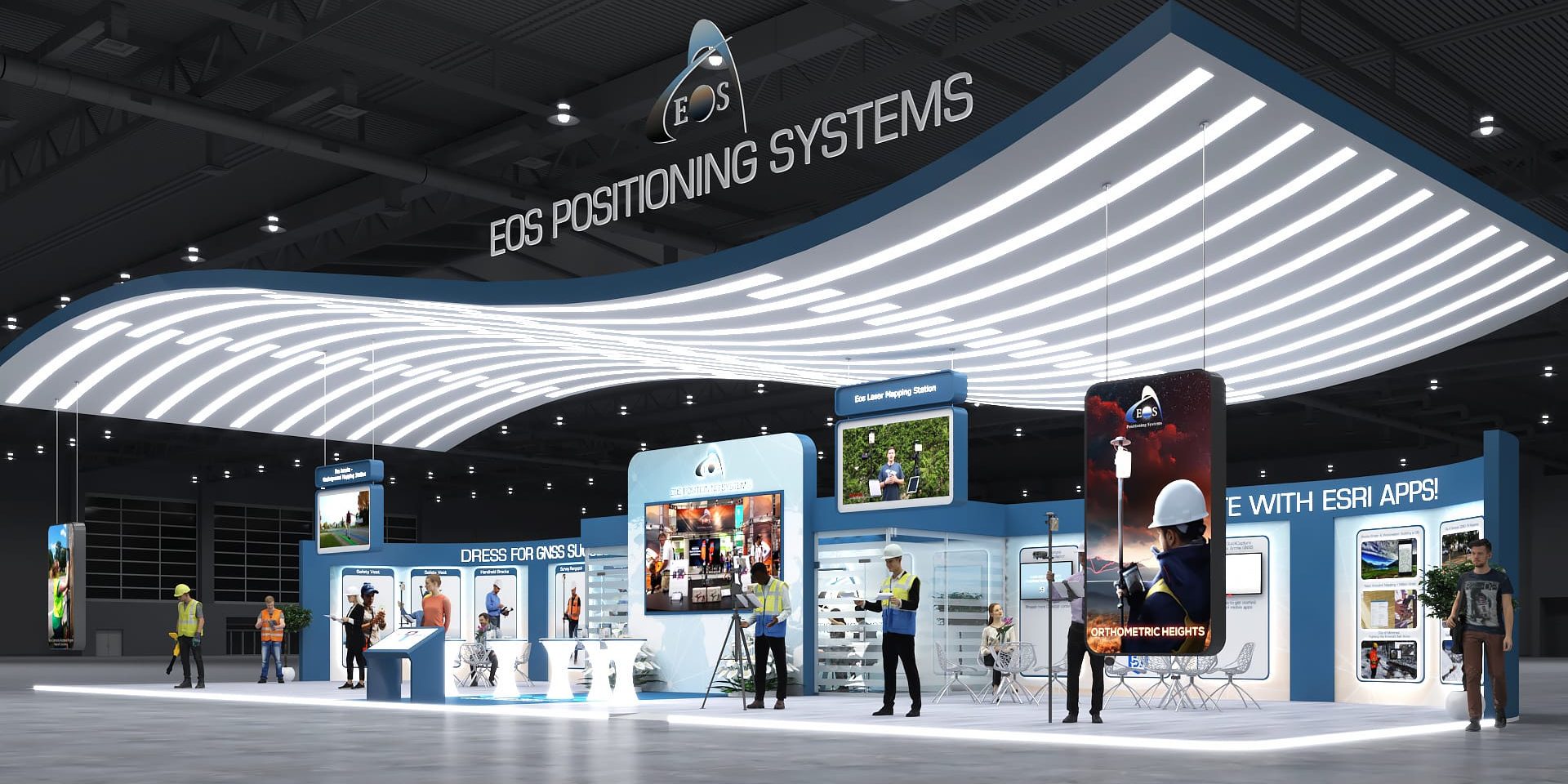
4. Browse the 3D Eos “virtual booth”!
Interact with 3D Arrow GNSS products and Esri-exclusive solutions (including Locate, Laser), browse related content, case studies, and more.
Link will be available from our sponsor listing page on Monday, July 13! Find our virtual 3D booth in the Sponsor Expo once you’ve logged into the Esri UC platform.
