
AmigoCloud is a cloud-based, Software as a Service (SaaS) mapping platform. Their app, AmigoCollect, is designed to allow a field crew with little training to easily collect highly accurate points, lines, areas, photos, and other data. AmigoCollect was one of the first apps to support Eos GNSS receivers, and it’s an easy way to take geospatial data on your phone. AmigoCollect makes it easy to visualize, collect, edit and share large geospatial datasets with extremely high accuracy when connected to an Eos GNSS receiver.
Integrated GPS
AmigoCollect seamlessly integrates with Eos GNSS receivers for survey-grade locations within the mobile app.
Choose Your Units
AmigoCollect lets you choose whether you’re collecting GPS data in metric or imperial units.
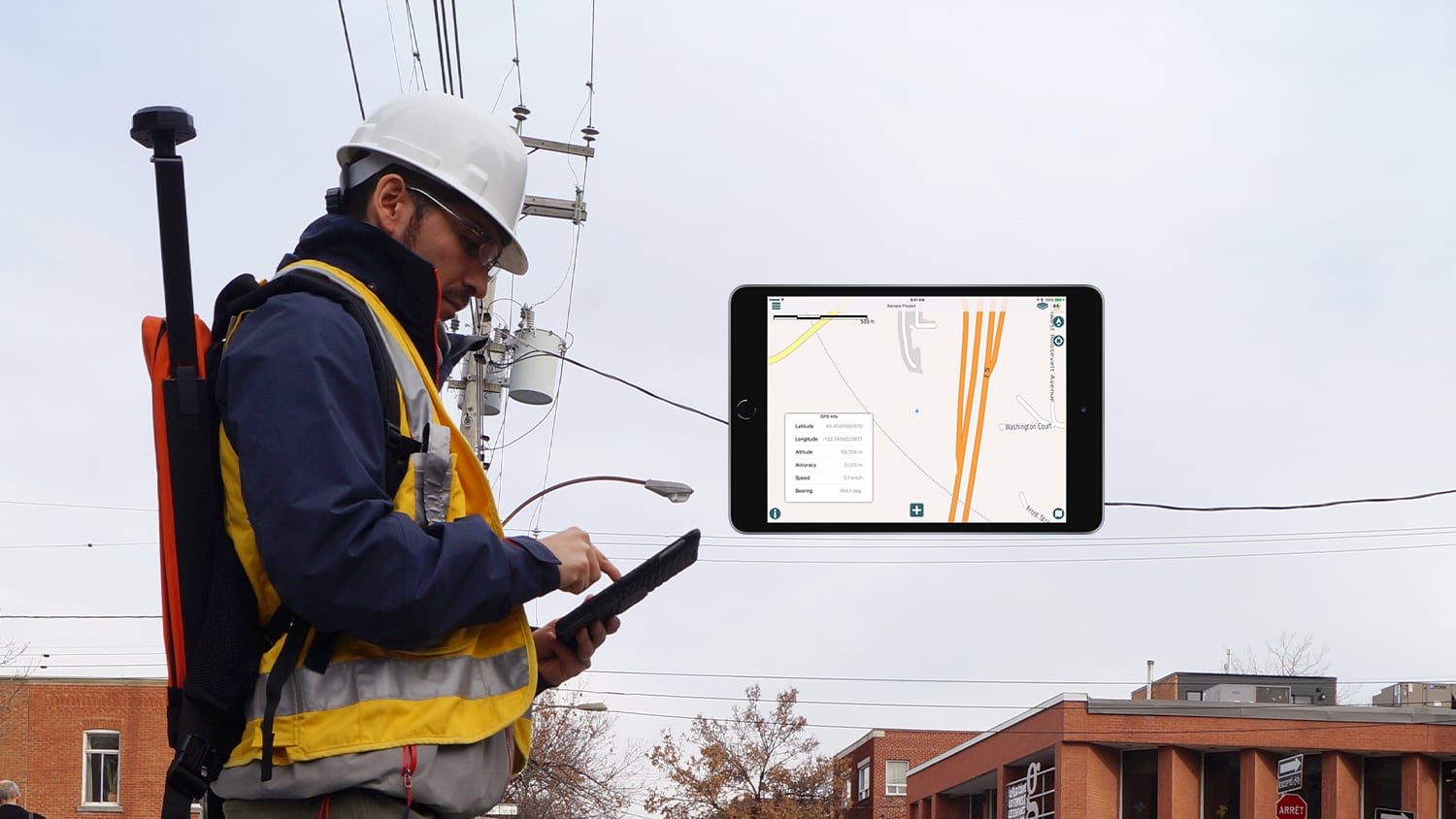
View Live Eos GNSS Metadata
Metadata from Eos GNSS receivers — such as estimated accuracy — are available directly within the app by clicking the information button.

Geospatially Reference Media
Collect photos, videos, documents, barcode scanned information, and more with extremely high accuracy from your Eos GPS receiver.
Collect Data Offline
AmigoCollect and Eos GNSS receivers both work in offline environments, so you don’t have to stop working just because your connection does.
Flexible Uses
AmigoCollect and Eos GNSS receivers can be used together for environmental, municipal, utility, and mining mobile work.
What We Like about this Partner App: AmigoCollect
iOS and Android
AmigoCollect is optimized to work with Eos GNSS receivers on iOS® and Android.
Easy to Use
AmigoCollect is an easy to use app. When combined with Eos GNSS receivers, the mobile solution requires little user training.
Offers a Demo
Interested in AmigoCollect? AmigoCloud offers a free trial, available by request on the AmigoCloud website.
Proven App for Use with Eos GNSS Receivers
AmigoCollect was one of the first GIS apps to support Eos GNSS receiver locations and metadata. Today, the combination of our Eos hardware and AmigoCloud’s software have become a proven solution for accurate mobile mapping. Its easy-to-use interface makes AmigoCollect a simple GIS app to use with high-accuracy locations.

Recommended Resources
AmigoCloud: Configuring AmigoCloud with Arrow GNSS
Other Apps You Might Like
