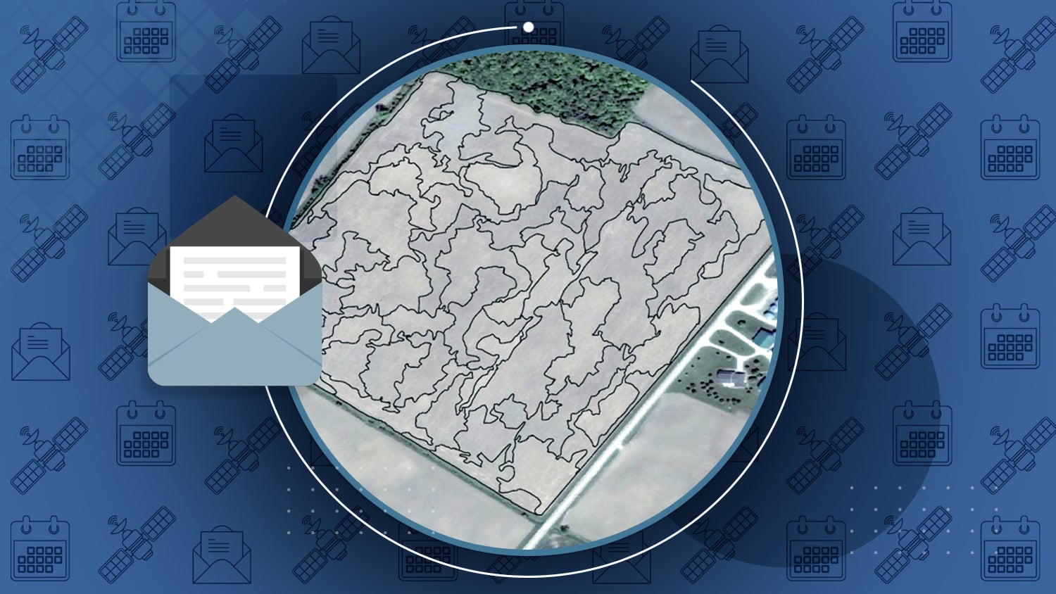

/// Veritas provides highly accurate fertilizer prescriptions for agricultural zones with Arrow 100 and ArcGIS Pro

From Eos: Canadian service provider Veritas Farm Management provides clients with fertilizer and seed prescriptions. The prescriptions provide guidance on the minimum amount of fertilizer needed to achieve the maximum yield. The soil sampling and analysis are completed using a variety of technology including the Arrow 100 and ArcGIS Pro.
Read More.


Esri Webinar: Capturing Hard-to-Reach Assets with Decimeter Accuracy
From Esri: Join Colorado design/survey consultancy DDSI to learn how they save an estimated 20% ROI per project. In this webinar, DDSI’s Mike George explains how the Eos Laser Mapping solution for ArcGIS Collector works and how it saves time and money. Eos and Esri join him.
NGS releases new Geoid18 model
From the NGS: “Hybrid geoid models are used to convert NAD83 ellipsoid heights from Global Positioning Systems (GPS) observations to orthometric heights (elevation). … GEOID18 is intended to be the last hybrid geoid model that NGS creates before the current vertical datums are replaced by the North American-Pacific Geopotential Datum of 2022 (NAPGD2022).”
GPS III SVN-74, First of Its Kind, Goes Active
From Inside GNSS: ‘The U.S. Air Force Second Space Operations Squadron (2 SOPS) has turned the first GPS III satellite, SVN-74, healthy and active. … SVN-74/PRN-04 launched on Dec. 23, 2018. Having successfully completed rigorous operational testing on orbit, the satellite now enters broadcast service. It is the first satellite of the third generation to undertake active duty.”
4th GPS civilian signal goes live
From GPS World: “A new GPS civilian signal is now available for use. The new signal is stronger, more accurate, more resilient to interference events, and interoperable with European Galileo system.”

/// Attn Windows Users: New Eos GNSS Tools (v1.8.7332) Released

A new version of Eos GNSS Tools (v1.8.7332) is now online and ready for download as of January 29, 2020. This version includes the following enhancements and bug fixes:
- Optimized packet handling on Bluetooth connection to prevent buffer overflow
- Improved connection stability for NTRIP and DIP
- Fixed a bug with NTRIP Auto-Connect
- Improved COM Port connectivity
- Fixed a bug of truncated NMEA messages in Terminal & Virtual COM port
- Overall stability improvements
In order to fully take advantage of these major enhancements, we strongly recommend updating your Arrow Bluetooth Communication firmware to version 2.2.905 or later.
To update the Bluetooth firmware an iOS® device is required (iPhone®, iPad® or iPad mini®):
- Download Eos Tools Pro from the App Store from an iOS device
- Pair the Arrow via Bluetooth with the device (from the Bluetooth settings)
- Launch Eos Tools Pro and you will be prompted to update the Bluetooth Communication Firmware
- Answer “Yes” and wait for update completion
To verify the Bluetooth Communication Firmware version, tap on the “I” (Info) icon on the top right corner of the screen
/// GNSS Constellation Status: January 29, 2020


/// Steve Laevens makes 28752 soil sampling simple

From Eos: When the Eos team saw Steve Laeven’s comment on Facebook, we knew we had to follow up to hear what Veritas and Deveron UAS were all about! A simple Facebook comment quickly turned into one of our most intricate case studies yet.

/// CalGIS in Long Beach

February 9-11
Hilton Long Beach
701 W Ocean Blvd
Long Beach, CA 90831
Booth #205
Visit Us at Booth 205!
/// Esri Fed GIS Conference

February 11-12
Walter E. Washington Convention Center
801 Mt Vernon Pl NW Washington D.C
Booth #917
Visit Us at Booth 917!
/// CartoPac User Group
February 11-13
Hilton Fort Collins
425 West Prospect Road
Fort Collins, CO 80526
Table area (no floorplan available)
Visit Us in the Expo Table Area!
/// Esri Midwest UC

February 25-26
Hilton Chicago
720 S. Michigan Avenue
Chicago, Illinois, 60605
Kiosk #105
Visit Us at Kiosk 105!
/// TechAdvantage

March 2-4
Ernest N. Morial Convention Center
900 Convention Center Blvd
New Orleans, LA 70130
Booth #1544