As a competitive consultancy, DDSI’s profit margins depend upon turning around timely and accurate surveys of telecommunications sites. With a goal of speeding up field work to increase profit margins, DDSI looked for a new GNSS data-collection system. Their biggest challenge with legacy handheld GPS devices was signal failure under canopy, and the time-consuming alternatives of using either a total station or manual measurements.
The Organization: DDSI Global
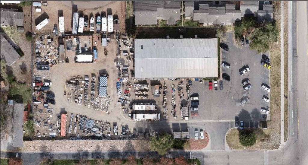
DDSI Global (Downtown Design Services, Inc.) is a Denver-area services provider that helps architecture and engineering (A&E) firms identify opportunities to expand telecommunication footprints. A typical DDSI project involves surveying a leased cell tower site to identify property and easement boundaries and to map underground utilities. Their work allows their clients to intelligently design wireless telecommunications expansions.
“Everything we do is about speed,” DDSI Project Manager Mike George said. “We have to be as accurate and as fast as possible.”
The Challenge: Little Room for Error
“There’s a bunch of flags, utilities all over the place, and no GPS reception under the trees. We needed an alternative solution to our field data collection methods.”
— Mike George, Project Manager and GISP, DDSI Global
Watch Mike George from DDSI present this story at the 2018 Esri GeoConX in Dallas:
DDSI performs two phases of data collection. First, field workers survey property boundaries with millimeter accuracy by using traditional survey methods. This provides the foundational map onto which topographic features can be layered.
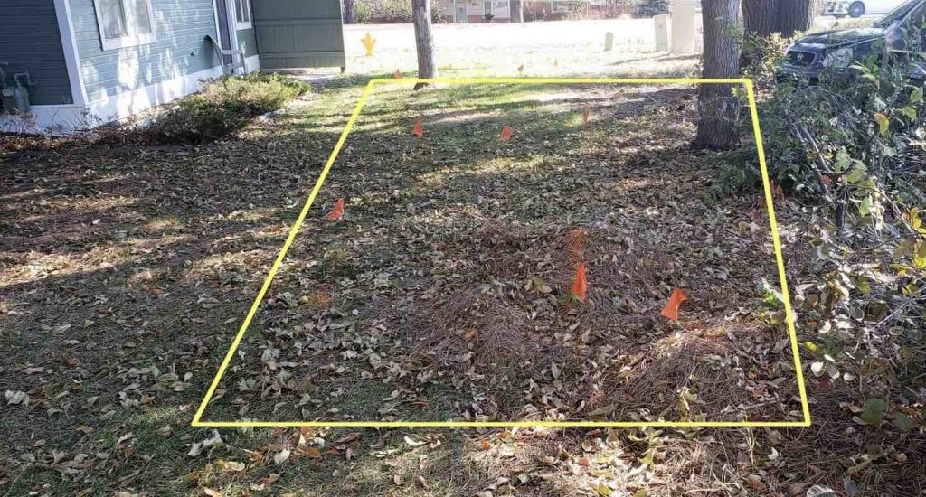
Topographic features, mapped with subfoot accuracy, include all utilities (marked with flags at the site) and potential construction obstacles (e.g., fences, trees).
“Because these firms are expanding, they want to pull in more fiber and power, so they need to know where existing fiber and power is coming from,” George said. “They also need to know where gas and water lines are, so they can design alternate locations and plan accordingly with their construction teams.”
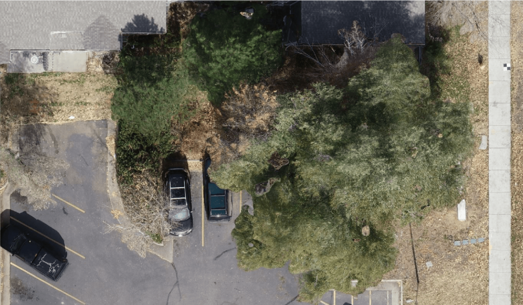
In the past, DDSI relied on legacy handheld GPS devices to capture these features. But the handheld GPS struggled to work under trees and near buildings, where signals were obstructed.
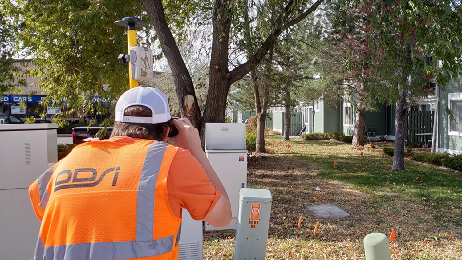
“There’s a bunch of flags, utilities all over the place, and no GPS reception under the trees,” George said. “We needed an alternative solution to our field data collection methods.”
In these cases, field workers typically pulled out the total station. But calibrating the total station takes time, as did switching between the two workflows depending on changing field conditions. Sometimes, neither technology worked as planned, so features needed to be measured manually.
“It made do, but it was not easy,” George said. “Sometimes under a tree, we needed to use standard tape measures and then sketch into our field books. I’d have the drafter at my desk later deciphering it.”
If bad data was collected, a crew had to go back to the site to correct it.
“Going back to a site twice is essentially a job killer,” George said. “Everything for us needs to happen in one day. The difference between having to survey a site once, or twice, is often the difference between making a project profitable or breaking even.”
The Solution: Seamless GNSS Laser Mapping
“This laser mapping solution has saved our drafters hours. In the survey world, that’s the difference between the project being profitable or just breaking even.”
— Mike George, Project Manager and GISP, DDSI Global
In 2018, a GNSS laser mapping solution from Eos Positioning Systems (Eos), Esri and Laser Technology, Inc. (LTI) made it possible to survey features from afar. The workflow utilized:
- ArcGIS Collector or ArcGIS Field Maps on iOS® — for data collection
- LTI TruPulse 200X laser rangefinder — for laser offsets
- Eos Arrow Gold GNSS receiver — for GNSS location accuracy
- Eos Tools Pro — for offset measurements
With this setup, field crews could turn any iPad® into a GNSS laser mapping device for collecting features under any conditions with submeter accuracy.
DDSI learned about the GNSS laser mapping solution in 2018 when Eos released it. George instantly realized the single pole setup could replace his legacy handheld devices and total station for utility locates.
“If all I needed was this one tool to map a flag under heavy tree canopy, then this would be a much better solution for us than those other ways,” he said.
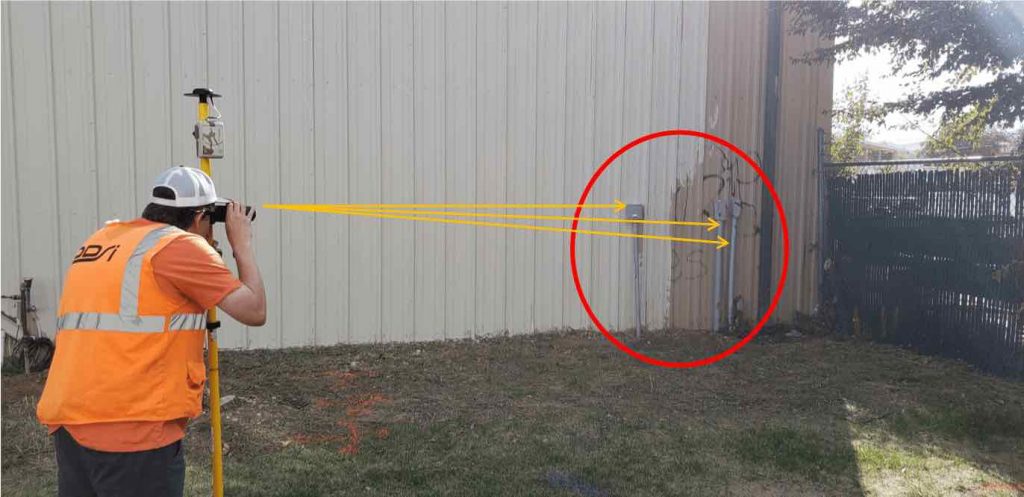
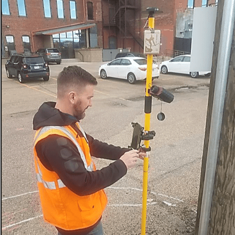
With the laser mapping solution, a field worker could walk the site with a range pole, an Arrow Gold GNSS receiver Bluetoothed into an iPad Mini®, ArcGIS® Field Maps (formerly ArcGIS Collector), and an LTI TruPulse 200X laser rangefinder. He could map utilities either by occupying them physically or by performing laser offsets from afar when trees or buildings obstructed GPS signals.
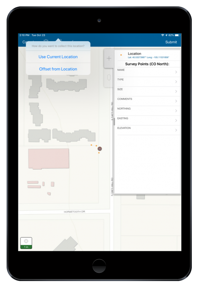
“I can get everything I need collected on the pole at the same time without having to change gears,” George said. “If I want to shoot an offset feature, it’s two taps in Field Maps, and I can select that routine. The integration of the three technologies is so seamless.”
George said the accuracy was more than sufficient out of the box, though DDSI does sometimes connect to an RTK network for centimeter accuracy.
“We’re getting plus or minus a foot out of the box, which is well within the threshold for utility locates,” he said.
The Results: Huge Time Savings and ROI
“With 90 to 95 percent of the work done in the field, we’ve made a huge time savings and ROI on each project. That’s what this Eos system does for us.”
— Mike George, Project Manager and GISP, DDSI Global
With the GNSS laser mapping solution, DDSI can perform all the required utility locates in three hours of steady work, allowing them to target two site surveys per day.
“We’re just cruising,” George said. “It’s go, go, go, collect a point, collect an offset. This tool just places a huge advantage on us to complete these jobs.”
LTI Senior Product Manager Derrick Reish visited a site and commented on DDSI’s efficiency.
“I could not believe how fast they were going,” Reish said.
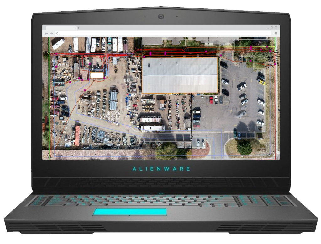
The laser mapping workflow also allows for real-time QA/QC, so bad data can be discarded in the field, and repeat trips are reduced.
“We can see right then if we got the shot we wanted or move it,” George said. “And the data goes right to the drafter via the cloud, so this eliminates them having to take the time to figure out what happened in the field from a ton of traditional survey point shots. With 90 to 95 percent of the work done in the field, we’ve made a huge time savings and ROI on each project. That’s what this Eos system does for us.”
Download a PDF of this article in ENGLISH.

