/// NEW Eos Laser Mapping Videos: Choose Your GPS Workflow!
Still searching for your perfect data-collection match after Valentine’s Day? We’ve got you covered!
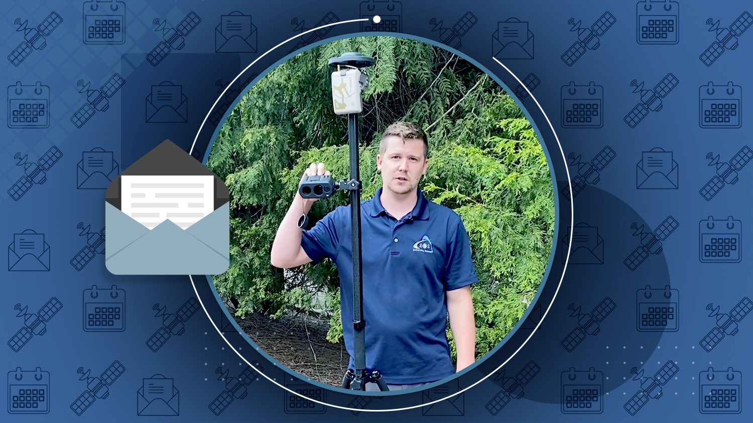
This past month, Eos released brand-new videos on Laser Mapping for ArcGIS. The videos will help you determine which of three laser-mapping methods is right for your needs. Choose from range-range/intersect, range-azimuth, and range-backsight methods.

Mapping Upgrade Reduces Labor Costs at The DDS Companies
15-minute presentation
Recently, The DDS Companies switched from open-source GIS to ArcGIS with Arrow GNSS. Watch project manager David Gigliotti describe their gains as they perform pipeline route delineations and other services.
Please help us with a brief survey
Eos would love to know which geospatial publications you read! By taking our 10-question survey, you’re helping us understand where to further spread the word about Eos.
James Litton, GPS and precision ag pioneer, dies
Article by Dana Goward, GPS World
Eos was saddened to learn of the passing of GPS-industry pioneer James Litton. Litton was the founder of NavCom Technology, Inc. Our deepest sympathies go to his family. Learn about his legacy >
Lunar GNSS Receiver Experiment (LUGRE) to Deliver First GNSS Fix from the Moon in 2023
Article by Inside GNSS
Over the moon about GNSS? You’re not alone. In the coming years, GNSS (LNSS?) will be used on the surface of the moon. It’s out of this world >
Firmware notice from Eos technical support manager Alvaro Paez:
Dear Eos customers: Please take a moment to ensure your Arrow receiver has the latest firmware:
– Arrow Gold, Arrow 200, and Arrow 100: Firmware version 6.0Aa01
– Arrow Lite: Firmware version 6.8Qg24p
To find your firmware version, check the “About” page of Eos Tools Pro (looks like this). If you need to update your firmware, please contact my technical support team. We are here to help!

David Gigliotti Sees Projects Come to Life with a new GPS system
David Gigliotti sat down with Eos to tell us all about how he and his team strive to exceed clients’ needs for construction, design projects, and more.

[Workshop] Eos Arrow GNSS Workshop with Esri ArcGIS Field Maps
- Date: Thursday, February 25 at 9:30am-12pm PST
- Registration: Open now! Closes 1 hour before event
Join Eos tomorrow with special guests from Esri and Colliers Engineering & Design (formerly Maser Consulting) for this live free training workshop using ArcGIS Field Maps, Arrow Gold GNSS, RTK and iPad®. By registering, you will receive the recording.
[Webinar] Understand the Technology that Underpins High-Accuracy Field Mobility
- Date: Thursday, March 25 at 12:30-1:15pm AEDT (Wednesday, March 24 at 8:30pm EST)
- Registration: Opens next week on Esri Australia website
Join guests from Esri Australia, 4D Global, FrontierSI and Eos for a live webinar about the current and future states of high-accuracy mobile mapping in Australia/New Zealand.
Subscribe to Esri Australia news to be notified when registration opens >

[Workshop] Eos Laser Mapping for ArcGIS Hands-On Training Workshop
- Date: Thursday, March 25 at 9:30am-12pm PST
- Registration: Open now! Closes 1 hour before event
Join Eos with special guests from Esri and LTI for this live training workshop. Learn about mapping with laser offsets, the benefits and hardware for three methods, and how to configure your web maps. A live outdoor laser mapping demonstration will follow using ArcGIS Field Maps, Arrow Gold GNSS, LTI laser rangefinders, and iPad. By registering, you will receive the recording.

[Webinar] Bring Your Buried Assets to Life
- Date: Wednesday, March 31 from 10-11am PST
- Registration: Opens next week on Esri website
Join Esri and Eos for a presentation on underground utility mapping. You’ll learn how to map buried utilities in ArcGIS using the new free Eos Locate™ solution for ArcGIS apps. You’ll also hear how Oakland County and OHM Advisors used this solution to map mixed utilities in Michigan. Panelists from all companies will be live to answer questions.