


Visit Eos Positioning Systems® (Eos) — a 2019 Esri Award-Winning Silver Partner and ArcGIS Online Specialty Partner — at the 2019 SCARC. This year’s event will be held at The Waters Building in Florence, SC. An authorized Eos representative will be exhibiting as a Silver Sponsor from October 23-25.
Eos is a Canadian company and Esri Silver Business Partner that specializes in simple, affordable, high-accuracy field solutions (GPS / GNSS) for the GIS and mapping community. Eos Arrow Series Bluetooth® GPS (GNSS) receivers fit directly into existing mobile GIS workflows and data-collection apps (e.g., Collector, Survey123, and even your own proprietary application!). Our solutions simply replace lower accuracy native device locations with higher-accuracy (submeter/cm) GNSS locations and metadata. The Arrow Series® GNSS (external Bluetooth® GPS) receivers work with any mobile device and field data-collection app.
Scroll down to learn how to find an authorized Eos representative. Ask for a demonstration of submeter and centimeter data-collection with Arrow GNSS!
Find Eos at the 2019 SCARC Conference!
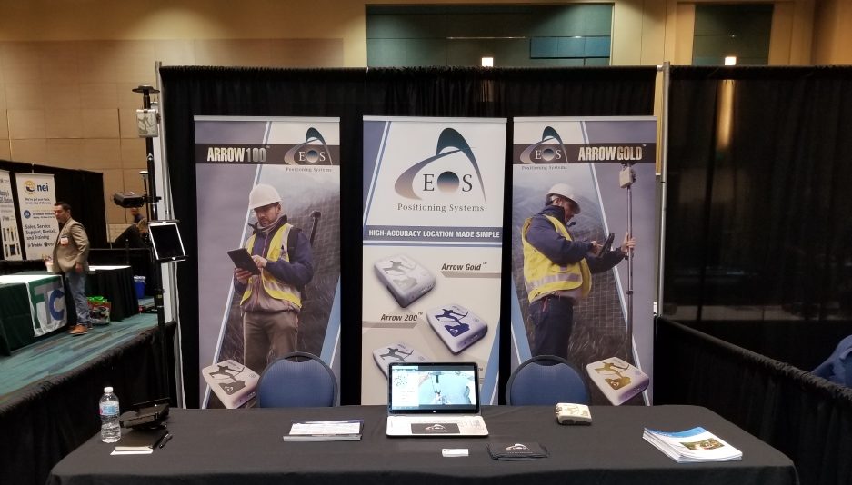
An authorized Eos Arrow representative will be exhibiting in the expo hall at the 2019 SCARC conference. Look for the below setup to find our expert GNSS team:
Look our team at Booth 209!

Location
The Waters Building
135 S Drgan Street
Florence, SC 29501
Expo Dates and Times
Oct. 23 to Oct. 25
Social Media
Event Website
Featured case study: City of Gastonia, NC

City of Gastonia Public Utility Department Looks to the Future of GIS with Arrow 100 and Esri ArcGIS
Two Rivers Utilities added hundreds of valves to its GIS as part of a new valve-exercising program, intended to reduce service interruptions and modernize valve-tracing on the Esri ArcGIS platform.