 Atlas® is a worldwide GNSS differential correction service, offering the most innovative base station-free corrections via L-Band satellites at accuracies ranging from meter level to a few centimeters. The Arrow Gold® GNSS, with its L-Band option, provides worldwide decimeter positioning to your smartphone, tablet or notebook computer. With approximately 200 reference stations worldwide and L-Band satellites distributing coverage from 75°N to 75°S, all of the earth’s landmass is covered.
Service Levels
- H100: 1 m 95% (50 cm RMS)
- H30: 30 cm 95% (15 cm RMS)
- H10: 8 cm 95% (4 cm RMS)
How it works
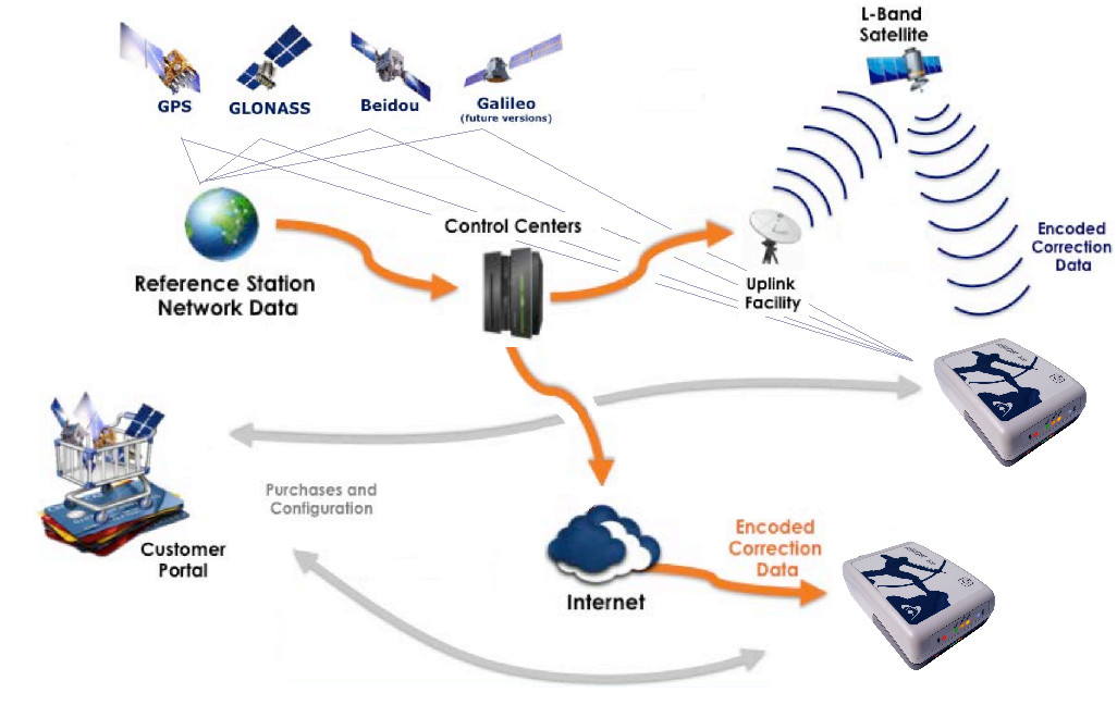
GNSS data are collected from approximately 200 base stations spread all over the world. Data is then processed at the Control Centers and corrections are uplinked to strategically located geostationary satellites. Each satellite broadcasts corrections for its region over specific L-Band frequencies.
The Arrow Gold®, when subscribed to an Atlas® service, receives both GNSS signals and the L-Band corrections on the same antenna and outputs a corrected position to your mobile device.
Atlas® corrections are also available over the Internet. In this case, the Arrow’s integrated L-Band radio is not necessary but internet connectivity (eg. Wifi, cellular, etc.) is a must.
What to Know about Atlas® Convergence
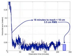
For the H100 service, reaching submeter is nearly immediate. For H30, an average of 4-5 minutes is required. For the H10 service, typical convergence time varies between 12 to 20 minutes depending on the GNSS constellation.
Once convergence is achieved and since carrier phase is used, the accuracy will remain consistent (even improve) as you collect data as long as the Arrow’s antenna maintains a clear, unobstructed view of the sky.
Benefits of using the Arrow Gold® GNSS with Atlas®
The Arrow Gold® using the Atlas® service offers the following benefits:
- World-wide real-time coverage
- 3 levels of service: sub-meter, sub-foot and decimeter
- Uses all constellations (GPS, GLONASS, Galileo, BeiDou) in view for faster and more robust convergence
- Very compact field solution with integrated battery and L-Band radio
- Competitive subscription pricing

