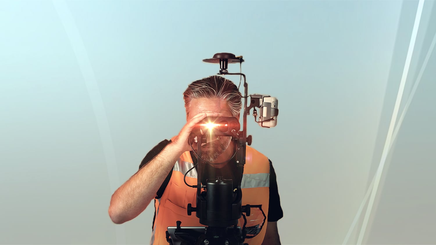
Eos Laser Mapping™ for ArcGIS was the world’s first real-time, laser offset solution that allows ArcGIS apps users to collect survey-grade locations from afar. This solution is perfect when your assets are located in hard-to-reach or GNSS-impaired environments, such as a manhole in the middle of a busy street, or a gas meter on the side of a tall building. This brochure explains at a high level the value of, and requirements for, using Eos Laser Mapping™, including:
- Which Esri ArcGIS apps work with the solution
- Which LTI laser rangefinders are recommended for use with the solution
- The 3 laser mapping methods available: Range-Range, Range-Backsite, and Range-Azimuth
Last updated 2021
Explore Related Knowledge Base Items
 1")
Free Eos Laser Mapping for ArcGIS Field Maps: Request the Recording
Eos is pleased to offer a free training workshop for Eos Laser Mapping™ with ArcGIS Field Maps. Learn how to map assets from afar while retaining high accuracy.
 2")
Eos Laser Mapping: Choose Your GPS Workflow!
With Eos Laser Mapping you have three standard workflows to choose from. This article shows you video and best uses for each setup.