Feature Story
/// Shaping the Approach to Reforestation
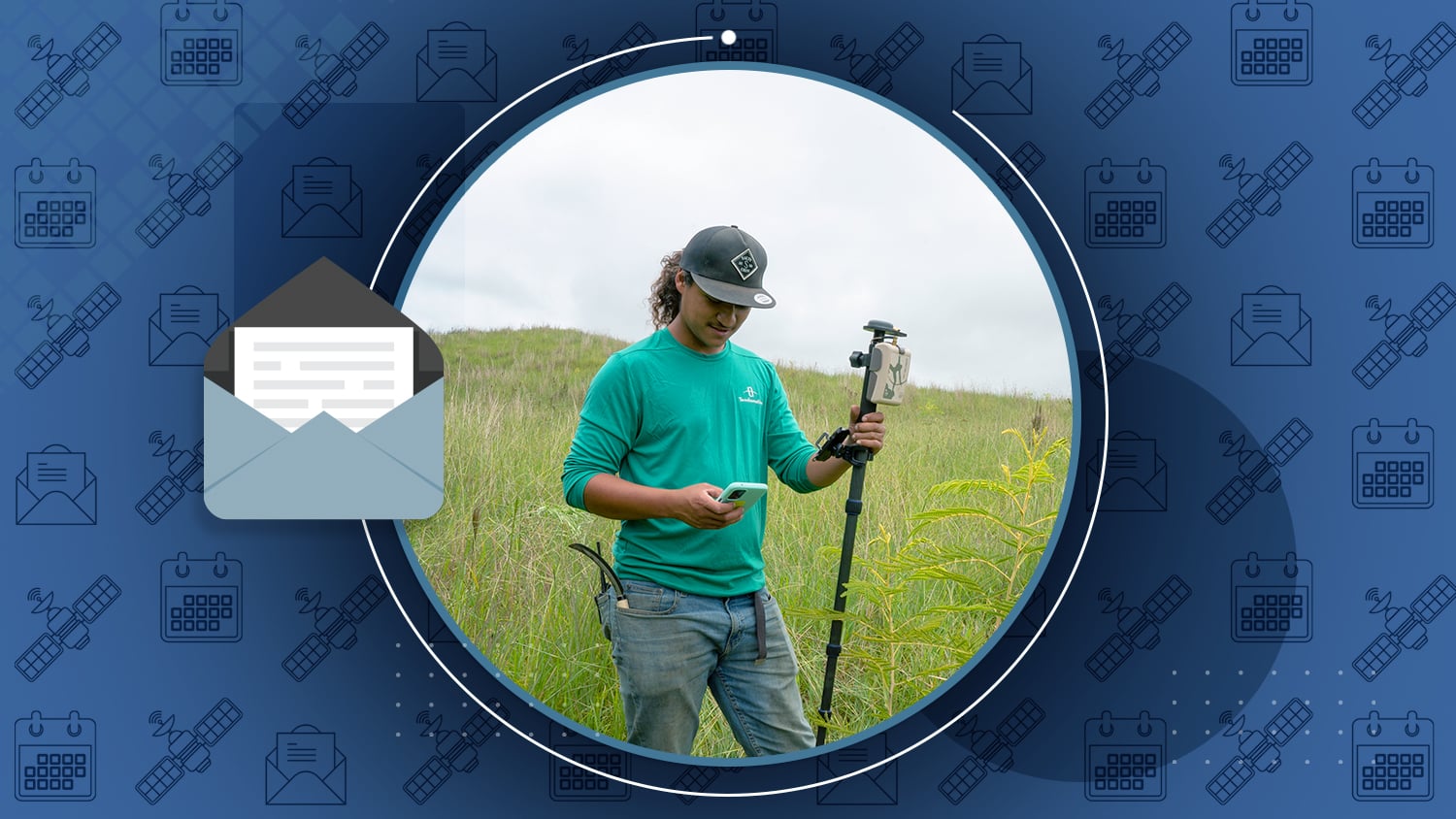
Terraformation is on a mission. They believe that the most effective means of reducing carbon in the atmosphere is through the planting of trees, which can sequester this tricky element. To target the challenging issue of being able to prove how many trees they plant and nurture to the stages of surviving and thriving, Terraformation has piloted a high-accuracy mobile mapping and dashboard-rich tracking and visualization system at some of its locations in Hawai’i. Learn how they use an Arrow 100+ GNSS receiver with ArcGIS Field Maps and ArcGIS Dashboards in this latest ArcWatch article from Esri.
Industry News

Where do GPS positions come from? What’s the difference between “GPS” and “GNSS”? Why are atomic clocks so critical to calculating coordinates on the face of our planet? This past month, Eos released the first article in a new series of educational content that will teach you everything you ever wanted to know about satellite positioning. Get started with the basics in part 1: learn where GPS comes from, how we calculate positions, and key takeaways to make you a smarter satellite user in the field.

StoryMap: “The Father’s Day Flood”
By Michael Cousins/OHM Advisors
How can GIS help after a 1000-year flood? Ask OHM Advisors. After Michigan’s Upper Peninsula was declared a federal major disaster in 2018, they deployed geospatial technologies to quickly evaluate risk, support cost comparisons, and help stakeholders make strong decisions.
Al’s Corner: Technical Tips

Frequently Asked Questions
A new resource on the Eos website
Big news. Instead of having to fill out a technical support request for common questions, we’ve published the top 12 FAQs to a new section of our website. We will add new FAQs as needed; you can also submit yours for consideration.
Current GNSS constellation status for May 26, 2023:

Customer Spotlight

David Malm Empowers Clients with Accuracy at Bolton & Menk
They say variety is the spice of life, and as GIS Project Manager at Bolton & Menk, Inc., David Malm has no shortage of diverse projects. In our latest customer spotlight, learn how David uses high-accuracy Arrow GNSS receivers and GIS applications to provide community-infrastructure solutions to municipalities.
Upcoming Events

AWWA ACE
June 12-14 | Toronto, Canada
Eos is pleased to return to the American Water Works Association ACE event, this year held in Toronto. Find us in the Esri booth #2631 at our partner pavilion.