

In This Issue
Reprint: Cal Poly shows how they use high-accuracy mapping for hands-on learning
Big Idea: Esri’s Morgan Zhang explains how GNSS works (you’ll want to bookmark this!)
Esri UC Is Here!
Esri UC attendees are invited to the Eos booth (#1025) for demos, discussions, and deep dives into all things GNSS. Also, let us buy you lunch Thursday! Details below …
Featured Customers
- California Polytechnic State University
- New Zealand’s Bioeconomy Science Institute Maiangi Taiao
Mapping the Future of Learning at Bartleson Ranch and Conservatory
By AnnMarie Cornejo
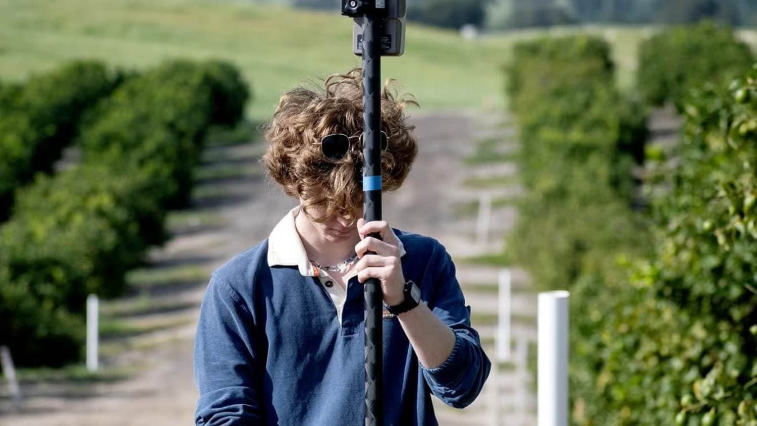
At Bartleson Ranch and Conservatory, California students are transforming a 450-acre property into a living laboratory. There, they gain hands-on experience by creating valuable GIS resources that will support agricultural research and ranch operations for years to come. Using an Eos RTK GNSS receiver, students collected highly accurate location data for water assets, irrigation infrastructure, reservoirs, and natural resources. They use this data to build a comprehensive digital map of the ranch. The project not only provides real-world technical training but also fosters collaboration across disciplines, giving students the opportunity to solve meaningful challenges and contribute to the long-term stewardship of a unique educational resource.
2026 Esri UC: Top 3 Ways to Engage with Eos Positioning Systems in San Diego

Heading to the 2026 Esri User Conference in a couple weeks? Stop by Eos Positioning Systems at Booth #1025 to see high-accuracy Skadi and Arrow GNSS receivers in action with ArcGIS apps. Get hands-on with the latest high-accuracy mapping technology and connect with our mobile experts. Attendees can also join our sponsored lunch session on Thursday for practical insights, news on what’s coming down the roadmap, and the latest developments in GNSS for ArcGIS users. Here is everything you need to know about finding our team at UC >
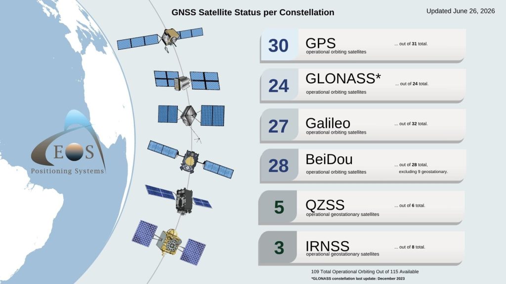
Current GNSS Satellite Status for June 26, 2026
Since last month, total global operational orbital (usable) GNSS satellites decreased by 1, going from 110 to 109.
What changed?
Total operational satellites in the GPS constellation decreased by 1 (31 went to 30).
Satellites in the following constellations stayed the same month-over-month: Galileo, GLONASS, BeiDou, QZSS, IRNSS.
More News
GNSS Accuracy Unlocked: How Correction Methods Improve Field Data Collection
By Morgan Zhang, Principal Product Engineer, Esri
Want to better understand how high-accuracy GNSS works in the field? A recent article from ArcUser breaks down the correction methods that make precise GIS data collection possible, from free satellite-based augmentation systems (SBAS) that deliver sub-meter accuracy to RTK and network RTK solutions that achieve centimeter-level precision.
Dive deep into this excellent explanation of GNSS >
How the Bioeconomy Science Institute Maiangi Taiao is using SouthPAN to save time and cost
At New Zealand’s Bioeconomy Science Institute Maiangi Taiao, field crews are using SouthPAN with an Eos Arrow GNSS receiver to achieve sub-metre accuracy in real time. The enhanced accuracy has reduced point capture times from minutes to seconds, helping teams collect more reliable data faster and make better-informed management and research decisions in the field.
Read the full account from the SouthPAN team >
Upcoming Events
Here’s where to find our team in the coming weeks:
Esri User Conference
July 14-16 | San Diego, CA, USA
Find Eos in Booth #1025 >