
CartoPac Mobile is an industry-specific mobile application from Eos partner American Innovations (formerly CartoPac). CartoPac Mobile and Eos GNSS receivers are designed to work together, to streamline field work for gas, pipeline, electric, and other utility owners and operators. The combined solution can be used to collect new installations (as-builts) with higher accuracy, perform routine inspections and maintenance with greater efficiency, and more readily comply with upcoming tracking and traceability regulations from governing bodies.
Accurate As-Builts
Finally, as-built records can be both accurate and affordable. CartoPac Mobile and Eos GNSS receivers are a reliable, proven solution for collecting complete, trackable, and traceable as-builts.
Real-Time RTK
Eos GNSS receivers provide real-time RTK accuracy directly into CartoPac Mobile. There’s no need to wait long periods of time in the field, or to post-process manually back in the office.
Rugged Solution
Eos GNSS receivers and CartoPac Mobile are designed to be taken into tough field conditions.

Improve Confidence
When you know exactly what is in the ground, exactly where it is, and exactly where it came from, you can increase confidence organization-wide.
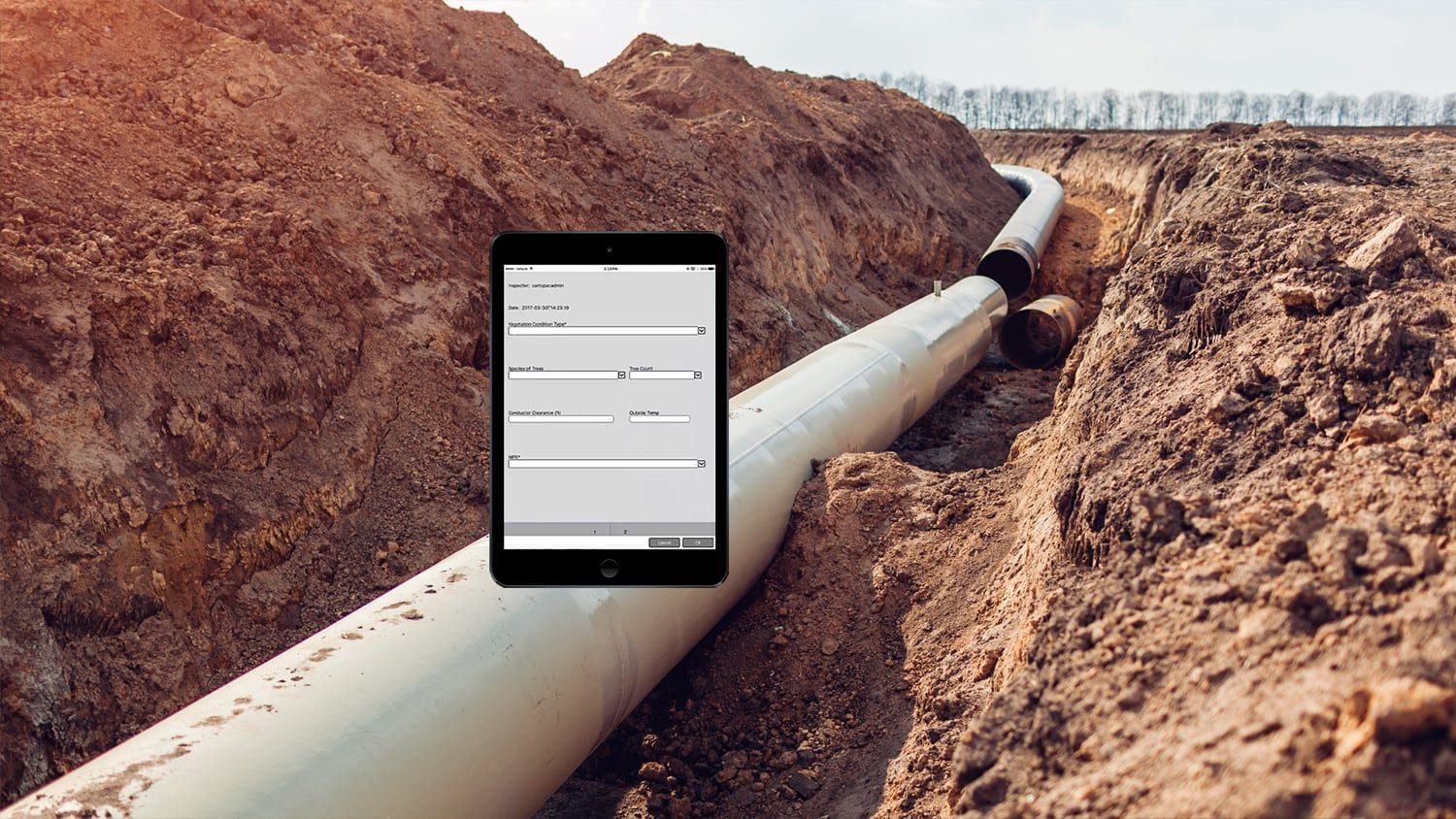
Multiple Workflows
CartoPac Mobile and Eos GNSS receivers can be used to capture accurate information about utility poles, transformers, ROWs, vegetation, and substation inspections.
Incorporate Sensors
Easily incorporate sensors, such as barcode scanners, to capture materials, lot numbers, and other data about your assets — all geo-referenced with survey-grade accuracy.
What We Like about this Partner App: CartoPac Mobile
iOS and Windows
CartoPac Mobile supports Eos GNSS receivers on iOS®, Windows, and Windows Mobile devices.
Customizable Design
CartoPac Mobile and Eos GNSS receivers can be combined for pipeline, utility, municipal, transportation, and other infrastructure data capture.
Industry Specific
CartoPac Mobile is streamlined to be used with gas, pipeline and other utility-related assets.
Absolutely Accurate As-Builts
Accurate as-builts are within reach. The integration of external Eos GNSS receivers with CartoPac Mobile means your team can safely and reliably capture assets as they are installed — with all the relevant regulatory data. Customers in utility industries are already reaping the benefits of the combination of partner technology.
What People Say about Eos GNSS and CartoPac Mobile
We saw our users struggling to get a good high-accuracy GPS solution within the iOS environment. The Arrow solution was very well received by our customers. It’s always encouraging when we can combine technologies and partner with our clients to solve real problems.
Glenn VlassCo-Founder, CartoPac
Recommended Resources

Get to Know CartoPac and Eos

Eos Positioning Systems partners with CartoPac International (now American Innovations)
Other Apps You Might Like
