MONTREAL, QUEBEC — May 07, 2025 — In a landmark moment for Canadian science and technology, the first all-Canadian Antarctic research expedition relied on Montreal-made Arrow Gold+™ GNSS technology for precise location data. In one of the most remote, harsh, and unmapped environments on Earth, the expedition brought together Canadian scientists, technicians, and institutions from all over the country, showcasing a variety of expertise on the global stage.
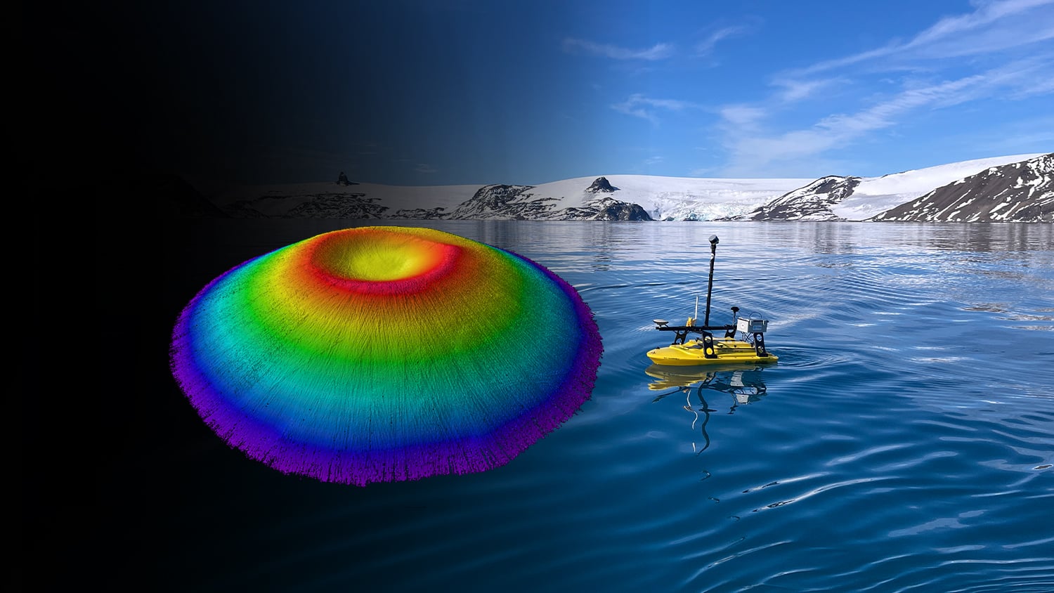
The month-long journey around the South Shetland Islands and the northern Antarctic Peninsula yielded surveys of coastal and oceanic sites. The crew relied on a small, unmanned surface vessel (USV) carrying various equipment for bathymetric surveys including an onboard computer, IMU sensor, and multibeam sonar.
In order to find the USV’s precise position in an environment with no land-based RTK infrastructure, the team relied on the Arrow Gold+ GNSS receiver, designed and manufactured by Canadian-based Eos Positioning Systems®. The Arrow Gold+ made use of Galileo High Accuracy Service (GalHAS), a free satellite-based PPP correction available worldwide from the European Agency for the Space Programme (EUSPA).
“There aren’t any RTK networks in Antarctica,” said Ocean Mapping Group research scientist Kevin Wilcox, who piloted the USV. “That sent us looking for the Arrow Gold+ and GalHAS corrections. When we found these, we realized we had a possible solution.”
While using GalHAS corrections, the Arrow Gold+ provided estimated accuracies of about 10 centimeters horizontal and 15-20 vertical.
“The vertical accuracy was especially important for our bathymetric work,” Wilcox said. “Any vertical error would directly add error to our depth.”
Sites surveyed include Admiralty Bay, Livingston Island, and Deception Island, which includes an active, flooded volcano caldera. The resulting, high-accuracy maps will support further scientific and oceanographic research, environmental monitoring, and improvements to marine charts.
Eos Positioning Systems extends heartfelt congratulations to the entire team for their groundbreaking work and thanks them for taking the Arrow Gold+ GNSS receiver on one of the most remote and challenging deployments to date.
About Eos Positioning Systems, Inc.
Eos Positioning Systems®, Inc., (Eos) is a leading Canadian designer and manufacturer of high-accuracy GNSS receivers for GIS and mapping applications. Founded with a mission to make high-accuracy location technology accessible to all, Eos offers GNSS solutions that are easy to use, affordable, and compatible with any device or software. Flagship Eos GNSS product lines include the Skadi Series™ and Arrow Series® which provide high-accuracy location data to any device or app. Learn more at eos-gnss.com.