Synopsis: High-Accuracy Data Collection (Arrow Gold®, ArcGIS), helps New York company reduce mobile labor costs
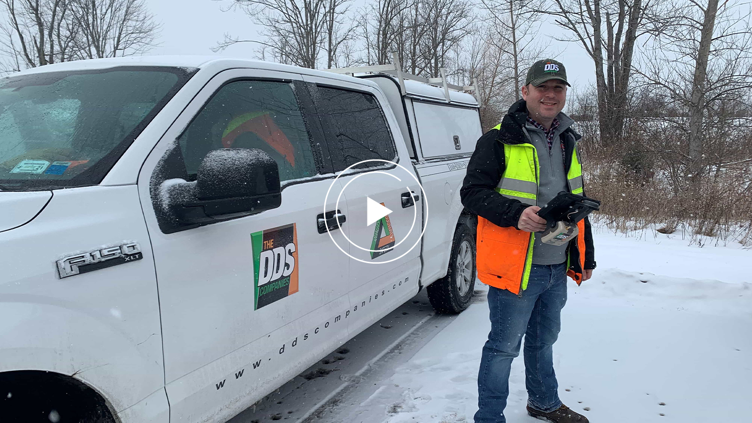
In this recorded presentation, David Gigliotti of The DDS Companies explains how his company used Eos Arrow receivers, the ArcGIS platform and ArcGIS Collector to drastically reduce labor during mobile work. Click play above to watch the presentation, or scroll down to read the transcript.
About DDS Companies
[Start transcript]
David Gigliotti
So I’m David Gigliotti, I work for The DDS Companies. I’m a project manager in our utility engineering group, responsible for natural gas transmission and distribution projects, both the engineering and permitting and project management of those projects.
The DDS Companies is a heavy civil and utility engineering and construction company. We not only do design work — we also are involved in the construction side of things. We have a pretty large engineering firm — we utilize numerous seats of AutoCAD, ArcGIS, MicroStation, Revit, and various other engineering software packages to complete our projects for our clients. We also have our own in-house surveying department and recently just started utilizing the Eos Arrow receivers coupled with drones and high definition scanners and other technology to help bolster our survey and field data collection.

The Challenge: Coordinating large groups of people while using paper maps in rugged terrain


A problem that we were encountering was doing route walks and feasibility reviews on projects. We would end up with large groups of people, like you can see in the picture here, on site. They were trying to evaluate the project, walk around, determine the best place to put a pipeline or where to put the development of a project. To accomplish that, we would need to bring a number of tools with us, one of which is field maps, which usually end up in paper format. And we would have to couple that with a survey support staff with a data collector similar to what you see on the right hand side of the screen here. That data collector would allow us to know where property information is, where our route is that we’re walking and whatever other data we would import into the data collector.
Some of the limitations that we were finding with this process was paper maps weren’t really holding up well in the field. It was convenient to take notes on paper maps just because you can write it down, but having that and then having a small data collector with not much to see on the screen, it was hard to to really see where you were on the paper maps coupled with the data collectors.
The other problem we started running into is the number of people that were on the route walk — again, you can see in the picture. There’s I think 12 or 15 people on this project that were walking around. We have everything from environmental delineation, survey, route development and engineering, we had our client out, we had some staff from state and local agencies with us walking a proposed pipeline that we were developing. Some of these people were necessary for the walk, and some of them we probably could have accomplished the same goal without.
Obstacles with rugged, muddy terrain

“It’s muddy, it’s wet, it’s cold, it’s raining, it’s snowing — we deal with all those different field conditions and the paper maps just don’t really hold up all that well in those conditions.”
— David Gigliotti, Project Manager – Gas Pipeline Engineering, The DDS Companies

This is another picture of a similar project. You can kind of see some of the field conditions we deal with. Sometimes, it gets into rugged terrain. It’s muddy, it’s wet, it’s cold, it’s raining, it’s snowing — we deal with all those different field conditions and the paper maps just don’t really hold up all that well in those conditions. By the time you get through a couple hours of your day, your maps are wet and all your notes are bleeding into the pages.
Here’s another picture of a project. This one shows pretty well the topography concerns that we see. Sometimes we’re up on top of mountains or down in ravines down in the valleys, and the bottoms of the mountains. Some of the work that we do requires us to do field delineation of environmental features, and we find that a lot of times those are in those valleys, down in the bottom of these ravines, and you’re not getting good signal down there for survey. So, we find our surveyors have to set control and traverse in to get to these locations. And that takes time, especially in some of these remote areas, where you’re miles away from a road, to get control set up and get into those areas to do traditional survey.
The Solution: Mobile data collection with Eos Arrow Receivers and ArcGIS Collector
One of the solutions that we came up with to try and solve some of these issues and help streamline this process was to implement ArcGIS Collector application on an iPad® and couple that with the Eos Arrow receiver to give us accuracy in the field. This allowed us to do a few things — the biggest one was eliminating the paper field maps and having a tablet in hand, an iPad, which allows us to see just as much information as we were seeing on the paper maps, but have it in digital maps.
The iPad with its protective case is pretty rugged, we’ve had it out in a lot of field conditions. It holds up to the weather, the snow and the rain, and it allows us to to cycle through data pretty easily in the field.
And the Arrow receiver coupled with that gives us a level of accuracy, in our case getting us down into submeter accuracy in the field. From what I’m seeing, it’s doing a pretty good job of doing that in most of the different field conditions that we’re in.
Like the surveying equipment, we do find limitations on occasion when we get into some of those ravines down in the valleys, where it’s having a tough time seeing the satellites, but it hasn’t taken too much adjustment to get that view back in. Sometimes just a step to the left or the right, and I’ll pick up a couple satellites and I’ll get my accuracy back.
Field Setup: Handheld mount with iPad and Eos Arrow Gold®
All right, I thought I could just show you guys what my rig looks like that I use in the field. I have my iPad mounted with the antenna on the top and the receiver on the back, so I have it all in one piece. It makes it very compact for use in the field, not carrying a lot of bulky hardware with me.
If I go on some projects and I’m really trying to showcase the accuracy, and that’s important for that level of deliverable, I’ll actually have a pole mounted system that I use that’ll actually mount the antenna on the top of a traditional surveying pole. It has a bracket for the receiver to mount on the side and a cradle to hold my iPad, and that looks more like what my clients are used to seeing for survey-level equipment.
So, that’ll add the ability to get more accurate points, too, because with the pole mounted system I can take my time setting it up — I can raise the antenna up higher to get a better view of the satellites, and I can also level the pole. For a lot of the work that I do, that level of accuracy isn’t required. If I’m within three or four feet on a route walk just trying to get some centerline shots, this is more than sufficient and is much more compact.
ArcGIS abilities on iPad


Just to kind of show you some of what I see on the iPad when I’m in the field, you can kind of see two different views here. The iPad has the ability of changing the background image to my data in the field. In the view on the left, you can see I have a topographic view, which I can use to see elevation differences in the field. And on the right, I have an aerial image. I want to say there’s probably six or eight other views in the ArcGIS Portal that we have on our iPads.
In addition, we load a whole host of layer information into this application as well for use in the field, and we’re able to toggle those layers on and off. So, when I’m in one scenario, I might want some layers on but not others. And then in a different scenario a few minutes later, I might want to toggle some things on or off and look at that differently. I also have the ability to turn on a legend. So, if I’m showing it to a client in the field, they can see what’s what and understand what the information is that we’re looking at.
Editable in field
All of this is dynamic, and we’ve got layers that we can set up to be editable in the field, which we’ve been using for data collection in the field as well. So when I’m out there, I can add notes and points and take pictures, and then draw lines and polygons in the field, which translates back into ArcGIS in the office.
Verifying accuracy with Eos Tools Pro and other applications

This view shows us the Eos (Tools Pro) app, which we have loaded on our iPad. This is something I use throughout the day. Usually early in the day, I’ll get my tablet set up and verify with this app that we’re getting good accuracy, we’re seeing a number of satellites, and I can switch over to this app and see more information about the satellites, what I’m connected to and the level of accuracy that I’m getting.

Using Theodolite for field photography and photo direction/angle
Another application that we use is this Theodolite, I’m not exactly sure how to pronounce the app, but it’s a camera app that we use for taking pictures of structures in the field. Prior to utilizing this app, we were taking pictures in the field. And when you get back in the office, sometimes you’re looking at the pictures and it’s hard to determine exactly where the picture is, or what direction you’re looking at. This adds a lot of that information into the picture. So, I can see the direction of the picture, I can see the angle, if the camera was tilted one way or the other, and there’s even a way to put some notes in here. So, we use these when we take our pictures in the field to add more context to the picture, which has proven to be pretty useful for us.
Our General Field Workflow
Part of the workflow that we go through, we have GIS analysts in house that help develop these maps on some projects. We have the luxury of being involved in the early design phase, where we might get into a desktop analysis or route review in the office prior to going in the field. We’ll source a host of data, download that into ArcGIS and build these web maps. Once we have the web map built, it’s relatively straightforward to put them onto the iPad. All of the data that we sourced and put into that web map is at our fingertips in the field, not just what we decide to have on us when we leave the office.
The Results: Saving time and increasing accuracy
“Specifically, for some of our field routing, environmental delineation and some of our inspection work, that level of accuracy that we are accustomed to getting with survey wasn’t necessary. So by switching to Arrow GNSS receivers with the iPads and ArcGIS Collector, we are able to eliminate the need for survey staff to be on site for some of these projects where the survey grade accuracy may not be necessary. So that removed a person from all of those activities, which reduces our cost significantly.”
— David Gigliotti, Project Manager – Gas Pipeline Engineering, The DDS Companies

Reduced field time preparation: Live into the GIS
One thing that we found was the new process we have with the Arrow receivers allowed us to reduce the field prep time. I’m finding that it only takes me 20-30 minutes with our GIS analysts to get a handful of layers put onto a web map and get a web map set up to be able to go in the field. And not only is that the case, if I have a scenario present itself and I need to leave to go to a job site today, I can stop and touch base with one of my analysts, have them create a map and I can leave the office. When I get to the job site, I can sync with the map and the map will come onto the iPad in the field while I’m there. So they can do some of that field prep on the fly. Or if I’m in the field and I need another layer, I’ve been able to call the office and have them add a layer, which has come up before. Which makes that very handy.
Legacy process: Time-consuming uploading, preparation, downloading, and data cleaning
The old process, we had to source the data and convert it, get it into AutoCAD and get it into a format that can be exported to the data collectors. Which was a lot of converting files, a lot of uploading to the data collectors to get them prepped for the field, which took time and field prep before we were able to go out.
And then the same thing on the back end — when we would get back from the field, we would have to download the data from the data collector, import it into AutoCAD, and convert it and clean it up before we could use it in our deliverables. With the new process, now when we’re collecting data in the field it’s coming live into GIS and allowing us to use that for our deliverables or convert that into CAD if we need to use that for the engineering portions of our projects.
Creating maps using ArcGIS web portals: Sharing web maps with project stakeholders
Another thing that we found very useful when we were generating these maps for use in ArcGIS Collector was we were able to make web portals for our clients as well, which have our logo and are proprietary to our company. So when they log in, it looks like they’re logging into our own hosted site and seeing their project in there. And having the web map and the ArcGIS Collector and ArcGIS in the office all talking to each other — they’re all updating live and it makes a very seamless process.
Summary

Just to kind of restate some of the results here, as a result of implementing the Arrow receivers with the iPads and ArcGIS Collector, we are able to eliminate the need for survey staff to be on site for some of these projects where the survey grade accuracy may not be necessary. Specifically, for some of our field routing, environmental delineation and some of our inspection work, that level of accuracy that we are accustomed to getting with survey wasn’t necessary. So that removed a person from all of those activities, which reduces our cost significantly.
Also, the reduction in time it takes for preparations going to the field and coming back, and then some of the added deliverables that we got at no cost, really puts us on a different level than we were before we started down this road.
If you have any questions or need any further information, feel free to reach out to me or Eos I appreciate you taking the time to watch my presentation.
Contact Information
You May Also Like One of These Success Stories

Customer Spotlight: David Gigliotti Sees Projects Come to Life
In this Customer Spotlight, we explore David Gigliotti’s use of a GPS system—comprised of Arrow Gold, iPad and ArcGIS—in upstate New York.

Capturing Hard-to-reach Assets with Decimeter Accuracy
In this Esri AEC webinar, DDSI Global shares how per-project ROI increased by 20% thanks to the use of Eos Laser Mapping for Collector during site surveys.
