Faced with extreme weather conditions and geography, Anchorage Water & Wastewater Utility is adopting a forward-thinking, five-year GIS asset-management plan that was jump-started with a high-accuracy GPS implementation including Eos Arrow 100 GNSS receivers, Esri Portal for ArcGIS®, and ArcGIS Collector
About the Organization: Anchorage Water and Wastewater Utility (AWWU)
On the edge of the Alaska wilderness, Anchorage residents enjoy some of the world’s purest water. The water from Eklutna Lake and Ship Creek constitutes 90 percent of the City of Anchorage’s public water supply, treated and delivered by Anchorage Water and Wastewater Utility (AWWU).
Forward-thinking asset management
AWWU is a forward-thinking organization that upholds a commitment to “Reliable Infrastructure” in its mission statement. As such, last year, the leadership team commissioned a best-practices roadmap for the utility’s GIS, which serves as their primary water and sewer asset management system.
“Our overall goal is to make the best use of the GIS,” AWWU GIS Manager Ed Sorenson said.
Collaborative process
Projects at AWWU are intentionally collaborative. The GIS team is part of a larger Engineering Department, which also includes a Technical Support team, who together recommend GIS projects to a leadership team. The process ensures ideas and feedback are solicited from all impacted teams.
“With regular requests for ideas and feedback from our teams, we make sure everyone has a voice, to see if we impact them,” Sorenson said.
“Our overall goal is to make the best use of the GIS.”
— Ed Sorenson, GIS Manager, AWWU

GIS Roadmap
In 2018, AWWU commissioned a GIS roadmap from California-based consultancy NorthSouth GIS LLC (NSGIS). In the GIS Master Plan detailing more than 100 line items designed to keep AWWU on the cutting edge of asset management, were two recommendations for GPS:
- “Better, easier, faster, and more reliable and rugged GPS data capture”
- “Sometimes in real-time”
Accurate, real-time GPS data collection would result in a variety of benefits, including cost reductions, reduced manual labor and data quality concerns, and more reliable navigation to assets in the field.
In fact, before receiving the GIS Master Plan, the GIS team had already tested new GPS receivers.
About the Challenge: Legacy GPS Workflows
“The legacy GPS units said they were submeter, but we were not always getting that.”
— Dave Boulier, Senior GIS Analyst, AWWU
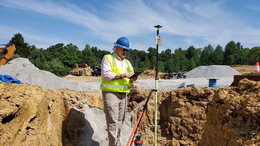
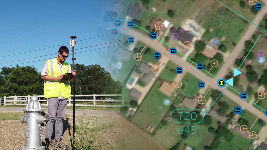
Assets enter the AWWU GIS through digitization. A GIS employee draws the hydrants, valves and other points from paper maps that have been scanned into the GIS. These points are then field-validated by field crews using GPS.
Not real time
The utility’s legacy GPS units were not real-time, so data would be captured in the field and taken back to the office for post processing. Afterwards, the GPS points would get entered into the GIS and validated against imagery aggregated from a variety of sources, including municipality-provided imagery.
This legacy process had become deprecated, though, and a better solution was needed to simplify the workflow.
Long location time
First, the GPS units themselves sometimes took thirty seconds to a few minutes to record a location. That time multiplies as field crews validate a couple hundred points per month, on average.
Missing data
Next, GPS points sometimes went “missing” during the differential post-processing task back in the office.
“We would get all the data back on the map, and some of them would have gotten lost,” Senior GIS Analyst Dave Boulier said. “Therefore, we would have to go out and GPS the points again.”
Inaccurate
Finally, the imagery validation step showed Boulier that the GPS points were not always within the six-foot error range of accuracy he could tolerate.
“With our imagery, it was clear if the GPS points were not within six feet,” he said. “The legacy GPS units said they were submeter, but we were not always getting that.”
About the Solution: Asset Acquisition with Arrow 100 GNSS Receivers, Esri Portal for ArcGIS, and ArcGIS Collector
“The Arrow 100 was the clear winner. Once you get a signal and it locks on, it’s almost instant collection. A lot of the times, it’s even better than half a meter.”
— Dave Boulier, Senior GIS Analyst, AWWU
During their 2017 GPS pilot test, the AWWU GIS team had already tested five different models of new GPS units. They tested on both iOS® and Android devices, and ultimately selected the Arrow 100 receiver to replace their legacy GPS units.
Choosing the Arrow 100
“The Arrow 100 was the clear winner,” Boulier said. “Once you get a signal and it locks on, it’s almost instant collection, and we’re getting submeter locations. A lot of the times, it’s even better than half a meter.”
The GIS team stood up Esri ArcGIS Collector, a map-based data collection app, on utility-owned iPhone® 7s. Approximately 50 field crew members share 18 Arrow 100 GNSS receivers when writing data to Collector. The GIS team also installed another Esri app, Explorer for ArcGIS, for field crews to access live data but not write to the database.
Setting up Portal for ArcGIS
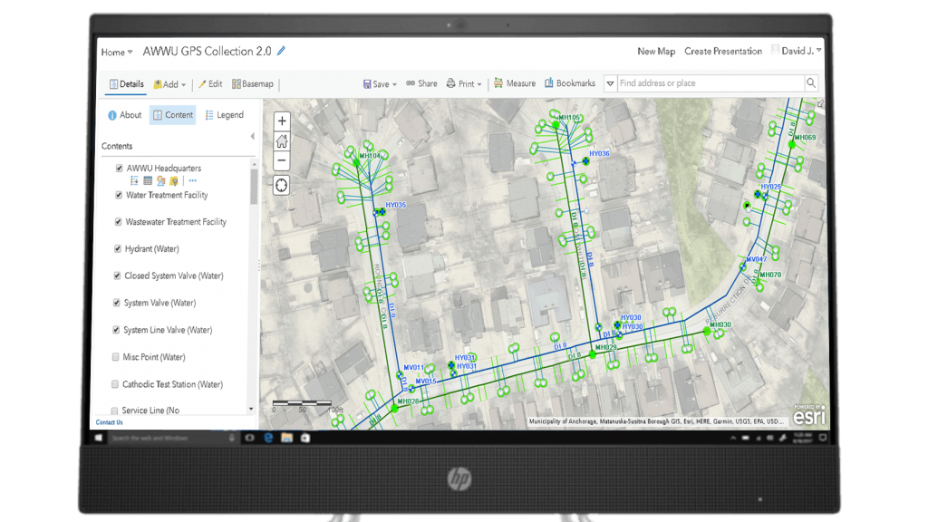
The Technical Services team collaborated with the GIS team to provide an Esri Portal for ArcGIS environment, which enabled secured, server-based access to read and write to the enterprise GIS in real time.
“We were able to integrate our Active Directory to where anyone with authorized credentials can use their login to access, update and share our web maps,” Boulier explained. “So our crews in the field are able to look directly at our local database, pull that data, and write directly to the database, without having to post-process.”
This also enables office teams to view live data from the field in Esri Enterprise Portal.
“As long as their screen is refreshed in Portal, someone in the office can see what’s being done in the field instantly,” Boulier said.
About the Results: Happy Field Crews, 25 Percent Savings
“A lot of times it can be challenging to ask your colleagues to adopt new technology. But with this, it seemed to click with everybody.”
— Dave Boulier, Senior GIS Analyst, AWWU
Saving 25 Percent
By eliminating post-processing, the teams were also able to eliminate the data loss that previously resulted in repeated field trips. Boulier estimates this improvement alone increased their asset acquisition by at least 25 percent.
“It’s big-time cost savings,” he said.
Rolling Out to Field Crews
On September 25, 2018, with the support of all groups involved, AWWU rolled out the new GPS data collection workflow utility-wide.
“It has been a pretty seamless rollout,” Boulier said. “A lot of times it can be challenging to ask your colleagues to adopt new technology. But with this, it seemed to click with everybody. It’s been fun to get this all set up, see it function in the field, and see everyone happy with it. It has sparked a lot of ideas.”
Future Opportunities
In the future, AWWU plans to use the Arrow 100 GNSS receivers for additional types of work, such as locating pipe main breaks.
“There’s so much stuff we can do,” Boulier said. “The whole GPS program has really pushed the utility to move forward with using ArcGIS Online and Portal.”
AWWU is also using live web maps to communicate ongoing projects to Anchorage residents. View AWWU’s public story maps here.
About the Author: Senior GIS Analyst Dave Boulier
Guest Post by Contributing Customer David Boulier, Engineering Technician IV, Strategic Asset Services Section, Engineering, at Anchorage Water & Wastewater Utility
David Boulier has worked for Anchorage Water & Wastewater Utility for nearly four years. As Senior GIS Analyst, Mr. Boulier combines his significant practical field work experience with a deep knowledge of the Esri ArcGIS platform (both web and desktop), mobile mapping solutions, AutoCAD, FME, database management and cartography. His primary responsibilities at the utility are: maintaining spatial and non-spatial databases related to GIS, acting as liaison between GIS staff and clients or users of GIS products, capturing spatial and attribute data, analyzing data, designing and producing maps and web/mobile applications, modeling spatial data, as well as maintaining the various programming scripts that tie in many of AWWU’s systems together with GIS data. Mr. Boulier is an early adopter, often looking for ways the utility can take advantage of the latest technology to better serve customers and employees with both better solutions and greater cost savings. Eos would like to thank Mr. Boulier for contributing to this story.


