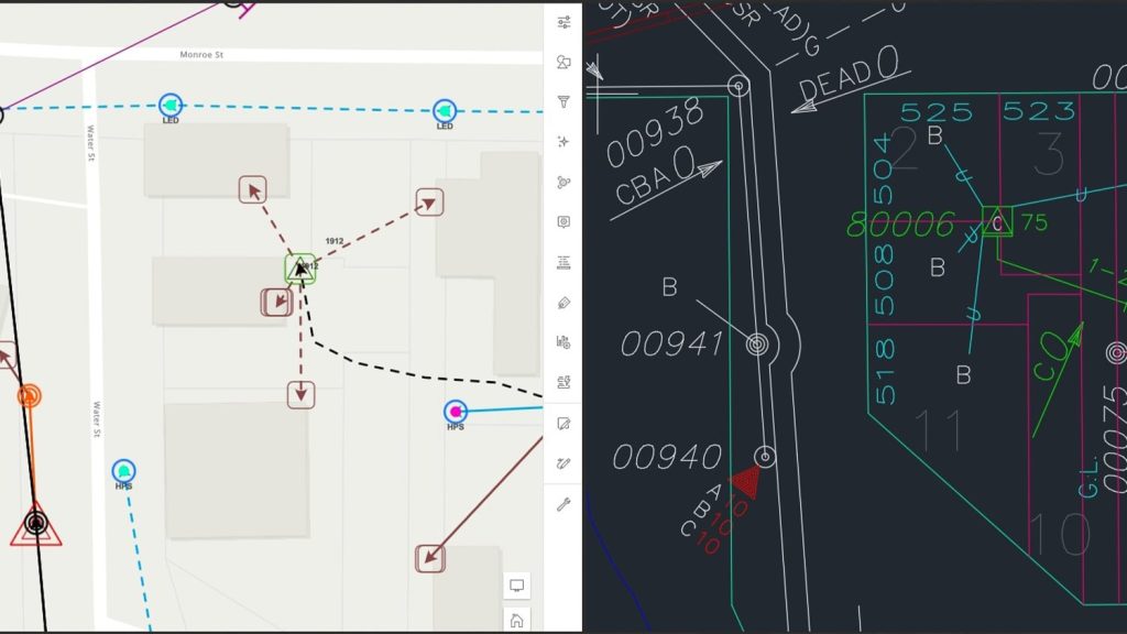
In his 35 years at Central Service Association (CSA), Charles Huddleston has witnessed the evolution of both the company itself and the utilities it serves. CSA is a not-for-profit association dedicated to providing technical solutions to its member utilities. As the Senior Vice President of Engineering, Charles is committed to creating solutions that not only address the operational needs of utilities, but also prioritize ease of implementation.
At one time, mapping and managing distribution networks was a labor-intensive manual exercise. Early on, Charles saw how technology could improve his processes with what is now known as a geographic information system (GIS). Charles next helped expand CSA’s offerings to include a mobile mapping solution, using the Eos Arrow 100® global navigation satellite systems (GNSS) receiver for real-time, high-accuracy locations. Today, information about a utility’s distribution networks is available with a few clicks of a mouse.
Learn more about Charles’s commitment to providing best-in-class solutions!
1. Why are you passionate about your job?
What makes me passionate is the emphasis we place on service. Service is a part of our name, and that’s our focus. The desire to serve our member utilities is central to everything we do.
Growing up, my dad was a utility manager, so I saw how utilities work from the inside. I did not think about it at the time, but as I age, I realize he exemplified the same values that now guide me. He did things the right way, the first time – no shortcuts. When I was in grad school, my research focused on modeling utility networks. When I graduated, CSA gave me the opportunity to continue that work. I find it very fulfilling to help utilities operate more efficiently.
2. How did you first find out about Eos Positioning Systems’ GNSS products?
CSA has been around for 85 years; I’ve been around for 35 of them. Before I got here, we provided mainly billing and financial systems. I was the first person in the engineering department and was tasked with developing a new engineering and operations toolset for utilities. Soon after I arrived, we surveyed our member utilities, and one of the things they wanted was an automated mapping and facilities management (AM/FM) system. Today, we call it GIS. So, we have been in the GIS business for over 30 years.
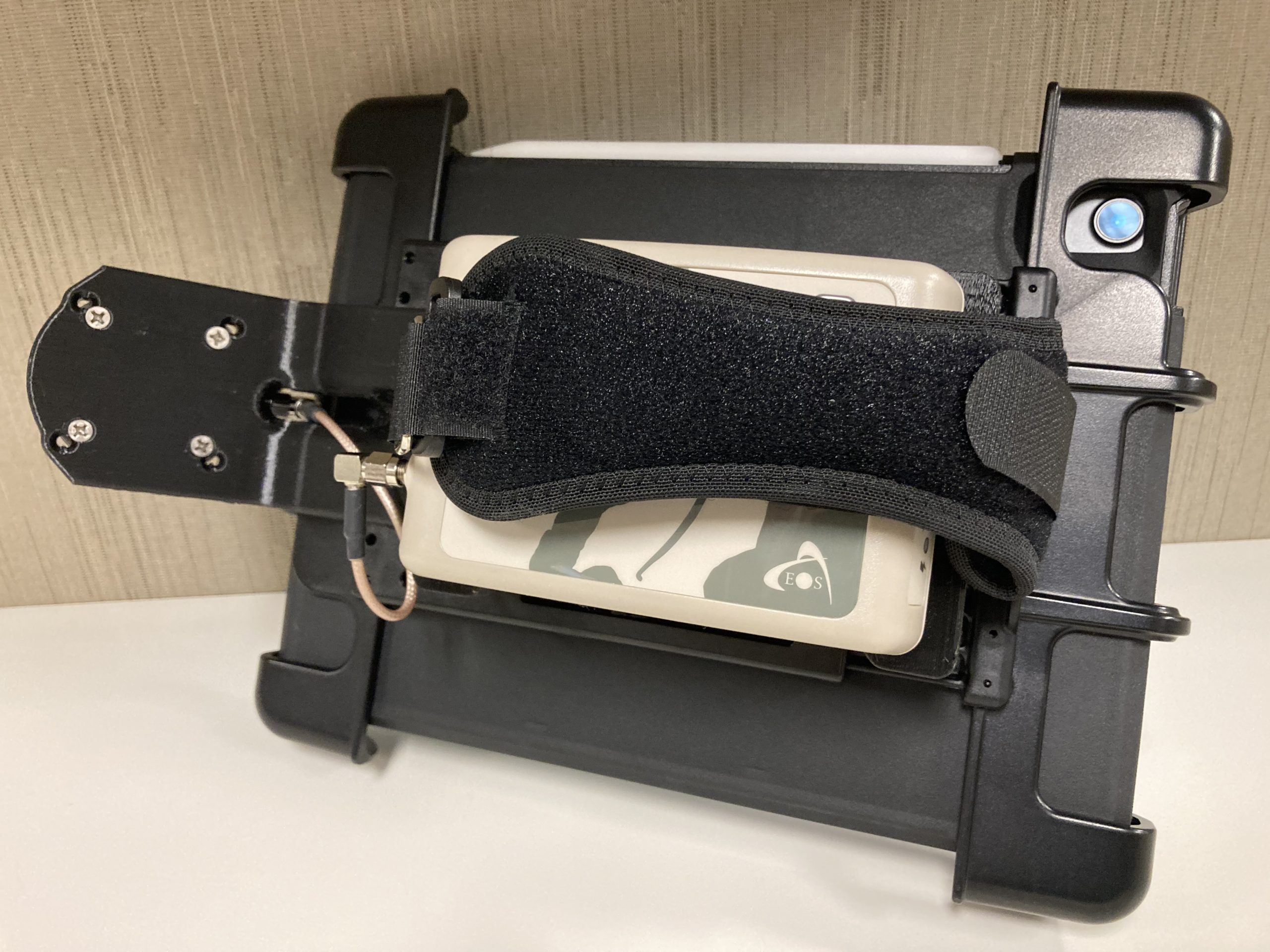
I found out about the Eos Positioning Systems® and Arrow GNSS receivers when we needed a way to provide our utilities with mapping capabilities on an iPhone® or iPad®. At the time our utilities were using a legacy GPS receiver to do a field inventory of their facilities, but they really wanted to do this on their iPhones and iPads.
So as luck would have it, while attending a conference, I talked with a fellow attendee about what I wanted to do. He said he had evaluated several GPS devices and recommended the Arrow Series®. So, we tested it with our software app UtiliGo, found it worked very well, and have been recommending it to our member utilities ever since.
3. What do you use Arrow Series® GNSS receivers for?
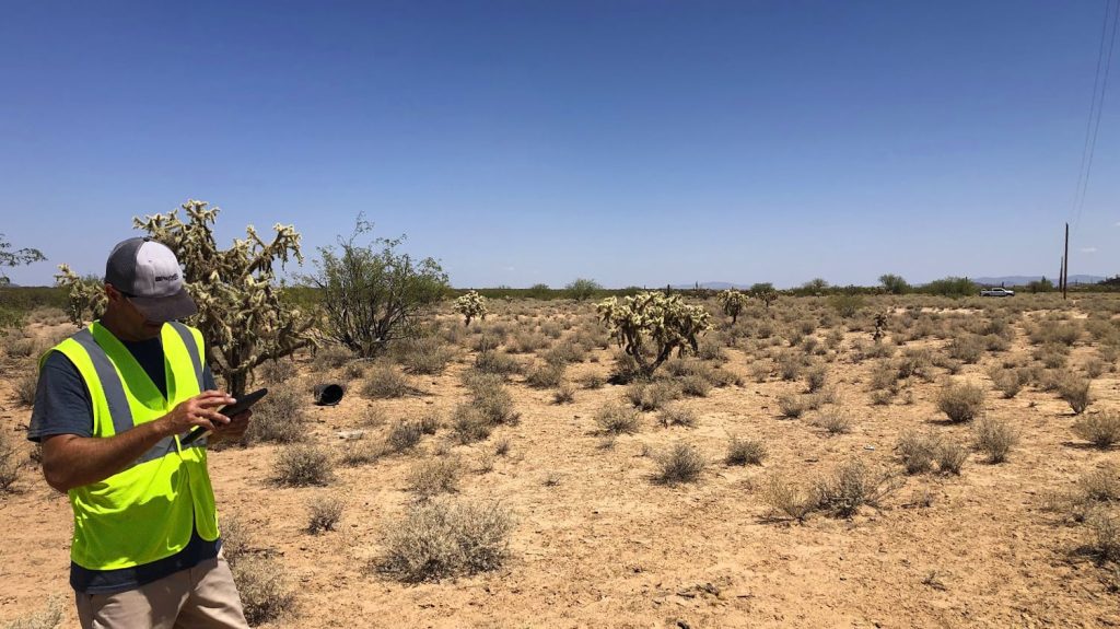
Right now, we use the Arrow 100 GNSS receiver with UtiliGo for field inventory. A good example of this is a small multi-service municipal utility providing electric, gas, water, and wastewater services. Several years back we converted their data from another system, but it had not been updated in years and was inaccurate. The new water superintendent wanted to update and capture their water facility locations. After seeing a demo, they agreed to be the first utility to use UtiliGo and the Arrow 100 in combination. The utility captured water valves, isolation valves, water lines, and meter sites (or customer locations) for their field inventory. They are very happy with the location accuracy and the overall results.
4. Do you have a favorite experience or memory from your projects with Eos Arrow?
The person in charge of data collection, and importing data into GIS, doesn’t really like computers. He was just not a technology guy. But once we showed him how to collect and view data on his iPad — well, now you can’t take his iPad away from him!
That would be the utility I just mentioned. The person in charge of data collection, and importing data into GIS, doesn’t really like computers. He was just not a technology guy. But once we showed him how to collect and view data on his iPad — well, now you can’t take his iPad away from him!
Another example comes to mind. We were exhibiting at a conference in Memphis. A utility was considering UtiliGo and asked if they could see how it worked. We went out on the streets of Memphis and did a demo using an iPad and the Arrow 100. Even in the middle of the city with the surrounding buildings, we got about 30 centimeters of accuracy. They were extremely impressed and are now UtiliGo users.
5. Do you have a favorite feature of Arrow GNSS receivers?
I have three. A big one is the Bluetooth® integration. After you pair it the first time, all you have to do is turn it on, and it just works every time.
The second is the availability of Wide Area Augmentation System (WAAS) corrections. For our utilities, that is a big deal. We work with a lot of small utilities, and budgetary constraints are a fact of life. So, any time we can utilize something free, that works, it’s a big win for everyone.
The final thing is the repeatability of the receiver. The colleague who recommended Arrow did testing on a variety of GPS receivers. He had a line of poles outside his workplace and would go out and shoot the same poles repeatedly with each GPS. The Arrow had the best repeatable accuracy.
Is there anything we didn’t ask you that you’d like to share with us?
The Arrow works as advertised and has been a huge help for us and our utilities. Looking ahead, we’re working on a new field staking solution. Our utilities have wanted this for a long time, but existing technology was not robust enough to provide the benefits our utilities needed. Technology has now advanced to where I believe we can provide a reliable, easy-to-use application that saves time, making their jobs easier and their operations more efficient. I’m really looking forward to beta testing later this year.

