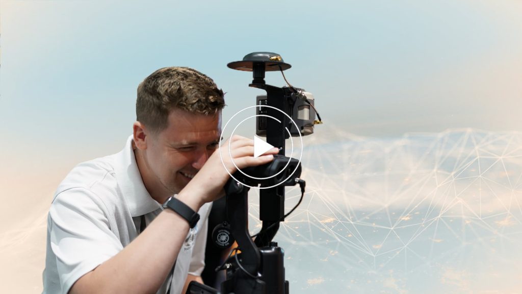
Damon Nelton always rises to the occasion. As the GIS Manager at Ellingson Companies, Damon’s goal is to make high-accuracy mapping accessible to all team members — even those with no prior experience in geographic information systems (GIS). When high-accuracy locations proved necessary for a gas-distribution construction project in 2019, Damon researched easy-to-use, high-accuracy global navigation satellite system (GNSS) receivers that his construction crews could implement in their daily work. Eos Arrow receivers with Esri’s ArcGIS® mobile apps became his solution.
Now, Damon has shared his GIS best practices across the company and even deployed more advanced workflows, such as Eos Laser Mapping™ for ArcGIS, in order to achieve his goals. We wanted to get to know Damon to learn what drives his passionate determination.
Keep reading to learn more about Damon …
1. Why are you passionate about your job?
What’s not to love? It’s maps, it has the juice. I have a continuous itch to learn and a hatred for being bored. GIS is fast and furious — there is never a dull moment. It is always changing and offering something new to figure out. I manage a growing team of GIS professionals and power-users at Ellingson Companies. It can be challenging at times when we are tasked to create new workflows and procedures, but we’re fortunate to have leadership who support us with the resources we need to overcome obstacles and to be successful. There is no better rush or excitement than being part of a team of all-stars cracking the code to a new GIS solution that could change the way a company of 50+ years does business!
2. How did you first find out about Eos Positioning Systems’ GNSS products?
We had a gas-distribution construction project that required us to track and survey buried assets as they were installed. Ellingson Companies already has an in-house survey team who assist with designing and installing agricultural-drain tile systems. However, this gas project was not going to have the survey team involved. We decided to research the acquisition of our own GNSS receivers because we knew the survey team’s equipment would be expensive and too complicated to deploy to our regular construction foremen. After some research for our options, we learned about the Eos GNSS receivers. During our evaluation of the product, we realized how affordable and easy to use it was for our non-GIS personnel. The Eos GNSS receivers also integrated seamlessly with our Esri mobile data collection apps.
3. What do you use Arrow Series® GNSS receivers for?
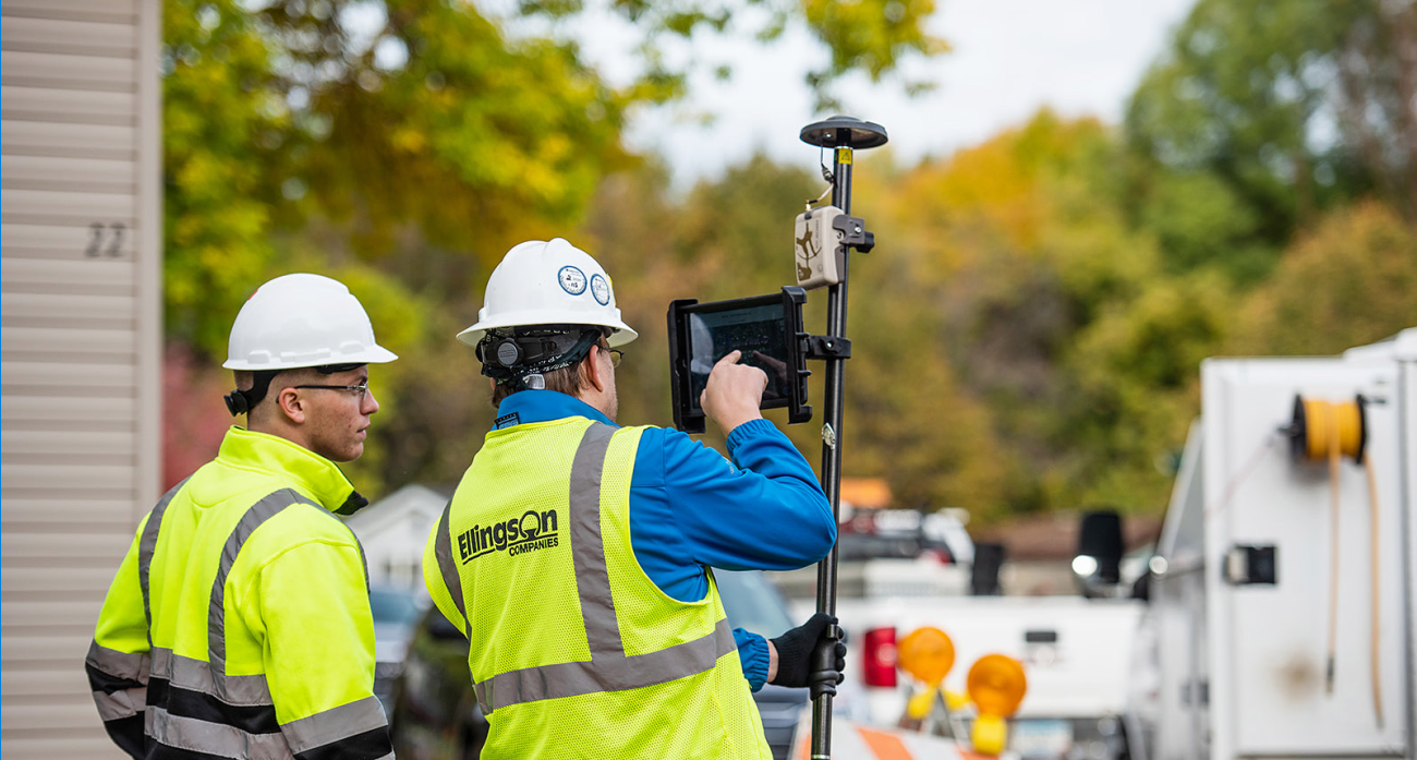
After completing our first project using an Arrow 100®, word got around quickly throughout the company about a new, easy way to record high-accuracy location data. Word also spread that this technology could be used by people with no prior GPS nor GIS knowledge. The feedback was positive. Ellingson Companies now owns a handful of both Arrow 100 and Arrow Gold® GNSS receivers, which are used throughout many of our divisions to record location data of mostly buried assets.
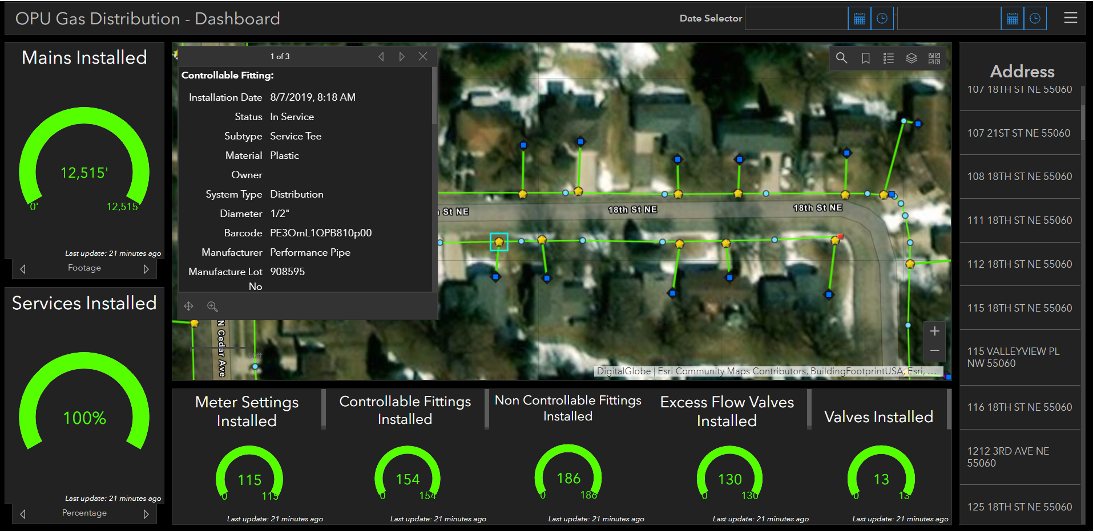
4. Do you have a favorite experience or memory from your projects with Eos Arrow?
As I mentioned above, there is nothing more thrilling than being part of a team that adds value with a new workflow; it’s powerful to know that you can improve the way an established business operates. My favorite story is about one of our company foremen, and this particular employee might just be allergic to technology. Within my first week of meeting this foreman, he had already broken three cell phones due to his bear claws. But there’s a positive twist. After training him for a few minutes on laser mapping with an Arrow GNSS receiver, he was actually able to capture gas meters located under house-roof eaves with high accuracy. This was one of the most fun experiences of my job.
5. Do you have a favorite feature of Arrow GNSS receivers?
In short, it’s the simplicity. Everyone at Ellingson Companies — from our experienced surveyors to our field crews and interns — find that the Arrow GNSS receiver just works. Its relative cost point is favorable, the learning curve is short, and our crew enjoys using it! We also like the Atlas® add-on satellite service that allows us to capture four- to six-inch accuracy in areas where we must work offline and have no access to RTK networks.
6. Is there anything we didn’t ask you that you’d like to share with us?
The Eos products have helped our crews transform from the traditional pen–and–paper workflow to a fully digital, real-time as-builting powerhouse. I foresee Ellingson Companies continuing to use Eos products and expect Eos to continue to innovate and push the limits of what’s possible.

