Cross-department team transitions to GIS data collection to face COVID-19 challenges
COVID-19 has changed everyday life as we know it — for many people, it has also drastically changed their work lives. For those under a shelter-in-place order, if their jobs cannot be done within the comfort of their homes, they may not have work at all. The City of Sarasota is actively working to avoid this potential issue through innovative field-mapping solutions. Their determination and creativity make our April Customer Spotlight: City of Sarasota a pleasure to deliver to you!
Navigating through difficult times
“He asked us to think outside the box for what we could do to create new projects,” Sarasota IT Director Herminio Rodriguez said.
Due to necessary workplace changes surrounding COVID-19, many staff at the City of Sarasota found themselves under-utilized or idle. The city wanted to find a way to keep their employees working while still managing taxpayers’ dollars effectively.
City Manager Tom Barwin put out a notice to all departments looking for creative ways to occupy these city workers. They needed tasks that were simple to implement while observing social-distancing best practices.
“He asked us to think outside the box for what we could do to create new projects,” Sarasota IT Director Herminio Rodriguez said.
Identifying an opportunity
“By implementing this project, we not only keep City staff productive, but we’ll also be collecting data that would otherwise cost hundreds of thousands of dollars if we outsourced the work,” Rockwell said.
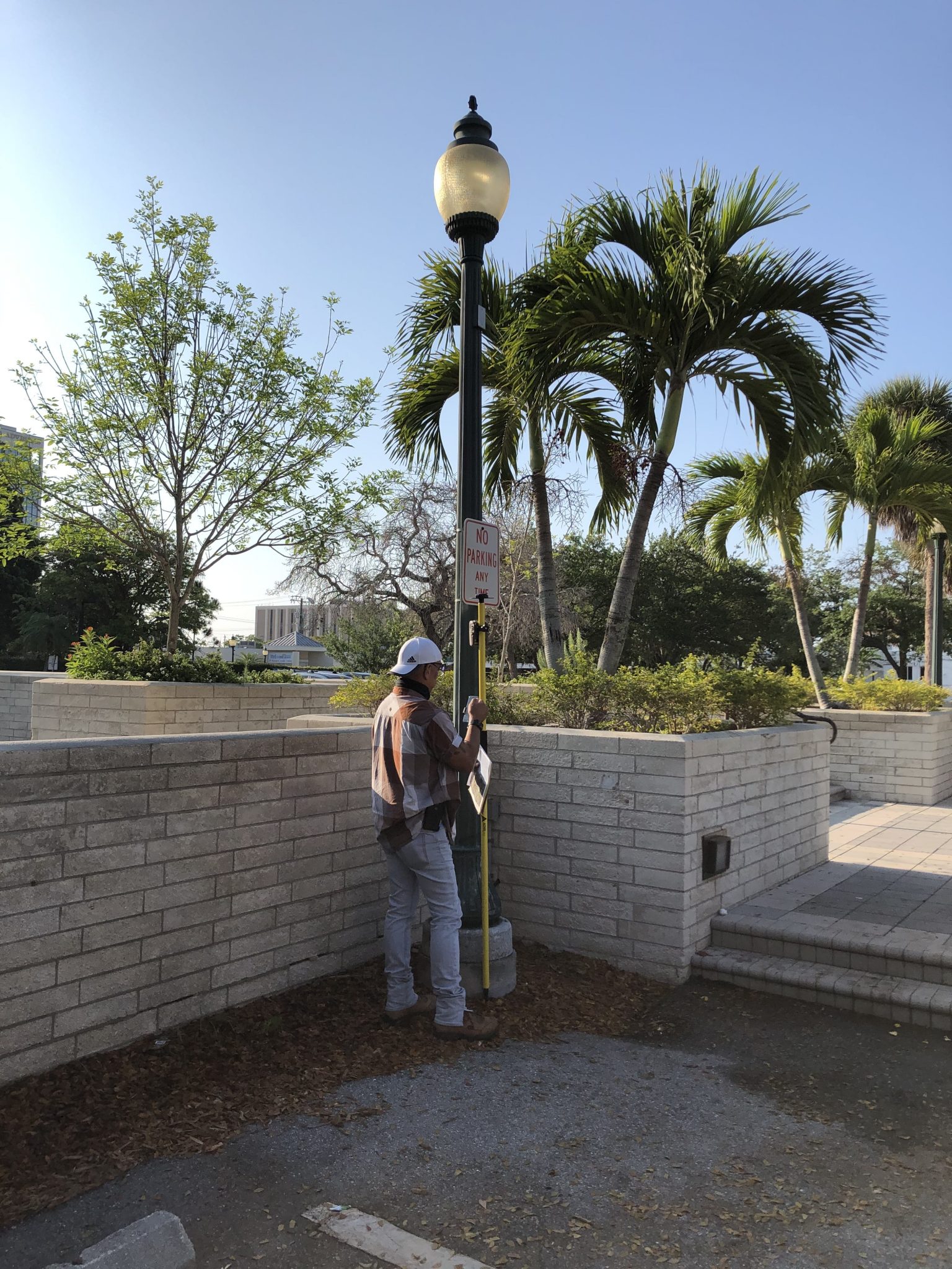
GIS Coordinator William Rockwell recognized an opportunity that could benefit all parties. He realized Sarasota had a history of outsourcing GNSS (GPS) data collection — costing the city hundreds of thousands of dollars. To make matters worse, the data was fairly inaccurate.
The city’s existing plan to rebuild its GIS database had an estimated five-year timeline. Normally, they wouldn’t have the staff or free time to collect this data any quicker. But COVID-19 presented a unique opportunity. By training otherwise idle staff to collect this data internally, the city estimated it could save hundreds of thousands of dollars in outsourced labor while updating crucial utility information in their GIS. This would also, at the same time, keep employees working during the crisis.
“By implementing this project, we not only keep City staff productive, but we’ll also be collecting data that would otherwise cost hundreds of thousands of dollars if we outsourced the work,” Rockwell said.
Together, Rockwell and Rodriguez calculated the cost of acquiring enough GNSS receivers for the idle staff to use and pitched the idea to upper management.
“The financial commitment was small from the city, but the return was huge,” Rodriguez said. “We could start capturing this massive amount of data that we really need. Once we put the whole picture together, the city management really liked it.”
Creating an easy-to-learn experience
From prior experience in field mapping, Rockwell knew that the technology would need to be extremely user-friendly so that people from any background could easily be trained.
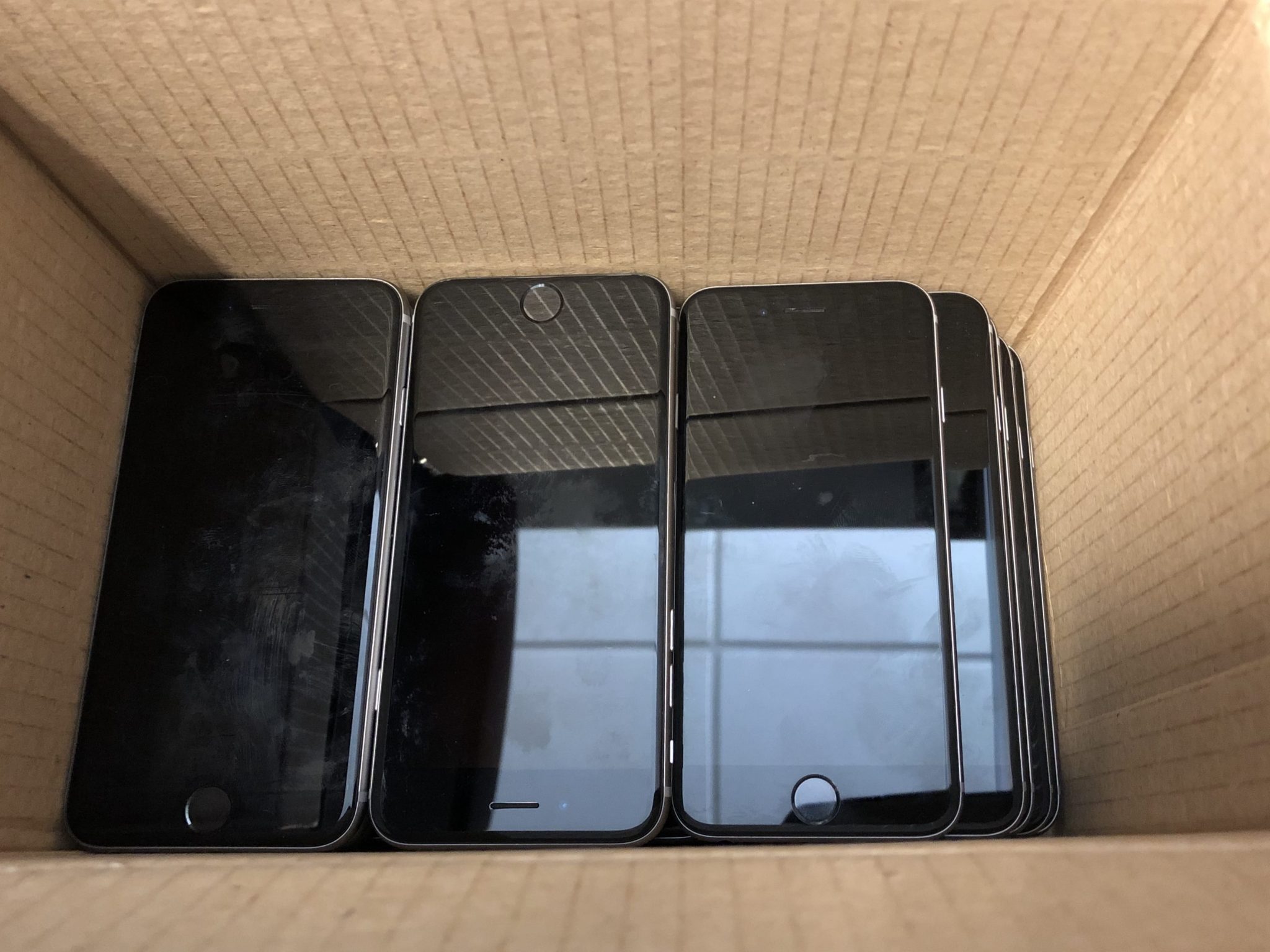
First, he decided to use what he already had available — a box of unused iPhone®s from the city — as offline data-collection devices. Since Sarasota already had an enterprise license agreement (ELA) with Esri, Rockwell had access to licenses of ArcGIS Collector. All that was missing were the GNSS receivers to complete the data collection system.
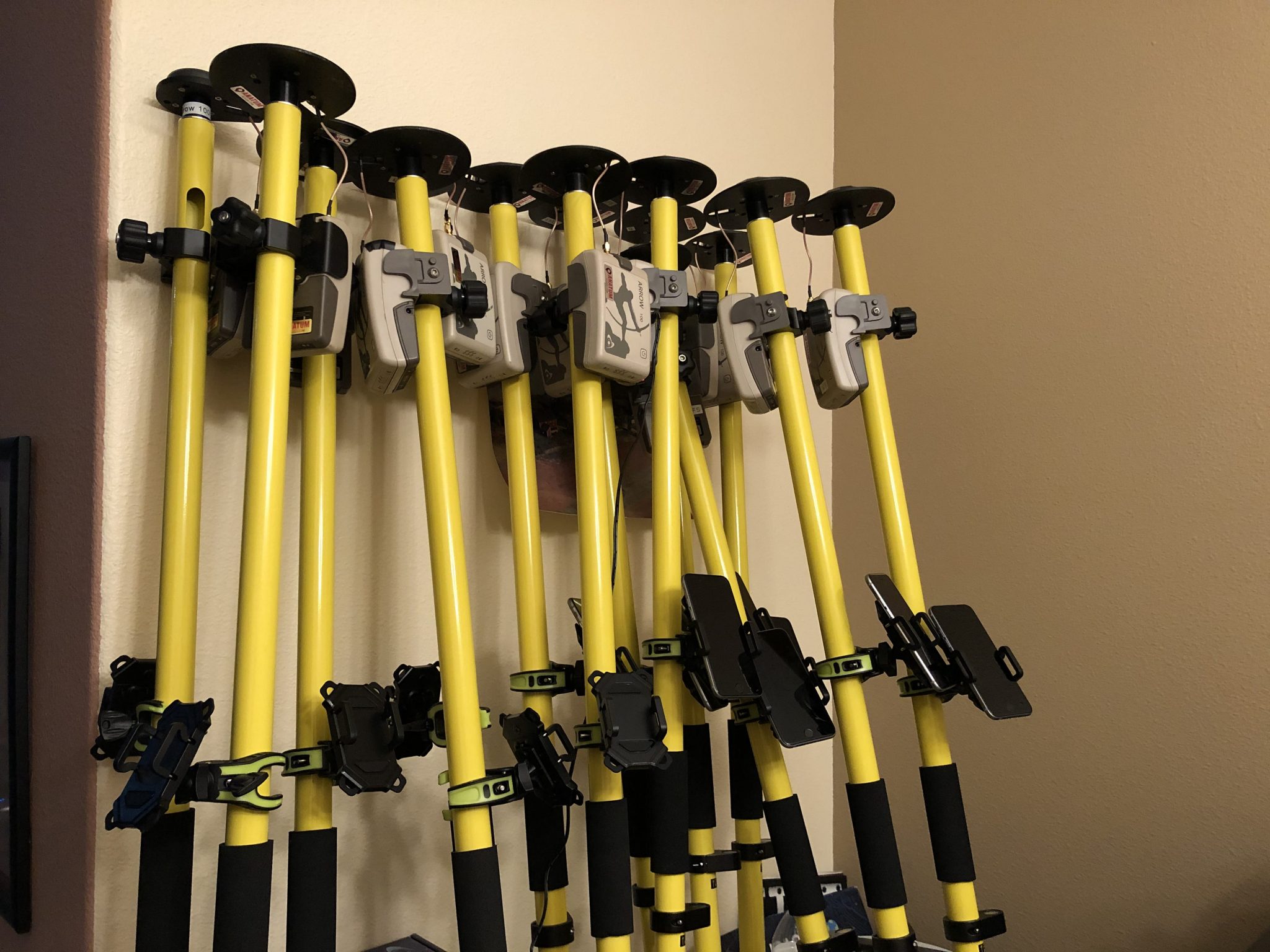
For this, Rockwell approached the city’s existing GPS vendor for 14 Eos Arrow 100 GNSS receivers. He then set them all up on range poles in his living room.
He then gathered the first team of trainees, which consisted of employees from a multitude of different departments: a parking enforcement officer and a transportation planner, just to name a few.
Training from a distance
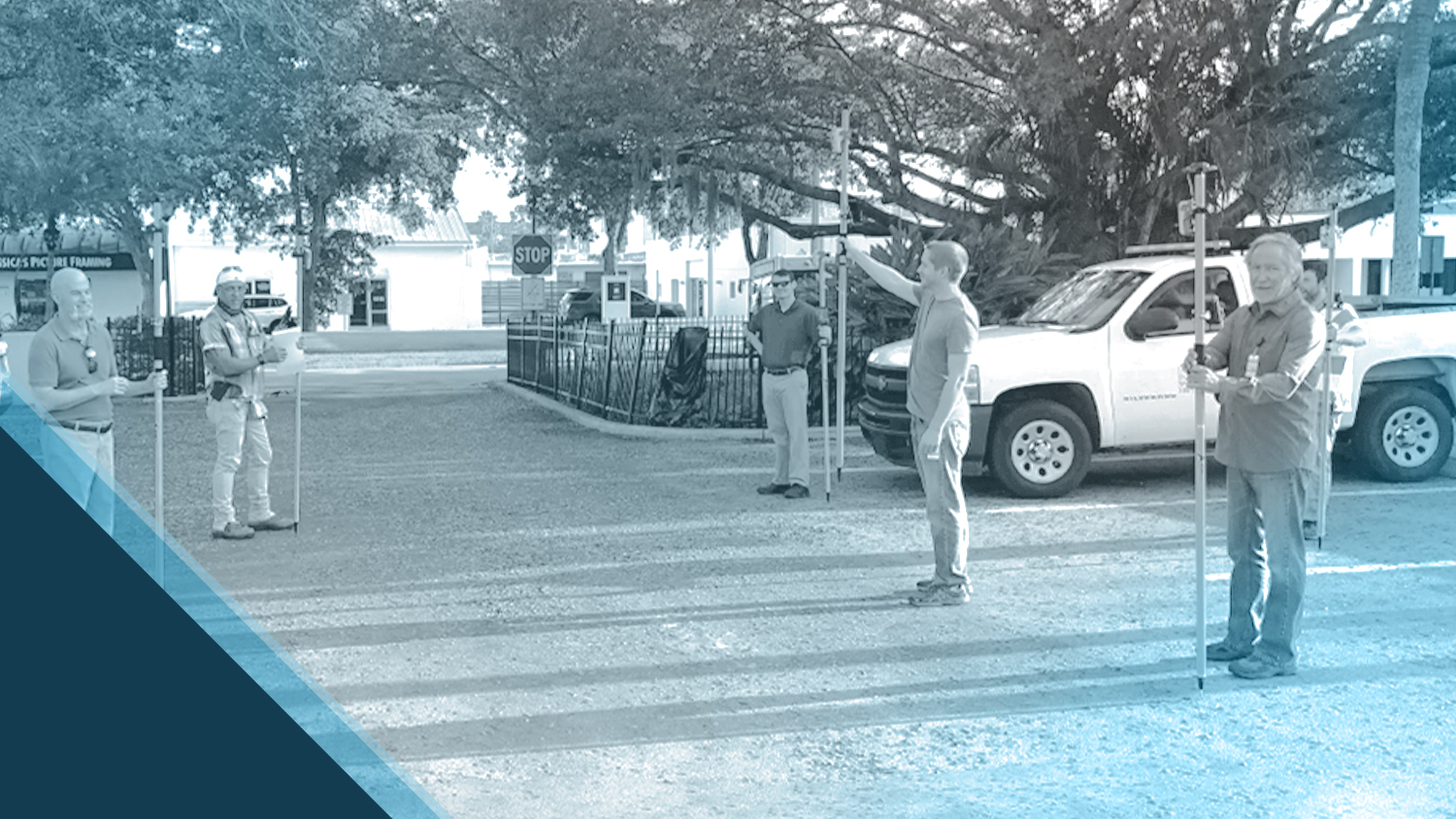
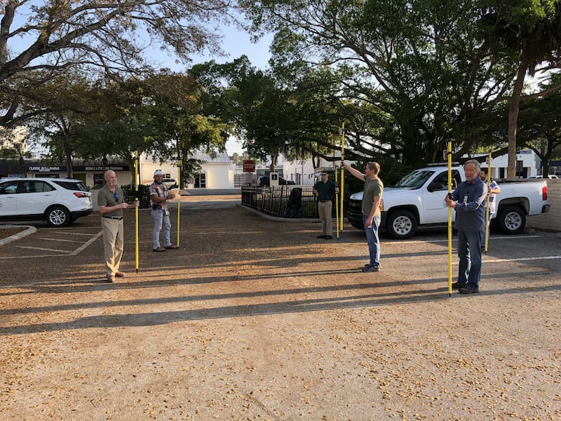
Rockwell hosted small-group training sessions in the city hall parking lot. Each employee was carefully separated six feet apart. From a maintained distance, Rockwell explained the basic concept of data collection using the high-accuracy Arrow 100 receivers with Collector.
The employees took turns collecting sample data so Rockwell could address any initial concerns. He also gave each of them a printed map series, created in ArcGIS Pro, that showed 28 grids of the city. This allowed the team members to easily mark off where they collected data each day.
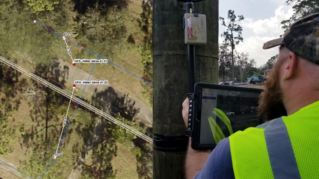
The Arrow 100 was both user friendly and effective. Under perfect satellite-visibility conditions, their accuracy was as good as seven inches, though under moderate canopy, they achieved an average of 2.5 feet (or 0.8 meters) accuracy.
At the end of each day, the workers synced their data to ArcGIS Online, which allowed Rockwell to monitor progress. These online collaboration features were key to making this socially distanced project successful.
A boost for employees and the city as a whole
“I’m thrilled the city is supporting this initiative,” Rodriguez said. “To be able to take employees doing very, very different jobs and put them in the field – this wouldn’t have been possible in a normal environment. We are excited that everyone is chipping in.”
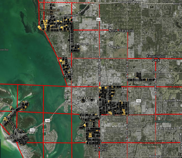
Through this type of agile innovation, the City of Sarasota has managed to turn the unprecedented coronavirus pandemic into an opportunity.
To date, seven field workers have collected 787 of the city’s 6,000 street lights and 1,690 of the city’s 16,000 road signs. Once finished, they will collect the city’s 35,000 trees. The project has been approved for 30 days, but it may well be expanded based on these encouraging initial results and on coronavirus developments.
Overall, the response to the project has been overwhelmingly positive.
“I’m thrilled the city is supporting this initiative,” Rodriguez said. “To be able to take employees doing very, very different jobs and put them in the field – this wouldn’t have been possible in a normal environment. We are excited that everyone is chipping in.”

