Joanna Tang is a Senior Ecologist and hands‑on habitat restoration champion for Vollmar Natural Lands Consulting. On any given day, you might find Joanna hiking through Southern California, surveying habitats, monitoring native species, getting her hands dirty planting a seedling, or chatting on the street with someone who will become her next restoration collaborator.
Surveys play a critical supporting role in her work, and Joanna is no stranger to mapping, whether it’s plants, infrastructure, site boundaries, or more. To build her maps, Joanna relies on a combination of Eos GNSS receivers (including the Skadi 100™ and Arrow 100®) and Esri apps (including ArcGIS® Field Maps and ArcGIS Survey123).
But Joanna isn’t just collecting data. She’s documenting the joy and purpose in conserving her local ecosystems. Explore her work in her own words below, and you’ll quickly see that her passion for conservation is contagious.

1. Why are you passionate about your job?
It’s so encouraging and empowering to know that I can play a part in helping my local ecosystem thrive.
As a habitat restoration practitioner, I get to, firstly, satisfy my curiosity by exploring outside and, secondly, contribute to my community by restoring and conserving native plants and animals. I love planting native species. I first learn about the ecosystem to understand what species would fit in, then get my hands dirty while putting plants in the ground, and finally watch the plants grow and provide habitat and food for native critters. It’s so encouraging and empowering to know that I can play a part in helping my local ecosystem thrive.
2. How did you first find out about Eos Positioning Systems’ GNSS products?
I heard about Eos products through a coworker. We were looking to replace old GPS units with new units that were accurate, reliable, affordable, Bluetooth®-enabled, and easy to use.
3. What do you use Eos GNSS products for?
Vollmar Natural Land Consulting is in the business of conserving and restoring California’s unique and endangered habitats, and to do that, we need to know where these habitats are. I use the Skadi and Arrow GNSS receivers for mapping biological resources and threats. Our surveys span a range of types: We might map interesting plants and animals in a reconnaissance survey; infrastructure, as a baseline for conservation easements; habitat polygons and population stands in a habitat assessment; special species occurrences on project sites; start- and end-points — or even a whole route — of a survey; the location of a monitoring plot or species invasion I need to revisit; or sometimes my favorite camping spot on a project site … the possibilities are endless!


4. Do you have a favorite memory from your projects with Eos hardware?
My favorite memory is forgetting that I’m using the GPS. It’s so easy to turn on, integrate with our mobile device, and then pack away. No fiddling with an excess of wires, buttons, or bulky parts that you have to hold.
5. Do you have a favorite feature of Eos GNSS receivers?
My favorite feature is its seamless Bluetooth® capabilities. This allows me to integrate it into any app I’m using on my mobile device, like ArcGIS Survey123 or ArcGIS Field Maps.

6. Is there anything we didn’t ask you that you’d like to share with us?
Eos reps are very helpful, responsive, and friendly. They really want to help you get your job done.
Explore Related Content

The First All-Canadian Antarctic Expedition Uses Galileo HAS and Eos GNSS to Map Underwater Features
Discover how the first all-Canadian Antarctic research expedition achieved high-accuracy underwater mapping using the Arrow Gold+ and Galileo HAS — all in one of the world’s most remote, RTK-free environments.
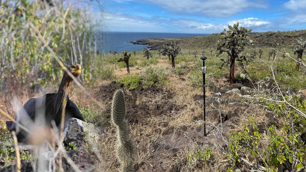
Do Giant Tortoises Make Good Neighbors?
Charles Lehnen uses brand-new Galileo HAS corrections with the Arrow Gold+ in the Galápagos archipelago. His work will study Santa Fe Island’s rewilding.