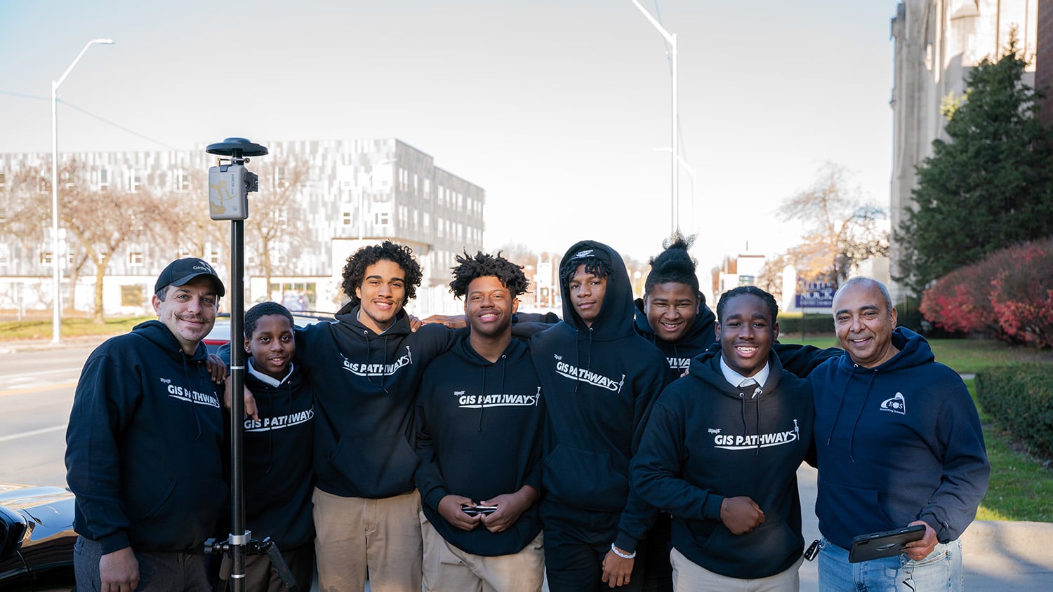
In Detroit, Michigan, a transformative program is helping high school students map their futures. The GIS Pathways program at Frederick Douglass Academy at Northern High School (FDA) is a 9-12th grade program providing instruction in geographic information systems (GIS), high-accuracy global navigation satellite systems (GNSS), drones, and related skillsets.
The program, which began in 2019, offers a unique blend of both technical and life skills.
Watch the video to hear the story from the students and faculty of FDA!
About FDA: The Genesis of a GIS Program
FDA is the only all-male, tuition-free public academy in the state of Michigan. Initially conceived as an alternative school for young men, it has evolved into a rigorous application-based institution with a strong emphasis on science, technology, engineering, and math (STEM) curriculum.

When Dr. Willie L. White II came on board as school principal, he searched for ways to include courses that would enhance students’ future career prospects. Recognizing the diverse career paths offered by GIS, he collaborated with then-science teacher and current GIS Pathways Lead Instructor Chad Segrist to develop the GIS Pathways program.
“GIS provides students a pathway to a particular career immediately out of high school,” White said. “You can use it in a number of different environments.”
To ensure a robust learning experience, FDA assembled a board of industry experts to guide students across many professional applications of mapping. Board members, who come from the private sector, help lead classes, facilitate connections with other industry professionals, and provide the students with valuable mentorship.
Detroit-based Esri Partner OHM Advisors has two employees on the GIS Pathways board. Partner and GIS Practice Lead Michael Cousins instructs the students in GIS, and Senior Technical Lead Ray Lillibridge teaches them how to fly drones, process the data, and even prepare for the FAA Part 107 pilot license exam. Meanwhile, RomoGIS founder Frank Romo also teaches the students GIS along with lessons in entrepreneurship.
“We really try to have those all-encompassing support systems so that students can get mentorship,” Romo said. “They can get technical expertise. They can get those soft skills. That’s really, I think, what makes this program different.”
Mastering Mapping
All FDA freshmen learn the fundamentals of GIS in their first year of high school. At the end of their first year, students decide if they’d like to continue with GIS Pathways based on an exit interview. On average, the program maintains a 94% retention rate.

After deciding to continue with the program, each GIS Pathways student who successfully completes the coursework can receive up to three Eastern Michigan University (EMU) credits annually, accumulating up to nine college credits by graduation. This helps reduce education costs for university-bound students and imparts valuable employment skills to those who do not continue to a university.
“Programs like this help students get more exposure to the real world or a new trade that they may not be thinking of,” FDA senior Xylon Holmes said.
As sophomores, GIS Pathways students learn ArcGIS® Pro software, data analysis, and the basics of mapping with high-accuracy GNSS receivers. Additionally, they initiate practical flight training, immersing themselves in the usage and operations of unmanned aerial vehicles (UAVs).
In their junior year, students delve into an enhanced curriculum where they deepen their understanding of data analysis, map creation, and high-accuracy GNSS data collection. This coursework involves collecting and utilizing their data and advancing their proficiency in web tools to support their work. The class also undertakes an advanced UAV course, further honing their skills in drone operation with georeferenced imagery.
In the final year of the program, students prepare to take the FAA Part 107 drone licensing test, create individual capstone GIS projects, and are encouraged to pursue paid internships. These internships have ranged from positions within the Detroit mayors’ GIS team to opportunities with consultancies such as RomoGIS.

Capturing Accurate Drone Imagery with High-Accuracy GNSS
Having the Arrow Gold has really allowed us to take this to the next level and teach them the full evolution of mapping with a drone. It allows our students to understand the full process from start to finish.
To develop their skills, students engage in real-world GIS applications through outdoor data collection labs. They use the Arrow Gold® GNSS receiver and ArcGIS Field Maps on iOS® and Android™ devices to map the locations of highly visible chevrons (large, arrow-shaped targets painted on the ground) with centimeter-level accuracy. Later, these chevron locations are used as ground control points (GCPs) to georeference drone imagery captured during class.


“Having the Arrow Gold has really allowed us to take this to the next level and teach them the full evolution of mapping with a drone,” Cousins said. “It allows our students to understand the full process from start to finish.”
Using the mobile setup is seamless for students, who have been using Bluetooth® devices like smartphones from a young age.
“My favorite part was setting up the Arrow Gold,” FDA senior James Coleman said. “It was easy for me to set it up and take it down.”
The students also capture imagery of the school grounds with a DJI Phantom 4 Pro drone. Lillibridge helps guide the students on their drone flights.

“They become excellent pilots, a couple of them even better than me,” Lillibridge said. “And with that they become confident enough to help guide the other students who may not have as much experience or are new to the school.”


After collecting both the GNSS data and drone imagery, Lillibridge assists the class in using ArcGIS Drone2Map to combine both elements into highly accurate 2D and 3D products. These can include orthophotos, orthomosaics, digital terrain models, 3D point clouds, or 3D mesh models.

“It’s amazing to see the students when they have that realization of what they’ve created,” Lillibridge said. “We can see all the lines of the [school] building [they captured]. We can see the individual bricks. We can see waving people below. It’s one of those things where you say, ‘Yes, we did it.’”
Mapping Futures: Combining Technical Skills with Life Skills
GIS Pathways actively fosters students’ exploration of how these skills can be applied in prospective careers, university programs, and beyond, making future aspirations a central focus.
“We want our students to be able to take advantage of every opportunity that comes their way,” FDA Dean of Culture Lawrence Davis said.

The aspirations of the class are diverse. Some students want to become doctors, work as engineers, pursue web design, open their own restaurants or – yes – become GIS professionals.
“What I’m most excited about is the opportunity to learn mapping in ArcGIS Pro, and also drone flying,” FDA senior Ashton Colson said. “I’m going into the engineering field, so I can use these skills in my career.”
Since the program’s inception, GIS Pathways Lead Chad Segrist has experienced firsthand how students have improved not only their technology skillsets, but also their soft skills, such as confidence and self-expression.
“Their confidence grows,” Segrist said. “In not only their skill set and in what they can accomplish, but in the way they can work with others and talk with others.”
Many students credit the program with improving their social skills and mental health, as well as cultivating a sense of leadership.
“It has made me a better leader,” FDA sophomore Rico Lee said. “I’ve come a long way mentally, physically. It just helped me.”
Fostering Success at FDA and Beyond
Since GIS Pathways’ inception, FDA has transformed from an “F”-graded school to an “A”-graded institution. Their post-secondary enrollment rate has risen by 30%.
“Our approach utilizing GIS as a pathway has led to an increase in enrollment each and every year,” Segrist said. “Presently we have 84 students. That is an approximate 15% increase from the end of last year.”

Through the program, students have achieved milestones extending beyond school. In October 2023, FDA seniors DeAnthony Neal and Xylon Holmes were invited by the Urban and Regional Information Systems Association (URISA) to present at the GIS-Pro conference in Columbus, Ohio. Their presentation in the conference plenary showcased their senior project, which focused on mapping student bus routes. Following the conference, Neal and Holmes created an ArcGIS StoryMap to share their experience with their classmates.
Not only have GIS Pathways students presented their work at conferences, but they’ve also showcased their talents in drone competitions, winning numerous trophies. After each extracurricular opportunity, the students often share their experiences with each other, so that their entire cohort can benefit.
The program has changed the lives of many of these students and equipped them with knowledge, purpose, confidence, and camaraderie.
“The more you know, the stronger you can be,” FDA senior Keith Anthony Morales said. “I think knowledge is freedom. Knowledge is power.”
How You Can Be Part of the Journey:
To learn more about the GIS Pathways program, visit FDA’s ArcGIS Hub. To contribute financially to the students’ dual-enrollment GIS credits, visit this Eastern Michigan University (EMU) foundation page and donate to the “02790 – GIS Education and Career Development Fund”.
Download a PDF of this article in ENGLISH.
You May Also Like One of These Success Stories

Midland Co. Maps Flood Damage w/ OHM’s GPS Smart Bike
In this 2020 MiCAMP session, OHM shows how they used a GPS Smart Bike (Arrow GNSS, ArcGIS QuickCapture) to map Midland County flood damage.

Dalhousie University Maps Urban Forestry for HRM
Urban Forestry with Eos Arrow 100 and Esri Collector: See how students used Collector and Eos Arrow GNSS to hold contractors accountable and save Halifax Regional Municipality over $270,000.
