Note: This 2022 webinar was hosted by National Rural Water Association (NRWA) and sponsored by Eos Positioning Systems with special guests from Esri and Oldham County Water District.
Do you need a digital map that shows all your assets? Have you got staff retiring, or wish you had a laser-guided shovel when a line needs to be dug up, or just wish you could find assets faster in the field? Now imagine this map is not only accurate, but able to be updated in real-time by your field workers — on any mobile device, with quality assurance.
In this 60-minute webinar with Eos and the National Rural Water Association (NRWA), you will hear best practices from industry experts and see a real-life use case of a rural water district that is successfully deploying accurate, digital maps of their systems in Kentucky.
Watch the webinar recording in the video below, or scroll down to read the full transcript.
Welcome to the Webinar
CHEYENNE JONES: All right. Good afternoon, rural water. My name is Cheyenne Jones. I’m the PR and communications manager for NRWA. As most of you know, we host these webinars, and if you need a certificate of attendance, you will automatically receive one after the webinar is over.
Please allow at least a few hours to receive this and you’ll also receive a copy of the recording. And if you’re watching this as the recording later on, after the live date, email webinars (at) NRWA (dot) org or a request for your certificate of attendance and we will get one made for you. At this time, I’d like to hand over to Sarah to give some introductions.
Introductions
SARAH ALBAN: Awesome. Thank you so much, Cheyenne and welcome everyone to “Beginners Guide to Mapping with High Accuracy GPS.” My name is Sarah Alban. I’m the director of marketing for Eos Positioning Systems.
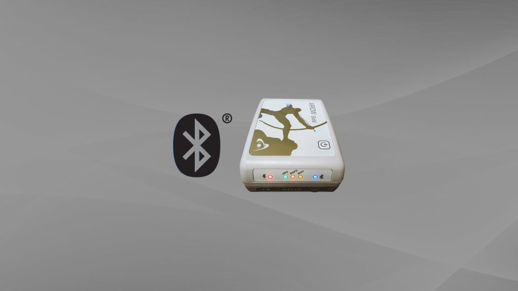
We are the Canadian manufacturer of high-accuracy Bluetooth GPS receivers for mobile crews, and we’re thankful to our partner NRWA and Cheyenne for hosting us today. We are also joined by special guests from both Esri and Oldham County Water District (OCWD).
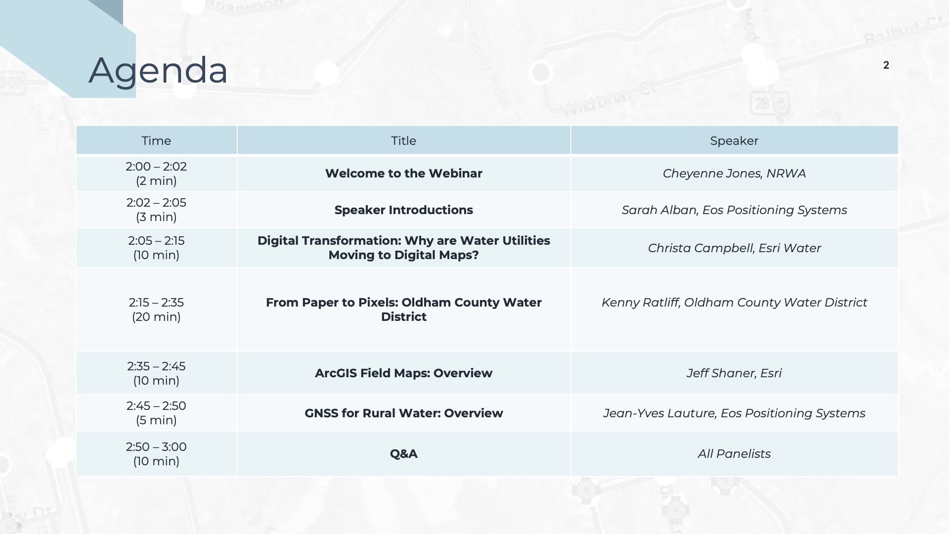
It is a full house today and we have an exciting agenda for you. First, Christa is going to start off by covering what is driving a demand for high-accuracy mobile mapping among rural water utilities. Then Kenny will share with us how his water district successfully went from paper maps to pixels and the value that they gained. And then finally, our two technology experts, Jeff and Jean-Yves, will take turns explaining the mapping, software and hardware enabling Kenny’s work. We are staying mostly at a high level, but we can always get more detailed during the Q&A.
Before I transition to our first speaker, just a few housekeeping items. If you have any questions or questions, please put them into the GoToWebinar chat and we’ll answer as many of these as we can at the end. Cheyenne and our speakers have been gracious enough to say, if we get a lot of questions, we’ll go just a little bit over.
And as for the recording, as Cheyenne said, you will receive this a few hours after the webinar closes. And then we also have some handouts for you that we’ve put together that you can download from the GoToWebinar sidebar, and those include an agenda to follow along. Those are estimated times on it, so we’ll try to stick to that as much as we can. We’ve got a written case study regarding the project that Kenny will talk to us about. And finally, we’ve got resources from all of our speakers.
I highly recommend downloading that handout. It contains a lot of helpful links, videos, blog posts, a lot of other things that you can access after the webinar. You can download any of those at any time.
As for troubleshooting, if you have any issues with the webinar, we recommend just closing it out and restarting GoToWebinar. So now let’s get to our speakers.
Christa Campbell

First off, we have got Christa Campbell. Christa leads Esri’s water industry team. She’s an experienced industry professional, a GIS advocate, and a lifelong learner. She’s a certified GIS professional and holds a graduate degree in geography.
Kenny Ratliff

Next up, we have Kenny Ratliff. Kenny has been the GIS Manager for Oldham County Water District in Kentucky for the past six years. And Kenny has more than 25 years of GIS experience and application in the areas of public water utility, emergency management, public health and military defense.
Jeff Shaner

Next, we have Jeff Shaner. Jeff is the Senior Product Lead for field apps also at Esri. With over 26 years of experience building software products at Esri, Jeff is focused on creating mobile solutions that simplify and improve the day-to-day operations of a mobile workforce.
Jean-Yves Lauture

And finally we have Jean-Yves Lauture. Jean-Yves, or JY, is the founder and CTO of Eos Positioning Systems. He’s actually credited with creating the world’s first Bluetooth GPS receiver, capable of providing one centimeter level accuracy into any iOS, Android, or Windows mobile device. It is also Jean-Yves’ birthday today. So please join me in wishing him a happy birthday.
And with that, we will go to Christa to learn first, why rural water professionals are seeing a higher need for and value in high-accuracy web mapping technology. Christa?
Digital Transformation: Why are Water Utilities Moving to Digital Maps?
CHRISTA CAMPBELL: Sarah, are you seeing my screen? Perfect. Then we’ll just get started.
I’m going to talk a little bit, as Sarah mentioned, about how utilities are shifting to digital maps and why they’re doing this. What benefit does it bring them? But before I get started, I would like to poll the audience.
If we could launch the poll, please? Okay. If you would take a few seconds to answer that poll, just whichever option is best applicable for you.
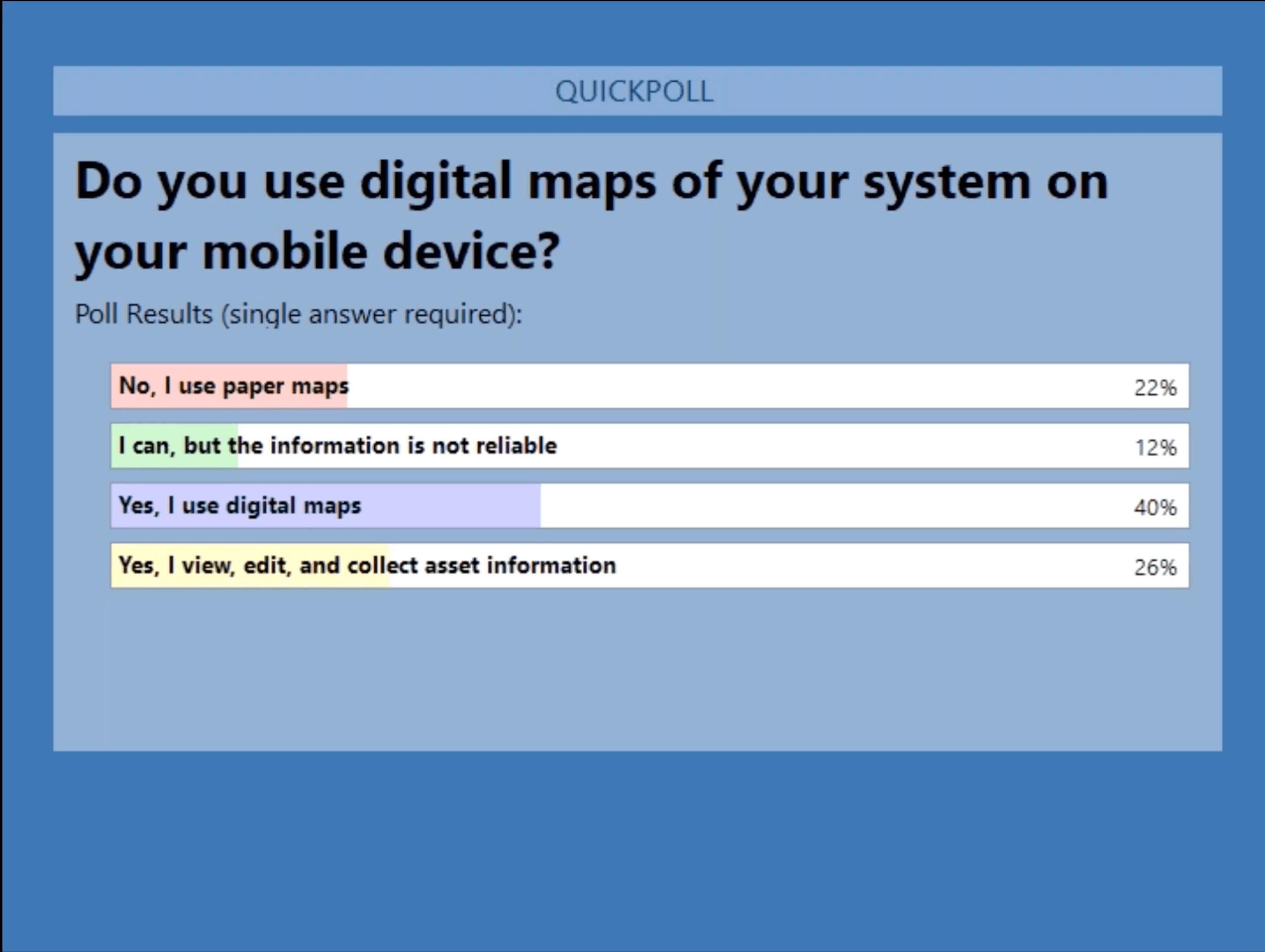
POLL: Do you use digital maps of your system on your mobile device?
- No, I use paper maps
- I can, but the information is not reliable
- Yes, I use digital maps
- Yes, I view, edit, and collect asset information
Hopefully one of these options applies to you. Alright. Let’s look at those full results.
It looks like many of you are using digital maps on your devices. A little less are actually editing and collecting information and we do have a percentage still using paper maps.
So, that’s actually good for me because my presentation is going to talk a lot about that transition from paper to digital. Thanks for completing the poll. Alright.
The Case for Implementing Digital Solutions
So why are water utilities implementing digital solutions? As most of us probably have already assumed, the COVID-19 pandemic was a big driver. For a lot of the customers that I’ve been working with the last few years, the pandemic really pushed them to implement new technology or extend the use of their existing technology because staff needed to be able to access resources remotely.
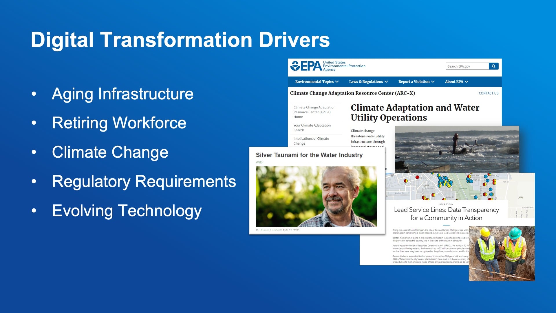
Aside from the pandemic though, there are a lot of drivers that are pushing utilities, large and small, to really consider what digital solutions can help them to achieve. Many of these you see on my slide are probably familiar to you. Aging infrastructure is a challenge. It’s becoming more costly to operate and maintain. What assets do you rehabilitate versus replace?
Our workforce is changing too — we’re all aging. Looking at metrics for water utilities, a third of professionals are considering retirement in the next few years, and many small and rural organizations have that person that knows everything about their system, and they’re going to take that crucial knowledge with them when they leave. So, how do we keep that knowledge with the utility and the next generation of staff?
Also, climate change. Often, we see extreme weather events in the news, and this is causing increased challenges for utilities. It’s increasing the amount of money they have to spend to respond to and rehabilitate after extreme weather events.
Regulatory requirements. The lead and copper rule revisions. This is really pushing utilities to understand where their assets are and what they are. Utilities have to do that service line inventory.
And then lastly, evolving technology. I feel like this one’s always been a challenge, but it’s definitely something that seems to be speeding up. Technology is constantly changing and there are some really good points to that because now a lot of the technology that enables digital transformation is just easier than it used to be. Transitioning to digital workflows.
Not every utility is at the same spot in this journey. And as we saw with the poll, there is a variety of where you’re at. Some of you are using paper, some of you are using digital — you’re just viewing information, you’re collecting information.
I used to work at a utility before I came to Esri, and I know we started with linen maps, 14-inch by 14-inch linen maps of our system. We had some as-builts, but it was a huge challenge to transition to a digital environment because those maps weren’t always accurate, and staff didn’t love the new digital solutions. We got a lot of complaints from the field crews that data was inaccurate. It’s very difficult. It took a long time, probably two years, before we had a full map of the system. And I realize I’m probably not convincing you with this story, but it’s so much easier now.
Common Questions
So let’s talk about the common questions I get now, which are similar to the questions I had when I was at a utility. These are the most common questions:
“Can we bring paper maps or excel data into a GIS?” which, you can. A geographic information system (GIS) is a database that has spatial intelligence and mapping. With paper maps, it’s a manual process to get that data in. As for excel data, yes, you can bring that into your GIS. If you have old AutoCAD files or any kind of electronic data, it’s usually pretty easy to get that into your GIS.
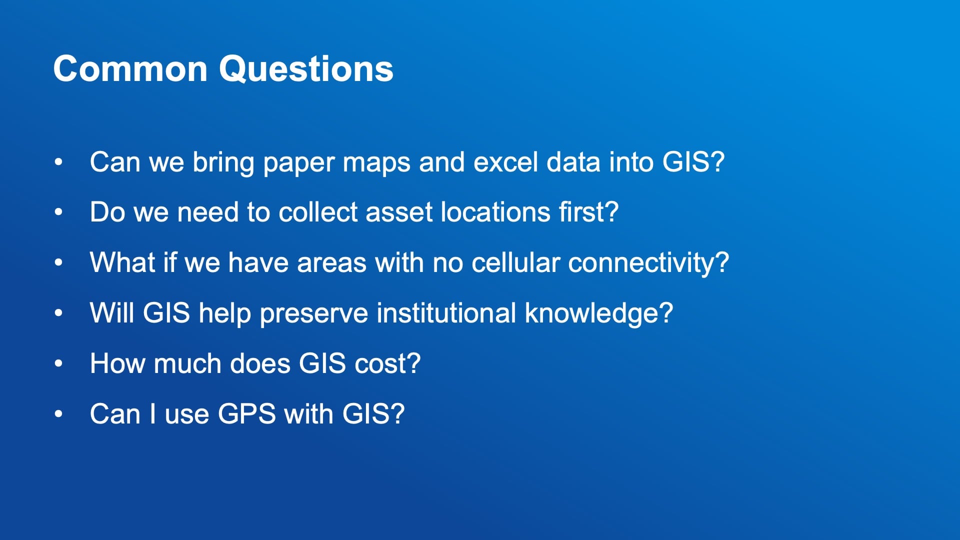
One thing that does happen, though, and this speaks to the second bullet point, “Do we need to collect asset locations first?” This is really based on your specific utility because it might take you so much time to get those paper map information into the GIS that it might be a more efficient route to start collecting asset locations in the field and building your map in real time. And I know Jean-Yves is going to talk about the high-accuracy receivers and Kenny is going to talk about that, too. But that’s a great way to really start collecting location assets during your daily workflows and building out your GIS information.
Another question we get a lot of times is about cellular connectivity. The applications that Jeff Shaner is going to talk about later in this webinar and other applications that Esri offers as part of their GIS solutions have the capability to go offline, which means you can use our field and mobile applications without being connected to a cellular network, and you’ll learn more about that later.
“Will GIS help preserve institutional knowledge?” Yes. This is one of the main reasons I’m seeing smaller rural systems move into GIS and digital solutions because it will enable them to keep that information with the staff at the utility when retiring staff leave. One of our customers paired a new operator with a retiring operator, and the first few weeks all they did was follow around the subject matter expert and make sure that that knowledge was entered into the GIS.
Lastly, “Can I use GPS with GIS?” Absolutely. That’s a lot of what we’re going to be talking about today. So, the high-accuracy devices that you’re going to learn about today pair very seamlessly with Esri field applications and make it really easy to get the high accuracy and the mapping all in one.
Why make the jump?
Okay, so why would you want to do this? Why digital transformation? There are so many benefits that are gained when moving, particularly from paper to a modern digital solution. But even when you’re just modernizing or upgrading the digital solutions you have in place, and what I see most with the utilities I work with is that the benefits are very strong in the operations asset management area and even moving into analytics.
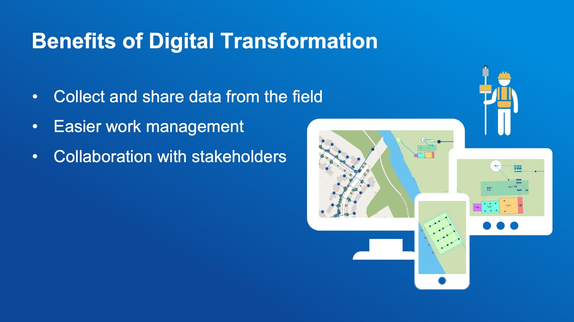
So, using digital maps and mobile applications enables staff to view data, as many of you are already doing. But what it does is it increases that collaboration and makes sure that everyone’s on the same page so that the people in the field and the people in the office are seeing the same things. Also, so that stakeholders, supervisors, and managers have access to information that is easier to understand. Maybe it’s a dashboard or an ArcGIS StoryMap. There are a lot of options and I’m happy to answer any questions about those options in the Q&A or if you want to reach out to me after this webinar. But the benefit is really around that coordination, communication, being able to monitor work, see work that’s being done, and then plan and provide the information needed to reach the goals of the utility.
I get super excited about our mobile apps because it was so hard when I was at a utility and now it’s so easy, and I love to see how these digital solutions really help organizations that transform.
I also wanted to share a few of our quotes that customers have provided after digitally transforming their utilities. The QR code here can be used to view a longer story about the work that was done, but I really enjoy working with these organizations. Garrett at Green Valley was amazing, and he’s presented a couple of times for Esri’s water team.
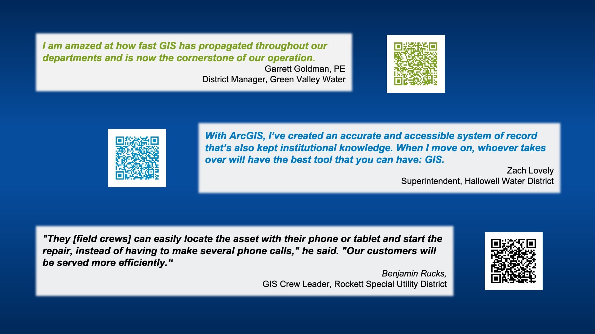
If you have any interest in learning their stories, just use a QR code and you can jump out to that. But next up, you have Kenny Ratliff and his story is amazing. I always love to hear what he’s up to, so I will not take any more time and I’ll pass it to Kenny.
From Paper to Pixels: A Manager’s Guide to Moving from Paper Maps to High-Accuracy Capture
KENNY RATLIFF: Thank you, Christa. And I will transition to show my screen. All right, so you should be seeing my StoryMap, which is a departure from the traditional PowerPoints.
And I think we have a poll to start off with.
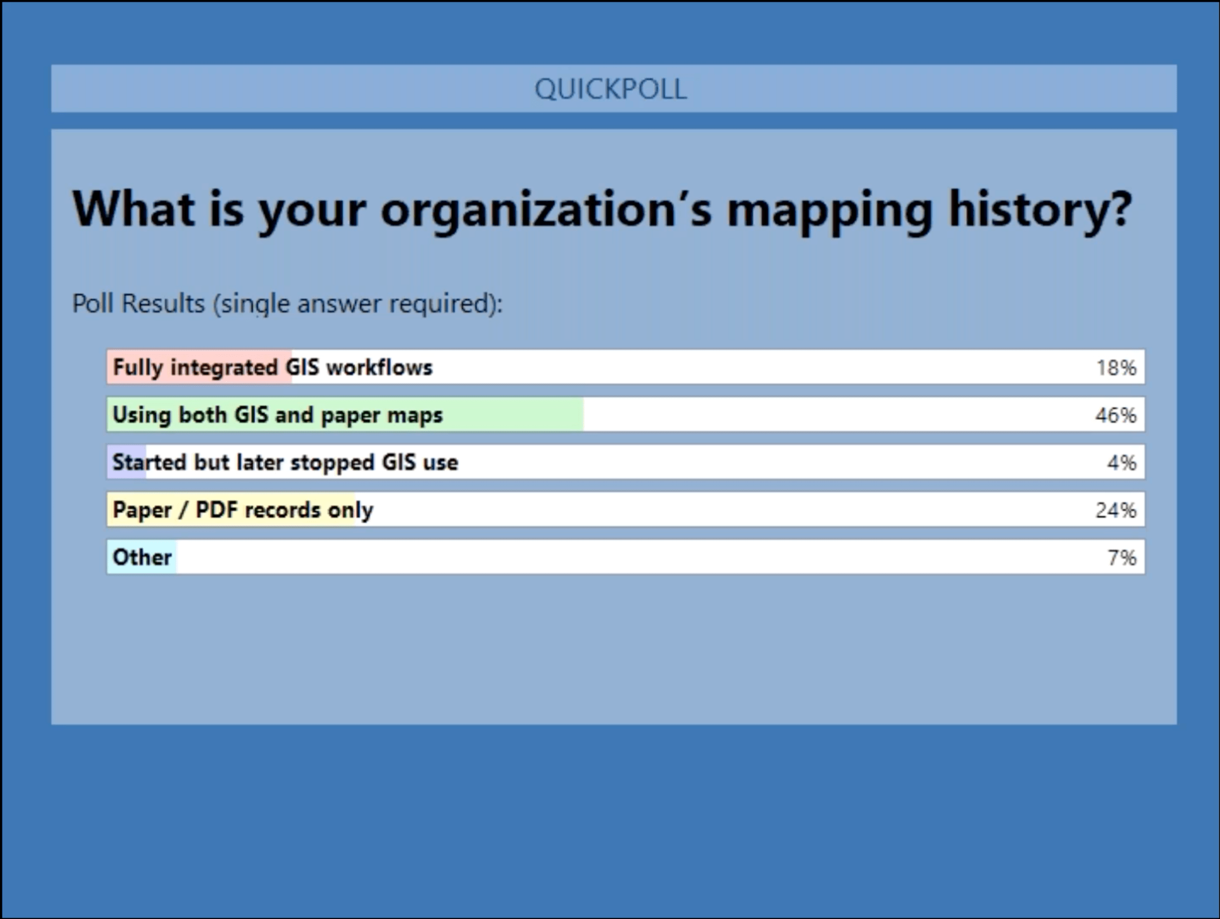
POLL: What is your organization’s mapping history?
- Fully integrated GIS workflows
- Using both GIS and paper maps
- Started but later stopped GIS use
- Paper / PDF records only
- Other
KENNY RATLIFF: And if you can convey those results to me once that is closed.
SARAH ALBAN: Yeah, they’re interesting. Nearly half of respondents say that they’re using both GIS and paper maps. Next, 18% are fully integrated with GIS workflows. Then 4% have started, but later stopped GIS use. And about a quarter of people at 24% have paper and PDF records only, and the remaining 7% is other.
KENNY RATLIFF: Okay. I appreciate that. And that’s a pretty diverse set of answers with not a lot of surprises. I’m always interested in the piece about started and stopped using GIS, because many folks started out buying the software or some software, whether it be CAD or GIS software and didn’t have the personnel to utilize it or didn’t have the time or the understanding of the training. And so, it went back up on the shelf somewhere and was never brought back off.
So we’re going to go to our next poll at this point, Sarah.
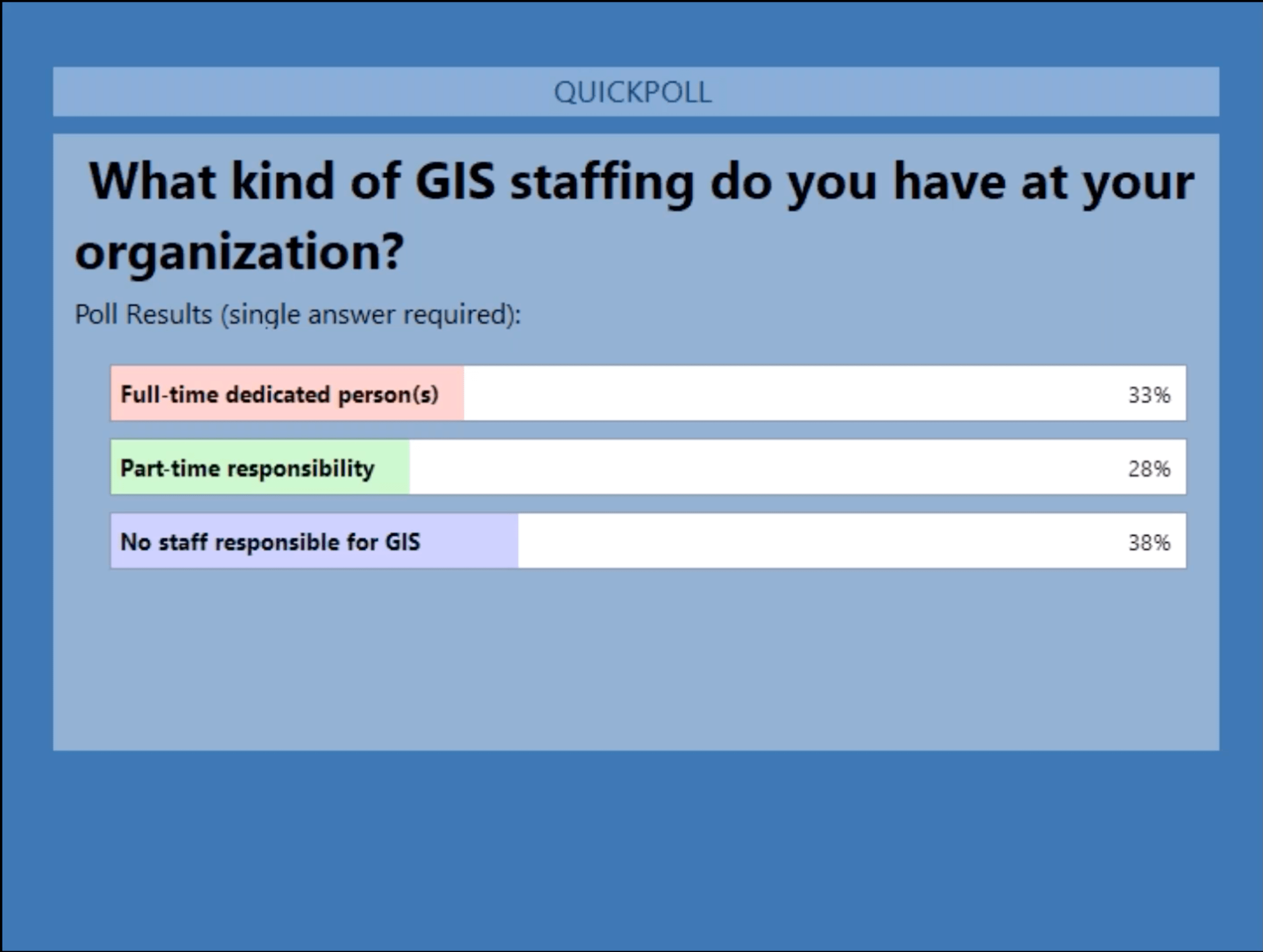
POLL: What kind of GIS staffing do you have at your organization?
- Full-time dedicated person(s)
- Part-time responsibility
- No staff responsible for GIS
KENNY RATLIFF: All right. And folks can answer those. I’ll be very interested to see what our audience looks like here.
SARAH ALBAN: Yeah, that is very close. So 33% have a full-time dedicated person or persons, 28% have it as a part time responsibility, and then 38% have no staff fully responsible for the GIS.
KENNY RATLIFF: Okay. And that’s not surprising either.
I am glad to see that there’s quite a number that have a full-time person that is running and working with the GIS And that is actually our case here at Oldham County. We have had that resource since 2016, and I’ll go through some of the dates here a little bit.
I have had a full-time GIS manager and prior to that, it was a part-time or half-time job for a gentleman that sort of picked it up as he went. And it was not his primary function. And it provided a really good framework and a base for us to jump from once I came on board. So, I’m going to go about this a little bit differently than I normally would. I wanted to gear this presentation toward managers and leadership levels as much as anything.
The Importance of High-Accuracy Locations
I want to start at the top. Normally, I start at the bottom, as in field collection, work my way up through the processes and workflows, and then talk about what you do with the data on the back end of all that.
But I’m going to start first to try and press why the data and the location of your assets and your infrastructure is vitally important. And, pretty extreme, but we see this more and more. You know, we have a lot of challenges in the water utility or any utilities these days with an aging workforce.
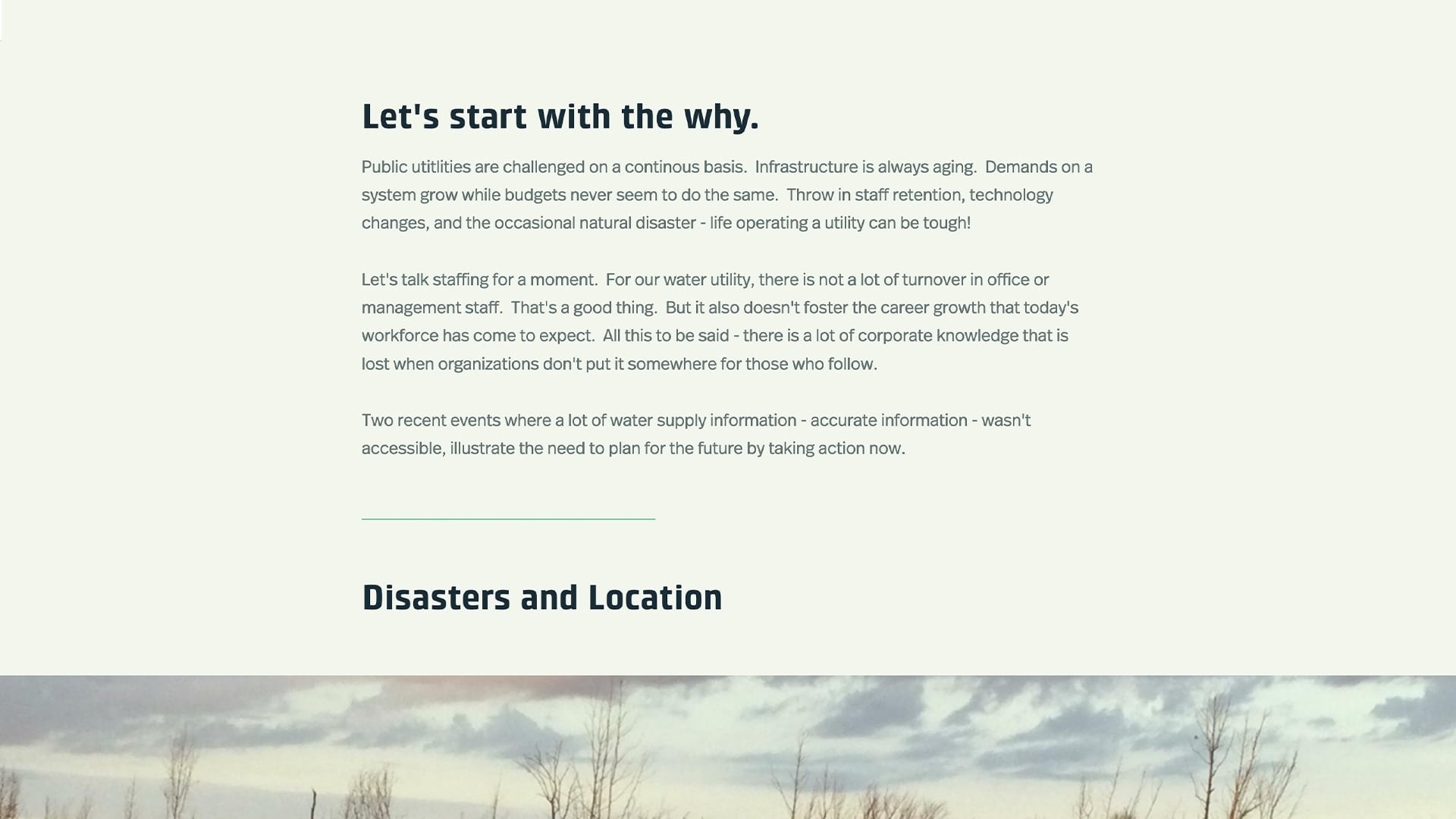
And Christa, to cover several of those reasons — with loss of staff, loss of knowledge — you lose an understanding of where things are and how they work in a system. Corporate knowledge is lost.
Finding Assets and Prioritizing Repairs in Disasters
December 2021 Tornado
So, we had two recent events here in Kentucky that I want to lead off with to kind of emphasize the importance. In December 2021, we had a tornado that came through western Kentucky. I think this was the second-longest-running tornado in the history [of Kentucky], if I quote that correctly. I actually attended a Kentucky Association of Mitigation Managers conference yesterday where they were talking about this. A lady from the National Weather Service mentioned that they were warning people through social media and other methods for about 8 hours as this tornado tracked from Arkansas, across western Tennessee and into Kentucky. However, it took just 2 minutes to wipe out pretty much the town of Mayfield, Kentucky.
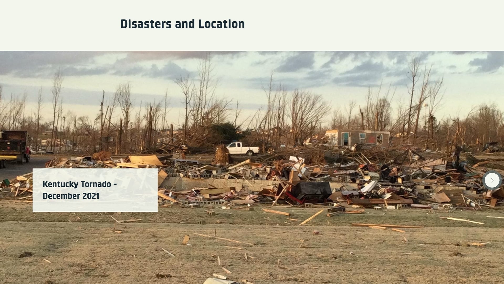
And all that is said to illustrate the point that if you don’t know where your infrastructure components lie, for example valves and your meters and other things that you need to get to in a hurry, you can’t expect responders to find those either.
And this is the candle factory, Mayfield Consumer Products. I’m sure a lot of people have heard the stories about what happened here.
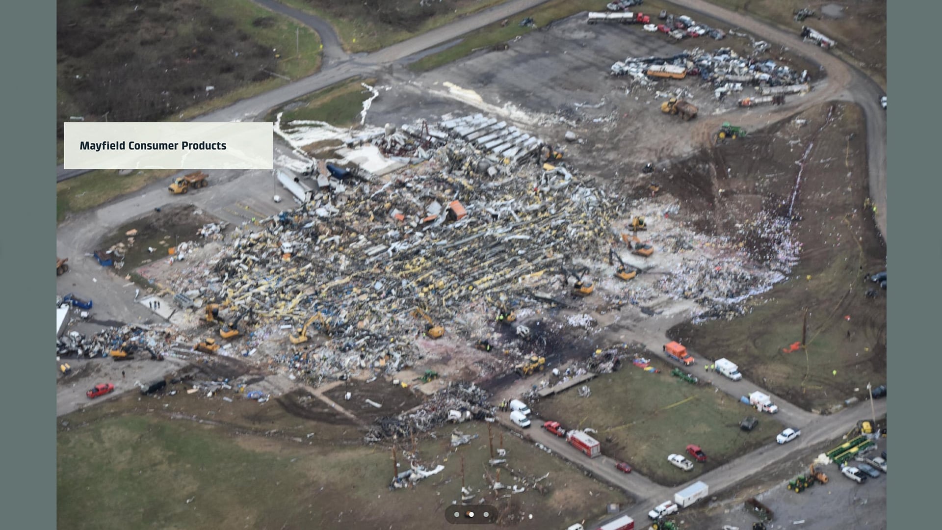
I do know secondhand, and I apologize if someone on here knows more detail, but when this was devastated by the tornado, several of the water tanks in the area were depleted. And so, they were not able to begin to refill those water tanks, mainly because nobody could find the fire valves here, so all the piping was spewing water and it drained the tank in a matter of a short time. So, knowing where that’s at, being able to get to it, at least knowing where it’s at to clear it, is paramount to a response and to getting things corrected and responding in an appropriate manner.
And again, the City of Mayfield. You know, if you have a map and the water meter shows over here, but it’s not there, it’s under this debris here — you’re going to have a hard time shutting some of these things down and recouping and recovering your system. So that’s the tornado example.
July 2022 Flooding in Kentucky
As for flooding in July in Kentucky, the current count of the fatalities is, I think, 40 people who have lost their lives. Two are unaccounted for still at this point in time. The floodwater swept through many of our eastern Kentucky counties.
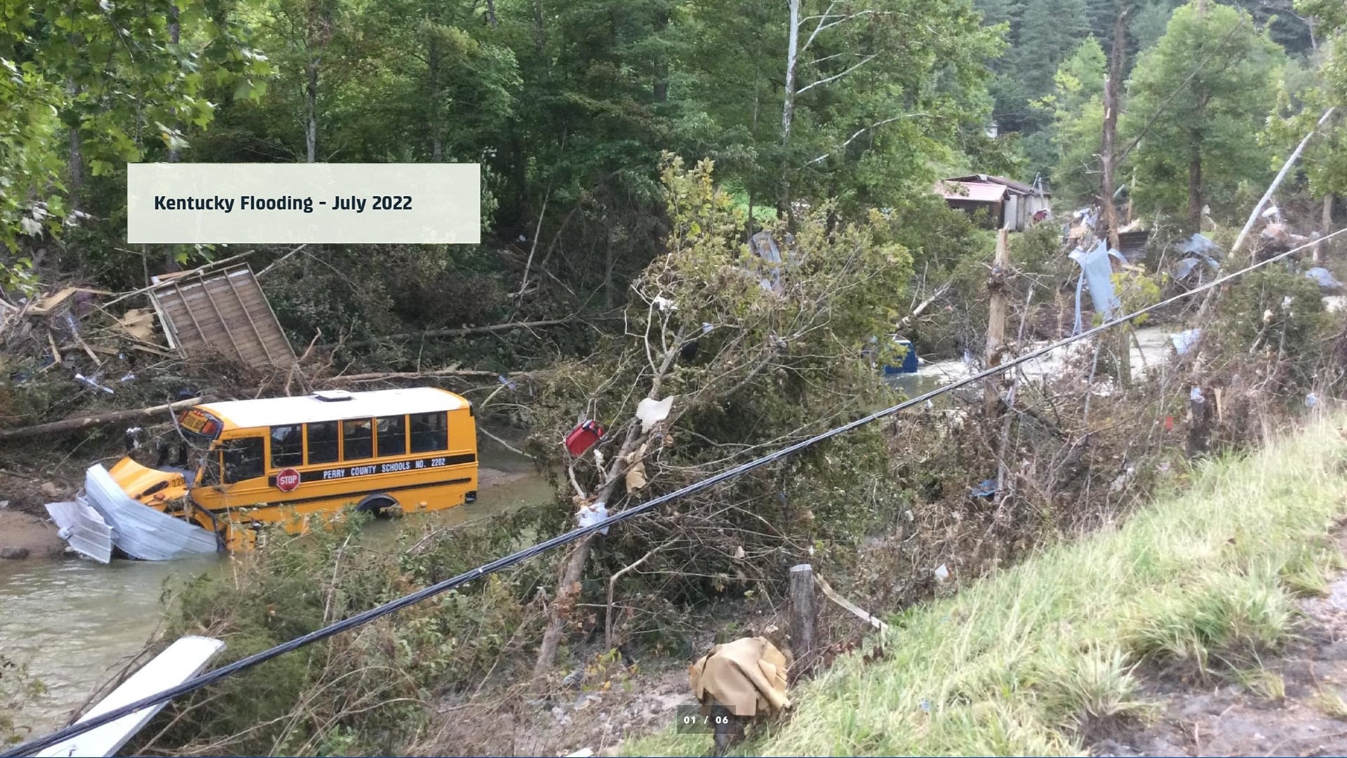
It’s a difficult place to have a utility. You’re very limited in where you can run water lines due to the elevation of the mountains, the creeks, the rivers. And there’s not a lot of good GPS’ed map information available for the most part. That’s not always the case, but when this flood happened, we actually ended up sending a couple of people down for several weeks to help recovery efforts. This is in Perry County — specifically Hazard, Kentucky. And if you didn’t know better, you would wonder what was here and why we’re digging there with a track hoe.
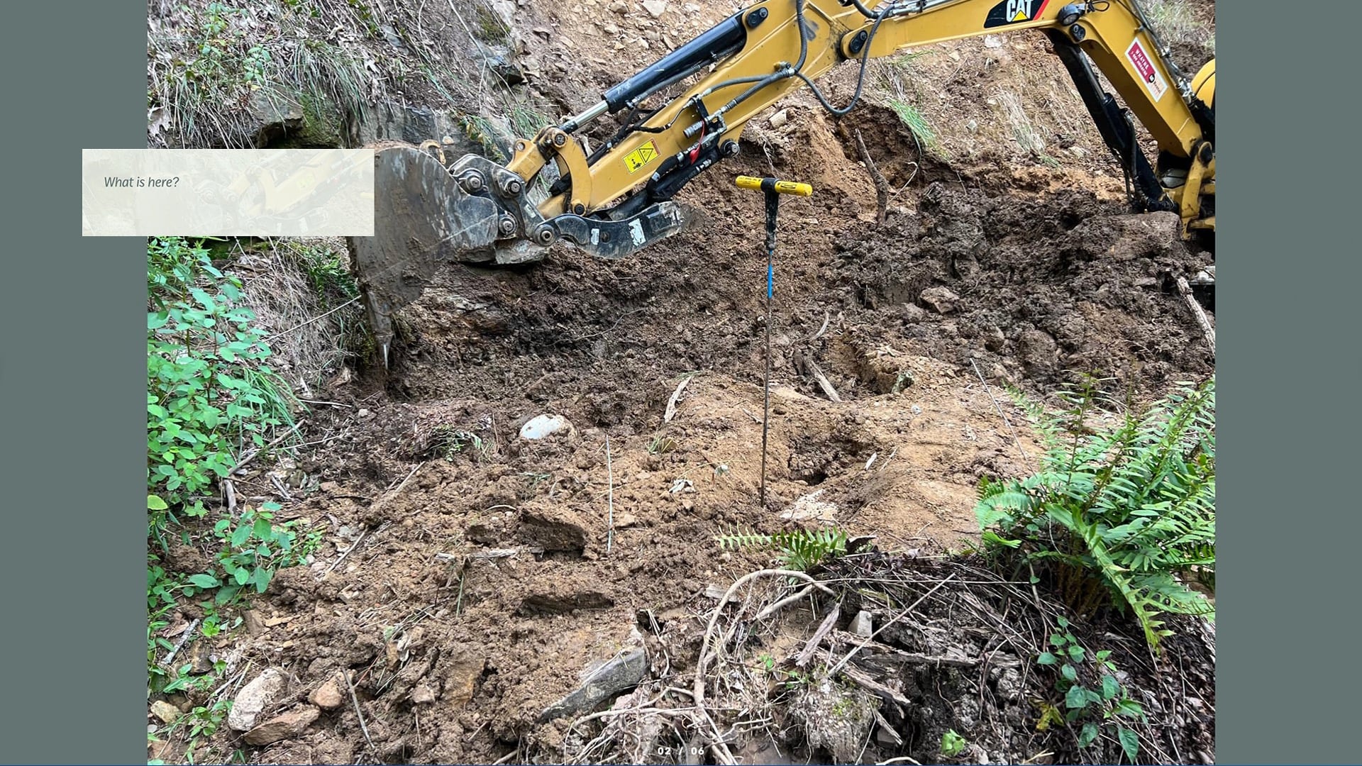
Well, this was a mudslide that occurred, and it happened to cover up one of their pump stations. So having the map, having the digital ability on your phone to say, “Hey, we’re sharing a map with you, we need you to go here.” This saves a lot of time and makes your response a whole lot quicker and more efficient, and you get things running very quickly.
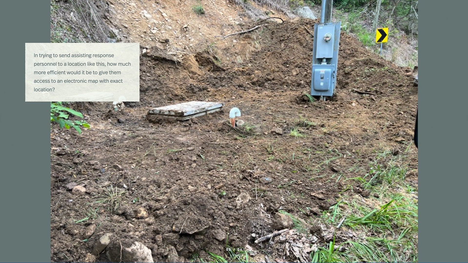
Down in this area, in several places, there were a mile or two miles of customers where the six-inch line was totally washed out and gone from the creeks. And we ended up tapping into the existing end of the water line and just running service lines as quick as we could to get water to those folks in an expedited manner.
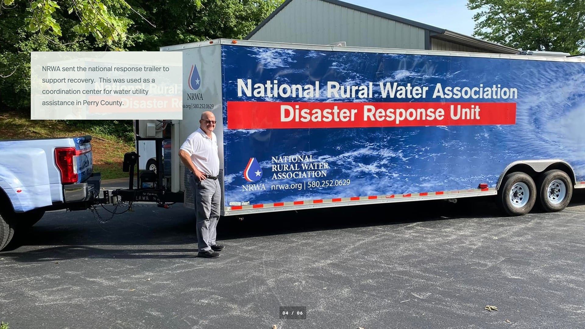
I want to give a shout out to the National Rural Water Association — if you’re not aware of this particular unit that they have in the picture, they sent this down. Next to it is our superintendent and CEO, Russ Rose. He flew to Arkansas, picked this rig up, and brought it to Kentucky for use in response. It was stationed in Perry County, where we were located. It has some box in there. It has some cooking capability; it also has the ability to plug into computers and work off of maps. So, this was a really nice set up and is available on request during a disaster.
So just an example of some of the data and what we found in those areas that may not have a mature GIS. The blue lines here, in the orange mark — this is supplied from an organization at the state level and is available to the public for the most part. But it’s all actually brought in, most times, from project planning sheets or maps, and it doesn’t accurately depict what was put in once that project was completed.
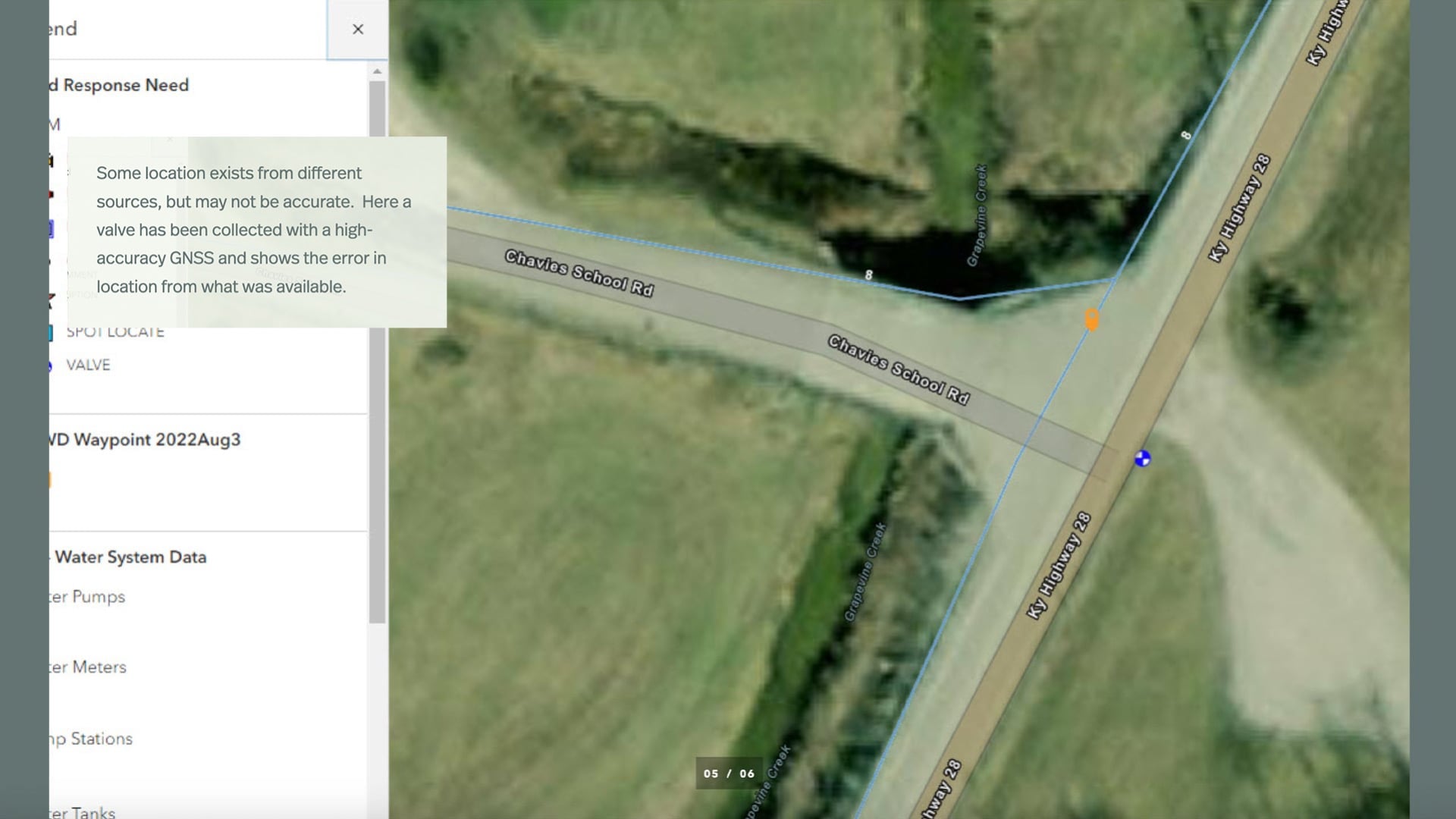
So, in this case, we had a line going to a school over here to the left, and we got out there and we ended up installing a valve to on this line going to the school. And you can see there’s a large difference as to where the line was depicted versus where the line was at. Unfortunately, I guess in this case, a lot of these lines were exposed due to the flooding, and it was easy to find them. But a lot of times you get debris again over top of these things, and you can’t find a valve to shut something off.
And this is just a depiction. For some of the paper maps, they were printing and gathering information as they went. It wasn’t always being collected electronically.
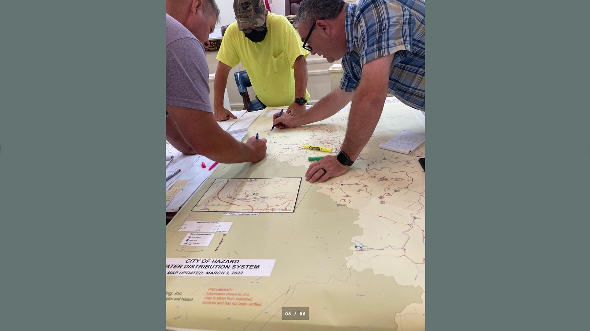
But we did end up collecting a lot of information electronically. And, I had a call from our guys a couple of days after they got there and they said, “Hey, can you create a map? I’m going to send you some GPS points of places. We need to go and fix things. Send that back to me in a shapefile so that this other organization can use it.” And I did that in just a little bit and sent it to them. And that was really the beginning of collecting and getting a comprehensive electronic version for that area.
About Oldham County Water
So, real quick, I’d like to tell you just briefly about Oldham County Water. We are a county just northeast of Jefferson County, Kentucky. We have almost 9,000 metered customers currently. Our water comes from wells along the Ohio River, and they were all subsurface.
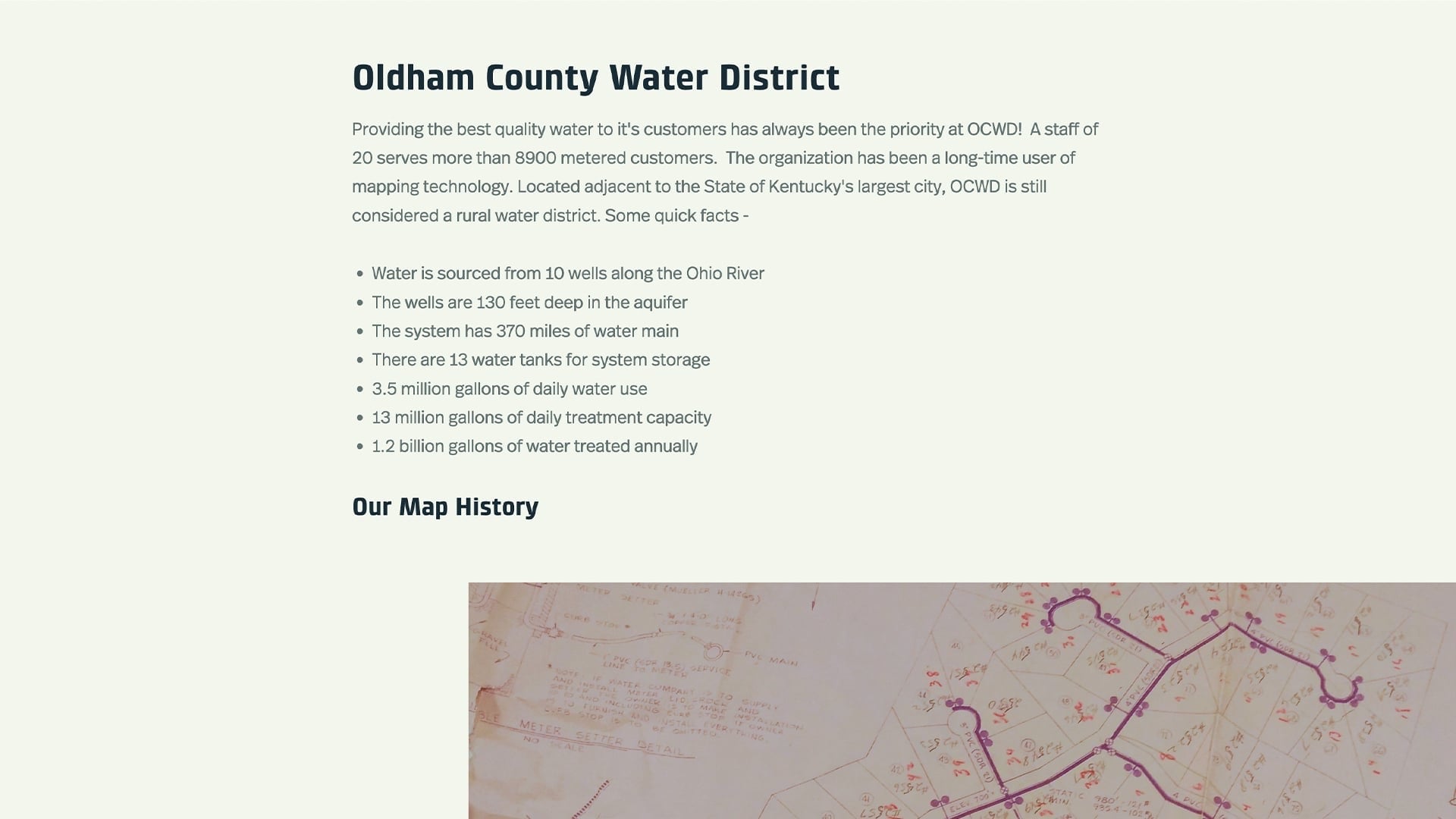
We treat those that are at our treatment plant in Westport. We have approximately 370 miles of main, 13 tanks, and you can see our usage here on average. And like many of you (I think, 40% of you responded you were using digital maps), you probably started with these type of maps. We have infrastructure that goes back to 1953. And we started with this, and I’ll reference this a little bit later to talk a little more detail about how we went from this to our GIS.
Digitizing Paper Maps to GIS Data
But we purchased the GIS software in 2001 and used the scan maps as a basis for “digitizing,” the fancy word for putting what you see here into an electronic version. And you can see over time what has happened to some of these that we had to begin with. They’re coffee stained and, in some places, torn. They’re not they’re not aging well as it is. We do have a set of map cabinets that you can’t see behind me. And we have scanned all of those maps now up to what we have recently installed, and we cataloged those with keywords so that we can go back and actually pull the paper maps. And I’ll give you an example of why that’s important as well.
So hopefully you can appreciate our staff member’s lanyard here on this tablet, the Hello Kitty lanyard was chosen along with the rainbow-colored hard case on the tablets because one or two of the guys may have left those on equipment, and that didn’t make it back or it was knocked into a ditch somewhere. So, we decided to color-code that so that they would not miss that when they were wrapping up.
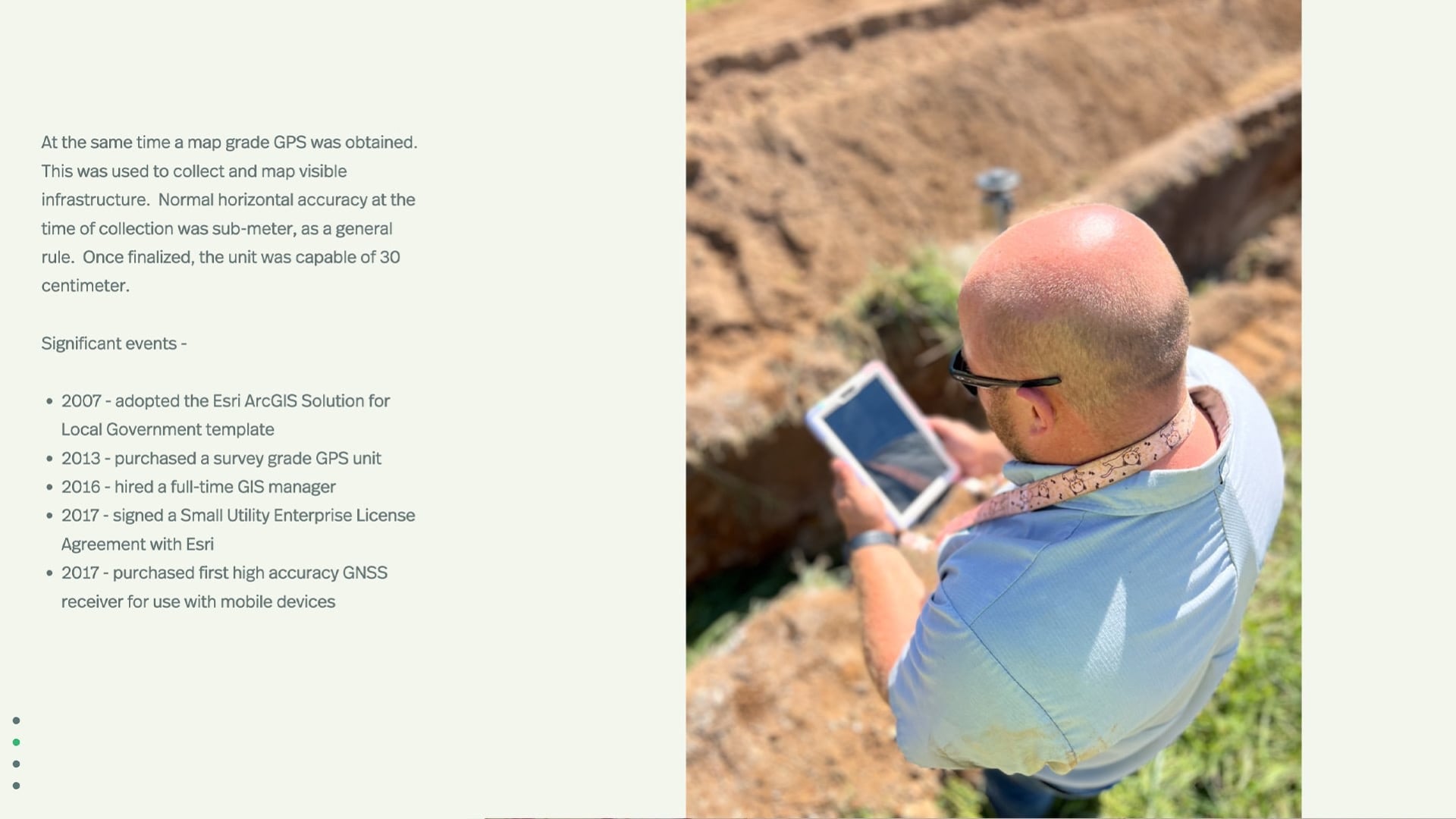
So, just some significant events. We started out with a legacy unit where you had to post-treat the data to get accuracy. Even then, it was about 30 centimeters of accuracy. That evolved later, and we purchased a low-end survey grade GPS unit, but it was just a little bulky to use and still required some exporting and importing and manipulation to get that into our authoritative database.
The New Workflow: ArcGIS and Eos Arrow Gold GNSS Receivers
In 2016, I came on board. We evaluated what we had in terms of some of our GIS components and software elected to go with the Small Utility Enterprise License Agreement (SUELA) with Esri.
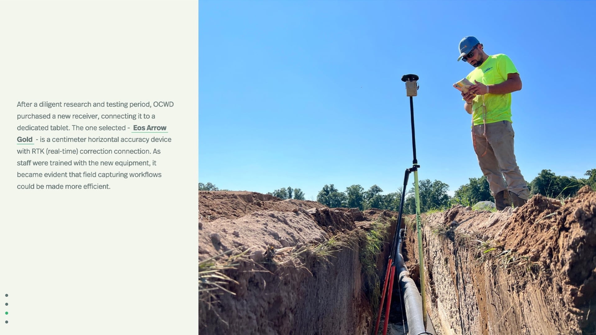
And then we moved the ArcGIS Online more recently just to fit our system better and what our needs were. And in 2017, we purchased our first high-accuracy receiver for use on mobile devices. And that particular receiver was the Eos Arrow Gold®, which gives us centimeter horizontal accuracy on average or better. We use a real time network provided at no cost by the Kentucky Transportation Cabinet, and all of our staff are trained to use these out in the field. I’m going to touch on the case study in just a moment.
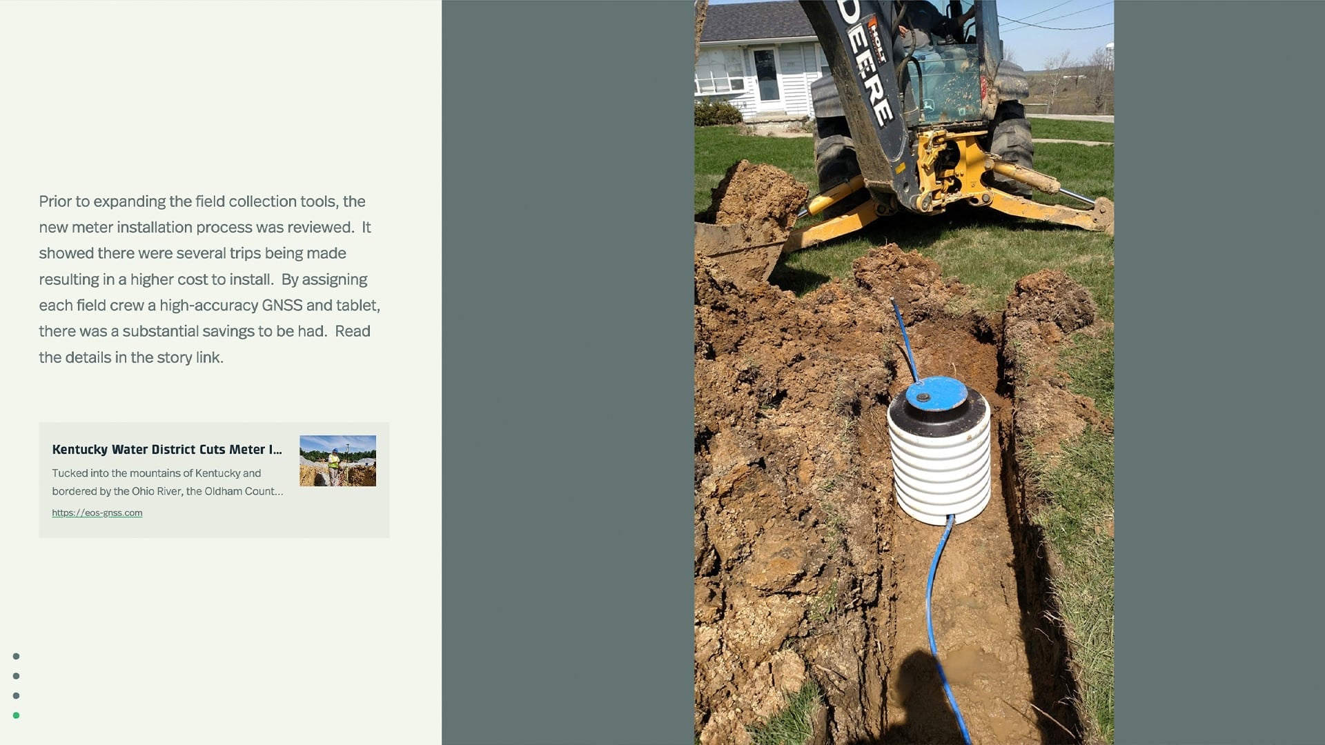
But you can see our staff member here. These are all new installations. We GPS every bell. Whether we’re installing it, or our contractors are installing it, we have inspectors there with this equipment. We currently have five Arrow Gold or Arrow Gold+™ units, all paired with tablets and assigned to different trucks or crews. And so, anytime we uncover something for a leak or repair or something, or even go through a neighborhood and have some downtime, we are GPS-ing all of our meters. With that being said, we have about 25% of our meters accurately captured and that continues to go up daily, really.
Cutting Installation Costs in Half by Improving Efficiency
When we were evaluating the benefit of putting units into the crews’ hands as opposed to the more technical unit that we originally had when I came on board, we looked at our meter installation and did a return-on-investment (ROI) study. At that time, we sent someone out to look at a site and then had come back, put a locate request in, send a crew out to see what they would need in terms of equipment, and then go back, put that in, and have them come back to the office. At the time, we had the one GPS unit, and they would say, “Oh, by the way Kenny, we put a meter in at this address. It needs to be GPS’ed.” And so then I would make a trip out.
So, we found that essentially, we could cut our installation cost in half by using these high-accuracy GNSS devices paired with the tablets and, say, “Guys, when you put it in, GPS it.” That cut our cost down tremendously and demonstrated the need, and why we would spend the money to get more units. It was that cost effective.
Using ArcGIS Dashboards to Track and Display Data
ArcGIS Online is where we host our layers now, and it’s nice because we can pull those in for many different things. We rely on ArcGIS Dashboards quite often to convey what’s going on at different levels.
For our field operations, this dashboard is showing our guys and what they’re doing out collecting.
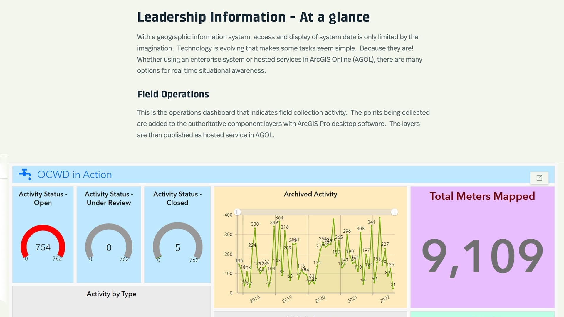
We currently have 770, which actually just went up. Right before the webinar started, we were at 769. But this shows you what’s open, what’s under review and what is closed. It also breaks it down here by type.
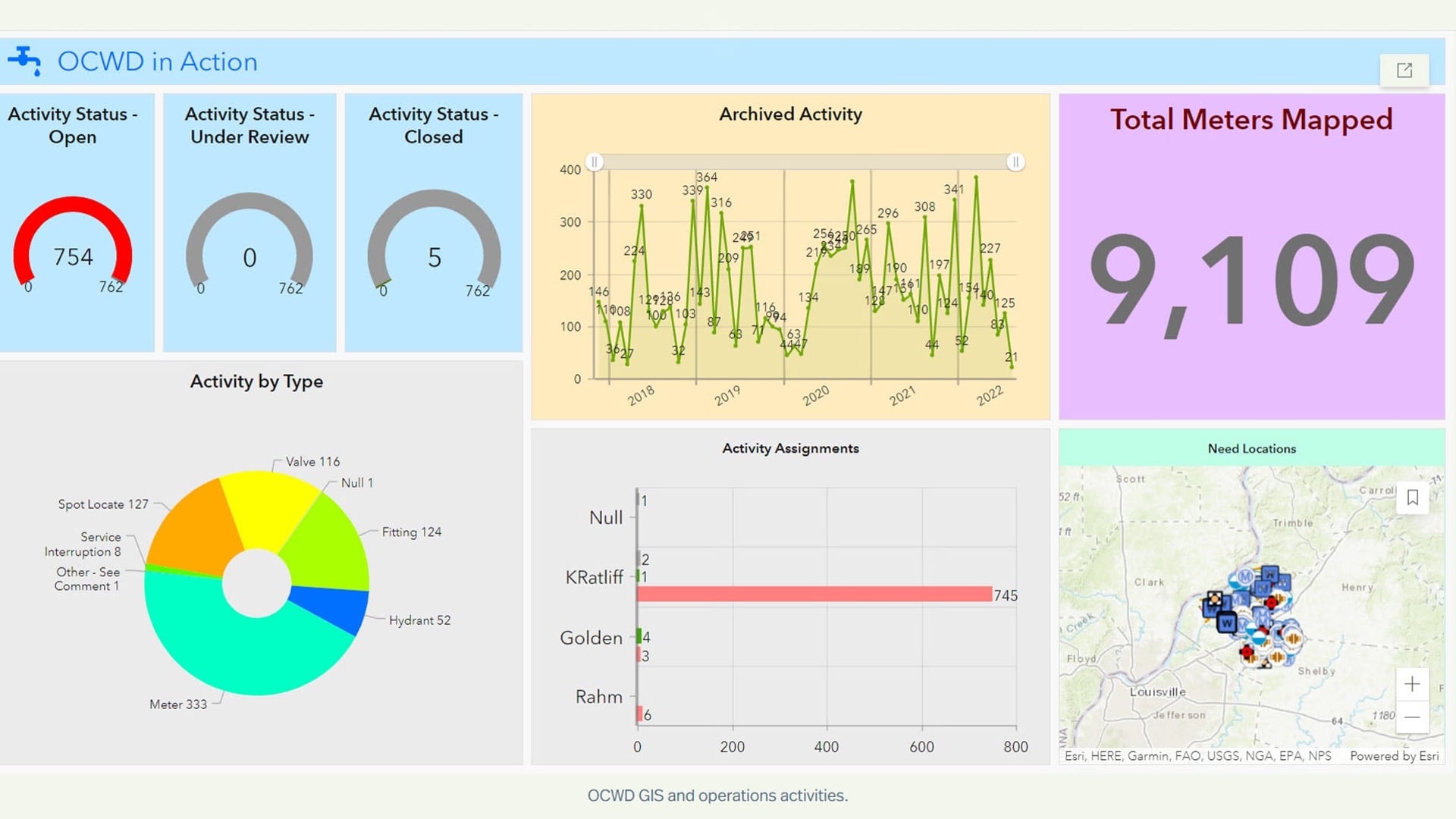
So, 333 of these are meters, 53 are hydrants. And this also kind of sums up the activity. This particular dashboard shows how we’re doing in terms of taking what they’re collecting, and we use a dedicated field communications layer that they add components into, whether it’s a meter or a water locate, a bell in a system, a fitting, etc., and I will convert those into our authoritative geodatabase.
And this is just over time, from 2017, how many that I have digitized into our system. I’ve tried to point out to Russ, our boss, that when I was working from home remotely, I was a lot more productive. There were less ridges and valleys here. I tried to convince him to go back to that, but he’s not having it. But again, that’s just a simple chuckle at how you can look at some of the analytics and what’s going on.
Additionally, the dashboard is nice because if I want to know where these fittings are, which need to be put into the system, I can click on this part, and I can tie these different views, these different components, together to be reactive. So those are all of our fittings that have been either put in, or repaired, or captured. Our spot locates are, again, bells where we have an installation going in, or where we’ve repaired a leak and we’ve shot the fitting repairs, at both ends of the pipe or a section. And then we can also break that down by showing where the assigned pieces are and what they look like. So, this is just a really nice wrap-up for our leadership and our field supervisor to see where we’re at in collection.
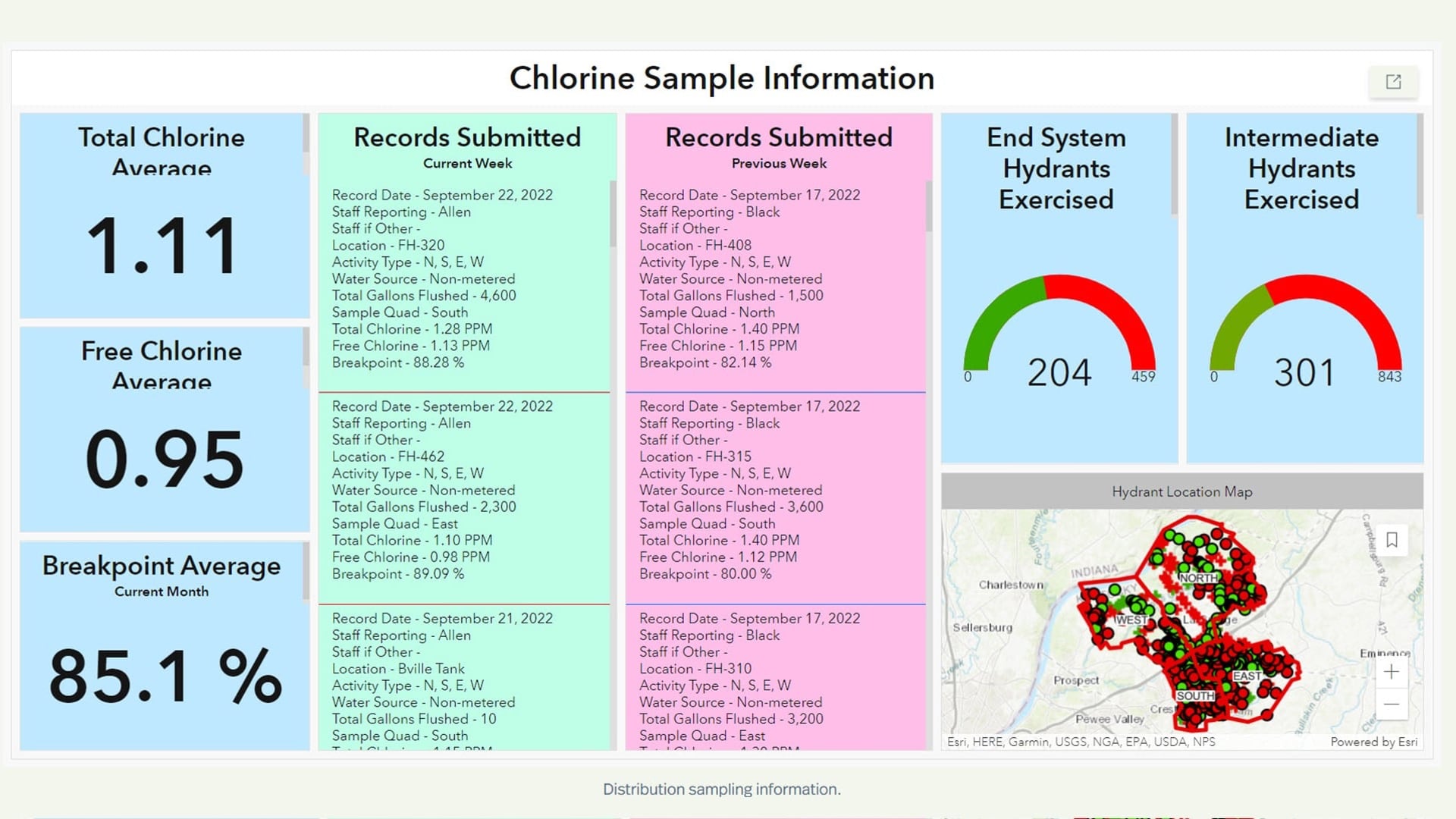
Distribution, again, we have a management type of dashboard. Our Kentucky Division of Water requires two daily samples for chlorine levels in our system. We break the county (or district) down into four segments, and we do four samples a day. So, on the weekends, there’s no oversight in terms of our on-call person going out and collecting these four samples.
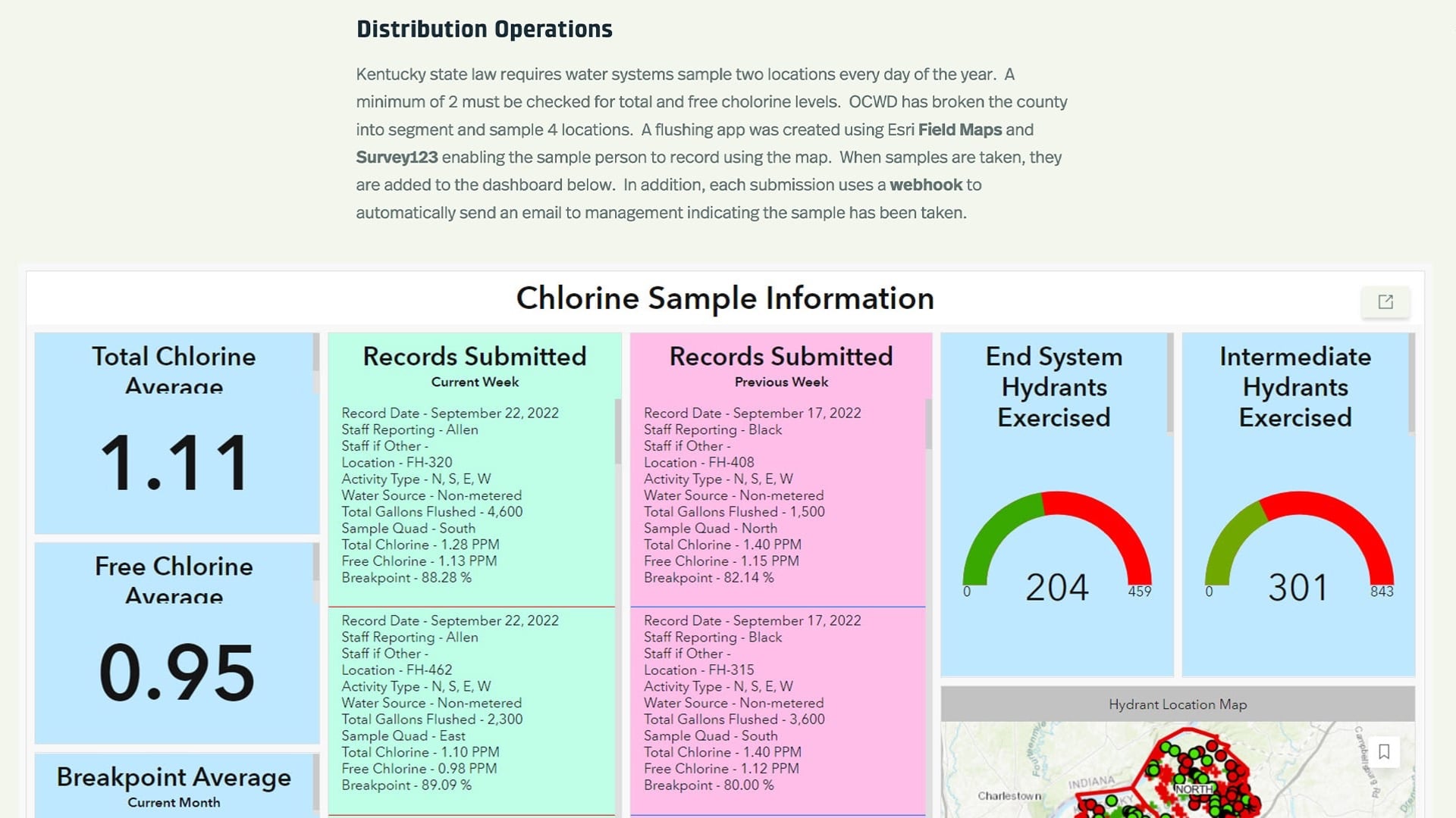
We created this dashboard that uses ArcGIS Field Maps, which Jeff will talk about in just a moment. And we have combined that and made it interactive with an ArcGIS Survey123 form, so that that person can flush and record this, and as soon as it’s submitted, it ends up in this dashboard.
The Benefits of Real-Time Dashboards and Webhooks
Additionally, we use a webhook that will send an email to management to show that that sample has been taken and what the results are. One of the reasons they like that is, if someone gets a shot, on a weekend especially, we don’t see that email come through. They can check the dashboard here and see where that last sample was taken. And this is averaging all of it. But we can follow up with the person and say, “Hey, it looks like we’ve got three samples. Did you do the fourth one?” And maybe they say, “No, I had to run home. I didn’t get to it yet. I’m going to get to it.” Or they record a sample on the side and they’re going to put it in later. But it’s just a checks and balances sheet for us to track all that.
And we try to flush our system at the end, system hydrants, at least twice a year and we shoot for three times a year to make sure that we’re turning our water over appropriately. More recently, we put everyone on the OCWD map, and this is the real-time map that you see. We do have vehicle tracking available. And so, these are all our vehicles and where they’re at currently, or at least within the last 5 minutes.
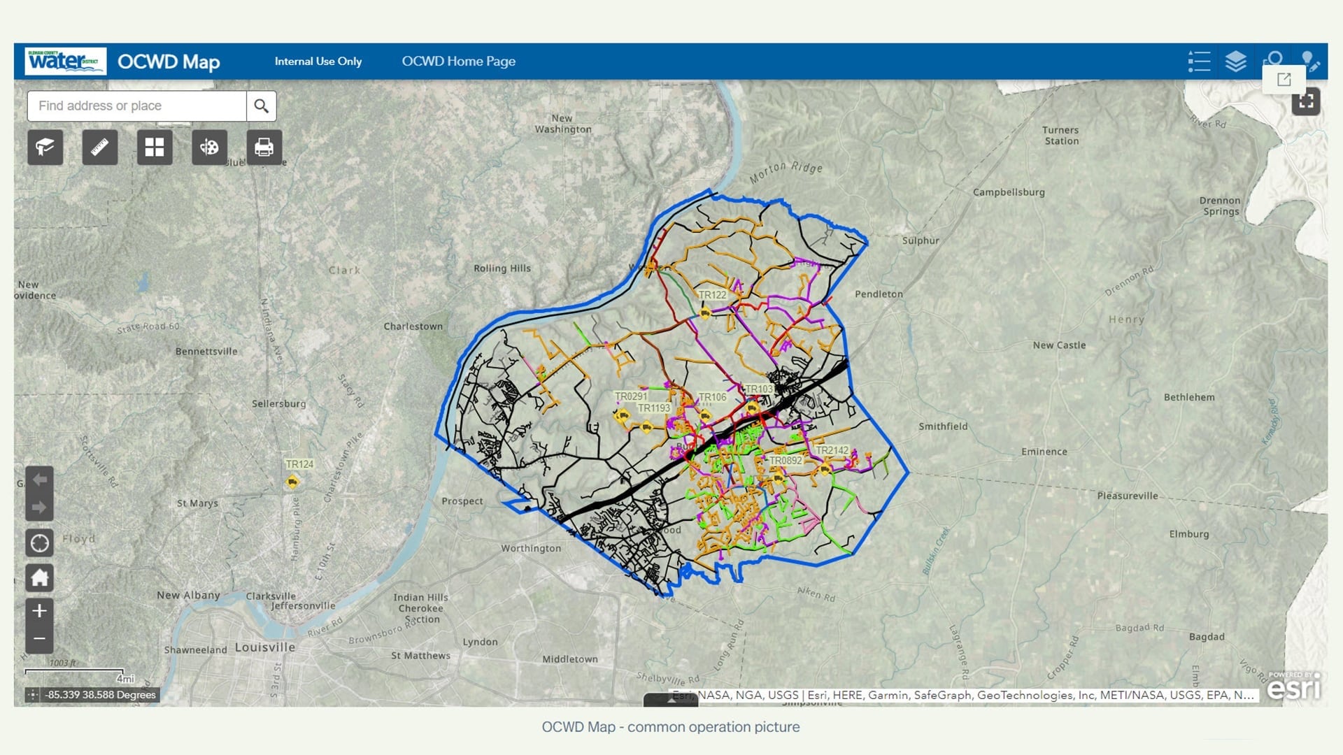
And this is handy when we have a situation where we have cut-offs and disconnects, and we want to get someone out there to quickly turn someone back on. We can look at this and know who is where and say, “Hey, can you go around the corner?” As opposed to trying to track folks down on the fly with a phone call and text messages.
Really quickly here, as managers and systems, you don’t need to host all the data. So, we piggyback and use services from other organizations who are providing the authoritative data sources. There are parcels and addresses and streets, and they’re all coming from our planning and zoning [teams]. You can have that coded into the map. The imagery is also a service coming from our next-door neighbor LOJIC, the Louisville County Information Consortium, and that is the latest, greatest, best available imagery that we bring in. And we do not have to house that or manipulate it at all.
Displaying the Data: You Are Only Limited by Your Imagination
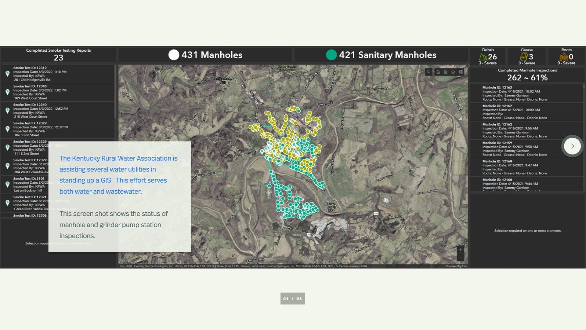
Just real quick, I’m going to run through some dashboards. The Kentucky Rural Water Association (KRWA) is assisting in standing up some GIS for other counties and enabling them. They are working with both water and wastewater. And this is just a dashboard showing the status of manhole and grounder pump inspections.
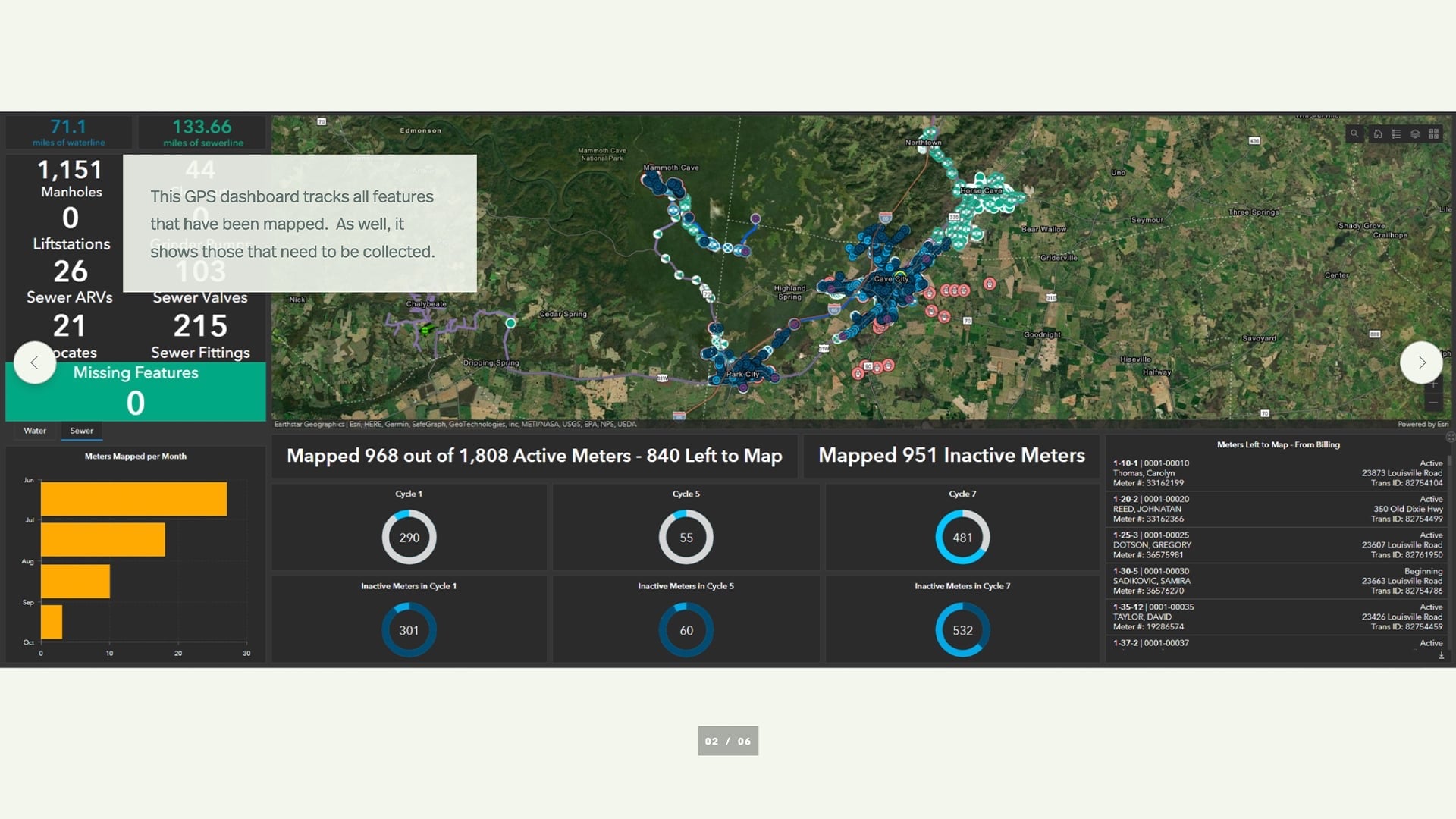
The dashboard shows all the features that need to be mapped or have been mapped and need to be mapped.
You can see here: boil water advisories, water leak information. I’m going to run through these pretty quickly, just to impress upon you that, these dashboards and their information — including how you want to convey it — is only limited by your imagination with the technology that we have these days.
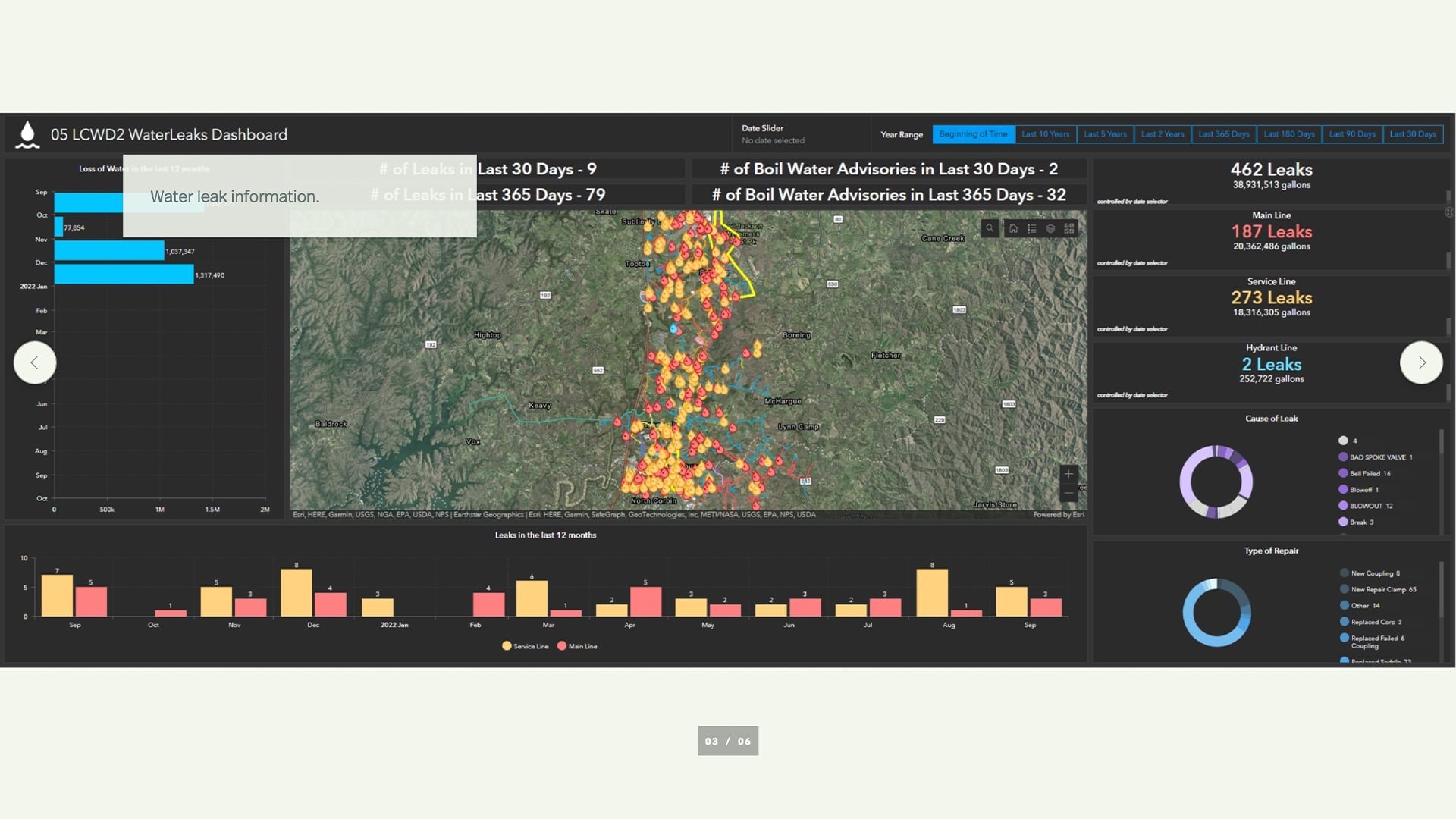
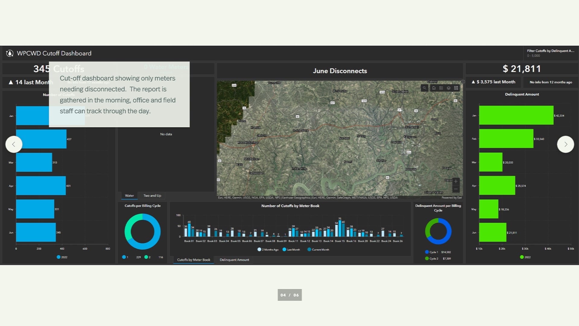
In this next dashboard you see valve inspections; these are being required across the country now. And then we have this information coming from the customer service software.
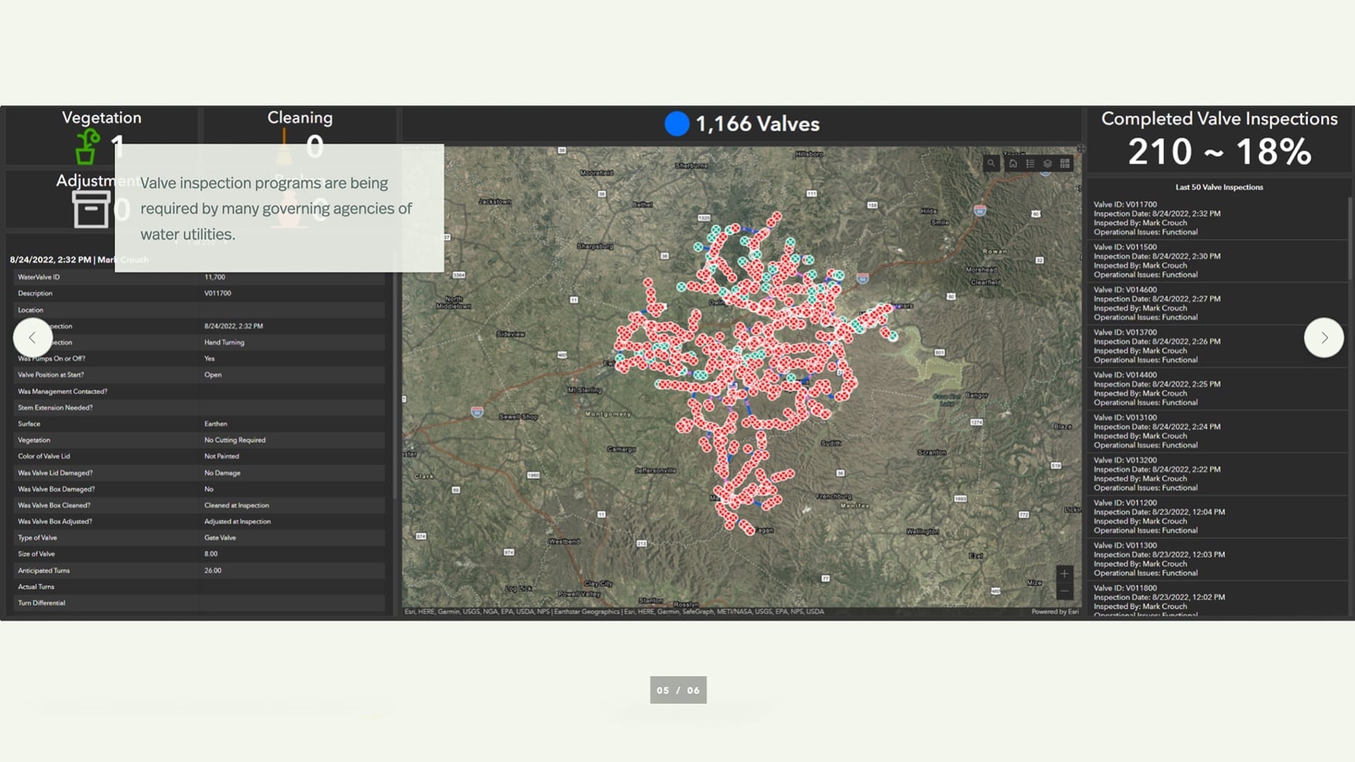
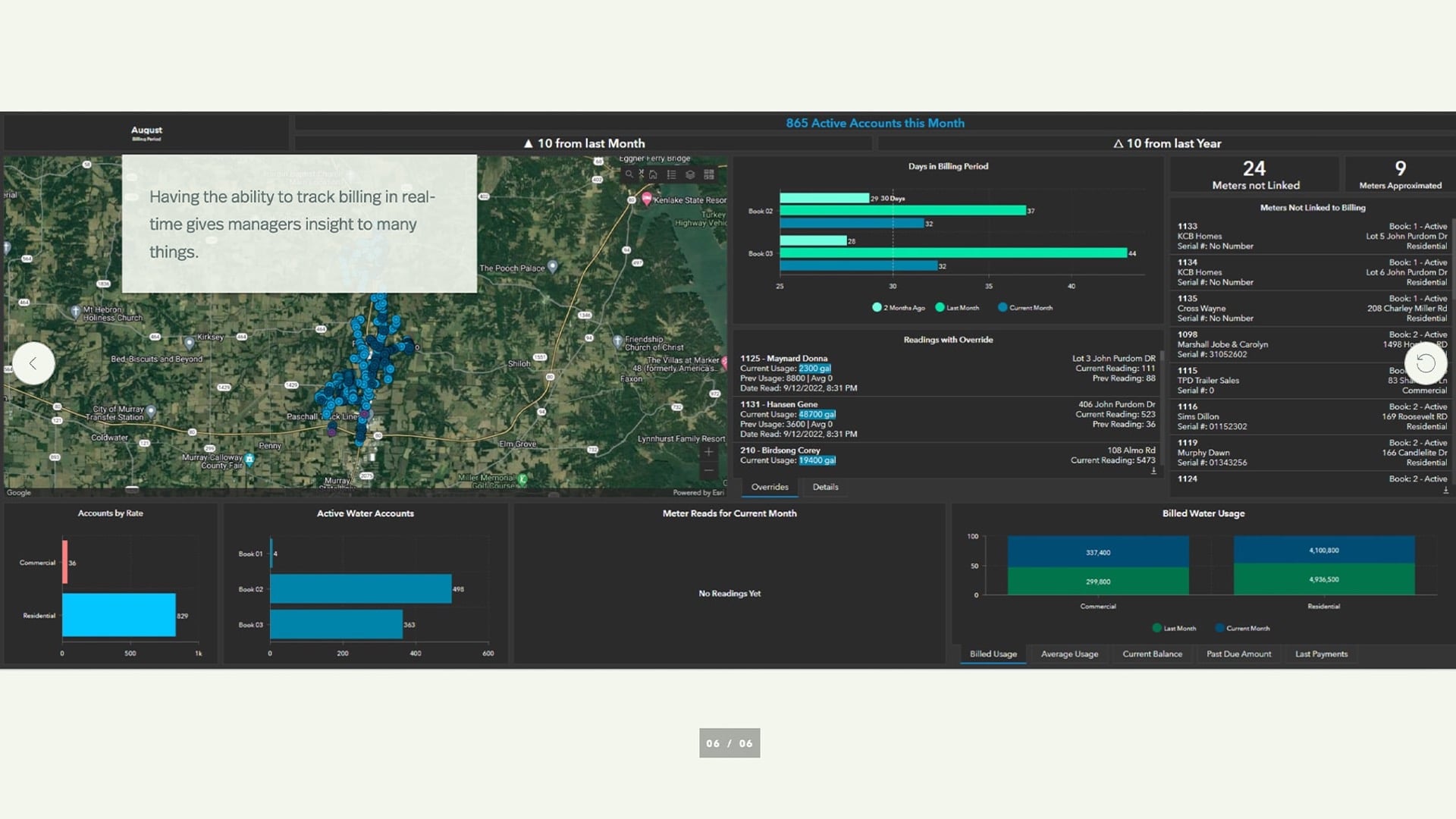
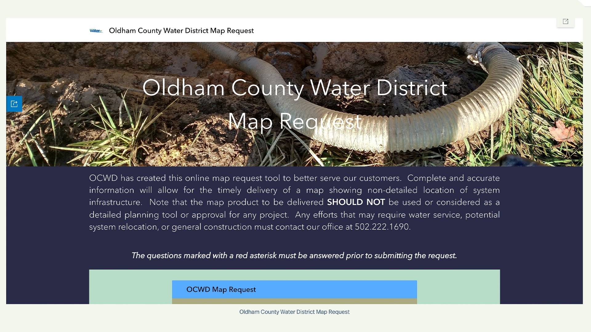
You can also throw out dashboards to the public. This is just a map request that we put together using ArcGIS Hub, ArcGIS Experience Builder and Survey123. So, any time that someone needs a map, they just simply go to our website, put in what the information that’s required, and then they are able to draw an area where they want that map, and we generate that and send it back to them. It also generates an email to us — again, a webhook type deal.
As for interacting with the public with locate requests, this is something that we installed the first of this year. We built it out, again with the Hub and Experience Builder tools from Esri. And this is just a simple way for the public to go in and find what they need. It cuts down on our calls.
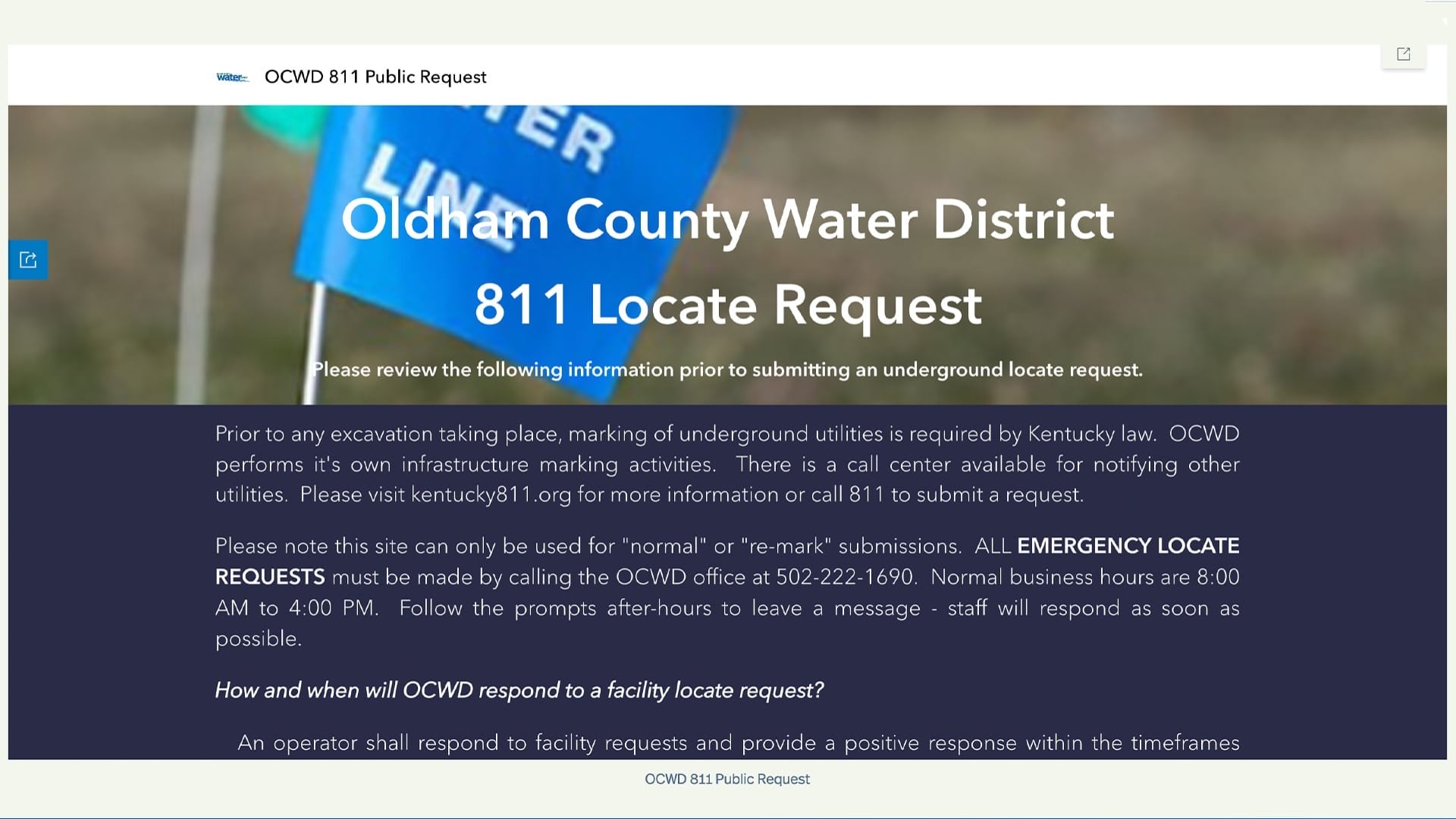
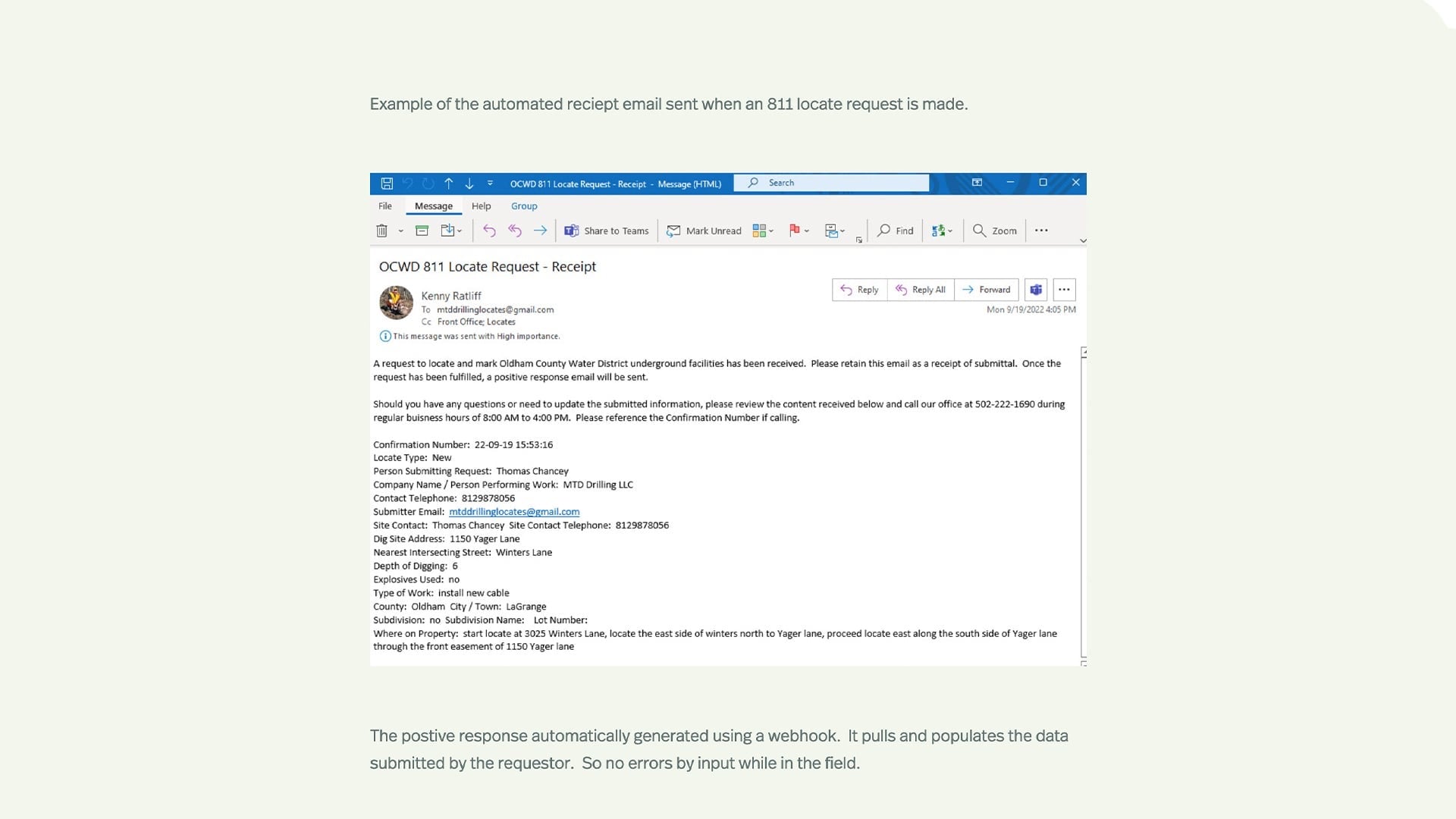
And the really quick thing I want to indicate here is when the public puts this in, as opposed to us trying to scribble and write things down, we know we’re not going to make errors when we reply. And so, this system is automated so that when they search up an address, it clicks the parcel, and they put in the information here. All that information, when we go out to do the locate and open up our other end of that to respond, is transferred. So there’s no typing or figuring out errors from our field guys and trying to respond.
So, when they submit their request, this is what our webhook generated email looks like to them. This is the receipt saying, “We got it, here’s the information we got.”
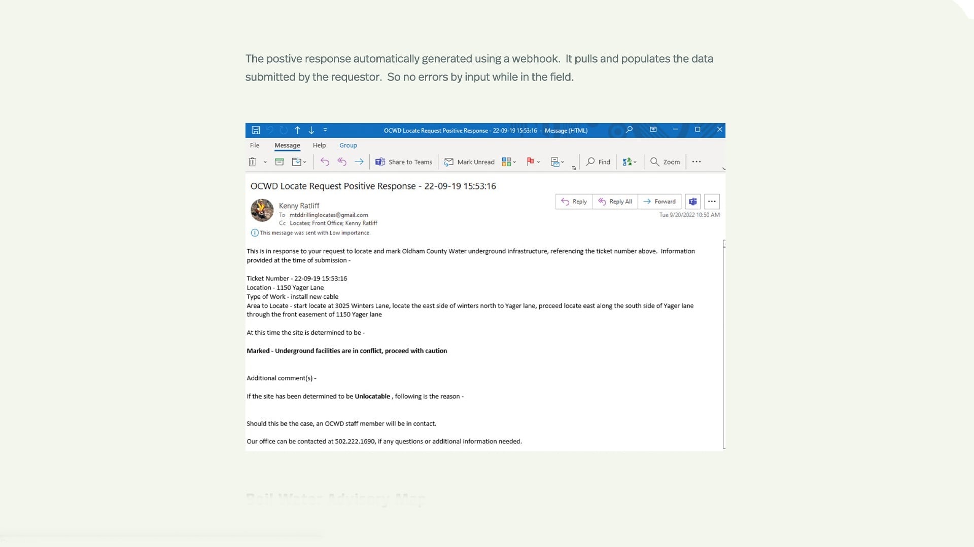
And then once our guys use the back end of the system and respond, all this is automatically populated and sent back to them, giving them the status of that particular location.
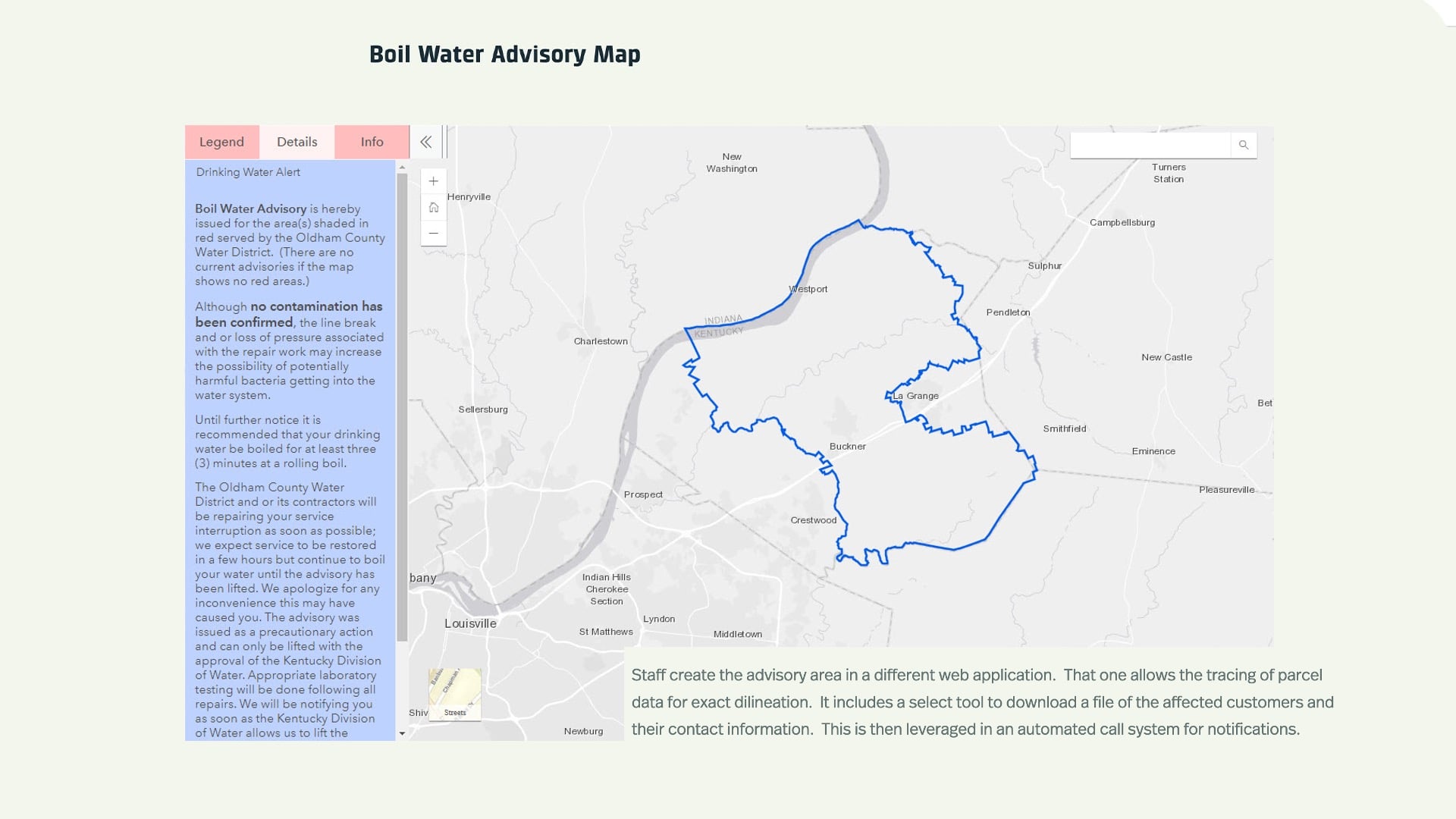
This is our boil water advisory map. Just another tool that we put out there — our folks select an area on a manager side, and it displays here. We also pull information from that manager-side of it and export the affected customers to a CVS or an Excel file. And then we have an automated call system. We plug that into and let people know what’s going on.
Bringing the Technology Together to Streamline System Repairs
So again, here is the big question everyone asks: “How do we get there?” Right. So this is the paper to pixels piece. This is what we have. We had a line that we actually discovered because it got hit several months ago. So even with our paper maps, we had to go back and determine that, well, there’s about 1,400 feet of my main that runs that we don’t have mapped. And so, we’re going to have to go out and spot dig that and add that to our system.
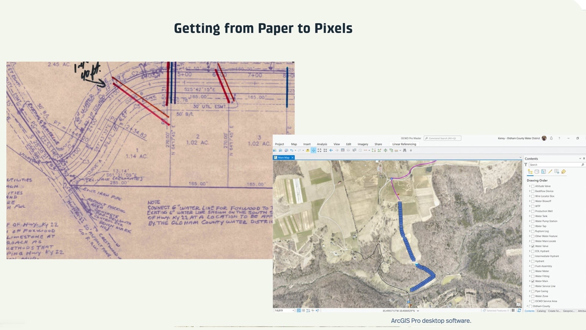
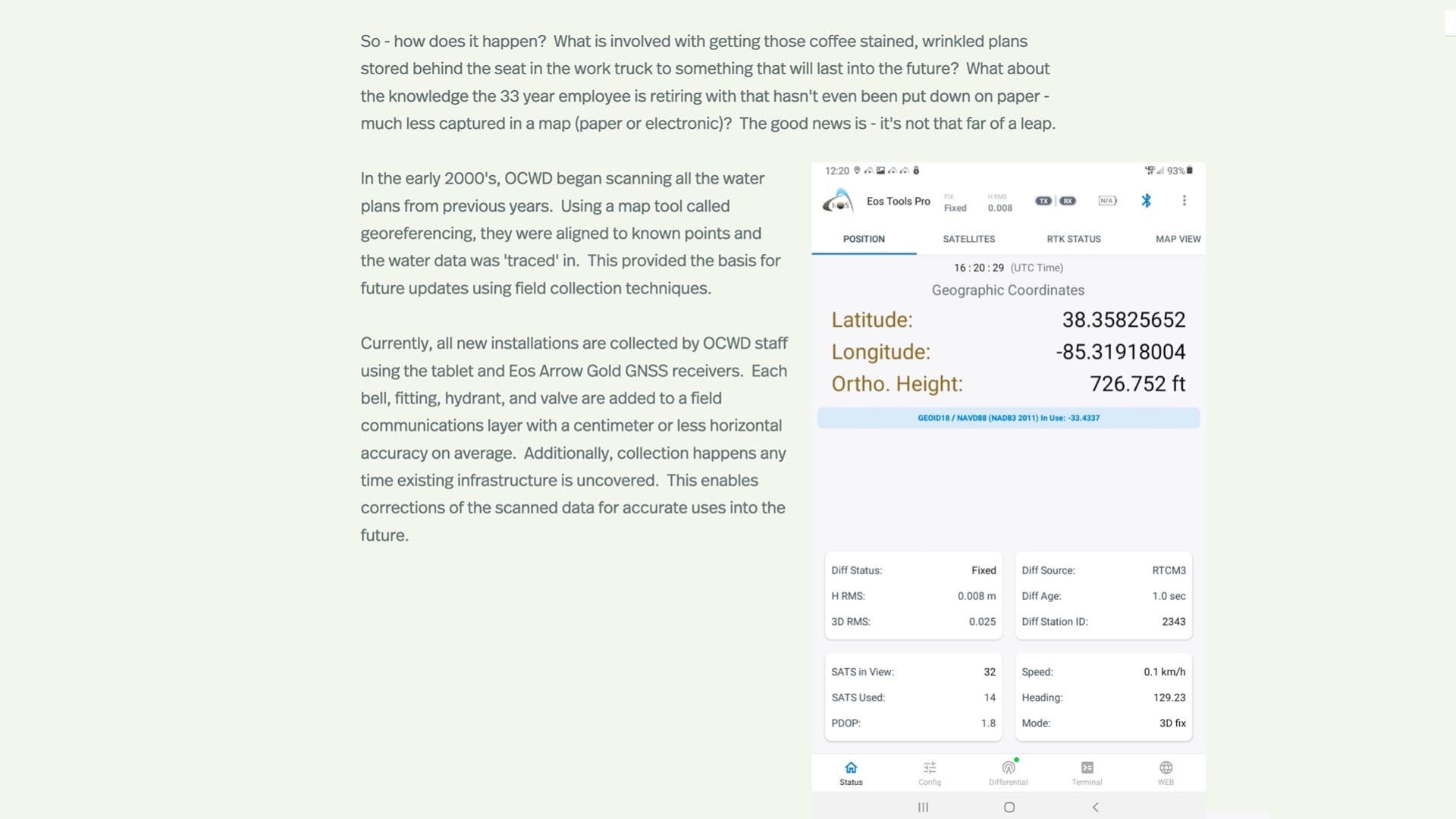
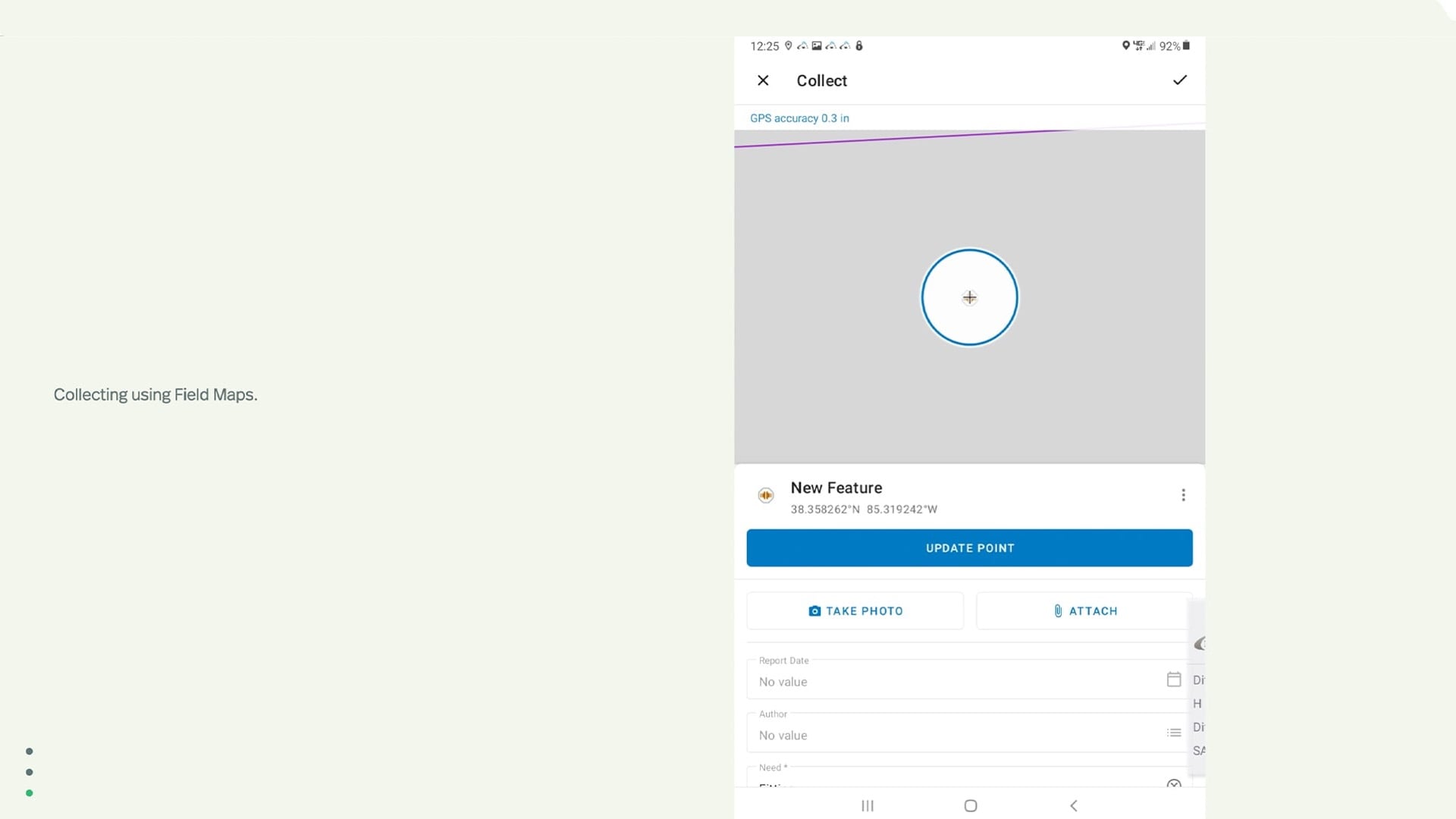
And this is the software, the desktop software that is used to take those field-communication data points and plug them into our system. This is a connection effort that we’re conducting currently, but this is the desktop software ArcGIS Pro. And then here is Eos Tools Pro, and application that works as the go-between from the receiver to ArcGIS Field Maps, which Jeff is about to talk about. Just showing here that you’re getting, you know, 0.8 centimeters accuracy on the horizontal.
Here is a quick capture of our service line that’s going in, and this is a crossover, so we’re getting our pipe casing point as well. We collect those pipe casings when they go into new subdivisions, so we don’t have to go probe around for those when we’re making connections.
With Field Maps, the nice thing about that is you can create a lot of different maps for different things. We have mowing locations, some flooding response maps, and they can also view the OCWD map, so everyone’s on the same page from the office to the field.
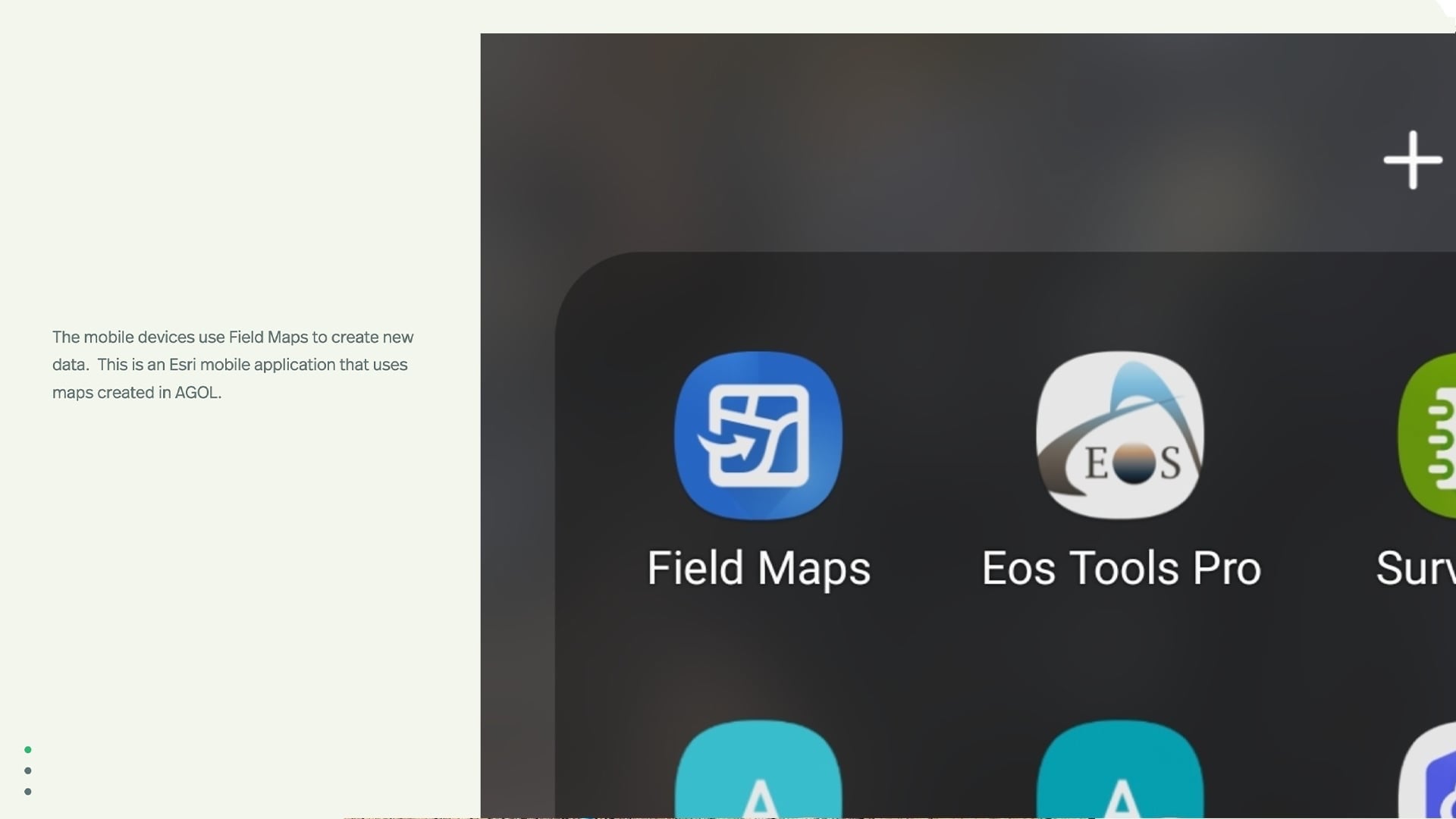
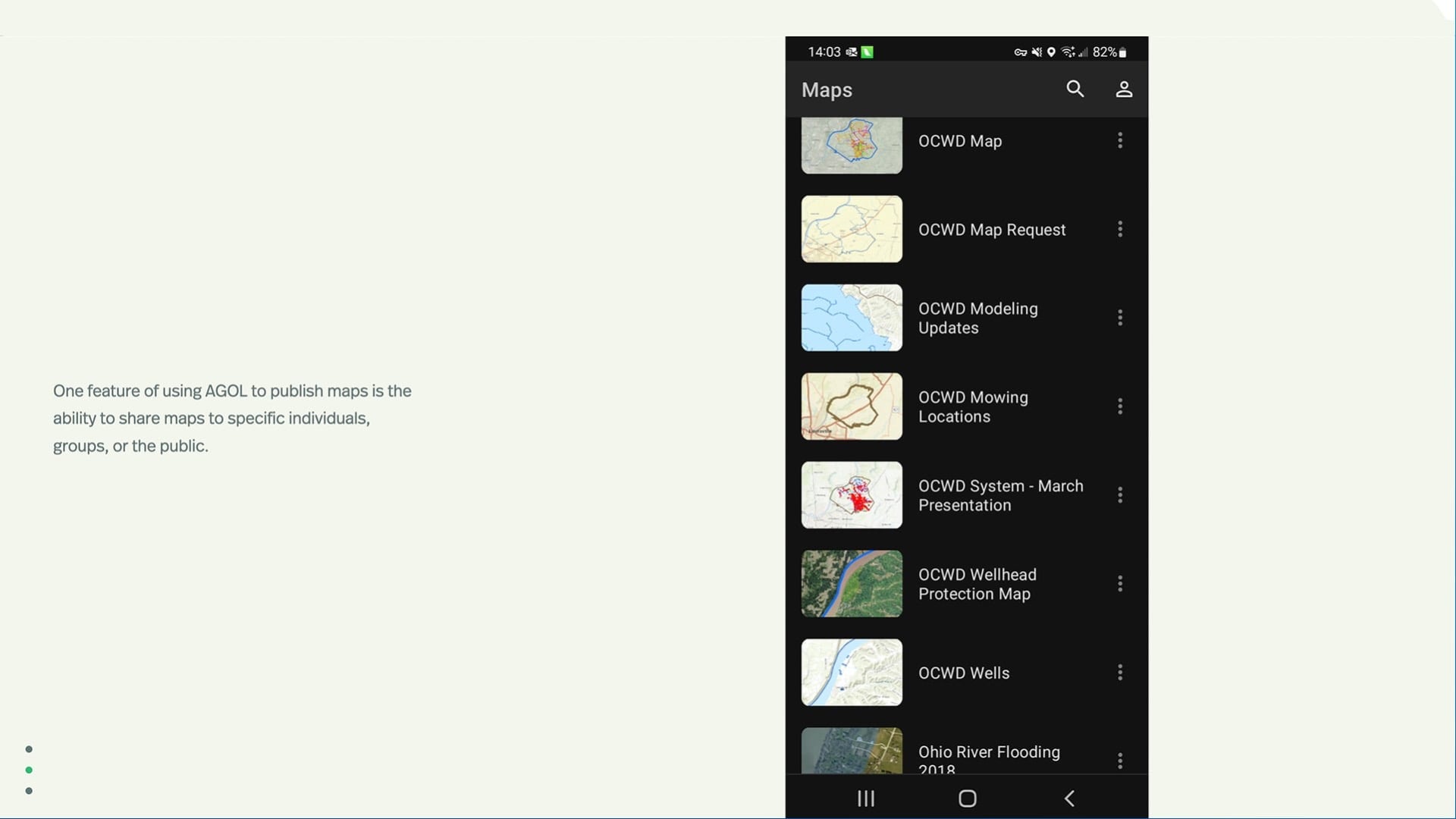
And that’s what it looks like in Field Maps when they’re going out and capturing that information. And that’s how with regard to that data, we’re moving from paper the pixels. We circumvent the paper. Not always, because we still have our as-builts that we retain, but they’re scanned, and we can utilize those along with the Field Map space.
A Picture is Worth a Thousand Words: Mapping What Can’t Be Seen
So, a picture is worth a thousand words. And that has a huge implication for us as water utilities, or any underground utility, because most of that’s underground and unseen. So when you capture something that can’t be found easily — that’s what we’re all about really, is getting the information and the longevity. These guys here have a wealth of information about our system, but if we’re not capturing that when they retire, we’re going to lose that. And how accurate that is really makes a difference in the long run.
And I’ll leave you with this quick story that two of our guys went out and we had a previously GPS-ed valve out in the middle of a field that had been grown over, and they did not know where it was at. But one stood off with the tablet, the other took the Eos device, walked out into the field with the antenna and the rod, and he was giving him directions.
“Go right, go left. Nope, six inches, go left, right, up.” And eventually he said, “It should be there.” And when they put the rod down, it clanked on the valve cover there in the middle of a grown-up field.
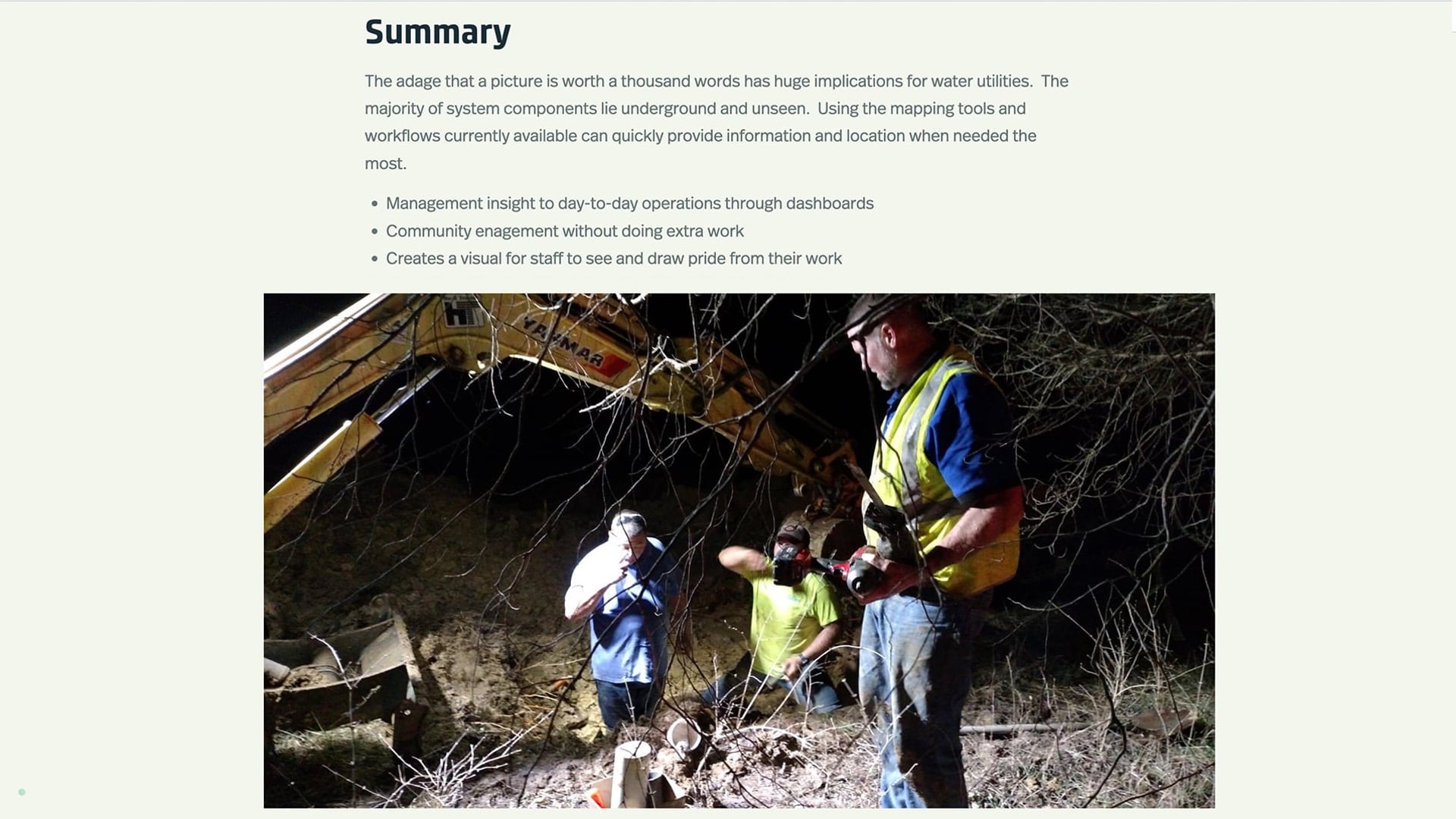
So that makes a big difference — especially finding that with the difference in a 350-boil water advisory versus a seven-boil water advisory. So that is our story in a nutshell. And I apologize if I’ve taken more than my share of the time, but I will stop and turn this over to Jeff.
ArcGIS Field Maps Overview
JEFF SHANER: That was wonderful. Kenny, thank you very much for that presentation. It’s wonderful to see how much of the ArcGIS system you’re taking advantage of in your work today and how you’re leveraging the Eos GNSS receivers to improve those operations as well.
Before we get started on the Field Maps overview, I think we have a poll that we want to do, so I’ll pass it over to Sarah. Sarah, do you want to launch that poll?
POLL: Did you know Esri has easy-to-use mobile applications?
- Yes, I use them, and want to learn what’s new
- Yes, I’ve heard, and am here to learn more
- No, I have ArcGIS, but didn’t know there were mobile apps
- No, I’ve heard of ArcGIS but didn’t know it worked on a mobile device
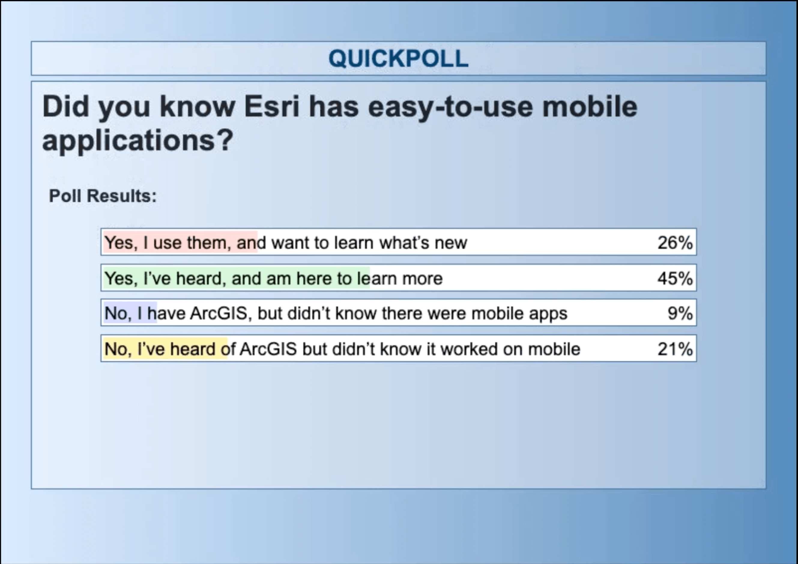
SARAH ALBAN: So, Jeff, we’ve got 45% saying that they have heard of the mobile apps and they’re here to learn more. About 26% say that they use these apps currently and want to know what’s new. There’s 9% who have ArcGIS but didn’t know that there were mobile apps. And finally 21% have heard of ArcGIS but didn’t know that worked on mobile.
JEFF SHANER: Awesome. Well, that’s great. So I’ll jump in and talk about Field Maps here. I’m going to give a brief overview on the product and what it can do. And then I’ll jump into the “what’s new” portion of my talk.
About ArcGIS Field Maps
I wanted to start and say that Esri has a suite of mobile applications that can be used for a variety of different purposes. And I’m going to focus our talk today specifically on our flagship mobile mapping application, and that’s called Field Maps.
It was launched in November of 2020. So, it’s a COVID baby, so to speak, and it’s a culmination of a number of different products and efforts that we’ve had underway for quite a few years.
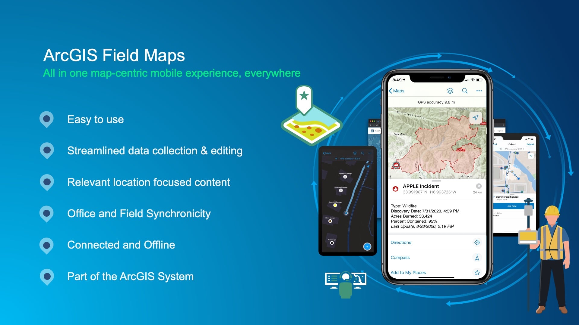
The foundation of it is that it’s designed for the non-GIS professionals that need to take and tear off maps and use them out in the field to visualize their asset data, to collect new information with ensured spatial accuracy, to connect their asset maintenance activities, to see where they are on the screen using their GPS position, and to be able to record and share that position so that they can ensure worker safety and efficiency in the work that they do and so much more.
ArcGIS Field Maps: Mobile and Web Application
And we’ve got thousands of users out using the system today for a variety of different needs. A key aspect of ArcGIS Field Maps is that it’s not just a mobile application. There’s an accompanying web application that is designed to help you configure and focus maps so that they’re fit for purpose on the mobile device.
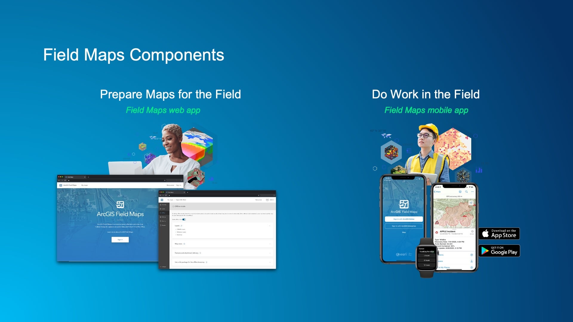
On the mobile device, we’ve built the application to run seamlessly on iOS devices, your iPhones, your iPads, as well as Android devices, both in phone and tablet form factors. But within the mobile application, you know, it’s designed for that person that’s out in the field trying to get their job done in a digital way.
You can see some of the requirements there, some of the key capabilities that we’ve been bringing forward as a part of the mobile app that transcend some of the data collection capabilities, include having the map be able to talk back to you.
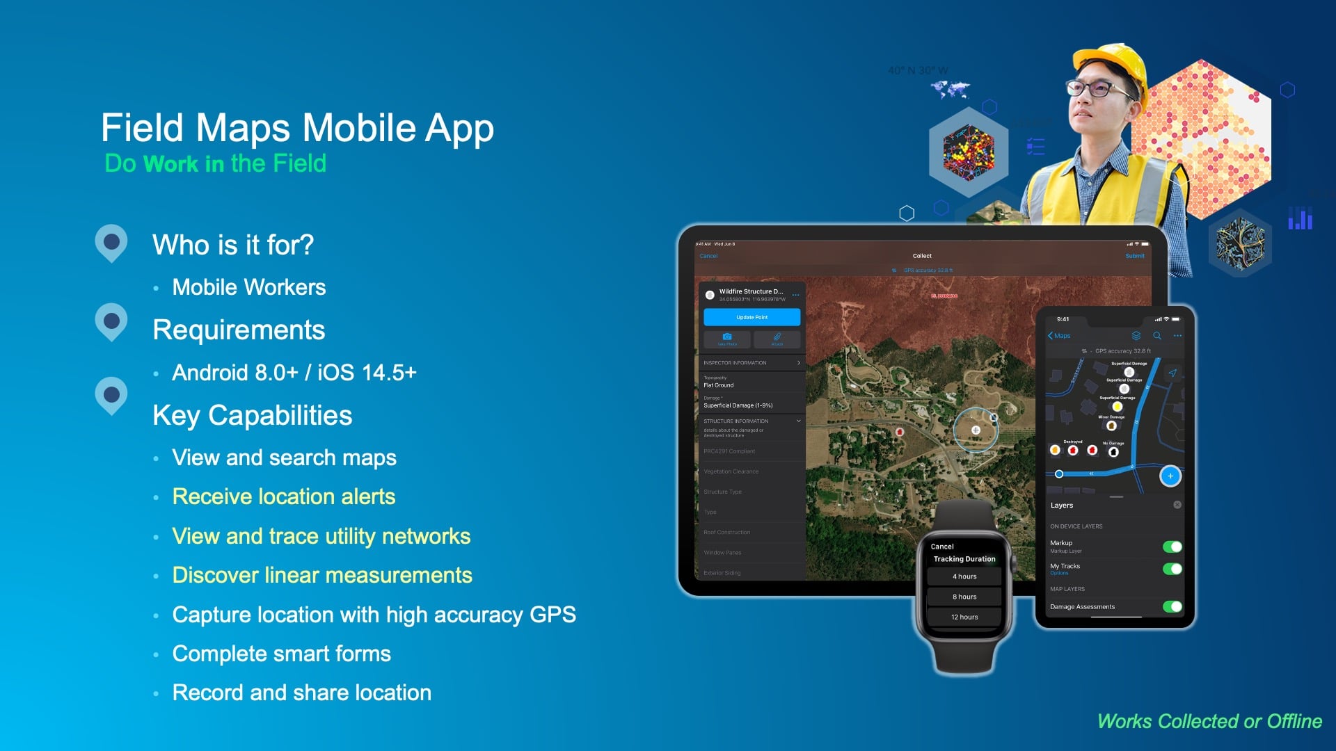
In other words, you can receive important notifications on your device based on the information that’s there. We are managing water networks, utility networks of any kind (e.g., electric, gas) and bringing that intelligence of the network forward so you can do outage management traces and much more with it. For example, looking at transmission over a linear measurement system and being able to derive information relative to mile markers. Those capabilities are a part of the mobile app.
Obviously, what we’re focused on today with high-accuracy GPS data capture, but also being able to blend that together with intelligent forms for inspection or just asset status in general capture.
Recording and Sharing Live Locations
And then the recording and sharing of locations. You can see we’re starting to take advantage of peripheral devices, like an Apple Watch®, as well as a part of that effort. The web app itself, as I mentioned earlier, is really for streamlining that “getting started” experience.
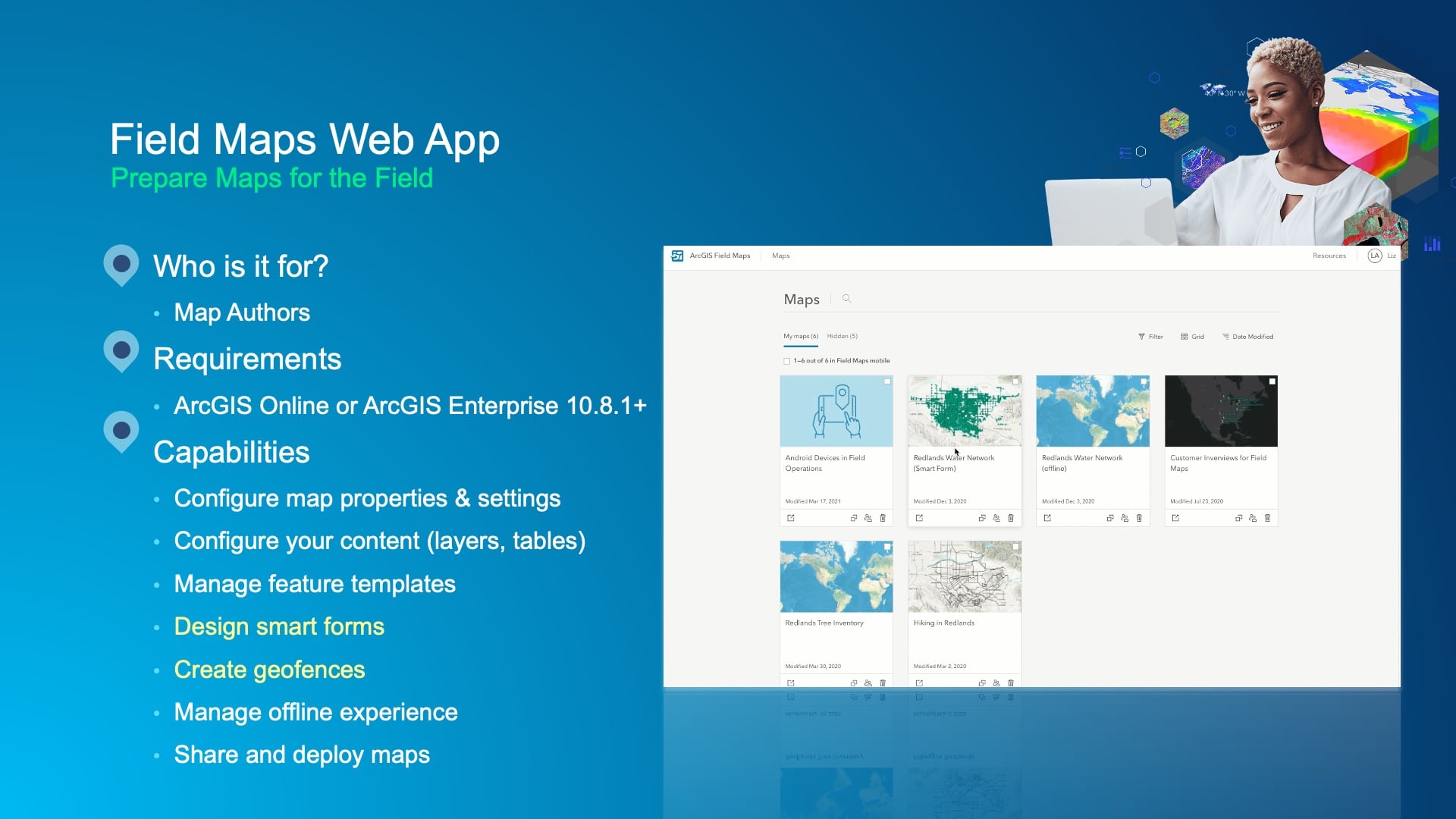
So, with this you can do a variety of tasks, including
- creating maps that you can then configure for use on a mobile device,
- being able to build your forms, defining what types of assets you’re going to want to capture,
- creating these “geofencing” buffers so you can receive those location-based alerts,
- managing the experience for working in a disconnected environment where there’s no Internet connectivity,
- and much more.
Core Capabilities: Interactive Maps with Effective Tools
Now I want to walk through some of the core capabilities just briefly and then get to the “what’s new” section. With the map, the map is central to everything you do inside of the mobile application. It really brings that out life, and I think it gives the experience within the app some focus, too.
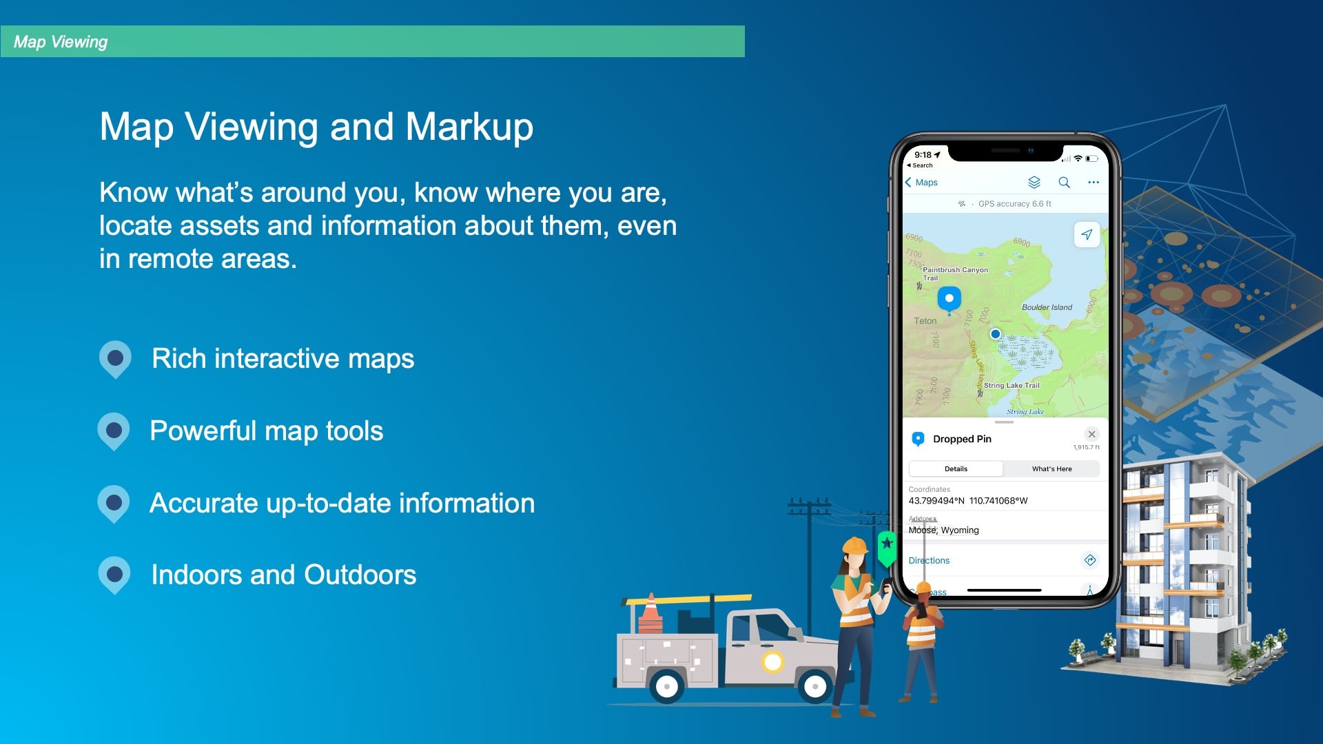
Now, the map has a set of layers. The layers drive what you can collect, but also what you interact with on the device. And you can build really rich, interactive maps using the ArcGIS system. And the Field Maps application has a set of powerful map tools that are a part of the experience that you can take advantage of for a variety of different activities, like what Kenny was getting at: trying to accurately locate something. When there’s an incident happening in the field, there’s a compass tool built into the product so that you can take advantage of that highly accurate GPS position and walk and navigate to that location and get precisely to where it is.
So, you can be more effective when you’re spending time and resources digging up underground infrastructure. Also important is that the maps aren’t just outdoor maps. We’ve been adding capabilities into the product to support working indoors as well and, with that, supporting indoor positioning sources as well as external positioning sources.
Leveraging High-Accuracy GNSS Receivers
On the data capture and editing side, that’s where a lot of organizations start with their maps. Being able to leverage high-accuracy GNSS receivers to capture information with inherent spatial accuracy is key to everything else you do with that data.
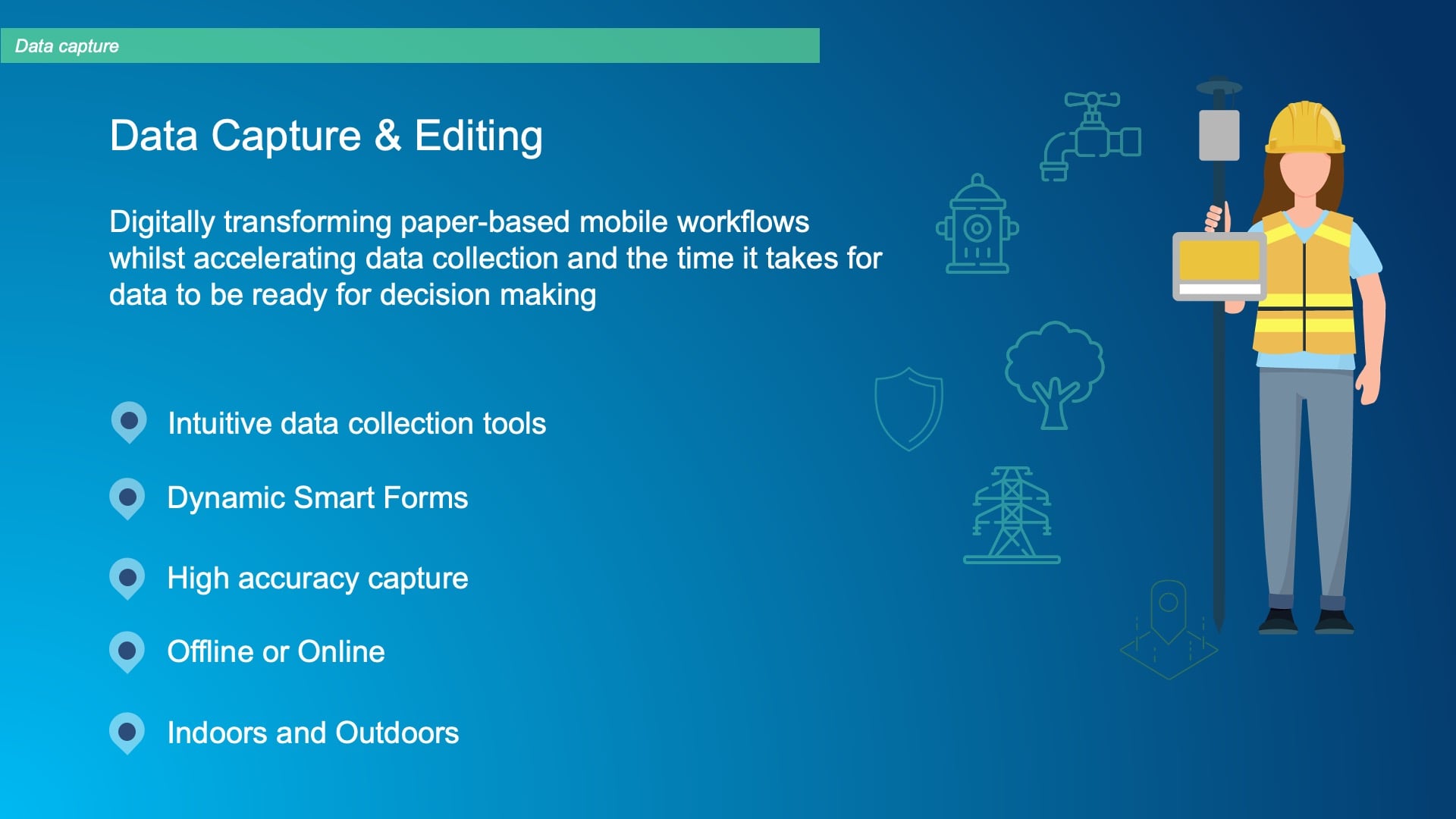
So, integrating efficiently and seamlessly with the Eos line of receivers is very important to us. Being able to also fill out information that’s relative to the assets that are managed in those layers is important to us. And providing these dynamic forms that can pull information from other layers and automatically populate data inside of the GIS system is really key.
And of course, everything needs to be able to support working in a disconnected environment. More and more important is leveraging technology for improving operational awareness. It can be a sore subject for some folks, but the ability to record and share locations or track positions is very useful in providing that awareness of where people are when you’re scheduling work. For example, being able to identify when someone’s been perhaps dwelling in a location too long and may need assistance. But it’s also quite useful in knowing where that person is in order to provide relevant information or notifications to them.
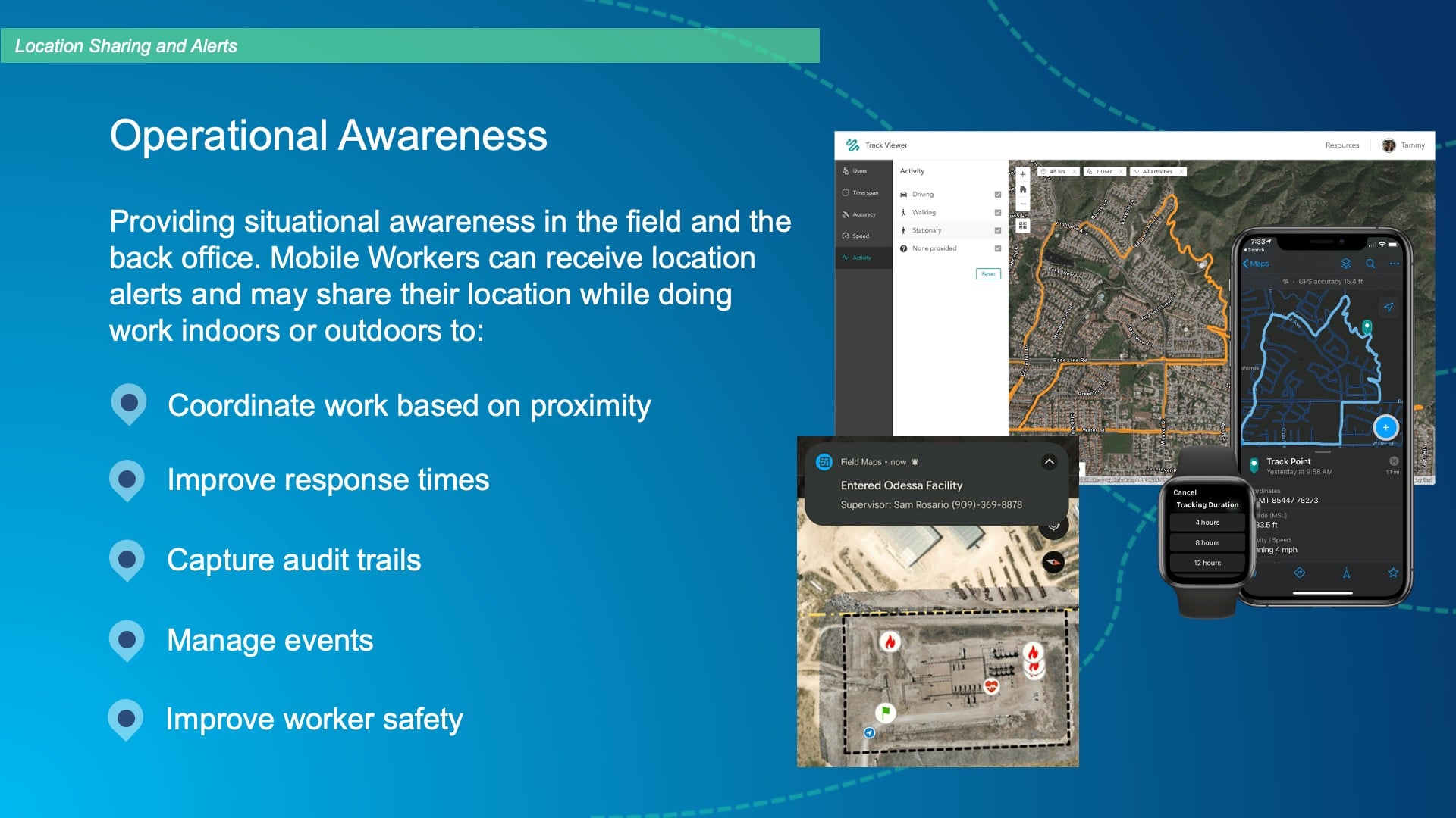
For example, in the screenshot here, you see this person entering a facility and perhaps needing the safety supervisor’s name and phone number, so they can contact them while they’re there. A lot of that information can come through the map, and it’s done via the ability to record and share your location as part of your interaction with the device. And we provide that as a capability in the mobile app.
Using Webhooks for Real-Time Updates
Now, Kenny touched on this briefly, too. He mentioned the concept of webhooks, and that’s part of a greater capability for automating workflows, providing additional business logic that feeds into the way that you work through a mobile device.
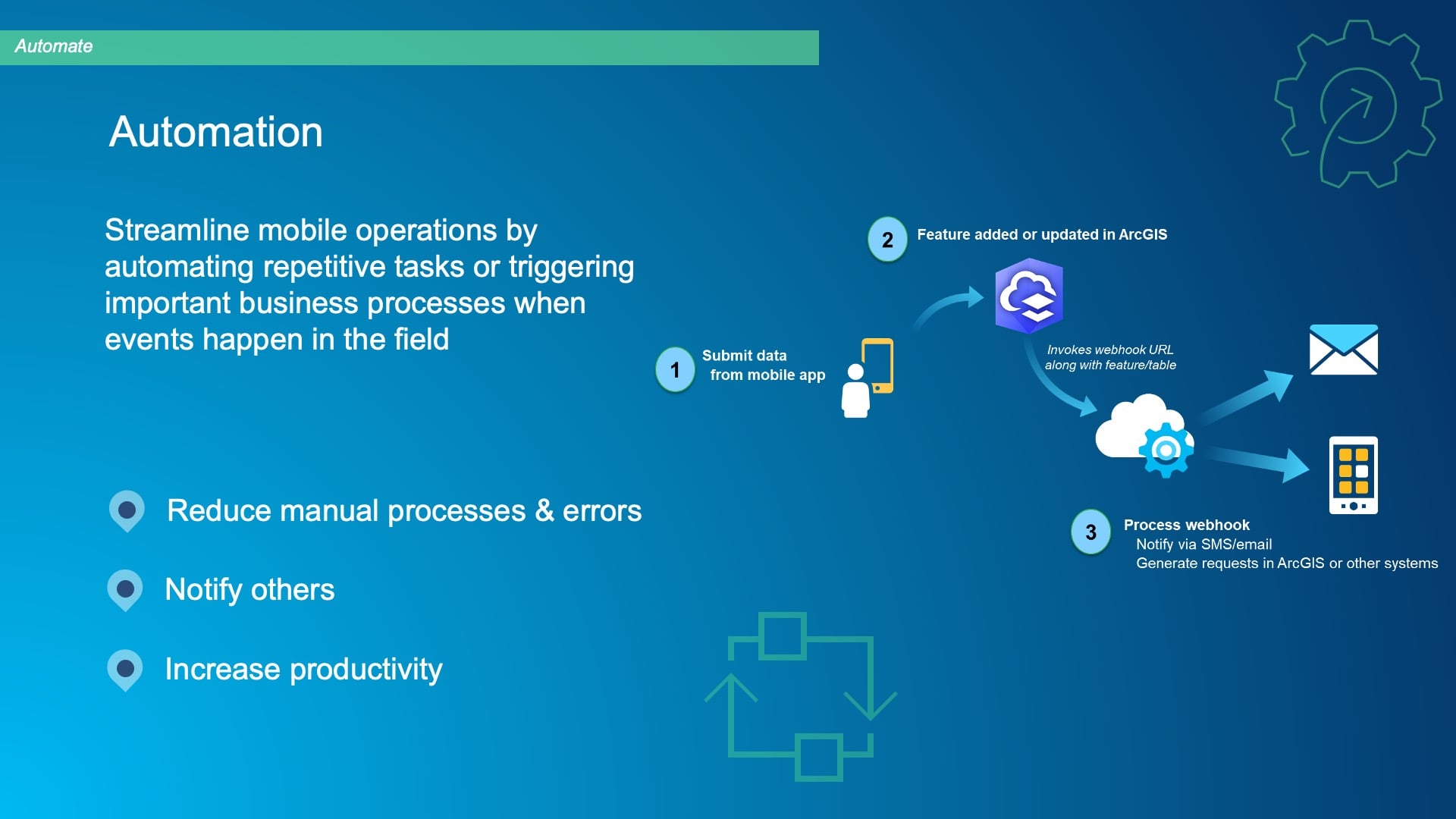
ArcGIS Field Maps supports the webhooks ArcGIS. That’s a part of our chips. And you can chain together things like Kenny showed with an email, based upon someone digitally submitting information — such as the capture of a new feature, or perhaps a field inspection report, or else when they’re responding to some emergency event — and then act on it efficiently.
So, know that as part of our ArcGIS Field Maps and the ArcGIS system, we support automation through webhooks and also with a developer technology called the Python API, so that you can script routine tasks and take that need to kind of do manual work out of the hands of your back-office staff and GIS staff; instead with webhooks, you can give them more time to be more efficient in the work they do.
ArcGIS Field Maps Road Map: What’s New?
This is the last slide I have. I wanted to talk about our product road map for ArcGIS Field Maps. Right now, in fact, just before this webinar started, we launched the second beta version for our November release. We’ve got a release coming up in November, and all the things that are listed here in the near-term are coming as a part of this.
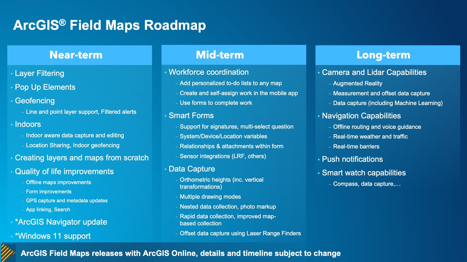
So, these upcoming near-term capabilities include
- dynamically filtering information within a device,
- being able to expose these really nice pop ups when you tap on your assets (and that includes even charting capabilities on the mobile device),
- supporting points and lines,
- filtering the alerts that are provided to you as a mobile worker when you get in proximity of a location,
- supporting all aspects of working indoors,
- extending the capabilities of our web applications to lower that barrier-of-entry for getting started
- and then a whole bunch of quality-of-life improvements that are underway, which are going to make both the web and mobile experiences much better.
We have another product called ArcGIS Navigator. We’re giving that a bit of a refresh. That’s a product that’s focused on vehicle-based navigation that works completely offline that you control the map for. You can have all of your asset data in the navigation app. So, look at that if you’re in need of a navigation solution.
And also coming to us late this year is support on the Windows platform with Windows 11 specifically. Microsoft has introduced a Windows subsystem for Android so it can fully run Android applications on a Windows 11 device, and we’ll be supporting that before the end of the year. And then finally, you can see a list of the things that we plan to do moving forward, both in 2023 and in in the longer-term.
So that’s a quick glimpse at ArcGIS Field Maps. And I’m going to pass it over to Jean-Yves, who, I’ll say it once again, has his birthday today. Happy birthday, Jean-Yves.
Beginner’s Guide to Mapping with High-Accuracy GPS
JEAN-YVES LAUTURE: Thank you so much. So I’ll go over a couple of slides briefly. And I think the best thing to do here is to just take the key takeaways from the three speakers that we had before us, from Christa, Kenny, and Jeff and then and give more space to questions.
The Evolution of GNSS
You know Christa, you mentioned GPS and GNSS. So, how is this all this possible today? When I started doing GPS years back in 1990s, I mean, it was just GPS. What I mean by that is that there was only the GPS satellites. GPS means the US sets of satellites; we call this a satellite constellation. Since then, we’ve seen other countries launch their own positioning constellations.
So, in the 1990s, we had to deal with having only six, seven, or eight satellite GPS satellites available to us at a time. After we saw the launch of the Russian GLONASS satellites, we started talking more about “GNSS” (global navigation satellite systems) as the way of the future with even more satellites. And after GLONASS was launched, we then saw the Chinese Beidou constellation be launched, and we also now have Galileo, which is a European Union (E.U.) constellation. All these are global satellites. They orbit around the Earth and give us many more satellites available for our field work. We also have some regional ones, of course, with Japan, the QZSS and India’s IRNSS, but you and I can’t access those unless we are physically located in those regions of the world because they do not orbit the planet.
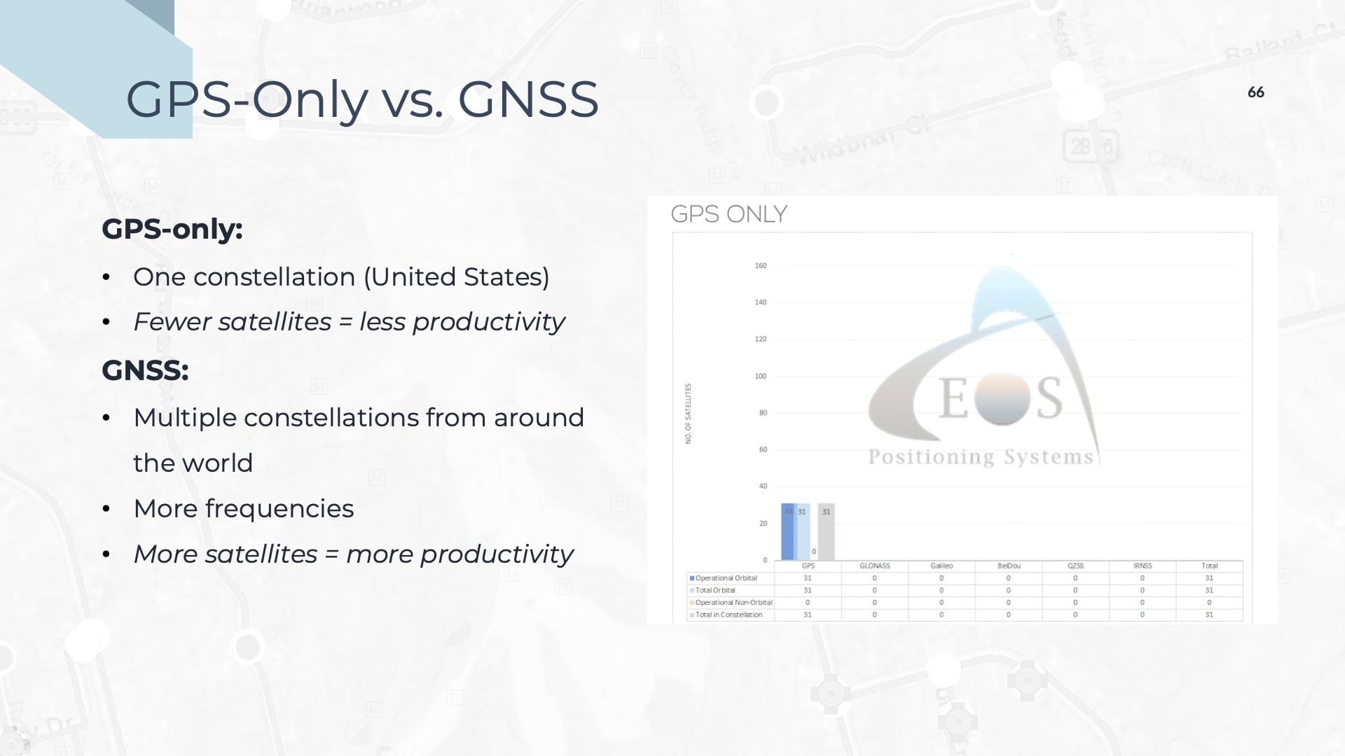
But all this is to say that, the face of field data collection has changed. Because we have gone from about 30i global satellites in the 1990s to about 150 global satellites today . So, you might be asking, “What does that give us?” Well, it gives us positioning systems that are easier to use in the field.
Technology has changed, of course. During this time we also saw the availability of differential corrections, which are used to make the receiver more accurate, become more widespread. Some states in the U.S. — for example, New York, Florida and a whole bunch of others — give free differential corrections to their users so you can go down to centimeter-level accuracy.
So, do you gain in accuracy by having all these satellites? Yes. You gain a little bit of accuracy, definitely. But also, you gain on the integrity of your location. And even more so, what you gain is productivity. When we went from having GPS-only satellites to having GLONASS plus GPS satellites, there was a gain of 50% productivity. And by adding two more constellations, Galileo and Beidou, which provided another 30 to 40 satellites and a total of four global positioning constellations, we got an extra 50% productivity on top of GPS with GLONASS. So, there’s a lot less downtime in the field, and you can do your mapping more easily.
Frequently Asked Questions about GNSS Accuracy
The next two slides are just to answer questions that I hear very often when I meet customers. One is, “What do I need in terms of accuracy? Do I need one centimeter accuracy? Do I need submeter accuracy? Do I need a few meters?”
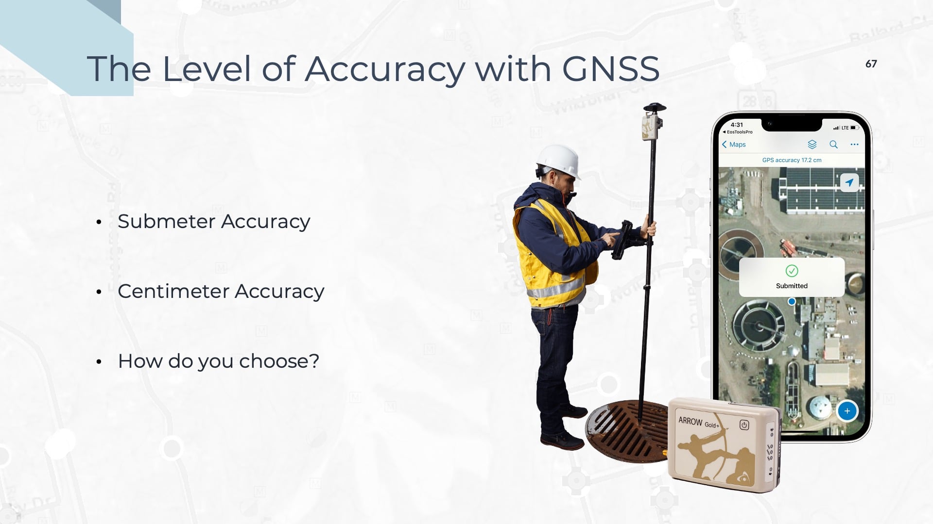
Of course, when we’re doing asset mapping, especially for water utilities, we have a mix of customer needs. Often, I’ll recommend submeter because that’s enough for them. This is the case if they just want to map the manholes. With submeter, they are sure that when they map a manhole, it’s on one side of the road instead of finding the map saying that it’s 30 feet away from its actual location, on the other side of the block. So that’s one gain that you have. On the other hand, when customers are looking at centimeter-level accuracy, this tends to be a smart choice when people will want to have extremely precise measurements; for example, they might want to measure the slope for gravity calculations. Another example is when a customer wants to do as-builting to create a true, 3D representation of their field data in their GIS. There are lots of applications that call for both centimeter-level and submeter-level accuracy; it will depend on your specific use cases.
Kenny, if I recall, went with the centimeter-level accuracy because they had a lot of as-builts, and they wanted to have a quick intervention — both when they’re looking for a valve during routine work, or in a disaster as he mentioned. The choice is yours, but I can tell you that more and more, with accuracy becoming more affordable, we find people going directly to the centimeter-level accuracy and creating what Esri calls a true “digital twin” of their assets in the field.
And the other question I hear is, “How do I make that jump?”
And that was the first thing that Christa said, you know: “When do we move into that, when do we start doing that? And, why do we have to do it?” I think that most of you who are using paper maps have seen the advantages of digital and the gains in that. Moving that direction has become much easier than it used to be.
Better Serving Customers with Speedy Repairs
One thing that Kenny said with his anecdote about the map requests was that these help better serve the customer. That’s one thing, you know, when you have an intervention to do on a valve — if something is broken and you want to shut it off, or you want to be there quickly — you now have direct access to your accurate data, and you know exactly where to go and how to fix it instead of searching through paper maps.
There was another point that Christa mentioned of, “Okay, do we map all the assets right now? Do we do we do it”? And I think that it’s less complicated than you think, mapping data, and it’s less complicated learning GNSS. The Esri apps, as we have said, have become easier to use. Technology and tools that used to be reserved for high-accuracy surveying is now simplified, so that anybody can use it. We have customers who use interns in the summer just to map their assets. The entire workflow has become available — and affordable at the same time.
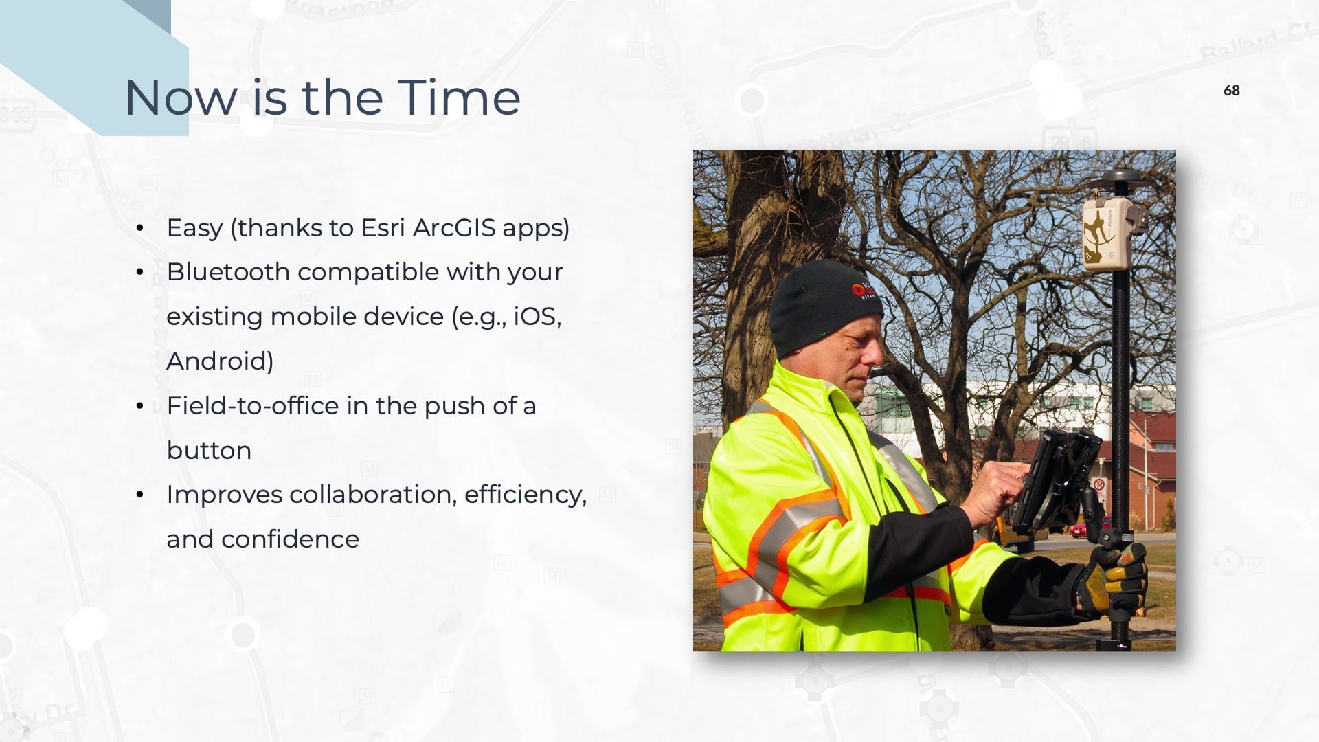
The Only Limit is Your Imagination
So, mapping your assets can provide a lot of benefits, as you saw in Kenny’s presentation, with regard to the information you can now share with people and the decisions that you can make.
And I remember what Kenny said, which I found very interesting: “Imagination is your limit.” Creativity. This is what you can do with your maps. The way you collect them, the information you want from them — it’s all really up to you. And I know that Esri has a lot of modular templates that facilitate the creation of those maps, so that you gather this data into your GIS with greater ease and standardized data models. So with this, we’ll go into Q&A.
Q&A
AUDIENCE QUESTION: “I currently use paper maps that are 80 years old. As technology keeps changing, how do I know that digital mapping being built today can be used in the next 80 years?”
CHRISTA CAMPBELL: It’s a great question. It’s also a trick question because you won’t be able to use the technology most likely in 80 years. Technology is something that you have to continuously make sure that you’re maintaining. And if you’re using your technology, then part of that natural process is, that as time goes on, you’re growing with the technology.
So, it’s a trick question. If you’re talking about just what’s there today, no. if you’re talking about, hey, we’re going to continue using technology, of course, 80 years from now, I can only imagine some 3D holographic type of integration. Maybe that’ll happen sooner than 80 years!
KENNY RATLIFF: And I would just offer up that in the 25 or so years I’ve worked with GIS, you know, you’ve got a common denominator in the shapefile that seems to transcend all the tools and the apps and software that’s come out. So, I envision that 80 years from now there will be something that, as Christa alluded to, you’ve progressed through and kept up with that technology, and you can evolve whatever data you may have to be able to use that in 80 years. So, I don’t think you would ever not be able to use it in some capacity.
JEFF SHANER: The way it’s going, Kenny, I think the shapefiles are still going to be around the though. [Laughter]
KENNY RATLIFF: I’m good with it.
JEAN-YVES: I think it will become easier, as Christa said. Maybe things can display on your screen, like a hologram. Imagine you could touch it, and then the valve turns off. Ooh. And fixes itself. I’m not sure. But the accuracy will not change — we’re down to one centimeter. So, the accuracy you captured will still be relevant. The data will be there. More computer machines will be available, but the accuracy will be there to stay, I would say.
AUDIENCE QUESTION: “Kenny, one of your polls asked about staffing. At what size system would you recommend it’s prudent to have a GIS manager?”
KENNY RATLIFF: So, speaking from my seat, it really depends upon your management in terms of what they want, how much emphasis they put on it, and what support they give.
In our situation, Russ is very insightful about looking into the future. And so, when he brought me on board, the whole intent was, “Hey, look, we’ve kind of done the B-game level data management, but we want our data to the point that, 20 or 25 years from now, they’re going to look back and say, ‘Wow, we really appreciate what you guys did.’” And that was his [Russ’s] focus on moving forward. So, he’s a visionary in that respect. Not all systems that we run into have the capacity to do that. I’m a tech as much as a manager, so it’s a great job because I get to build the stuff and I get to work in the data, which not a lot of people get to do. You’re either a manager or you’re that technician, and I get to blend both. I always say they let me go out and run a track hoe and drive the dump truck on occasion as well.
So, it really depends on the system, your board, your leadership and at the end of the day where you want to be. I will say that the cost in the technology is coming down. As far as cost and availability — with the access to this stuff [becoming greater] — there’s not a really good reason not to do it, whether you do it part-time, full-time, or otherwise. But it really just depends. I think, Christa, I saw this on some of your notes earlier — it depends on the system and what you can afford, and what the expectation is from the customers, as well, will drive that.
CHRISTA CAMPBELL: For sure. And some of the smaller systems, some of our customers only have, for instance, three or seven employees, and they really don’t have the bandwidth to have a dedicated GIS person. A lot of times what that means is that the engineer is also the GIS person, or the circuit rider is helping them. You know, they’ve connected with the National Rural Water Association, and they’re getting help from there. But definitely, Kenny, it’s [dependent on] the size of the system, what resources are available, and what they need to accomplish. Sometimes just [having] dedicated employees spend a quarter or a half of their time is enough to create a map, have it digitally, and make sure it’s maintained.
AUDIENCE QUESTION: “Christa, would you speak a little bit to the licensing options for the software for small and rural water utilities? And then, Jean-Yves, could you please speak to GNSS receiver prices ranges.”
CHRISTA CAMPBELL: Sure. I’ll be very quick. Esri has several different licensing options for small and rural utilities. We have enterprise licensing that has special pricing. We have cloud-based mapping, which has specifically been developed for small and rural systems. And then we have two programs on which we work with state rural water associations. The first one is a pass-through program that enables a buy one, get one free [arrangement], basically, for web GIS — so that smaller utilities can learn. And we have a brand-new multitenant program that allows state rural water associations to host content for their members. That’s brand new.
So, if that’s something you’re interested in, please don’t hesitate to reach out to me. It’s a great value to the very small association members.
JEAN-YVES LAUTURE: And on my side, in terms of the GNSS receivers, it really depends on the level of accuracy. There is a wide range of GNSS receiver models, ranging from submeter- all the way to centimeter-level accuracy. And even the centimeter-accurate models, we have three of these. Now, if you want to make pricing a little bit more complex, you’ll also have variety based on the frequencies the receiver model supports, ranging from low-frequency systems to full-band systems (which support all sorts of everything, by which I mean, every single possible signal that exists right now, sent by all those satellites). So, prices will range from a little bit above $2000 to about $8000 or $9,000 for the top-of-the-line systems.
SARAH ALBAN: Awesome. That puts us right at the 15-minute mark. So we’re going to go ahead and respect folks’ time. If you submitted a question and we weren’t able to answer it, we’re going to try to touch base with you offline via email.
I want to again thank everybody for spending some time with us today. Thank you NRWA and Cheyenne, and to all of our presenters and also to Emma Hardy and Mariah Salazar, who have been helping us on the backend. And hopefully we’ll see everybody again soon. Thank you.


