
ArcGIS QuickCapture is the big-button, high-speed data collection app from Eos partner Esri. When combined with Eos GNSS receivers, QuickCapture can be used to map features from moving vehicles (or otherwise in motion) with extremely high accuracy, at speed. All Eos GNSS receivers can provide QuickCapture with submeter or centimeter accuracy at up to 20 positions per second! So every time you tap the big button app, your Eos GNSS receiver is poised to give you a reliable position.
Capture Data at Speed
Collect survey-grade data from a bicycle, car, helicopter, or other moving vehicle with the push of a button, when connected to Eos GNSS.
20 Positions per Second
Eos GNSS receivers provide precise positioning at up to 20 Hz, so no matter when you tap, your GNSS position is ready.
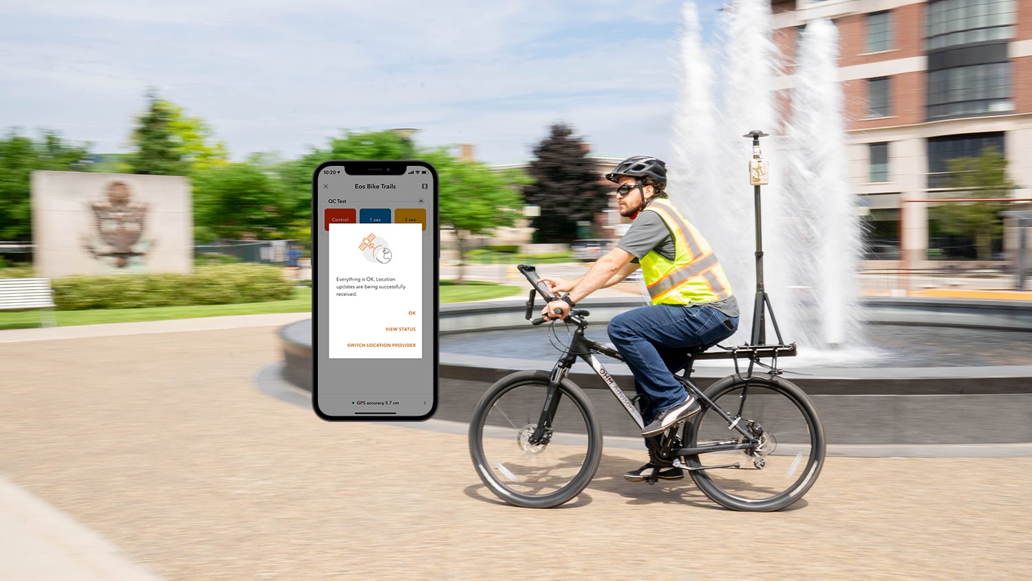
Map Trails and Switchbacks
Capture every twist and turn, even with skinny trails, thanks to submeter accuracy or better with Eos GNSS and QuickCapture.

Transform Transportation Data
Quickly create accurate inventories of street signs, cracked pavement, and other critical observations about your roads and highways.
Assess Crop Conditions
Farm hands with virtually no geospatial training can easily take Eos GNSS receivers and QuickCapture to the field and record crop health and other data down to centimeter accuracy.
Ultimate Field Efficiency
QuickCapture is designed to make data-capture easy — and so are Eos GNSS receivers. Your crew can get up and running quickly, and accurately with this efficient combination.
Consider the Eos GNSS Receiver Bundle with ArcGIS
U.S. purchasers are eligible to bundle specific Eos GNSS receivers with flexible ArcGIS licensing from authorized Eos resellers.
What We Like about this Partner App: ArcGIS QuickCapture
Device Agnostic
ArcGIS QuickCapture supports Eos GNSS receivers on iOS®, Android and Windows devices.
Flexible and Familiar
Eos GNSS receivers can send up to 20 positions per second straight to ArcGIS QuickCapture’s big button interface. Just push the button, and the hardware and software take care of the rest.
High Level Support
Eos representatives can provide you with fast, free technical support as you set up ArcGIS QuickCapture with Eos GNSS receivers.
Precision, On the Go
ArcGIS QuickCapture and Eos GNSS receivers are a perfect, precise mapping solution for teams who need to map fast, without sacrificing accuracy.
Success Stories with Eos GNSS Receivers and ArcGIS QuickCapture

Field Data Collection Improves Access to Québec Mtn Bike Trails
Velo Quebec uses Arrow 100® and ArcGIS QuickCapture to quickly map bike trails at speed. The data helps ensure land owners maintain the trails.
More Info
Midland Co. Maps Flood Damage w/ OHM’s GPS Smart Bike
In this 2020 MiCAMP session, OHM shows how they used a GPS Smart Bike (Arrow GNSS, ArcGIS QuickCapture) to map Midland County flood damage.
More Info
Vineyard Maps 500,000 Vines with Survey-Grade Accuracy
Learn how one premium-wine producing vineyard saved over a half-million dollars by choosing RTK cloud-based mapping over physical barcode IDs.
More InfoWhat Customers Say about Using Eos GNSS Receivers with ArcGIS QuickCapture
We put ArcGIS QuickCapture and the Arrow 100® to the test while ice skating on a lake near the Vélo Québec office during a harsh Canada winter. The results were remarkable: easy to use, easy to carry, and great accuracy. QuickCapture and the Arrow 100® were able to perfectly map and attribute the tracks on ice.
Francis TétraultMountain Biking Project Manager, Vélo Québec
Companies Using Eos GNSS Receivers with ArcGIS QuickCapture

Recommended Resources
Eos Positioning Systems releases new Arrow Bundles with Esri licensing

How to Use Multiple ArcGIS Apps on iOS® Concurrently with Arrow
Other Apps You Might Like
