Eos Positioning Systems

Tel.: +1 (450) 824-3325 (CAN)
  • Technical Support
  • EnglishEnglish
    • Français Français
    • Español Español
  • Home
    • About
    • Contact
    • Technical Support
    • Subscribe
    • Testimonials
    • Users
  • Products
    • Arrow Series™
      • Arrow Gold
      • Arrow 200
      • Arrow 100
      • Arrow Lite
      • Comparison Chart
    • Accessories
      • Antennas
      • Mounting Equipment
      • Extra Battery & Power
      • Field Gear
      • Atlas® Service
    • Tools and Apps
      • Eos Tools Pro
      • Eos GNSS Tools
      • Eos Utility
      • Eos Server
      • Arrow USB Drivers
    • Solutions
      • Geoid Height
      • Eos Locate™ for ArcGIS
      • Laser Mapping
  • News
    • Latest News
    • Success Stories
    • Events
    • Newsletter
    • Press Releases
    • Blog
  • Learning Center
    • Arrow
      • How-To Articles and PDFs
      • Video Tutorials
      • Arrow Datasheets (PDFs)
      • Manuals (PDFs)
    • GNSS
      • GNSS Articles
      • iOS and Bluetooth®
  • Partners
    • Field Apps
      • Esri
      • AmigoCloud
      • CartoPac®
      • Corvallis Microtechnology (CMT)
      • DigiTerra
      • Futura
      • GeoMobile Innovations
      • GI Geoinformatik GmbH
      • mapitGIS
      • SPOT
      • SST Software
      • TAXUS IT
      • TerraGo
    • Hardware
      • iOS
      • Android
      • Windows
      • Laser Technology
      • Tablet EX Gear
CONTACT
  • Home
  • Blog
  • ArcGIS Field Maps: A list of our favorite resources for the new Esri mobile application (so far)

ArcGIS Field Maps: A list of our favorite resources for the new Esri mobile application (so far)

by Eos Positioning Systems / Wednesday, 18 November 2020 / Published in Blog, Latest News, News
ArcGIS Field Maps Supports Arrow GNSS

ArcGIS Field Maps: Here are our favorite links and resources pertaining to the newest Esri mobile app

In case you missed it, Esri released the long awaited ArcGIS Field Maps application this past month. Here is a list of our favorite resources, including timeline of announcements, app links, helpful migration guides from Esri, information on your Arrow GNSS compatibility, and more!

Download ArcGIS Field Maps for iOS
Download ArcGIS Field Maps for Android

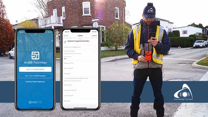
The new Esri ArcGIS Field Maps application works with Arrow GNSS for high-accuracy

To learn more about what Field Maps is, which applications it combines, and how it will impact your work with Eos Arrow Series receivers, please click here to read our initial post about the Field Maps beta.

Learn which apps Field Maps combines and how Field Maps works with Arrow GNSS

Timeline of announcements from Esri

In addition to the new video above, “Get to Know Field Maps,” Esri has released a variety of helpful announcements and resources this year for current ArcGIS apps users who are familiarizing themselves with Field Maps. Here are the most helpful resources we have found to date, with the dates they were published and key information highlights:

  • November, 2020 “ArcGIS Field Maps Migration Guide,” contains:
    • Lays out your account requirements, including which features can be expected with helpful comparison charts
    • Detailed migration workflows from Collector, Explorer, and Tracker to Field Maps, each with its own dedicated chapter
  • November 02, 2020 “Migrate to ArcGIS Field Maps,” contains:
    • User interface comparison for Collector/Explorer versus Field Maps (with screenshots)
    • Links to helpful resources, including
      • “Take Your Web Maps Offline with Field Maps“
      • “Create a map” (for Field Maps)
  • November 02, 2020 “Get to Know ArcGIS Field Maps,” contains:
    • Updated details about collecting data, viewing maps, performing markups, tracking mobile workers, and working offline with new Field Maps screenshots
  • June 18, 2020, “Introducing ArcGIS Field Maps,” contains:
    • First official announcement from Esri regarding Field Maps
    • Answers to commonly asked questions about the new mobile app
    • Sets out which apps Field Maps combines, and which features will be added in which order
    • Introduces the web application side of Field Maps with new screenshots
    • Provides insight into estimated sunset dates for apps such as Collector (though this is a moving target)
    • Link to download the beta (no longer required since the app has since been released)

Advanced GNSS data capture within the new Field Maps app

In addition to supporting basic high-accuracy data capture, Field Maps also supports advanced workflows, such as:

  1. RTK laser mapping
  2. Eos Locate for underground utility mapping

For users currently using the above solutions, your workflows will feel very similar, if not the same, when using Field Maps as compared to ArcGIS Collector with your Arrow GNSS receiver.

For more information about support of laser mapping and underground locates with Field Maps, read this release here.

Learn about laser mapping and underground locates in Field Maps with Arrow GNSS

For more information

Eos will periodically update this article to include new announcements pertaining to Field Maps.

To be the first to know about Field Maps updates that pertain to Arrow GNSS users, please subscribe to our monthly newsletter.

I would like the latest GNSS/GIS news delivered monthly!

More Eos news we recommend:

Arrow 100 bundle with Arrow GNSS and Esri ArcGIS Software
21/12/2020
Eos Positioning System Announces new Arrow Bundles
READ MORE
TCP IP Eos Tools Pro Run Multiple Esri Mobile GIS Apps
05/11/2020
Eos Positioning Systems announces ability to consume Arrow GNSS location data in multiple Esri apps concurrently
READ MORE
Feature image - Subsite Eos Locate press release - web
15/09/2020
Eos Positioning Systems announces compatibility of Eos Locate™ for ArcGIS with Subsite® Electronics Products
READ MORE
Eos Positioning Systems announces compatibility of Eos Laser Mapping™ and Eos Locate™ with Esri ArcGIS Field Maps (beta)
24/08/2020
Eos Positioning Systems announces compatibility of Eos Laser Mapping™ and Eos Locate™ with Esri ArcGIS Field Maps (beta)
READ MORE
ArcGIS Field Maps Supports Arrow GNSS
25/06/2020
ArcGIS Field Maps Beta Supports High-Accuracy Arrow GNSS Locations, Elevations and Metadata
READ MORE
23/06/2020
Release: Eos Positioning Systems Releases Eos Tools Pro for Windows
READ MORE

For more information about getting started with Arrow, contact Eos.

Contact Eos Today

CONTACT EOS
Tagged under: ArcGIS Field Maps

About Eos Positioning Systems

Our technical team pioneered the BYOD (Bring Your Own Device) high-precision Bluetooth GPS / GNSS market more than a decade ago when they designed the SXBlue product line. In early 2014, this same team founded Eos Positioning Systems® to design the next generation high-performance Bluetooth receivers, the Arrow Series, which includes the world’s first Apple approved iOS RTK GNSS receiver capable of real-time centimeter accuracy, the Arrow 200.

NEED TECHNICAL SUPPORT?

Contact support now >

Search

Categories

  • Arrow Series™
  • Blog
  • Bluetooth
  • Firmware
  • GIS Articles
  • GNSS Articles
  • How-To Articles
  • News
    • Event Archive
    • Latest News
    • Success Stories
  • Newsletters
  • Press Release
  • Sessions
  • Technical Bulletin
  • Video Tutorials
  • Webinar

Archives

Twitter

Tweets by EosGNSS
Follow @EOSGnss

CONTACT

Eos Positioning Systems®, Inc. (Eos)

1160 Rue Lévis, Suite 100
Terrebonne QC, J6W 5S6
Canada

call-answer : +1 (450) 824-3325

M-F : 8:30 a.m. to 5:00 p.m. (ET)

Follow Eos:

SITE MENU

  • Home
    • About
    • Contact
    • Technical Support
    • Subscribe
    • Testimonials
    • Users
  • Products
    • Arrow Series™
    • Accessories
    • Tools and Apps
    • Solutions
  • News
    • Latest News
    • Success Stories
    • Events
    • Newsletter
    • Press Releases
    • Blog
  • Learning Center
    • Arrow
    • GNSS
  • Partners
    • Field Apps
    • Hardware

QUICK LINKS

  • Get Fast Technical Support
  • Contact Eos for Sales Inquiries
  • Subscribe to the Eos Newsletter
  • Compare Arrow GNSS Receivers
  • Find Partner Apps & Hardware

logo-standard-eos-blanc

Eos Positioning Systems © 2014 - 2020
Website designed and created by Backside Pixels

TOP