Niagara Region deployed a real-time GNSS data collection system using their own RTK base station. They were then able to implement a real-time GIS workflow that improved their ability to keep infrastructure safe through locates
The Organization: Niagara Region
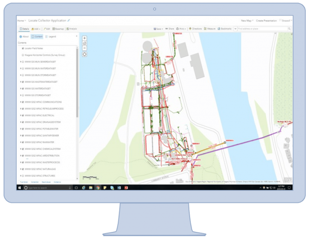
Niagara Region is a Canadian municipality that performs water and wastewater locates for nearly 200 treatment facilities. Faced with limited legacy methods (e.g., manual workflows, third-party contractors), they sought an affordable, accurate solution to perform real-time locates in house. They deployed Esri ArcGIS Online web maps, ArcGIS Collector® on iPad®, and an Arrow Gold GNSS receiver with an on-premise base station. The result was an affordable, intuitive solution that provided 3-cm locations throughout their facilities.
The Challenge: Locating Facility Yard Piping is Complicated
Niagara Region needed a real-time solution for infrastructure locates, especially in congested areas where mapping required centimeter accuracy
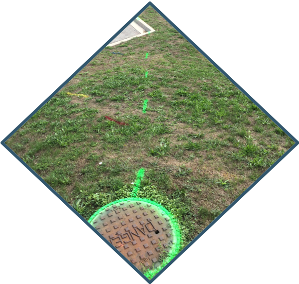
Like many Ontario municipalities, in addition to locating within the public right-of-way, Niagara Region provides locates at water and wastewater treatment facilities. Their biggest challenge was that approximately 40% of buried pipes could not be located with conventional methods. This was due to non-metallic pipe materials, electromagnetic interference, and incorrect tracer-wire installation.
In addition, third-party service providers using paper maps would fail to mark all infrastructure. This left Niagara Region with the time-consuming task of verifying the field locates against their desktop GIS.
In 2015, Niagara Region brought treatment plant locates in house. This enabled them to utilize the same geospatial ticket-management system and handheld GPS receivers that were being used in the public right-of-way for treatment facilities. This solution was better, but field data currency and GPS accuracy were risks that needed to be addressed.
The Solution: ArcGIS Online and Arrow Gold for Locates
“The reason we chose the Arrow Gold was that it had repeatable, centimeter accuracy.”
— Greg Epp, Asset Information Manager, Niagara Region
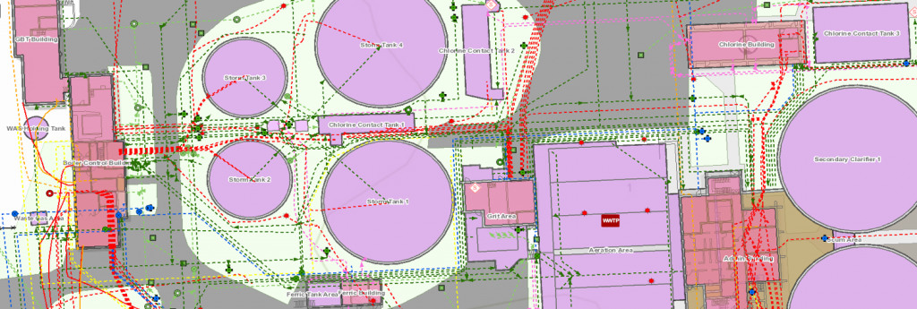
Niagara Region’s skilled GIS team had built a complete, accurate, and updated picture of their 183 facilities. But to utilize their GIS in the field, they needed to update both hardware and software.
First, they created and published custom web maps in ArcGIS Online. Next, they made these maps accessible via ArcGIS Collector® on iPad. Collector enabled field crews to quickly access the latest GIS data from the office.
“There’s a lot of input we’re making to the GIS every single day, and getting this information to the field used to be a time-consuming process,” Niagara Region Asset Information Manager Greg Epp said. “Collector is consuming changes as they are being made in the office.”
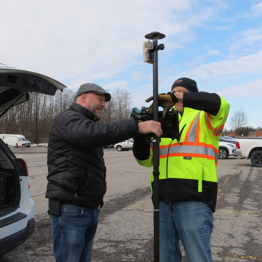
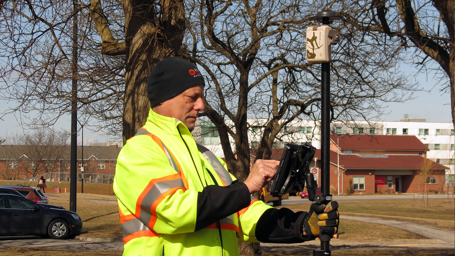
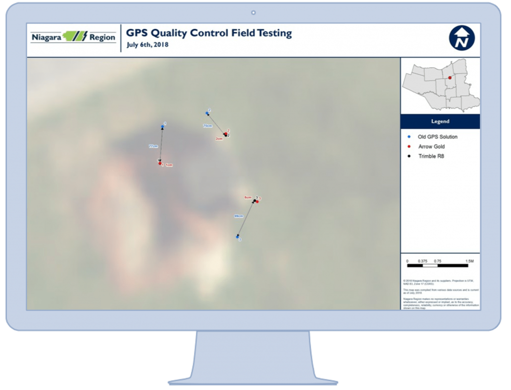
Niagara Region deployed Collector on iPads for real-time access to their GIS. Paired with an Eos Arrow Gold GNSS receiver for higher accuracy, and an RTK base station to broadcast real-time corrections over the Internet, they achieved 3-5 cm accuracy within their service area.
They also needed to boost their crew’s location accuracy, which with their legacy GPS receivers was only 1-3 meters. After research, Niagara Region purchased two Arrow Golds RTK GNSS receivers.
“The reason we chose the Arrow Gold was that it had repeatable, centimeter accuracy,” Epp said.
They installed one Arrow Gold as a base station, with the help of Canadian consultancy and authorized Eos representative GPS Precision. They paired the other Arrow Gold with the iPad, which enabled them to receive real-time centimeter corrections from the base station without paying for an RTK network subscription.
“The great thing is that the base station radius covers our entire region of operation,” Epp said. “We didn’t realize that we could afford a more modern survey-grade GNSS receiver for the same price of our older units.”
The field crew runs Eos Tools Pro to handle the base station’s differential corrections. Eos Tools Pro also provides audible alerts to let field crews know if their accuracy falls outside of tolerance.
“That’s been really helpful, because they don’t have to be staring at the screen to know what their accuracy is,” Epp said. “It’s really intuitive.”
The Results: Seamless, Real-Time Locates in Congested Facilities
“For us to be able to leverage this technology to map assets with high-accuracy in congested areas is really important to keeping our infrastructure safe through locates.”
— Chris Sawatsky, Asset Information Technician, Niagara Region
The ArcGIS Online and Arrow Gold base/rover solution made it easier for Niagara Region to comply with requests in a more timely manner. It also increased their ability to map assets in congested areas, where it is common to find 200-300 different sets of underground infrastructure.
“We work really hard at keeping a highly accurate GIS system here in the office,” Asset Information Technician Chris Sawatsky said. “For us to be able to leverage this technology to map assets with high-accuracy in congested areas is really important to keeping our infrastructure safe.”
Infrastructure Locate Technician Lou Appel, who is in charge of physically marking assets, said the solution was very easy to adopt.
“This tool has helped us get into a comfort zone as to where our structures are,” he said.

