Synopsis
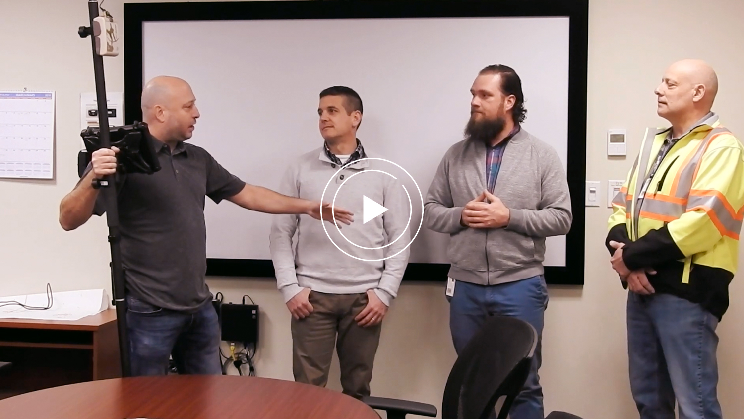
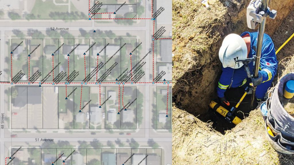
In this video, Niagara Region and GPS Precision discuss how using Arrow Gold as a base station/rover combination enabled survey-grade accuracy on iOS® with Esri’s ArcGIS Collector. The municipality is using the field solution on iPad®s to perform water-infrastructure locates with high-accuracy, in-house. It has led to an increased confidence they can keep infrastructure safe, especially in densely populated areas. This is part one of a two-part video series.
Transcript for “Video Case Study: Niagara Region and GPS Precision”
Bernard-Luc Gagnon: Hi everybody my name is Bernard from GPS Precision. And today I’m with Greg Epp from the Niagara Region. And Greg will explain to us why he chose a technology that lets him use GIS right away. Its what we call eye accuracy GIS GPS. And today it’s with the Arrow Gold mixed with an iPad. So Greg.
Greg Epp: Yeah so we had to upgrade our units, they were about 5 or 6 years old and were due for replacement. The reason we chose Arrow Gold was that it has subsidiary GPS and we do a lot of locates for water in the wastewater treatment facilities and definitely the subset of your accuracy; the repeatable sub-centimetre accuracy helps us locate in congested areas. The second thing was the price point. I believe the price since we purchased our original GPS has come down significantly. So while we were purchasing a mapping grade GPS, we didn’t realise that we could afford a survey grade GPS for the same price.
Bernard: And on top of that’s what we did with Niagara Region too we to install a base on top of their building. It’s a partnership between GPS precision and Niagara Region. And it will allow them to not have to pay any RTK Network subscription. So they are significant reductions in cost here.
Greg: The great thing is that the radius covers the entire region so the whole service gets us some level of accuracy.
Bernard: We’re looking at a radius of 15 kilometres and you’ll still be between one to three centimetre. We tested it out with up to 80 kilometres and we were still around three-centimeter accuracy. Other people went further than that, but that’s just pushing the limit. How has that worked for you so far?
Greg: Yeah we’ve done a number of locates at our treatment plants and it’s worked great. We’ve used it extensively the right way, and in both cases, it worked quite well.
Bernard: This is great. So, Greg, can you introduce your team to us?
Greg: Sure, so I have with me Chris Sawatsky and Lou Appel. Introduce yourselves and tell us a little bit about what you guys do.
Chris Sawatsky: I’m Chris Sawatsky am an asset information technician with a background in GIS. And for us, I think this unit has been important for us to be able to take our GIS and translate that into the field with high accuracy. We work really hard at keeping a high accurate GIS system here in the office. And for us to have to perform locates in congested areas. I think this technology that we can leverage from to make high accuracy locates is ultimately really important to keeping our infrastructure safe through locates.
Bernard: Because you have, sorry, like a lot of paths that are very close to each other.
Chris: Yes if you were to take a look at one of our treatment plants it’s not unusual to see two to three hundred different sets of infrastructure buried in the ground, so, yes we drove some very congested areas. Thank you.
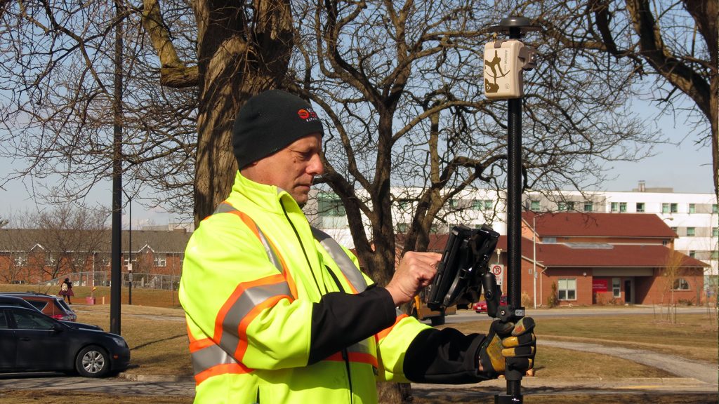
Lou Appel: I’m Lou Appel. I am the infrastructure locate technician and the field rep. Basically I’m the guy going out there putting the marks out in the field. I find that the system that we’re currently using right now is very beneficial. It helps me in locating infrastructure when it’s typically buried by overgrowth in the summertime or snow in the wintertime. And again as Chris had mentioned, when we’re doing our actual locates on our facilities where there’s multiple types of infrastructure that’s almost layered on top of each other. This tool helps get us into a comfort zone as to where our structure is.
Bernard: So Lou, just a question for you; your background is not GIS right?
Lou: No.
Bernard: So you use Collector [for ArcGIS] on our GIS is when it’s been properly set up by Greg and Chris here. How easy it is for you to use in the field?
Lou: So, it’s actually intuitive; it’s just plain like having any app on your phone. You can just sort of step through it, and it really is quite easy to manipulate. It’s been effective.
Bernard: And how long of training did you feel you needed to get before using it?
Lou: I would say, you know what? Coming right out of the box you could probably be shown it a couple of times just to walk through it and then once you’re into that it’s just a question of repeatability; you know using it over and over again but it’s quite easy right off the bat.
Bernard: Okay that’s very interesting. Another point for Chris and Greg, So the advantage to be from the field to the office taking data is that as long as the setup is done right with the data arms and the alignment of the data, it could be a little bit challenging. But if it’s done right, as soon as you start to store data, your data has no chance to get corrupt. Is that right?
Greg: Yeah so with the old unit we didn’t have the accuracy to be able to collect information on the field and bring it back to the office but with this solution because it’s a subsidy near solution. We are able to refine our GS base bunch of information. That opened up new opportunities to create a more accurate GIS. So yeah it’s a seamless process going from the field to the office.
Bernard: So the real-time capability, did you have your data the accuracy right away in the field and being on the cloud then changed with you guys working.
Greg: That’s another point too because we’re using Collector and it’s a source or service that’s being streamed out as changes are being made in the office. These changes are already making you push with the field. So that’s another point that we’re looking at because there’s a lot of input that we’re making every single day and pushing the personal information to the field was a time-consuming process before.
Bernard: Because it’s very challenging to keep updated accurate GIS data. Right? Okay, if you guys set up the GNSS value so that you can gather the points and all that information at once. It can give you more confidence in the data when you’re looking at it afterwards.
Greg: Yeah the one great thing about the [Eos Tools Pro] app is that it’ll give you beeps or notifications depending on the accuracy that you’re getting. And that’s been really helpful in the field because when you’re not staring at the unit you’re out walking and you kind of know what your accuracy is just by walking around. It’s really intuitive.
Bernard: Okay so the alarm is very helpful for sure and it helps to reduce errors. Oh, this is great. So, guys, we’re going to go in the field and just show very quickly how Lou is going to collect some data. Chris is going to show us a couple of different things too.
So, thank you very much guys we’ll show you what we’re going to do in the field in not too long.
Thanks!


